Founding year: Wikidata; Wikipedia’s history section gives the same year. First post office: 1820.The full story ↓
History grade
What drives Fairhaven’s History grade
On its age, its old homes and the National Register, Fairhaven is more historic than 92% of U.S. towns, #120 of 283 in Massachusetts. Its age holds the grade up; its National Register listings pull it down.
A
HistoryA character grade: shown, never part of Fairhaven’s overall grade.
Massachusetts towns list more on the Register than most of the country (a typical Massachusetts town has 46.0 per 10,000 residents, the U.S. 2.4), so Fairhaven’s 5.7 sits below most of its state (23% of Massachusetts towns have fewer) while its 9 historic buildings outnumber those of 75% of U.S. towns.
How sure. Graded on any two of the three inputs instead, the letter would range from A− to A+. The pre-1940 share is a Census survey estimate (±3.6 points). Two sources give 1659.
Founding year: Wikidata (other dates in Quick answers). Homes: Census ACS 2020–24. National Register: National Park Service, May 2026 list; each listing counted once (boundary changes and added documentation belong to their listing), and a historic district counts its contributing buildings. How TownRatings grades history →
What stands out about Fairhaven’s past
Read from the archive, the National Register and the record. The page puts what stands out first.
Fairhaven was first settled in 1659 as "Cushnea," the easternmost part of the town of Dartmouth. It was founded on land purchased by English settlers at the Plymouth Colony from the Wampanoag sachem Massasoit, and his son, Wamsutta.
Passages that mention Fairhaven, cut from the printed page as they were published.
History of Bristol County, Massachusetts, with biographical sketches of many of its pioneers and prominent men1883 · page 162Read the page →
Read the text
"Section 2. Tho inhabitants of said town of Acushnet shall be hidden to pay to the collector of taxes of the town of Fairhaven all the arrearages of taxes legally assessed upon them before this act takes effect, and also their proportion of State and county taxes as may be assessed upon them before taking the next State valuation, said proportion to be ascertained and determined by the last valuation of the said town of Fairhaven ; and said town of Acushnet to pay four twenty-thirds of the debts due and owing from the town of Fairhaven at the lime of
Text read by machine from the scan; it may contain errors.
Brief history of the town of Fairhaven, Massachusetts1903 · page 21Read the page →
Read the text
other Act was passed incorporating Samuel Borden and others as "The Proprietors of Crow Island Bridge," and "empowered to erect a Bridge from the easterly side of Crow Island, in Acushnet river, aforesaid, to Fairhaven vilhige, in the town of New Bedford aforesaid, a few feet south of the dwelling of the widow Elizabeth Adams, to the land of the said Samuel Borden." This bridge was "to have a draw of at least twenty-eight feet in width, which draw shall be raised up for all vessels without toll
Text read by machine from the scan; it may contain errors.
History of Bristol County, Massachusetts, with biographical sketches of many of its pioneers and prominent men1883 · page 114Read the page →
Read the text
It retained its original area until Feb. 22, 1812, when the town of Fairhaven was set off. A part of Dartmouth was annexed March 20, 1845, and a part of Acushnet April 9, 1875.
Text read by machine from the scan; it may contain errors.
Brief history of the town of Fairhaven, Massachusetts1903 · page 17Read the page →
Read the text
February 23, 1787, the town of New Bedford was set off from Dartmouth, and included the present towns of Acushnet and Fairhaven and the city of New Bedford. In 1795 the villages of Fairhaven and Oxford were connected by a bridge across Herring river and the layout of Mdin street north to North street. In 179G the old toll bridge between New^ Bedford and Fairhaven, crossing Fish island and Popes island was built.
Text read by machine from the scan; it may contain errors.
Scans and text from the Internet Archive. Books published in 1930 or earlier, which are in the public domain.
By decade
Fairhaven, decade by decade
7 decades in the archive, from the 1650s to the 1940s. Scroll each row; tap a photo for its story.
Nothing in the archives for these yearsWeddings on Main Street, storms, parades, school pictures, the old store. If it’s in your family album, it belongs here.
In 1659, according to Wikidata and Wikipedia’s history of the town. Fairhaven’s post office opened in 1820, and the census of 1850 counted 4,304 people here.
How does Fairhaven rank for history?
Fairhaven is more historic than 92% of U.S. towns, #120 of 283 in Massachusetts. The History grade combines the town’s founding era, the share of homes built before 1940 and its National Register listings. It’s a character grade, so it isn’t part of the overall grade. How it works.
What is on the National Register in Fairhaven?
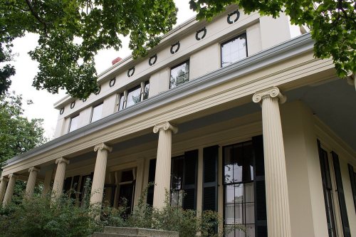
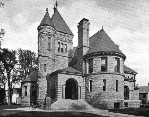
8 listings: 7 buildings and 1 structure. 9 historic buildings in all.
How old are the homes in Fairhaven?
40% of Fairhaven’s homes were built before 1940 (Census estimate, ±3.6 points), against a typical 21% for a Massachusetts town; the median home was built in 1952.
Founding dates: Wikidata, Wikipedia, the U.S. post office records of Blevins & Helbock (CC0) and the Census. Homes by year built: Census ACS 2020–24. National Register of Historic Places: National Park Service (list of May 22, 2026). Old photos, postcards and papers: Wikimedia Commons, the Library of Congress and other public archives, credited on each item’s page. Maps: U.S. Geological Survey historical topographic maps (via Esri) and Sanborn fire-insurance maps (Library of Congress). History text and census tables: Wikipedia (CC BY-SA 4.0). Places that used to be: USGS Geographic Names Information System (2021).
From Wikimedia Commons (15), the Library of Congress (2), Wikidata (1), the National Register of Historic Places (8), Wikipedia, Wikidata and Wikipedia for famous people, U.S. Geological Survey historical maps, U.S. Census counts (via Wikipedia), the US Post Offices dataset (Blevins & Helbock), the USGS Geographic Names Information System and old county and town histories (Internet Archive). Archive images are copied here with their credits and licenses, shown on each photo’s page. Refreshed monthly.


 1900
 1900
 1912
 c. 1916
 1916
 1916
 1918
 1919
 1940
 2009
 2004