Most of Montgomery was built recently: 9% of its homes predate 1940 and the median home dates from 1978. Below: 1 old photo or paper, maps from 1887 on, and the census since 1790.
Montgomery was first settled in 1767 and was officially incorporated in 1780 during the American Revolutionary War. The town was named after General Richard Montgomery, who died in the Battle of Quebec, part of an American attempt to capture Quebec City and gain Canadien support for the Patriot movement. The town took land from Westfield, Southampton, and unincorporated land that is now Huntington. For two centuries a farming community with a small town center, its population began to increase when Interstate 90 was built in 1957. Montgomery serves as an outer commuter town to Springfield.
In a preceding paragraph the act ci'eating the town is referred to at some length. On February 25, 1792, Montgomery surrendered a small portion of its territory to the town of Russell, and on IMarch 6 of the same year parts of Norwich and Southampton were annexed to Montgomery. The organization was accomplished with little ceremony, and the first meeting for the election of officers was held at the house of Zadock Bosworth on December 14, 1780. At that time all the offices were filled
Text read by machine from the scan; it may contain errors.
Scans and text from the Internet Archive. Books published in 1930 or earlier, which are in the public domain.
Timeline
Montgomery, 1767 to 2010
Woven from the archive, old maps, post office records, the National Register and the people born here.
In 1767, according to Wikipedia’s history of the town. Montgomery’s post office opened in 1839, and the first U.S. census counted 449 people here in 1790.
Founding dates: Wikidata, Wikipedia, the U.S. post office records of Blevins & Helbock (CC0) and the Census. Homes by year built: Census ACS 2020–24. National Register of Historic Places: National Park Service (list of May 22, 2026). Old photos, postcards and papers: Wikimedia Commons, the Library of Congress and other public archives, credited on each item’s page. Maps: U.S. Geological Survey historical topographic maps (via Esri) and Sanborn fire-insurance maps (Library of Congress). History text and census tables: Wikipedia (CC BY-SA 4.0). Places that used to be: USGS Geographic Names Information System (2021). How TownRatings grades history →
From Wikimedia Commons (19), Wikipedia, U.S. Geological Survey historical maps, U.S. Census counts (via Wikipedia), the US Post Offices dataset (Blevins & Helbock), the USGS Geographic Names Information System and old county and town histories (Internet Archive). Archive images are copied here with their credits and licenses, shown on each photo’s page. Refreshed monthly.


 Date?
 2013
 2010
 2010
 2010
 2010
 2010
 2010
 2010
 2010
 2010
 2010
 2010
 2010
 2010
 2010
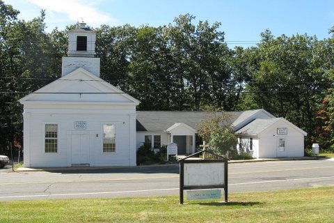 2009
 2009
 2007


