Westfield dates to 1660, and 24% of its homes were built before 1940
More historic than 96% of U.S. towns · #72 of 283 in Massachusetts. What drives it
14 places in town are on the National Register, among them two historic districts with 446 buildings between them. Below: 12 old photos and papers, maps from 1884 on, and the census since 1790.
Founding year: Wikidata; Wikipedia’s history section gives the same year. First post office: 1795.The full story ↓
History grade
What drives Westfield’s History grade
On its age, its old homes and the National Register, Westfield is more historic than 96% of U.S. towns, #72 of 283 in Massachusetts. All 3 inputs are above most U.S. towns; its age ranks highest and its share of homes from before 1940 lowest.
A+
HistoryA character grade: shown, never part of Westfield’s overall grade.
Massachusetts towns list more on the Register than most of the country (a typical Massachusetts town has 46.0 per 10,000 residents, the U.S. 2.4), so Westfield’s 115 sits above most of its state (66% of Massachusetts towns have fewer) while its 463 historic buildings outnumber those of 97% of U.S. towns.
How sure. Graded on any two of the three inputs instead, the letter would range from A to A+. The pre-1940 share (±2.8 points) is firm at this size. Two sources give 1660.
Founding year: Wikidata (other dates in Quick answers). Homes: Census ACS 2020–24. National Register: National Park Service, May 2026 list; each listing counted once (boundary changes and added documentation belong to their listing), and a historic district counts its contributing buildings. How TownRatings grades history →
What stands out about Westfield’s past
Read from the archive, the National Register and the record. The page puts what stands out first.
The area was originally inhabited by the Pocomtuc, and was called Waranoke or Woronoco (meaning "the winding land"). Trading houses were built in 1639 to 1640 by European settlers from the Connecticut Colony. Massachusetts asserted jurisdiction, and prevailed after a boundary survey. In 1647, Massachusetts made Woronoco part of Springfield. Land was "incrementally purchased from the Native Americans and granted by the Springfield town meeting to English settlers, beginning in 1658." The area of Woronoco or "Streamfield" began to be permanently settled in the 1660s. In 1669, "Westfield" was incorporated as an independent town; in 1920, it would be re-incorporated as a city. The name Westfield would be named for being at the time the most westerly settlement. "Streamfield" was considered a name for the town for being settled in between two "streams" that flow downtown, the Westfield River…
Passages that mention Westfield, cut from the printed page as they were published.
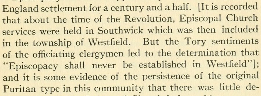
The history of the celebration of the two hundred and fiftieth anniversary of the incorporation of the town of Westfield, Massachusetts, August 31, September 1, 2, 3, 1919, and appendix with reminiscences of the last half-century1919 · page 67Read the page →
Read the text
England settlement for a century and a half. [It is recorded that about the time of the Revolution, Episcopal Church services were held in Southwick which was then included in the township of Westfield. But the Tory sentiments of the officiating clergymen led to the determination that "Episcopacy shall never be established in Westfield"]; and it is some evidence of the persistence of the original Puritan type in this community that there was little de-
Text read by machine from the scan; it may contain errors.
In 1780, having these things in mind and having increased their new settlement so that ft numbered something like 400 inhabitants, the people here, with the sanction and assistance of those at Westfield, besought the general court, praying that they be set olT and incorporated as a new town of the county. The legislative records on this subject read as follows: "AYhereas the inhabitants of the northerly part of "Westfield, called the New Addition, on the east side of Westfield river, and the south-
Text read by machine from the scan; it may contain errors.
History and genealogy of the family of Thomas Noble of Westfield, Massachusetts1878 · page 630Read the page →
Read the text
Ltbia Noble, dau. of James, was b. in Westfield, Mass., Dec. 7, 1704. She joined Westfield church, May 27, 1733, and prob. d. in Westfield, Apr. 18, 1768, n. 63.
Text read by machine from the scan; it may contain errors.
History and genealogy of the family of Thomas Noble of Westfield, Massachusetts1878 · page 223Read the page →
Read the text
RuTB NoBLX, dau. of Ideut Stephen, was b. in Westfield, Mass., June 1, 1756, and d. in Montgomery, Mass., Nov. 16, 1790, sb. 34. * She m. 1779, Mastim Boot of Westfield; s. of Martin and Eunice (Lamb) Boot He was b. Feb. 20, 1 753, accd. to the family record, but Mch. 11, 1753, accd. to the record of the town of Westfield.
Text read by machine from the scan; it may contain errors.
Scans and text from the Internet Archive. Books published in 1930 or earlier, which are in the public domain.
By decade
Westfield, decade by decade
3 decades in the archive, from the 1880s to the 1910s. Scroll each row; tap a photo for its story.
Nothing in the archives for these yearsWeddings on Main Street, storms, parades, school pictures, the old store. If it’s in your family album, it belongs here.
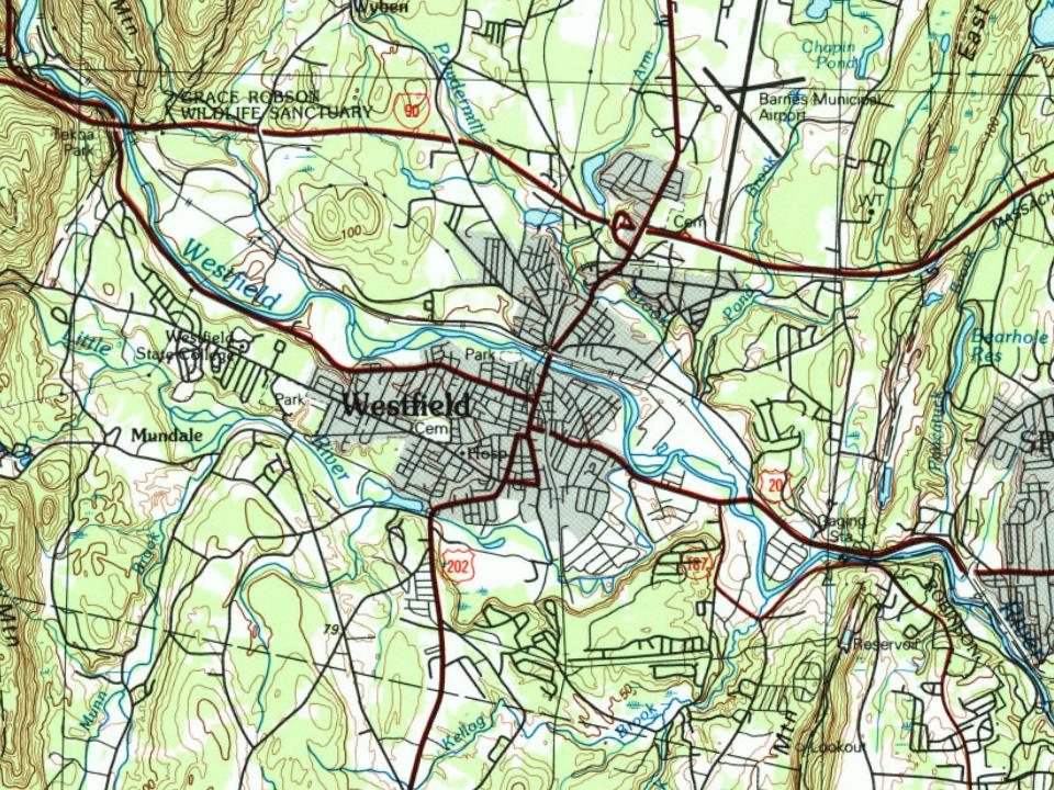
Every edition of the U.S. Geological Survey’s map of Westfield. Tap a year, or press play to watch the town change.
1896Holyoke sheet · 1:125,000
U.S. Geological Survey historical topographic maps (public domain), via Esri’s collection of the scans. The red ring marks the center of Westfield.
Every building
Westfield, building by building, 1884–1917
Fire insurance maps drew every building, what it was made of and what it was used for, so insurers could price the risk of fire. Pick a year, then a sheet.
In 1660, according to Wikidata and Wikipedia’s history of the town. Westfield’s post office opened in 1795, and the first U.S. census counted 2,204 people here in 1790.
How does Westfield rank for history?
Westfield is more historic than 96% of U.S. towns, #72 of 283 in Massachusetts. The History grade combines the town’s founding era, the share of homes built before 1940 and its National Register listings. It’s a character grade, so it isn’t part of the overall grade. How it works.
What is on the National Register in Westfield?
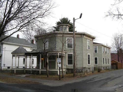
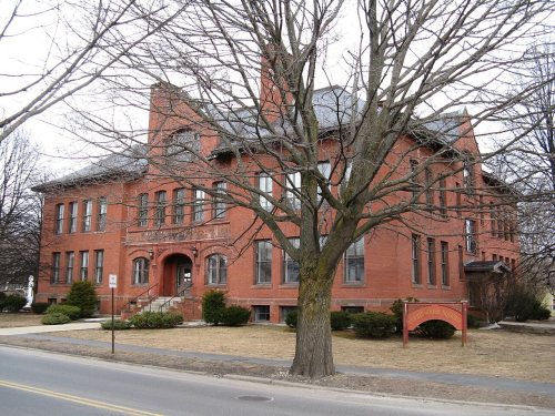
14 listings: 11 buildings, among them the Westfield Municipal Building (listed 1978, the first), 2 historic districts, the Westfield Center Commercial Historic District and the Westfield Center Historic District, with 446 contributing buildings, and 1 site. 463 historic buildings in all.
How old are the homes in Westfield?
24% of Westfield’s homes were built before 1940 (Census estimate, ±2.8 points), against a typical 21% for a Massachusetts town; the median home was built in 1964.
Founding dates: Wikidata, Wikipedia, the U.S. post office records of Blevins & Helbock (CC0) and the Census. Homes by year built: Census ACS 2020–24. National Register of Historic Places: National Park Service (list of May 22, 2026). Old photos, postcards and papers: Wikimedia Commons, the Library of Congress and other public archives, credited on each item’s page. Maps: U.S. Geological Survey historical topographic maps (via Esri) and Sanborn fire-insurance maps (Library of Congress). History text and census tables: Wikipedia (CC BY-SA 4.0). Places that used to be: USGS Geographic Names Information System (2021).
From Wikimedia Commons (7), the Library of Congress (5), Wikidata (6), the National Register of Historic Places (14), Wikipedia, Wikidata and Wikipedia for famous people, U.S. Geological Survey historical maps, U.S. Census counts (via Wikipedia), the US Post Offices dataset (Blevins & Helbock), the USGS Geographic Names Information System, Sanborn fire insurance maps (Library of Congress) and old county and town histories (Internet Archive). Archive images are copied here with their credits and licenses, shown on each photo’s page. Refreshed monthly.

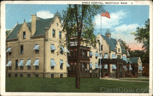







 1905
 1907–1915
 1907–1915
 c. 1913
 1916
 1916
 1916
 1916
 1916