Lynnfield dates to 1638, and 13% of its homes were built before 1940
More historic than 80% of U.S. towns · #222 of 283 in Massachusetts. What drives it
3 places in town are on the National Register, among them a historic district with 12 buildings. Below: 3 old photos and papers, maps from 1886 on, and the census since 1790.
Founding year: Wikidata; Wikipedia’s history section gives the same year. First post office: 1836.The full story ↓
History grade
What drives Lynnfield’s History grade
On its age, its old homes and the National Register, Lynnfield is more historic than 80% of U.S. towns, #222 of 283 in Massachusetts. All 3 inputs are above most U.S. towns; its age ranks highest and its National Register listings lowest.
A−
HistoryA character grade: shown, never part of Lynnfield’s overall grade.
Massachusetts towns list more on the Register than most of the country (a typical Massachusetts town has 46.0 per 10,000 residents, the U.S. 2.4), so Lynnfield’s 13.0 sits below most of its state (29% of Massachusetts towns have fewer) while its 17 historic buildings outnumber those of 79% of U.S. towns.
How sure. Graded on any two of the three inputs instead, the letter would range from B to A−. The pre-1940 share is a Census survey estimate (±4.6 points). Two sources give 1638.
Founding year: Wikidata (other dates in Quick answers). Homes: Census ACS 2020–24. National Register: National Park Service, May 2026 list; each listing counted once (boundary changes and added documentation belong to their listing), and a historic district counts its contributing buildings. How TownRatings grades history →
What stands out about Lynnfield’s past
Read from the archive, the National Register and the record. The page puts what stands out first.
The town of Lynnfield was first settled in 1638 and was made a district separate from Lynn in 1782. It was later officially incorporated in 1814. Historically, Lynnfield functioned as two separate villages connected by one governing body: in Lynnfield Center resided a mostly agricultural population, while South Lynnfield was a crossroad situated amongst neighboring larger towns. During this time, the town had two inns, a granite rock quarry, a small, carbonated beverage bottler, and various eating institutions.
Passages that mention Lynnfield, cut from the printed page as they were published.
Municipal history of Essex County in Massachusetts1922 · page 392Read the page →
Read the text
towns were founded. In 1733 Lynn people settled Amherst, New Hampshire. On March 13, 1638, Lynn was granted "six miles into the country." This land was called Lynn End for many years, and constitutes the present town of Lynnfield, September 9, 1639, a tract of land four miles square was added to the territory of Lynn. This was settled and became known as Lynn Village, until it was set off March 17, 1653, as a separate town and called Reading. It now comprises the towns of Reading, North
Text read by machine from the scan; it may contain errors.
Municipal history of Essex County in Massachusetts1922 · page 212Read the page →
Read the text
Methodist society was formed in 1816, and a house of worship erected in 1823. There are now two churches in the town, one at the village of Lynnfield, a Congregational society, with Rev. Francis George as pastor, and a Congregational at Lynnfield Center. The Episcopal denomination holds services regularly in Lynnfield Center, occupying the Congregational church building.
Text read by machine from the scan; it may contain errors.
History of Essex County, Massachusetts, with biographical sketches of many of its pioneers and prominent men1888 · page 379Read the page →
Read the text
First Parish. — The First Church of Lynnfield was formed August 17, 1720, though a meeting-house appears to have been built some five years before. It had always been a hardship for worshippers of that remote region to attend service at the First Parish house, some living more than seven miles distant.
Text read by machine from the scan; it may contain errors.
History of Essex County, Massachusetts, with biographical sketches of many of its pioneers and prominent men1888 · page 252Read the page →
Read the text
But down to 1814 no very extensive tract had been severed. In that year Lynnfield, which had been called Lynn End, and having been incorporated as a district in 1782, was set off" as a separate town under its present name. Another portion was, by legislative action, taken from the mother town in 1815, and incorporated under the name Saugus, thus reviving the old name in that detached portion of the
Text read by machine from the scan; it may contain errors.
Scans and text from the Internet Archive. Books published in 1930 or earlier, which are in the public domain.
By decade
Lynnfield, decade by decade
2 decades in the archive, from the 1900s to the 1910s. Scroll each row; tap a photo for its story.
Nothing in the archives for these yearsWeddings on Main Street, storms, parades, school pictures, the old store. If it’s in your family album, it belongs here.
In 1638, according to Wikidata and Wikipedia’s history of the town. Lynnfield’s post office opened in 1836, and the first U.S. census counted 491 people here in 1790.
How does Lynnfield rank for history?
Lynnfield is more historic than 80% of U.S. towns, #222 of 283 in Massachusetts. The History grade combines the town’s founding era, the share of homes built before 1940 and its National Register listings. It’s a character grade, so it isn’t part of the overall grade. How it works.
What is on the National Register in Lynnfield?
Three places: the Meetinghouse Common District (listed 1976), the Hart House (1990) and the Henfield House (1991).
How old are the homes in Lynnfield?
13% of Lynnfield’s homes were built before 1940 (Census estimate, ±4.6 points), against a typical 21% for a Massachusetts town; the median home was built in 1964.
Founding dates: Wikidata, Wikipedia, the U.S. post office records of Blevins & Helbock (CC0) and the Census. Homes by year built: Census ACS 2020–24. National Register of Historic Places: National Park Service (list of May 22, 2026). Old photos, postcards and papers: Wikimedia Commons, the Library of Congress and other public archives, credited on each item’s page. Maps: U.S. Geological Survey historical topographic maps (via Esri) and Sanborn fire-insurance maps (Library of Congress). History text and census tables: Wikipedia (CC BY-SA 4.0). Places that used to be: USGS Geographic Names Information System (2021).
From Wikimedia Commons (12), the Library of Congress (1), Wikidata (1), the National Register of Historic Places (3), Wikipedia, Wikidata and Wikipedia for famous people, U.S. Geological Survey historical maps, U.S. Census counts (via Wikipedia), the US Post Offices dataset (Blevins & Helbock), the USGS Geographic Names Information System and old county and town histories (Internet Archive). Archive images are copied here with their credits and licenses, shown on each photo’s page. Refreshed monthly.


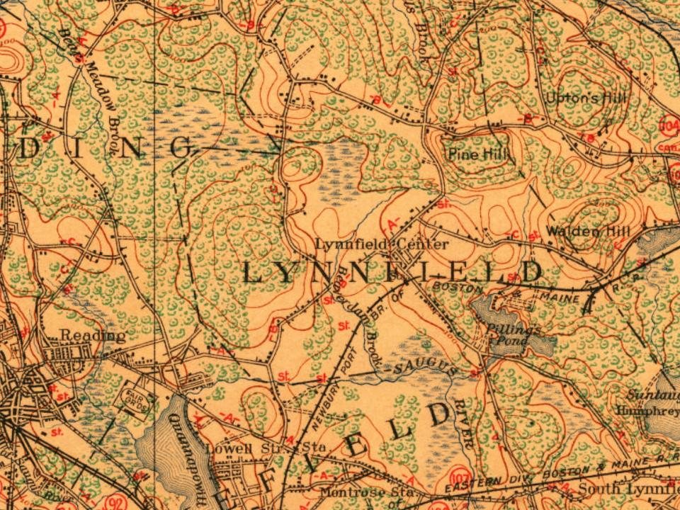


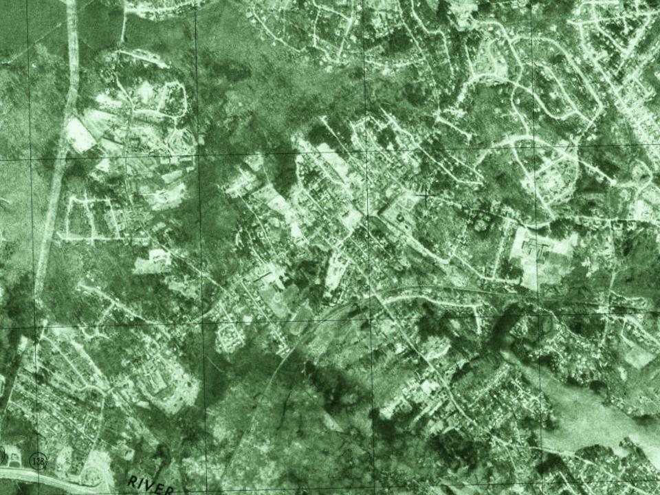


 1907–1915
 2022
 2017
 2010
 2010
 2010
 2010
 2010
 2010
 2008
 2008


