Peabody dates to 1626, and 22% of its homes were built before 1940
More historic than 90% of U.S. towns · #153 of 283 in Massachusetts. What drives it
17 places in town are on the National Register, among them two historic districts with 71 buildings between them. Below: 14 old photos and papers, maps from 1887 on, and the census since 1860.
Founding year: Wikidata. First post office: 1855.The full story ↓
History grade
What drives Peabody’s History grade
On its age, its old homes and the National Register, Peabody is more historic than 90% of U.S. towns, #153 of 283 in Massachusetts. All 3 inputs are above most U.S. towns; its age ranks highest and its National Register listings lowest.
A
HistoryA character grade: shown, never part of Peabody’s overall grade.
Massachusetts towns list more on the Register than most of the country (a typical Massachusetts town has 46.0 per 10,000 residents, the U.S. 2.4), so Peabody’s 16.5 sits below most of its state (34% of Massachusetts towns have fewer) while its 90 historic buildings outnumber those of 89% of U.S. towns.
NoteThe founding year comes from Wikidata alone; no second source gives 1626.
How sure. Graded on any two of the three inputs instead, the letter would range from A− to A. The pre-1940 share (±2.3 points) is firm at this size.
Founding year: Wikidata (other dates in Quick answers). Homes: Census ACS 2020–24. National Register: National Park Service, May 2026 list; each listing counted once (boundary changes and added documentation belong to their listing), and a historic district counts its contributing buildings. How TownRatings grades history →
What stands out about Peabody’s past
Read from the archive, the National Register and the record. The page puts what stands out first.
The area was long inhabited by Native American people known as the Naumkeag.
The area was settled as part of Salem in 1626 by a small group of English colonists from Cape Ann led by Roger Conant. It was subsequently referred to as the Northfields, Salem Farms, and Brooksby. Several area residents were accused of witchcraft during the Salem witch trials of the late 17th century, three of whom were executed (John Proctor, Giles Corey, and Martha Corey).
Passages that mention Peabody, cut from the printed page as they were published.
The history of Boxford, Essex County, Massachusetts, from the earliest settlement known to the present time1880 · page 139Read the page →
Read the text
Shortly before his death (1700) William Peabody erected the first saw and grist mill that ever existed in the town. The grist-mill was situated on the stream that flows back of the old Spiller house in the East Parish, where the ruins are still visible; the saw-mill was situated farther down the stream. The original building of the grist-mill, stood until Sept. 23, 1815, when the terrific gale, which our older inhabitants remember so well, blew it from its
Text read by machine from the scan; it may contain errors.
The history of Boxford, Essex County, Massachusetts, from the earliest settlement known to the present time1880 · page 126Read the page →
Read the text
others dissented from the rest of the town about the place, and nothing was further done at that meeting. A week from that day the inhabitants met again, and chose Thomas Andrews, Ensign John Perley, John Peabody, Quartermaster Tyler, and Thomas Hazen, to be a committee to “carry on the work of building’the meeting-house in the town of Boxford according to their best discretion, improving men in our own town if they may be obtained reason-
Text read by machine from the scan; it may contain errors.
Scans and text from the Internet Archive. Books published in 1930 or earlier, which are in the public domain.
By decade
Peabody, decade by decade
One decade in the archive so far: the 1900s. Scroll each row; tap a photo for its story.
Nothing in the archives for these yearsWeddings on Main Street, storms, parades, school pictures, the old store. If it’s in your family album, it belongs here.
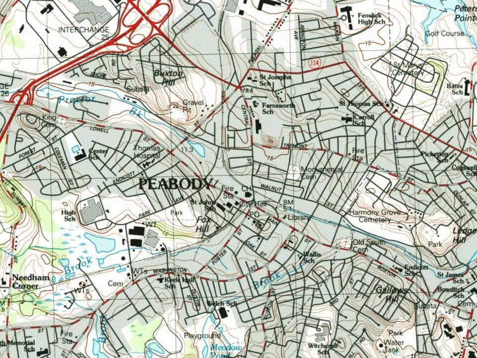
Fire insurance maps drew every building, what it was made of and what it was used for, so insurers could price the risk of fire. Pick a year, then a sheet.
In 1626, according to Wikidata. Peabody’s post office opened in 1855, and the census of 1860 counted 6,549 people here.
How does Peabody rank for history?
Peabody is more historic than 90% of U.S. towns, #153 of 283 in Massachusetts. The History grade combines the town’s founding era, the share of homes built before 1940 and its National Register listings. It’s a character grade, so it isn’t part of the overall grade. How it works.
What is on the National Register in Peabody?
17 listings: 15 buildings, among them the Peabody City Hall (listed 1972, the first), and 2 historic districts, the Peabody Civic Center Historic District and the Washington Street Historic District, with 71 contributing buildings. 90 historic buildings in all.
How old are the homes in Peabody?
22% of Peabody’s homes were built before 1940 (Census estimate, ±2.3 points), against a typical 21% for a Massachusetts town; the median home was built in 1966.
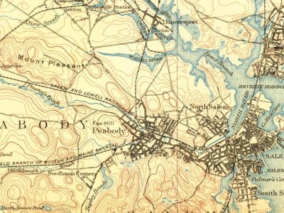
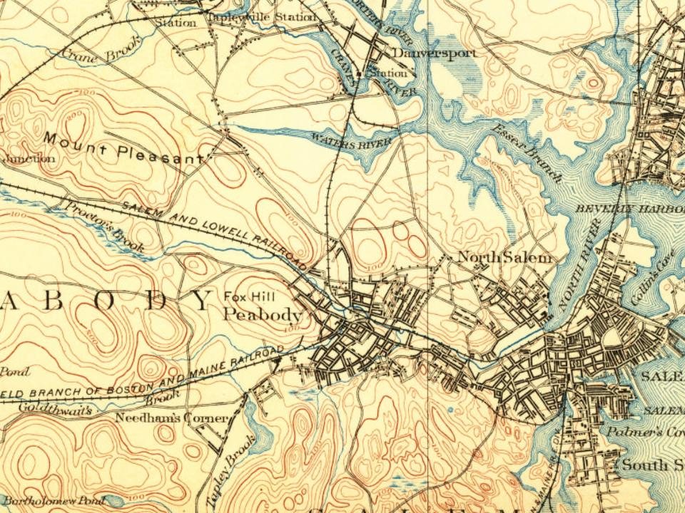
Founding dates: Wikidata, Wikipedia, the U.S. post office records of Blevins & Helbock (CC0) and the Census. Homes by year built: Census ACS 2020–24. National Register of Historic Places: National Park Service (list of May 22, 2026). Old photos, postcards and papers: Wikimedia Commons, the Library of Congress and other public archives, credited on each item’s page. Maps: U.S. Geological Survey historical topographic maps (via Esri) and Sanborn fire-insurance maps (Library of Congress). History text and census tables: Wikipedia (CC BY-SA 4.0). Places that used to be: USGS Geographic Names Information System (2021).
From the Library of Congress (14), Wikidata (2), the National Register of Historic Places (17), Wikipedia, U.S. Geological Survey historical maps, U.S. Census counts (via Wikipedia), the US Post Offices dataset (Blevins & Helbock), the USGS Geographic Names Information System, Sanborn fire insurance maps (Library of Congress) and old county and town histories (Internet Archive). Archive images are copied here with their credits and licenses, shown on each photo’s page. Refreshed monthly.
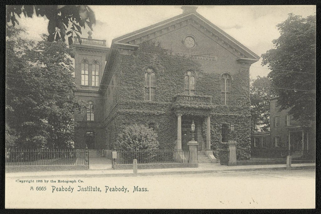



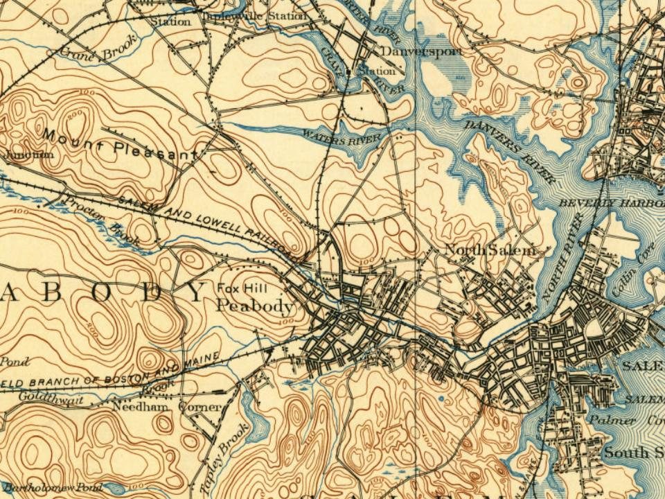

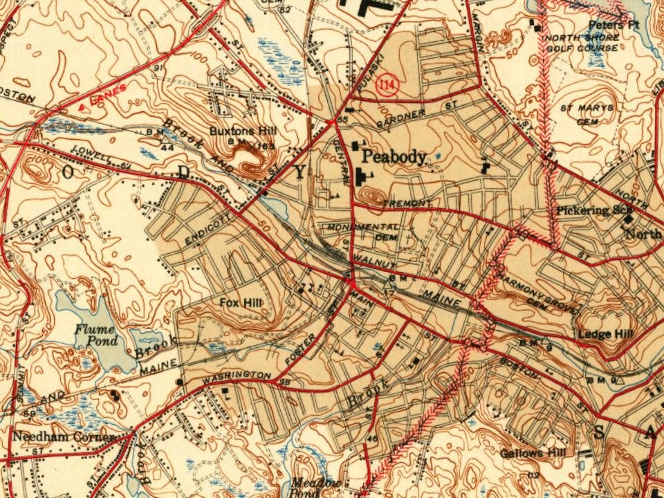
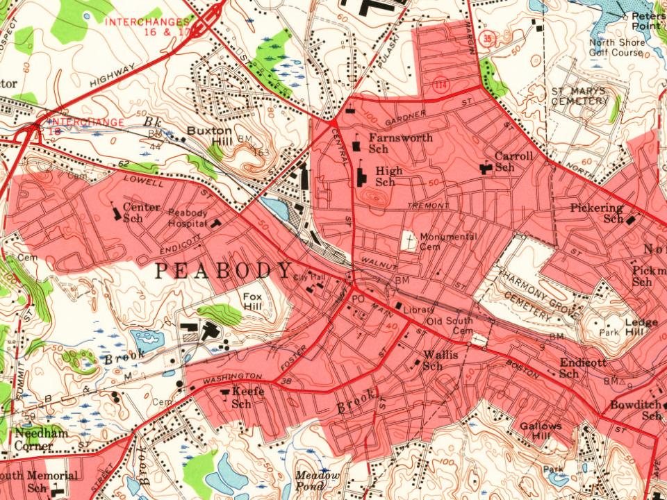
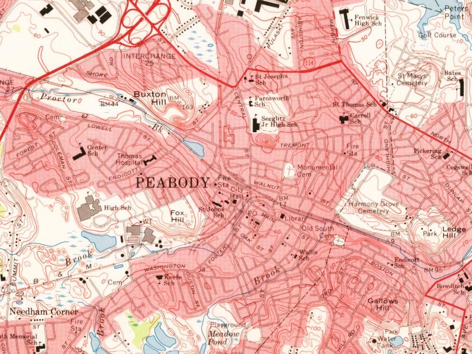


 1905
 1905
 1905
 1905
 1905
 1905
 1905
 1905
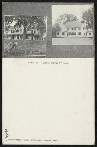 1905
 1905
 1905
 1905
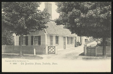 1905


