Lowell dates to 1653, and 44% of its homes were built before 1940
Among the most historic 1% of U.S. towns · #20 of 283 in Massachusetts. What drives it
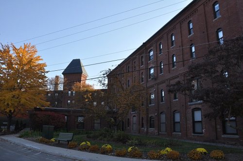
39 places in town are on the National Register, among them the Lowell Locks and Canals Historic District, a National Historic Landmark, and ten historic districts with 1,056 buildings between them. Below: 6 old photos and papers, maps from 1886 on, and the census since 1830.
Founding year: Wikidata. First post office: 1826.The full story ↓
History grade
What drives Lowell’s History grade
On its age, its old homes and the National Register, Lowell is among the most historic 1% of U.S. towns, #20 of 283 in Massachusetts. All 3 inputs are above most U.S. towns; its age ranks highest and its National Register listings lowest.
A+
HistoryA character grade: shown, never part of Lowell’s overall grade.
Among the 400 U.S. cities of 100,000 or more, Lowell ranks #17 on History.
Massachusetts towns list more on the Register than most of the country (a typical Massachusetts town has 46.0 per 10,000 residents, the U.S. 2.4), so Lowell’s 126 sits above most of its state (67% of Massachusetts towns have fewer) while its 1,496 historic buildings outnumber those of 99% of U.S. towns.
NoteThe founding year comes from Wikidata alone; no second source gives 1653.
How sure. Graded on any two of the three inputs instead, the letter would still be A+. The pre-1940 share (±2.1 points) is firm at this size.
Founding year: Wikidata (other dates in Quick answers). Homes: Census ACS 2020–24. National Register: National Park Service, May 2026 list; each listing counted once (boundary changes and added documentation belong to their listing), and a historic district counts its contributing buildings. How TownRatings grades history →
What stands out about Lowell’s past
Read from the archive, the National Register and the record. The page puts what stands out first.
The country’s official list of buildings and places worth saving. One is a National Historic Landmark, the highest tier. Boundary changes and added documentation are counted with their listing.
The Pawtucket Falls, which provided the hydropower for Lowell's industry in the 1800s, also served as an important seasonal fishing site for native people at the time of European colonization in the 1600s. The Pawtucket people are named for this location, literally meaning "at the falls" in Massachusett.
Passages that mention Lowell, cut from the printed page as they were published.
History of Middlesex County, Massachusetts, with biographical sketches of many of its pioneers and prominent men1890 · page 283Read the page →
Read the text
The Salem and Lowell Railroad, a branch of the old Boston and Lowell Road, runs through the southern and central part of the town, and the Boston and Maine has a branch about a mile farther north, thus bringing the stations within six miles of Lowell, and about twenty-two of Boston. The city of Lawrence is also quite accessible by these railroads and by carriage roads.
Text read by machine from the scan; it may contain errors.
History of Middlesex County, Massachusetts, with biographical sketches of many of its pioneers and prominent men1890 · page 281Read the page →
Read the text
The north part of the town called North Tewksbury, has land of a superior quality, and from various points the prospects are remarkably beautiful of Lowell, the neighboring towns and also of the distant bills of New Hampshire. It possesses a small village, a church, and formerly had a post-office which the proximity of Lowell rendered superfluous.
Text read by machine from the scan; it may contain errors.
History of the town of Townsend, Middlesex County, Massachusetts1878 · page 120Read the page →
Read the text
The meeting-house at the Harbor was built according to written contract, by John Hart and Amos Morse, in 1853. Daniel G. Bean, of Lowell, was the architect. Perhaps the shade of Sir Christopher Wren never hovers over this edifice without hastening to Lowell to salute this "cunning artificer." This house was dedicated in the spring of 1854.
Text read by machine from the scan; it may contain errors.
Scans and text from the Internet Archive. Books published in 1930 or earlier, which are in the public domain.
Timeline
Lowell, 1653 to 1952
Woven from the archive, old maps, post office records, the National Register and the people born here.
Nothing in the archives for these yearsWeddings on Main Street, storms, parades, school pictures, the old store. If it’s in your family album, it belongs here.
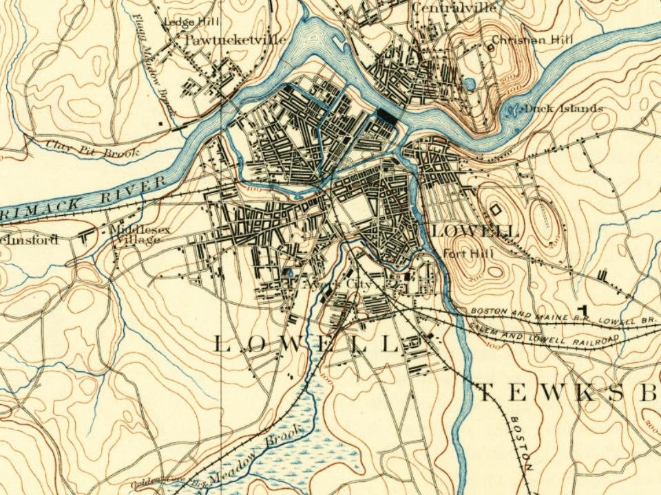
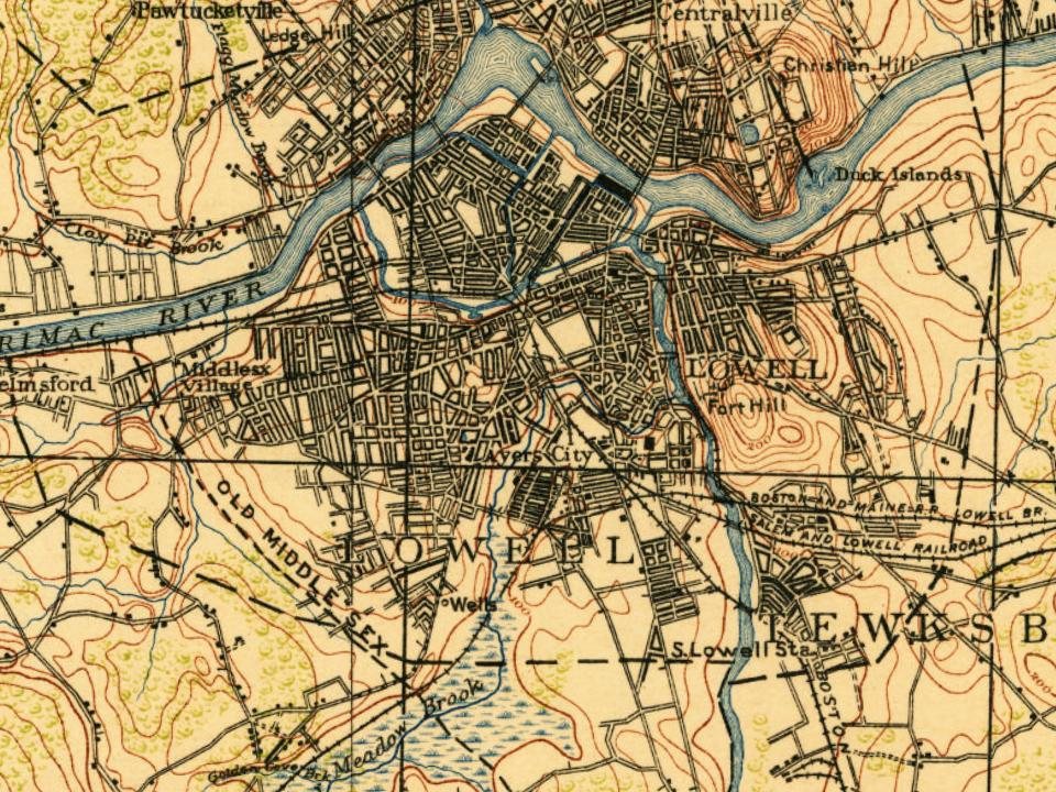
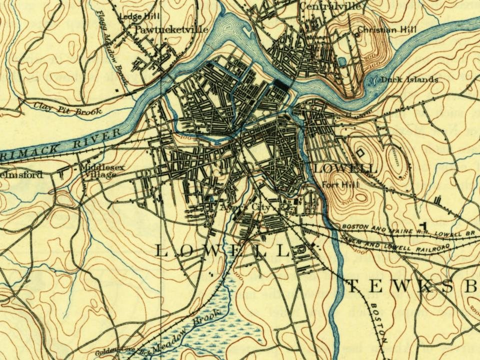
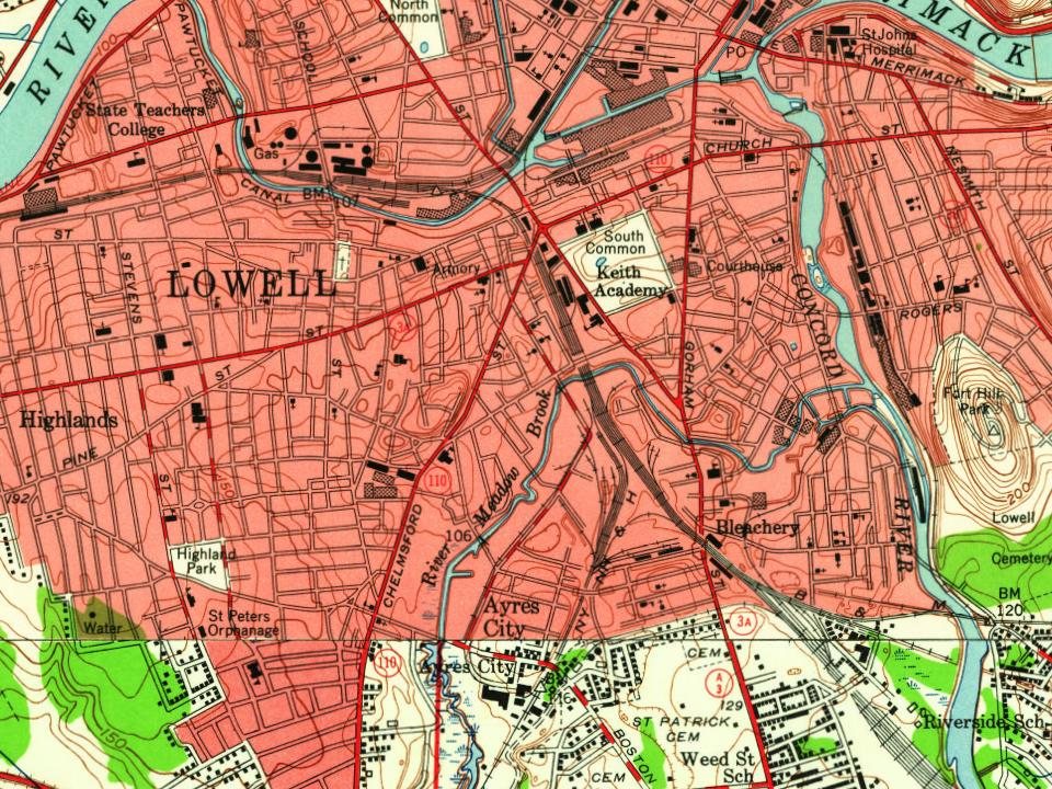
Every edition of the U.S. Geological Survey’s map of Lowell. Tap a year, or press play to watch the town change.
1886Lowell sheet · 1:62,500
U.S. Geological Survey historical topographic maps (public domain), via Esri’s collection of the scans. The red ring marks the center of Lowell.
Every building
Lowell, building by building, 1892–1907
Fire insurance maps drew every building, what it was made of and what it was used for, so insurers could price the risk of fire. Pick a year, then a sheet.
In 1653, according to Wikidata. Lowell’s post office opened in 1826, and the census of 1830 counted 6,474 people here.
How does Lowell rank for history?
Lowell is among the most historic 1% of U.S. towns, #20 of 283 in Massachusetts. The History grade combines the town’s founding era, the share of homes built before 1940 and its National Register listings. It’s a character grade, so it isn’t part of the overall grade. How it works.
What is on the National Register in Lowell?
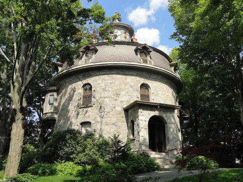
39 listings: 25 buildings, among them the Chelmsford Glass Works' Long House (listed 1973, the first), 14 historic districts with 1,056 contributing buildings, and 1 site. 1,496 historic buildings in all.
How old are the homes in Lowell?
44% of Lowell’s homes were built before 1940 (Census estimate, ±2.1 points), against a typical 21% for a Massachusetts town; the median home was built in 1953.
Founding dates: Wikidata, Wikipedia, the U.S. post office records of Blevins & Helbock (CC0) and the Census. Homes by year built: Census ACS 2020–24. National Register of Historic Places: National Park Service (list of May 22, 2026). Old photos, postcards and papers: Wikimedia Commons, the Library of Congress and other public archives, credited on each item’s page. Maps: U.S. Geological Survey historical topographic maps (via Esri) and Sanborn fire-insurance maps (Library of Congress). History text and census tables: Wikipedia (CC BY-SA 4.0). Places that used to be: USGS Geographic Names Information System (2021).
From Wikimedia Commons (5), the Library of Congress (1), the National Register of Historic Places (40), Wikipedia, Wikidata and Wikipedia for famous people, U.S. Geological Survey historical maps, U.S. Census counts (via Wikipedia), the US Post Offices dataset (Blevins & Helbock), the USGS Geographic Names Information System, Sanborn fire insurance maps (Library of Congress) and old county and town histories (Internet Archive). Archive images are copied here with their credits and licenses, shown on each photo’s page. Refreshed monthly.


 ★ Landmark





 1851
 c. 1865