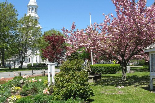
Harwich dates to 1670, and 13% of its homes were built before 1940
More historic than 84% of U.S. towns · #195 of 283 in Massachusetts. What drives it
5 places in town are on the National Register, among them a historic district with 40 buildings. Below: 16 old photos and papers, maps from 1887 on, and the census since 1790.
Founding year: Wikipedia. First post office: 1793.The full story ↓
History grade
What drives Harwich’s History grade
On its age, its old homes and the National Register, Harwich is more historic than 84% of U.S. towns, #195 of 283 in Massachusetts. All 3 inputs are above most U.S. towns; its age ranks highest and its share of homes from before 1940 lowest.
A−
HistoryA character grade: shown, never part of Harwich’s overall grade.
Massachusetts towns list more on the Register than most of the country (a typical Massachusetts town has 46.0 per 10,000 residents, the U.S. 2.4), so Harwich’s 36.8 sits near the middle of its state (42% of Massachusetts towns have fewer) while its 50 historic buildings outnumber those of 85% of U.S. towns.
NoteThe founding year comes from Wikipedia alone; no second source gives 1670.
How sure. Graded on any two of the three inputs instead, the letter would range from B+ to A. The pre-1940 share (±2.8 points) is firm at this size.
Founding year: Wikipedia (other dates in Quick answers). Homes: Census ACS 2020–24. National Register: National Park Service, May 2026 list; each listing counted once (boundary changes and added documentation belong to their listing), and a historic district counts its contributing buildings. How TownRatings grades history →
What stands out about Harwich’s past
Read from the archive, the National Register and the record. The page puts what stands out first.
Harwich was first settled by Europeans in 1670 as part of Yarmouth. The town was officially incorporated in 1694, and originally included the lands of the current town of Brewster. Early industry involved fishing and farming. The town is considered by some to be the birthplace of the cranberry industry, with the first commercial operation opened in 1846. There are still many bogs in the town, although the economy is now more centered on tourism and as a residential community. The town is also the site of the start/finish line of the "Sail Around the Cape", which rounds the Cape counter-clockwise, returning via the Cape Cod Canal.
Passages that mention Harwich, cut from the printed page as they were published.
History of Barnstable County, Massachusetts, 1620-1637-1686-18901890 · page 891Read the page →
Read the text
BREWSTER was set off from Harwich and incorporated as a town February 19, 1803. From 1747, when Harwich was divided into parishes, until the division in 1803, it was known as the north precinct or parish of Harwich. It is situated on the north side of the Cape, and is bounded east by Orleans, south by Harwich, west by Dennis, north by Cape Cod bay, and covers an area of about twentyfour square miles.
Text read by machine from the scan; it may contain errors.
Court for "an additional Act of Incorporation explanatory of the former, and vesting in this town all the powers, privileges, and immunities heretofore enjoyed by the North Precinct of the old town of Harwich before the setting off this town ; and to dissolve said parish as such," etc. The fact is, the division of the town of Harwich had been most strenuously opposed not only by the inhabitants residing in the South Precinct, but by numbers of highly influential and respectable persons in the North Precinct;
Text read by machine from the scan; it may contain errors.
The following proceedings, consequent upon the division effected, appear in the town records : — "Agreeably to an Act of General Court, Feb. 19, 1803, to divide the town of Harwich, and inc. the North Parish thereof into a separate town by the name of Brewster; agreeably to the 2d section of sd. act, the Remonstrants to the act living in the North Parish, together with such widows as live therein, and who shall request it, have liberty to remain, with their families
Text read by machine from the scan; it may contain errors.
History of Barnstable County, Massachusetts, 1620-1637-1686-18901890 · page 847Read the page →
Read the text
In 1753 the South parish, now the present town of Harwich, took action in matters relating to schools, and " choose Lieut. Zachariah Smalley, John Gage and Gershom Hall, to hire school masters or school mistress'," but whether they carried out the vote of the parish
Text read by machine from the scan; it may contain errors.
Scans and text from the Internet Archive. Books published in 1930 or earlier, which are in the public domain.
Timeline
Harwich, 1670 to 2020
Woven from the archive, old maps, post office records, the National Register and the people born here.
Nothing in the archives for these yearsWeddings on Main Street, storms, parades, school pictures, the old store. If it’s in your family album, it belongs here.
In 1670, according to Wikipedia’s history of the town. Harwich’s post office opened in 1793, and the first U.S. census counted 2,392 people here in 1790.
How does Harwich rank for history?
Harwich is more historic than 84% of U.S. towns, #195 of 283 in Massachusetts. The History grade combines the town’s founding era, the share of homes built before 1940 and its National Register listings. It’s a character grade, so it isn’t part of the overall grade. How it works.
What is on the National Register in Harwich?
5 listings: 4 buildings and 1 historic district, the Harwich Historic District, with 40 contributing buildings. 50 historic buildings in all.
How old are the homes in Harwich?
13% of Harwich’s homes were built before 1940 (Census estimate, ±2.8 points), against a typical 21% for a Massachusetts town; the median home was built in 1976.
Founding dates: Wikidata, Wikipedia, the U.S. post office records of Blevins & Helbock (CC0) and the Census. Homes by year built: Census ACS 2020–24. National Register of Historic Places: National Park Service (list of May 22, 2026). Old photos, postcards and papers: Wikimedia Commons, the Library of Congress and other public archives, credited on each item’s page. Maps: U.S. Geological Survey historical topographic maps (via Esri) and Sanborn fire-insurance maps (Library of Congress). History text and census tables: Wikipedia (CC BY-SA 4.0). Places that used to be: USGS Geographic Names Information System (2021).
From Wikimedia Commons (16), Wikidata (2), the National Register of Historic Places (5), Wikipedia, Wikidata and Wikipedia for famous people, U.S. Geological Survey historical maps, U.S. Census counts (via Wikipedia), the US Post Offices dataset (Blevins & Helbock), the USGS Geographic Names Information System, Sanborn fire insurance maps (Library of Congress) and old county and town histories (Internet Archive). Archive images are copied here with their credits and licenses, shown on each photo’s page. Refreshed monthly.


 1907–1915
 1907–1915
 1907–1915
 c. 1908
 c. 1911
 1916
 c. 1930
 c. 1930
 c. 1930
 c. 1930
 c. 1930