Guest, Sign inJoin

Post to Harwich Port

We’ll email a one-tap link to publish your post. No password, and nothing is public until you click it.
Already a member? Sign in
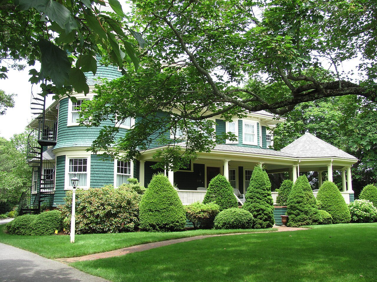
Augustus Snow House, Harwich Port MAPhoto: John Phelan · CC BY 3.0
–Not graded
History · Harwich Port

Harwich Port’s post office opened in 1851, and 28% of its homes were built before 1940

Below: 6 old photos and papers, maps from 1887 on, and old-book passages.

1851first post office
0on the National Register
28%homes built before 1940
6old photos & papers
From Harwich Port’s archive · credits on each photo
Quick answers

How Harwich Port began

When was Harwich Port founded?

1851

The Harwich Port post office opened in 1851, the earliest record of the town by name.

2020 census: 1,899175 years
Founding year: the first Harwich Port post office (Blevins & Helbock, CC0).

What stands out about Harwich Port’s past

Read from the archive, the National Register and the record. The page puts what stands out first.

★ What stands out · On the map

Harwich Port on the map, 1887 to 1974

Every edition of the U.S. Geological Survey’s map of Harwich Port. Tap a year, or press play to watch the town change.

Harwich Port on the 1887 USGS mapHarwich Port on the 1893 USGS mapHarwich Port on the 1949 USGS mapHarwich Port on the 1961 USGS mapHarwich Port on the 1974 USGS map1887Yarmouth sheet · 1:62,500

U.S. Geological Survey historical topographic maps (public domain), via Esri’s collection of the scans. The red ring marks the center of Harwich Port.

The story so far

Harwich Port, in brief

Wikipedia doesn’t have a history of Harwich Port yet. The photos, dates and memories neighbors add here are how it gets written.

Harwich Port (also spelled Harwichport) is a small affluent seaside community and census-designated place (CDP) situated along the Nantucket Sound in the town of Harwich in Barnstable County, Massachusetts, United States. It is named after the port of Harwich in Essex, England. As of the 2020 census, Harwich Port had a population of 1,899. It is a popular vacation spot on Cape Cod and is home to the Wychmere Beach Club and the Allen Harbor Yacht Club. Also, one of its popular mottos is "Three Harbors, One Port," referencing to Saquatucket, Wychmere, and Allen Harbor, which are all located in Harwich Port. Well known residents include Bill O'Brien, former head coach and general manager of th…

Its first post office opened in 1851. Between the 2010 and 2020 censuses its population grew from 1,644 to 1,899 (+16%).

Intro from Wikipedia. Population: U.S. Census Bureau.

From the old history books

What they wrote about Harwich Port, 1860–1890

Passages that mention Harwich Port, cut from the printed page as they were published.

Harwich Port, lying S. W. of the latter settlement, is, perhaps, more thickly settled; a village of recent growth, of considerable business, — chiefly connected with navigation and the fisheries, — and contains a Cong, meeting-house known as " the Pilgrim Church," a neat edifice ; a Methodist meeti…
The history of Cape Cod1860 · page 493Read the page →
Read the text

Harwich Port, lying S. W. of the latter settlement, is, perhaps, more thickly settled; a village of recent growth, of considerable business, — chiefly connected with navigation and the fisheries, — and contains a Cong, meeting-house known as " the Pilgrim Church," a neat edifice ; a Methodist meeting-house, near by, — the society occupying it being one of the oldest on the Cape, though dating back little more than half a century; and a hotel; the dwellings and other structures generally betokening a good

Text read by machine from the scan; it may contain errors.
Harwich Port lies on the south side of the town. It owes much of its growth to the fisheries and the coasting trade. There are many yet living who remember when the houses were few in number and far apart. Records show that for many years before 1753 the territory upon which the village stands was …
History of Barnstable County, Massachusetts, 1620-1637-1686-18901890 · page 855Read the page →
Read the text

Harwich Port lies on the south side of the town. It owes much of its growth to the fisheries and the coasting trade. There are many yet living who remember when the houses were few in number and far apart. Records show that for many years before 1753 the territory upon which the village stands was held by Ephraim Covel, who lived near Grass pond; but at which date, he being dead, it was in possession of his daughters, viz.: Thankful, wife of Edward Nickerson; Sarah, wife of Benjamin Nickerson; Mercy, wife

Text read by machine from the scan; it may contain errors.

Scans and text from the Internet Archive. Books published in 1930 or earlier, which are in the public domain.

By decade

Harwich Port, decade by decade

One decade in the archive so far: the 1930s. Scroll each row; tap a photo for its story.

Then & now

Stand where they stood

No then-and-now pairs yet. Take a photo from the same spot as an old one and they appear here side by side.

Allen Harbor Marine Service, Harwichport, Cape Cod, Mass (64196)
Retake this viewAllen Harbor Marine Service, Harwichport, Cape Cod, Mass (64196), c. 1930

Find the spot, match the angle, and add your photo. It becomes the first then-and-now pair on Harwich Port’s page.

Retake this view · +15
Famous people

Famous people close to Harwich Port

Nobody well known was born in Harwich Port itself, so here are the best known from just nearby.

See all →
Help out

Finish Harwich Port’s story

Most archives stop around 1920. The photos from after that are in family albums, not libraries.

Decades since 1900 with photos
00s10s20s30s40s50s60s70s80s90s
1 of 10 decades. The empty ones are waiting for someone’s album.
Stories next door

History across the town line

Each neighbor’s History grade, on the same three inputs.

Questions about Harwich Port’s history

What year was Harwich Port founded?

The Harwich Port post office opened in 1851, the earliest record of the town by name (U.S. post office records).

Memory lane

What the archives can’t tell you, neighbors can.

Town Square →
Start a conversation
Sources

Where this page comes from

Founding dates: Wikidata, Wikipedia, the U.S. post office records of Blevins & Helbock (CC0) and the Census. Homes by year built: Census ACS 2020–24. National Register of Historic Places: National Park Service (list of May 22, 2026). Old photos, postcards and papers: Wikimedia Commons, the Library of Congress and other public archives, credited on each item’s page. Maps: U.S. Geological Survey historical topographic maps (via Esri) and Sanborn fire-insurance maps (Library of Congress). History text and census tables: Wikipedia (CC BY-SA 4.0). Places that used to be: USGS Geographic Names Information System (2021). How TownRatings grades history →

From Wikimedia Commons (6), U.S. Geological Survey historical maps and old county and town histories (Internet Archive). Archive images are copied here with their credits and licenses, shown on each photo’s page. Refreshed monthly.