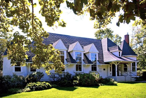
Founding year: Wikidata. First post office: 1798.The full story ↓
History grade
What drives Dennis’ History grade
On its age, its old homes and the National Register, Dennis is more historic than 73% of U.S. towns, #247 of 283 in Massachusetts. Its age holds the grade up; its National Register listings pull it down.
B+
HistoryA character grade: shown, never part of Dennis’ overall grade.
Massachusetts towns list more on the Register than most of the country (a typical Massachusetts town has 46.0 per 10,000 residents, the U.S. 2.4), so Dennis’ 3.4 sits below most of its state (19% of Massachusetts towns have fewer) while its 5 listings outnumber those of 70% of U.S. towns.
NoteThe founding year comes from Wikidata alone; no second source gives 1639.
How sure. Graded on any two of the three inputs instead, the letter would range from B− to A−. The pre-1940 share (±2.1 points) is firm at this size.
Founding year: Wikidata (other dates in Quick answers). Homes: Census ACS 2020–24. National Register: National Park Service, May 2026 list; each listing counted once (boundary changes and added documentation belong to their listing), and a historic district counts its contributing buildings. How TownRatings grades history →
What stands out about Dennis’ past
Read from the archive, the National Register and the record. The page puts what stands out first.
Indigenous peoples have been living in the Cape Cod region for at least 9,000 years. The historic Algonquian-speaking Wampanoag are one of 69 tribes of the original Wampanoag Nation.
After being settled by English colonists of the New Plymouth Colony in 1639 as part of the town of Yarmouth, Dennis became known as the East Precinct. The northern sections of the town were called Nobscussett, Sesuit and Quivet by the original inhabitants.
Passages that mention Dennis, cut from the printed page as they were published.
History of Barnstable County, Massachusetts, 1620-1637-1686-18901890 · page 520Read the page →
Read the text
Cemeteries. — In a town as old in its settlement as the territory of Dennis, these resting places for the dead are necessarily numerous. In the north part are the Worden, Sears, Howes, Hall and Paddock burying places, being private family grounds; also a general burial ground at East Dennis, and another at Dennis. At South Dennis we find one old one, and one at the Congregational church ; at Dennis Port, one; and another at West Dennis. Two ancient grounds exist — the Indian, on the shore of Scargo lake, and that of the Friends at
Text read by machine from the scan; it may contain errors.
History of Barnstable County, Massachusetts, 1620-1637-1686-18901890 · page 521Read the page →
Read the text
In 1730, after a period of neglect, the school affairs had become better settled, improvements were made, and two teachers were employed^ still traveling from division to division. In 1770 school houses had been erected at Nobscusset and Quivet Neck, and the town of Dennis, when erected, had as many districtsor divisions as the entire territory of both towns the century before. The original East Dennis school house was built in 1769 near the present site of Worden Hall. It was warmed by the old fire place, and not until its successor was erected
Text read by machine from the scan; it may contain errors.
from his pastoral relations to this town, after a ministry of twenty years. Mr. G. removed from town.1 A church organization was now effected in the Eastern Precinct, and Rev. Joslah Dennis was ordained June 22. The chief details of the progress of this church and parish will find their appropriate place in the introductory part of the annals of the town of Dennis.
Text read by machine from the scan; it may contain errors.
Dennis, set off as a distinct Parish in 1721, — being from that time known as the East Precinct, — was until the year 1794 a constituent part of Yarmouth. It was incorporated as a Town, June 19, 1793. The principal Indian names were Nobscusset, Sursidt, and Qirivet.1 Situation, Boundaries, etc. — It is situated iu lat.41° 45' N.
Text read by machine from the scan; it may contain errors.
Scans and text from the Internet Archive. Books published in 1930 or earlier, which are in the public domain.
By decade
Dennis, decade by decade
3 decades in the archive, from the 1900s to the 1940s. Scroll each row; tap a photo for its story.
Nothing in the archives for these yearsWeddings on Main Street, storms, parades, school pictures, the old store. If it’s in your family album, it belongs here.
In 1639, according to Wikidata. Dennis’ post office opened in 1798, and the census of 1850 counted 3,257 people here.
How does Dennis rank for history?
Dennis is more historic than 73% of U.S. towns, #247 of 283 in Massachusetts. The History grade combines the town’s founding era, the share of homes built before 1940 and its National Register listings. It’s a character grade, so it isn’t part of the overall grade. How it works.
What is on the National Register in Dennis?
5 listings: 4 buildings, among them the Josiah Dennis House (listed 1974, the first), and 1 site.
How old are the homes in Dennis?
11% of Dennis’ homes were built before 1940 (Census estimate, ±2.1 points), against a typical 21% for a Massachusetts town; the median home was built in 1970.
Founding dates: Wikidata, Wikipedia, the U.S. post office records of Blevins & Helbock (CC0) and the Census. Homes by year built: Census ACS 2020–24. National Register of Historic Places: National Park Service (list of May 22, 2026). Old photos, postcards and papers: Wikimedia Commons, the Library of Congress and other public archives, credited on each item’s page. Maps: U.S. Geological Survey historical topographic maps (via Esri) and Sanborn fire-insurance maps (Library of Congress). History text and census tables: Wikipedia (CC BY-SA 4.0). Places that used to be: USGS Geographic Names Information System (2021).
From Wikimedia Commons (25), Wikidata (5), the National Register of Historic Places (5), Wikipedia, Wikidata and Wikipedia for famous people, U.S. Geological Survey historical maps, U.S. Census counts (via Wikipedia), the US Post Offices dataset (Blevins & Helbock), the USGS Geographic Names Information System and old county and town histories (Internet Archive). Archive images are copied here with their credits and licenses, shown on each photo’s page. Refreshed monthly.


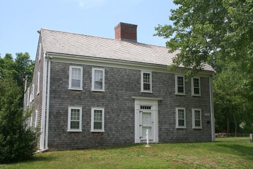


 c. 1930
 c. 1930
 c. 1930
 c. 1930
 c. 1930
 c. 1930
 c. 1930
 c. 1930
 c. 1930
 2014
 2013
 2012
 2012
 2012
 2009
 2009
 2009
 2007
 2007
 2007
 2006
 2006