Guest, Sign inJoin

Post to Dennis Port

We’ll email a one-tap link to publish your post. No password, and nothing is public until you click it.
Already a member? Sign in
–Not graded
History · Dennis Port

Dennis Port’s post office opened in 1862, and 13% of its homes were built before 1940

Below: 24 old photos and papers, maps from 1887 on, and old-book passages.

1862first post office
0on the National Register
13%homes built before 1940
24old photos & papers
1famous people
From Dennis Port’s archive · credits on each photo
Quick answers

How Dennis Port began

When was Dennis Port founded?

1862

The Dennis Port post office opened in 1862, the earliest record of the town by name.

2020 census: 3,487164 years
Founding year: the first Dennis Port post office (Blevins & Helbock, CC0).

What stands out about Dennis Port’s past

Read from the archive, the National Register and the record. The page puts what stands out first.

★ What stands out · By decade

Dennis Port, decade by decade

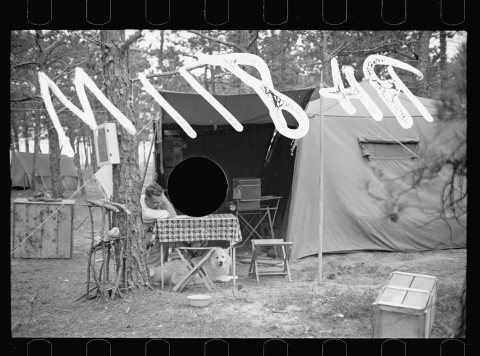
One decade in the archive so far: the 1930s. Scroll each row; tap a photo for its story.

On the map

Dennis Port on the map, 1887 to 1974

Every edition of the U.S. Geological Survey’s map of Dennis Port. Tap a year, or press play to watch the town change.

Dennis Port on the 1887 USGS mapDennis Port on the 1893 USGS mapDennis Port on the 1949 USGS mapDennis Port on the 1961 USGS mapDennis Port on the 1974 USGS map1887Yarmouth sheet · 1:62,500

U.S. Geological Survey historical topographic maps (public domain), via Esri’s collection of the scans. The red ring marks the center of Dennis Port.

The story so far

Dennis Port, in brief

Wikipedia doesn’t have a history of Dennis Port yet. The photos, dates and memories neighbors add here are how it gets written.

Dennis Port (or Dennisport) is a census-designated place (CDP) in the town of Dennis in Barnstable County, Cape Cod, Massachusetts, United States. As of the 2020 census, Dennis Port had a population of 3,487. The Swan Pond River and Upper County Road demarcate Dennis Port's western border with West Dennis. The village of West Harwich lies directly to Dennis Port's east, with the border demarcated by the median of Division Street. To the north of Dennis Port is South Dennis. Like other villages along Nantucket Sound, Dennis Port features warm-water beaches, like Haigis Beach, Sea Street Beach, and Glendon Road Beach. Many consider these among Cape Cod's most desirable beaches for swimming an…

Its first post office opened in 1862. Between the 2010 and 2020 censuses its population grew from 3,162 to 3,487 (+10%).

Intro from Wikipedia. Population: U.S. Census Bureau.

From the old history books

What they wrote about Dennis Port in 1890

Passages that mention Dennis Port, cut from the printed page as they were published.

tendence of B. F. Bee, the inventor, who also was superintendent of the tap and die factory. The village now contains two houses of worship and one school house. The railroad station for accommodation of Dennis Port and West Harwich, is situated in the western part of the village. Stores here were …
History of Barnstable County, Massachusetts, 1620-1637-1686-18901890 · page 861Read the page →
Read the text

tendence of B. F. Bee, the inventor, who also was superintendent of the tap and die factory. The village now contains two houses of worship and one school house. The railroad station for accommodation of Dennis Port and West Harwich, is situated in the western part of the village. Stores here were formerly kept by Ebenezar Kelley, Nathan Foster, Sheldon Crowell and Elijah B. Sears. The present stores are kept by Richard Baker and J. C. Baker.

Text read by machine from the scan; it may contain errors.
Dennis Port has been an active fishing station since the last century, closely related with West Harwich. As early as 1810 we find a good old-fashioned store here, kept by John Payson, in a lean-to of his residence, on what is now Main street. J. P. Wixon has his old account books, which show the q…
History of Barnstable County, Massachusetts, 1620-1637-1686-18901890 · page 534Read the page →
Read the text

Dennis Port has been an active fishing station since the last century, closely related with West Harwich. As early as 1810 we find a good old-fashioned store here, kept by John Payson, in a lean-to of his residence, on what is now Main street. J. P. Wixon has his old account books, which show the quaint and usual sales of rum, molasses, tobacco and wool — the dry goods of that day. Joshua Wixon, in 1833, opened a store of general goods and groceries, which he continued until his death in 1878. Barnabas Wixon also had, in 1833,

Text read by machine from the scan; it may contain errors.

Scans and text from the Internet Archive. Books published in 1930 or earlier, which are in the public domain.

Timeline

Dennis Port, 1839 to 1930

Woven from the archive, old maps, post office records, the National Register and the people born here.

  1. 19th century
  2. 1839Born hereSusan H. Wixon is born here
  3. 1887On the mapFirst mapped by the U.S. Geological Survey
  4. 20th century
  5. 1930In the archiveDennisport Beach, Cape Cod, Mass (77264)
Then & now

Stand where they stood

No then-and-now pairs yet. Take a photo from the same spot as an old one and they appear here side by side.

Dennisport Beach, Cape Cod, Mass (77264)
Retake this viewDennisport Beach, Cape Cod, Mass (77264), c. 1930

Find the spot, match the angle, and add your photo. It becomes the first then-and-now pair on Dennis Port’s page.

Retake this view · +15
Help out

Finish Dennis Port’s story

Most archives stop around 1920. The photos from after that are in family albums, not libraries.

Decades since 1900 with photos
00s10s20s30s40s50s60s70s80s90s
1 of 10 decades. The empty ones are waiting for someone’s album.
Stories next door

History across the town line

Each neighbor’s History grade, on the same three inputs.

Questions about Dennis Port’s history

What year was Dennis Port founded?

The Dennis Port post office opened in 1862, the earliest record of the town by name (U.S. post office records).

Memory lane

What the archives can’t tell you, neighbors can.

Town Square →
Start a conversation
Sources

Where this page comes from

Founding dates: Wikidata, Wikipedia, the U.S. post office records of Blevins & Helbock (CC0) and the Census. Homes by year built: Census ACS 2020–24. National Register of Historic Places: National Park Service (list of May 22, 2026). Old photos, postcards and papers: Wikimedia Commons, the Library of Congress and other public archives, credited on each item’s page. Maps: U.S. Geological Survey historical topographic maps (via Esri) and Sanborn fire-insurance maps (Library of Congress). History text and census tables: Wikipedia (CC BY-SA 4.0). Places that used to be: USGS Geographic Names Information System (2021). How TownRatings grades history →

From Wikimedia Commons (5), the Library of Congress (19), Wikidata and Wikipedia for famous people, U.S. Geological Survey historical maps and old county and town histories (Internet Archive). Archive images are copied here with their credits and licenses, shown on each photo’s page. Refreshed monthly.