Hanson dates to 1632, and 23% of its homes were built before 1940
More historic than 92% of U.S. towns · #124 of 283 in Massachusetts. What drives it
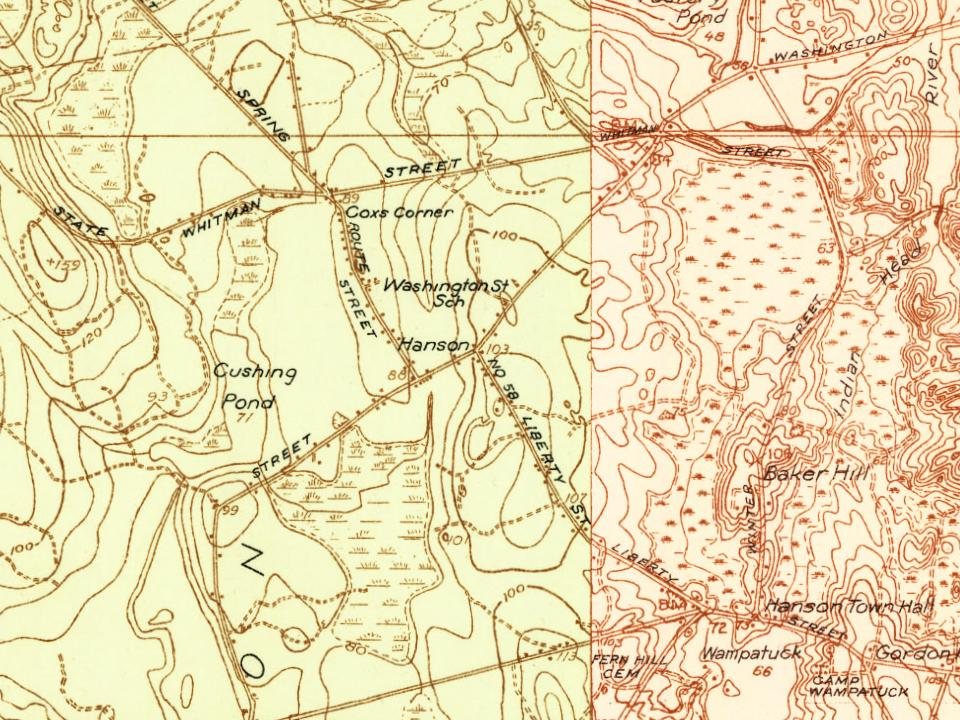
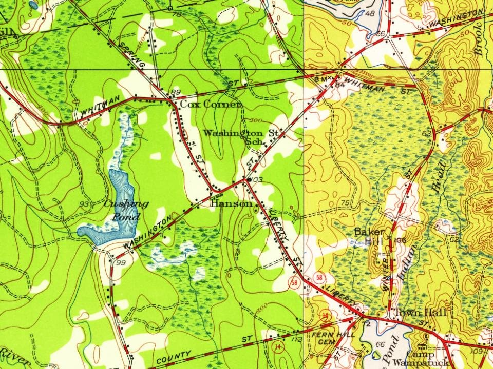
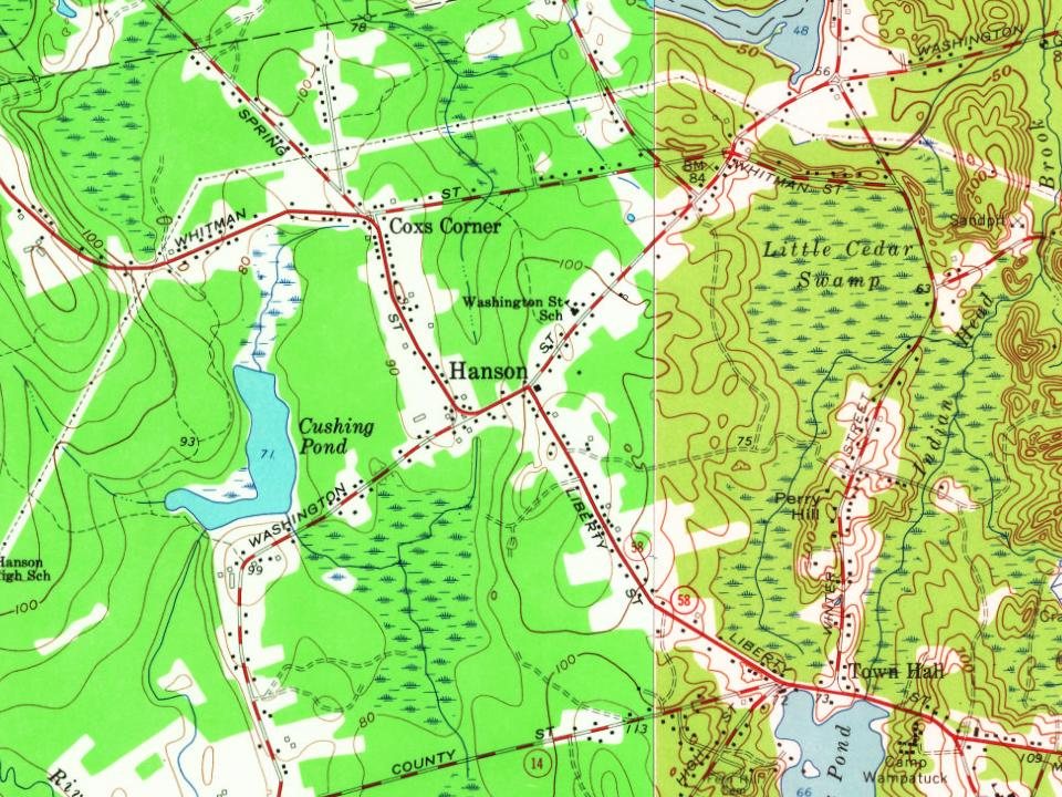
2 places in town are on the National Register, among them a historic district with 51 buildings. Below: 6 old photos and papers, maps from 1885 on, and the census since 1850.
Founding year: Wikidata; Wikipedia’s history section gives the same year. First post office: 1821.The full story ↓
History grade
What drives Hanson’s History grade
On its age, its old homes and the National Register, Hanson is more historic than 92% of U.S. towns, #124 of 283 in Massachusetts. All 3 inputs are above most U.S. towns; its age ranks highest and its National Register listings lowest.
A
HistoryA character grade: shown, never part of Hanson’s overall grade.
Massachusetts towns list more on the Register than most of the country (a typical Massachusetts town has 46.0 per 10,000 residents, the U.S. 2.4), so Hanson’s 48.8 sits near the middle of its state (48% of Massachusetts towns have fewer) while its 52 historic buildings outnumber those of 85% of U.S. towns.
How sure. Graded on any two of the three inputs instead, the letter would range from A− to A. The pre-1940 share is a Census survey estimate (±5.3 points). Two sources give 1632.
Founding year: Wikidata (other dates in Quick answers). Homes: Census ACS 2020–24. National Register: National Park Service, May 2026 list; each listing counted once (boundary changes and added documentation belong to their listing), and a historic district counts its contributing buildings. How TownRatings grades history →
What stands out about Hanson’s past
Read from the archive, the National Register and the record. The page puts what stands out first.
Hanson was first settled in 1632 as the western parish of Pembroke. The town was officially incorporated in 1820, and was named for Maryland publisher of the Federal Republican newspaper and U.S. Senator Alexander Contee Hanson. Hanson was a champion of free speech and freedom of the press, and he was severely beaten and his newspaper offices were attacked and destroyed by an angry mob after he published an article that was critical of the administration shortly after the outbreak of the War of 1812.
Passages that mention Hanson, cut from the printed page as they were published.
History of the early settlement of Bridgewater, in Plymouth county, Massachusetts, including an extensive Family register1840Read the page →
Read the text
Poor Meadow River, above mentioned, passes through Abington and the north-west corner of Hanson, entering the east parish on the easterly side ; and, uniting with the river coining from Halifax, through Monponset Pond and Robin's Pond, is then called Satucket River, and after receiving a small increase from Black Brook unites with John's River, as before stated. Hobart's works in Abington, and Cushing's in Hanson, formerly called Moor's Forge, stand on the Poor Meadow stream ;' and
Text read by machine from the scan; it may contain errors.
History of the early settlement of Bridgewater, in Plymouth county, Massachusetts, including an extensive Family register1840Read the page →
Read the text
ever belonging to Bridge water in its greatest extent. The greatest part of Abington, and what is now Hanson, at that period, belonged to Bridgewater, which must then have contained about ninety-six square miles. In this situation, and with these extensive territorial dimensions the town remained, without change or diminution, till June 10, 1712, when Abington was incorporated.
Text read by machine from the scan; it may contain errors.
History of Brockton, Plymouth County, Massachusetts, 1656-18941895 · page 38Read the page →
Read the text
Howard, was, on the petition of the selectmen of the town, annexed to Bridgewater, October 15, 1730. These several grants and additions constituted all the territory ever belonging to Bridgewater in its greatest extent. The greatest part of Abington and what is now Hanson at that period belonged to Bridgewater, which must then have contained about ninety-six square miles. In this situation, and with these extensive territorial dimensions, the town remained without change or diminution till June 10, 1712, when Abington was incorporated.
Text read by machine from the scan; it may contain errors.
History of the early settlement of Bridgewater in Plymouth county, Massachusetts, including an extensive Family register1897 · page 23Read the page →
Read the text
1730- These several grants and additions constituted all the territory ever belonging to Bridgewater in its greatest extent. The greatest part of Abington, and what is now Hanson, at that period belonged to Bridgewater, which must then have contained about ninety-six square miles. In this situation, and with these extensive territorial dimensions the town remained, without change or diminution, till June 10, 1712, when Abing-
Text read by machine from the scan; it may contain errors.
Scans and text from the Internet Archive. Books published in 1930 or earlier, which are in the public domain.
By decade
Hanson, decade by decade
One decade in the archive so far: the 1900s. Scroll each row; tap a photo for its story.
Nothing in the archives for these yearsWeddings on Main Street, storms, parades, school pictures, the old store. If it’s in your family album, it belongs here.
In 1632, according to Wikidata and Wikipedia’s history of the town. Hanson’s post office opened in 1821, and the census of 1850 counted 1,217 people here.
How does Hanson rank for history?
Hanson is more historic than 92% of U.S. towns, #124 of 283 in Massachusetts. The History grade combines the town’s founding era, the share of homes built before 1940 and its National Register listings. It’s a character grade, so it isn’t part of the overall grade. How it works.
What is on the National Register in Hanson?
Two places: the Camp Kiwanee Historic District (listed 2005) and the District 7 School House (2005).
How old are the homes in Hanson?
23% of Hanson’s homes were built before 1940 (Census estimate, ±5.3 points), against a typical 21% for a Massachusetts town; the median home was built in 1972.
Founding dates: Wikidata, Wikipedia, the U.S. post office records of Blevins & Helbock (CC0) and the Census. Homes by year built: Census ACS 2020–24. National Register of Historic Places: National Park Service (list of May 22, 2026). Old photos, postcards and papers: Wikimedia Commons, the Library of Congress and other public archives, credited on each item’s page. Maps: U.S. Geological Survey historical topographic maps (via Esri) and Sanborn fire-insurance maps (Library of Congress). History text and census tables: Wikipedia (CC BY-SA 4.0). Places that used to be: USGS Geographic Names Information System (2021).
From Wikimedia Commons (6), the National Register of Historic Places (2), Wikipedia, Wikidata and Wikipedia for famous people, U.S. Geological Survey historical maps, U.S. Census counts (via Wikipedia), the US Post Offices dataset (Blevins & Helbock), the USGS Geographic Names Information System and old county and town histories (Internet Archive). Archive images are copied here with their credits and licenses, shown on each photo’s page. Refreshed monthly.




 1901–1907
 1907–1915
 1907–1915
 1907–1915
 1907–1915


