East Bridgewater dates to 1649, and 20% of its homes were built before 1940
More historic than 88% of U.S. towns · #160 of 283 in Massachusetts. What drives it
2 places in town are on the National Register, among them two historic districts with 43 buildings between them. Below: 6 old photos and papers, maps from 1885 on, and the census since 1850.
Founding year: Wikidata. First post office: 1831.The full story ↓
History grade
What drives East Bridgewater’s History grade
On its age, its old homes and the National Register, East Bridgewater is more historic than 88% of U.S. towns, #160 of 283 in Massachusetts. All 3 inputs are above most U.S. towns; its age ranks highest and its National Register listings lowest.
A
HistoryA character grade: shown, never part of East Bridgewater’s overall grade.
Massachusetts towns list more on the Register than most of the country (a typical Massachusetts town has 46.0 per 10,000 residents, the U.S. 2.4), so East Bridgewater’s 29.7 sits near the middle of its state (39% of Massachusetts towns have fewer) while its 43 historic buildings outnumber those of 84% of U.S. towns.
NoteThe founding year comes from Wikidata alone; no second source gives 1649.
How sure. Graded on any two of the three inputs instead, the letter would range from B+ to A. The pre-1940 share is a Census survey estimate (±4.2 points).
Founding year: Wikidata (other dates in Quick answers). Homes: Census ACS 2020–24. National Register: National Park Service, May 2026 list; each listing counted once (boundary changes and added documentation belong to their listing), and a historic district counts its contributing buildings. How TownRatings grades history →
What stands out about East Bridgewater’s past
Read from the archive, the National Register and the record. The page puts what stands out first.
Every edition of the U.S. Geological Survey’s map of East Bridgewater. Tap a year, or press play to watch the town change.
1885Abington sheet · 1:62,500
U.S. Geological Survey historical topographic maps (public domain), via Esri’s collection of the scans. The red ring marks the center of East Bridgewater.
Places that used to be
Lost post offices, old corners, places now gone and burying grounds
East Bridgewater’s post office has been open since 1831. Two other post offices opened and closed inside today’s town.
The land that is now known as East Bridgewater was first settled by Europeans in 1630 as an outgrowth of the Plymouth and Duxbury plantations. It was a part of Olde Bridgewater, as the "East Parish" founded in 1723, until it officially separated from Bridgewater and incorporated on June 14, 1823.
The town was located on the northern portion of the Taunton River, and had an economy primarily based on agriculture, though industrial development followed. Iron works in the town provided muskets and cannon for the Colonial armies during the American Revolution.
Passages that mention East Bridgewater, cut from the printed page as they were published.
History of Brockton, Plymouth County, Massachusetts, 1656-18941895 · page 804Read the page →
Read the text
standing at the intersection of the present line between the city of Brockton and the town of West Bridgewater with the south line of Oak street ; thence at a right angle southerly from said town line two hundred and eighty-nine rods ; thence easterly in a line parallel to said town line to the town of East Bridgewater; thence northerly by said town line of East Bridgewater to said present boundary line, — with all the inhabitants and estates therein, is hereby set of!' from the town of West Bridgewater and anne.xed to and made a part of the said city of Brockton. The portion thereof lying west of Main street shall constitute a part of the third ward thereof, and the portion
Text read by machine from the scan; it may contain errors.
History of Brockton, Plymouth County, Massachusetts, 1656-18941895 · page 5Read the page →
Read the text
In 1851 Mr. Baalis Sanford, a young boy of sixteen years from the adjoining town of East Bridgewater, came into the store taking the place of Melville Hayward, who had left to engage in the study of law and afterward became distinguished in his profession in New York city. Young Sanford, now senior partner of the present firm, was at once given charge of the books, a responsibility which he has had from the first till now.
Text read by machine from the scan; it may contain errors.
History of the early settlement of Bridgewater, in Plymouth county, Massachusetts, including an extensive Family register1840 · page 99Read the page →
Read the text
East Bridgewater is principally indebted to the Allen family for the burying ground, meeting-house lot, and common or training-field, which were given by them.
Text read by machine from the scan; it may contain errors.
Scans and text from the Internet Archive. Books published in 1930 or earlier, which are in the public domain.
By decade
East Bridgewater, decade by decade
5 decades in the archive, from the 1840s to the 1940s. Scroll each row; tap a photo for its story.
Nothing in the archives for these yearsWeddings on Main Street, storms, parades, school pictures, the old store. If it’s in your family album, it belongs here.
In 1649, according to Wikidata. East Bridgewater’s post office opened in 1831, and the census of 1850 counted 2,545 people here.
How does East Bridgewater rank for history?
East Bridgewater is more historic than 88% of U.S. towns, #160 of 283 in Massachusetts. The History grade combines the town’s founding era, the share of homes built before 1940 and its National Register listings. It’s a character grade, so it isn’t part of the overall grade. How it works.
What is on the National Register in East Bridgewater?
Two places: the East Bridgewater Common Historic District (listed 1999) and the Sachem Rock Farm (2006).
How old are the homes in East Bridgewater?
20% of East Bridgewater’s homes were built before 1940 (Census estimate, ±4.2 points), against a typical 21% for a Massachusetts town; the median home was built in 1977.
Founding dates: Wikidata, Wikipedia, the U.S. post office records of Blevins & Helbock (CC0) and the Census. Homes by year built: Census ACS 2020–24. National Register of Historic Places: National Park Service (list of May 22, 2026). Old photos, postcards and papers: Wikimedia Commons, the Library of Congress and other public archives, credited on each item’s page. Maps: U.S. Geological Survey historical topographic maps (via Esri) and Sanborn fire-insurance maps (Library of Congress). History text and census tables: Wikipedia (CC BY-SA 4.0). Places that used to be: USGS Geographic Names Information System (2021).
From Wikimedia Commons (4), the Library of Congress (2), the National Register of Historic Places (2), Wikipedia, Wikidata and Wikipedia for famous people, U.S. Geological Survey historical maps, U.S. Census counts (via Wikipedia), the US Post Offices dataset (Blevins & Helbock), the USGS Geographic Names Information System and old county and town histories (Internet Archive). Archive images are copied here with their credits and licenses, shown on each photo’s page. Refreshed monthly.


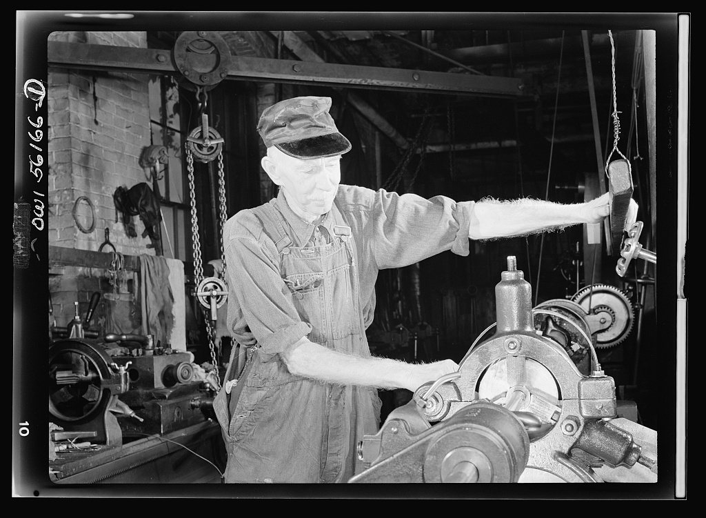


 1942


