Greenfield dates to 1686, and 44% of its homes were built before 1940
More historic than 98% of U.S. towns · #40 of 283 in Massachusetts. What drives it
10 places in town are on the National Register, among them three historic districts with 117 buildings between them. Below: 16 old photos and papers, maps from 1887 on, and the census since 1790.
Founding year: Wikidata; Wikipedia’s history section gives the same year. First post office: 1792.The full story ↓
History grade
What drives Greenfield’s History grade
On its age, its old homes and the National Register, Greenfield is more historic than 98% of U.S. towns, #40 of 283 in Massachusetts. All 3 inputs are above most U.S. towns; its age ranks highest and its National Register listings lowest.
A+
HistoryA character grade: shown, never part of Greenfield’s overall grade.
Massachusetts towns list more on the Register than most of the country (a typical Massachusetts town has 46.0 per 10,000 residents, the U.S. 2.4), so Greenfield’s 70.8 sits near the middle of its state (58% of Massachusetts towns have fewer) while its 125 historic buildings outnumber those of 91% of U.S. towns.
How sure. Graded on any two of the three inputs instead, the letter would range from A to A+. The pre-1940 share is a Census survey estimate (±3.2 points). Two sources give 1686.
Founding year: Wikidata (other dates in Quick answers). Homes: Census ACS 2020–24. National Register: National Park Service, May 2026 list; each listing counted once (boundary changes and added documentation belong to their listing), and a historic district counts its contributing buildings. How TownRatings grades history →
What stands out about Greenfield’s past
Read from the archive, the National Register and the record. The page puts what stands out first.
The Pocumtuck nation (an Indigenous American tribe) first settled and originally inhabited the Greenfield area. Native American artifacts found in the area have been dated between 7,000 and 9,000 BCE. The Pocumtucks planted field crops and fished local rivers. Some sources claim that they were wiped out by the Mohawks in 1664 and that the land was left unoccupied. Other sources show that the Pocumtucks joined the Wampanoag chief Metacom in August 1675 in the fight against English encroachment, indicating a continued presence in the area. The Pocumtuck also played an important role in the Battle of Turner's Falls on May 19, 1676, and tribal oral tradition indicates that following the battle, elements of the Pocumtuck fled to and were incorporated into the Abenaki people to the north and the Mahican people to the west.
Passages that mention Greenfield, cut from the printed page as they were published.
Official souvenir program, Greenfield (Massachusetts) sesqui-centennial, 1753 June 9 1903 ..1903Read the page →
Read the text
In 1767 Conway was set off from Deerfield and then it was discovered by Greenfield that there had been inserted surreptitiousl}' in the organic act, sentences which deprived Greenfield of the enjoyment of one-half of the income from the land sequestered for the use of the church, which up to this time Greenfield had enjoyed, according to the report of the committee on the division of the town. The citizens of Greenfield arose in arm.s. Deerfield, in pursuance of her claim, and by the organic act, proceeded to harvest the crops grown upon the sequestered land, and while so doing there appeared a force of men with carts and tools, who after a pitched battle succeeded in dispersing the Deerfield men and capturing the harvested crops. But Deerfield had the law
Text read by machine from the scan; it may contain errors.
Greenfield (Massachusetts) sesqui-centennial, 1753 June 9 19031903Read the page →
Read the text
The number of tons of freight received in Greenfield yearly is about 276,000 ; there are shipped yearly about 121,000 tons; there is transferred at the Greenfield freight station for other points about 168,000 tons yearly ; in addition there is set off and made up into trains about 240,000 tons ; there are about 50 passenger trains that pass through Greenfield every week day, going north, south, east and west.
Text read by machine from the scan; it may contain errors.
Official souvenir program, Greenfield (Massachusetts) sesqui-centennial, 1753 June 9 1903 ..1903Read the page →
Read the text
There are 42 miles of local electric trolley lines controlled and managed by Greenfield men and capital; there are 2,000,000 passengers carried on these lines yearly; the number of car miles run is 500,000 yearly. The Greenfield and Turners Falls system, connecting Greenfield with Turners Falls, Millers Falls and Montague, was opened in 1895 ; the Greenfield, Deerfield and Northampton system was fully opened in March, 1903. It connects Greenfield with Deerfield, South Deerfield, Whately, Hatfield, Northampton and points beyond.
Text read by machine from the scan; it may contain errors.
History of the town of Ashfield, Franklin County, Massachusetts from its settlement in 1742 to 19101910 · page 109Read the page →
Read the text
In 1814, John Alden was chosen agent to oppose the new road from Greenfield to Ashfield "in all its stages. " Vote, 98 to 20. In 1818, the town chose Thomas White, Esq., to ajjijcar at Court of Sessions at Greenfield to ojjpose building a bridge at Shelbume Falls.
Text read by machine from the scan; it may contain errors.
Scans and text from the Internet Archive. Books published in 1930 or earlier, which are in the public domain.
By decade
Greenfield, decade by decade
6 decades in the archive, from the 1830s to the 1930s. Scroll each row; tap a photo for its story.
Nothing in the archives for these yearsWeddings on Main Street, storms, parades, school pictures, the old store. If it’s in your family album, it belongs here.
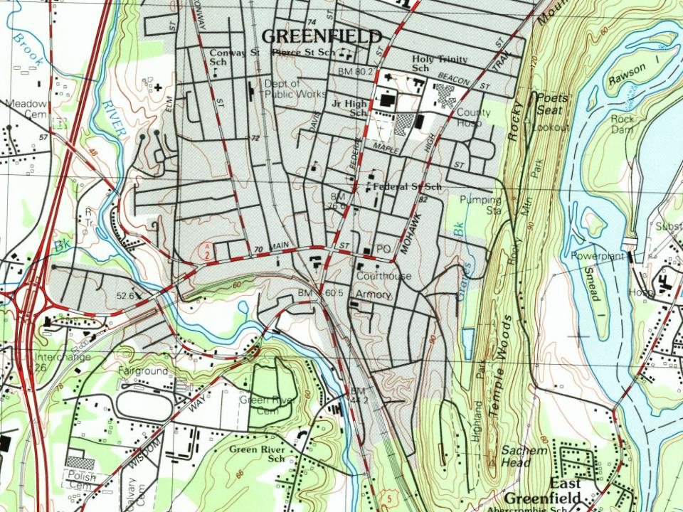
Fire insurance maps drew every building, what it was made of and what it was used for, so insurers could price the risk of fire. Pick a year, then a sheet.
In 1686, according to Wikidata and Wikipedia’s history of the town. Greenfield’s post office opened in 1792, and the first U.S. census counted 1,498 people here in 1790.
How does Greenfield rank for history?
Greenfield is more historic than 98% of U.S. towns, #40 of 283 in Massachusetts. The History grade combines the town’s founding era, the share of homes built before 1940 and its National Register listings. It’s a character grade, so it isn’t part of the overall grade. How it works.
What is on the National Register in Greenfield?
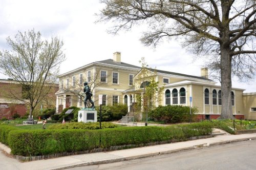
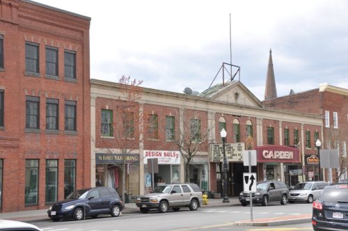
10 listings: 7 buildings, among them the Weldon Hotel (listed 1980, the first), and 3 historic districts, the Main Street Historic District, the East Main-High Street Historic District and the Franklin County Fairgrounds, with 117 contributing buildings. 125 historic buildings in all.
How old are the homes in Greenfield?
44% of Greenfield’s homes were built before 1940 (Census estimate, ±3.2 points), against a typical 21% for a Massachusetts town; the median home was built in 1947.
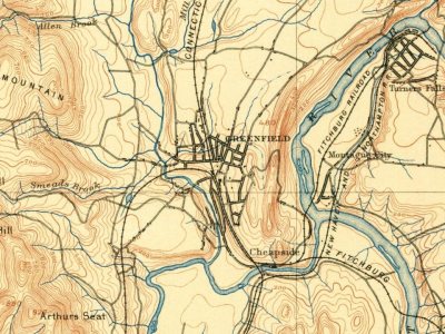
Founding dates: Wikidata, Wikipedia, the U.S. post office records of Blevins & Helbock (CC0) and the Census. Homes by year built: Census ACS 2020–24. National Register of Historic Places: National Park Service (list of May 22, 2026). Old photos, postcards and papers: Wikimedia Commons, the Library of Congress and other public archives, credited on each item’s page. Maps: U.S. Geological Survey historical topographic maps (via Esri) and Sanborn fire-insurance maps (Library of Congress). History text and census tables: Wikipedia (CC BY-SA 4.0). Places that used to be: USGS Geographic Names Information System (2021).
From Wikimedia Commons (16), Wikidata (2), the National Register of Historic Places (10), Wikipedia, Wikidata and Wikipedia for famous people, U.S. Geological Survey historical maps, U.S. Census counts (via Wikipedia), the US Post Offices dataset (Blevins & Helbock), the USGS Geographic Names Information System, Sanborn fire insurance maps (Library of Congress) and old county and town histories (Internet Archive). Archive images are copied here with their credits and licenses, shown on each photo’s page. Refreshed monthly.









 1907–1915
 1907–1915
 c. 1908
 c. 1911
 1913
 1917
 c. 1930
 c. 1930
 c. 1930
 c. 1930


