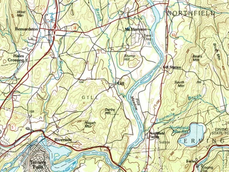
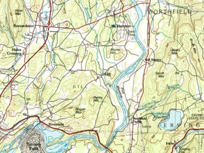
2 places in town are on the National Register, among them two historic districts with 157 buildings between them. Below: 4 old photos and papers, maps from 1986 on, and the census since 1850.
The Gill post office opened in 1822, the earliest record of the town by name. Two smaller post offices, Riverside (1872) and Mount Hermon (1886), opened inside today’s town and later closed.
First census: 754 in 18502020 census: 1,551204 years
How historic is Gill?
A+
More historic than 95% of U.S. towns, on its age, its old homes and the National Register.
Founding year: the first Gill post office (Blevins & Helbock, CC0).The full story ↓
History grade
What drives Gill’s History grade
On its age, its old homes and the National Register, Gill is more historic than 95% of U.S. towns. All 3 inputs are above most U.S. towns; its National Register listings ranks highest and its age lowest.
A+
HistoryA character grade: shown, never part of Gill’s overall grade.
Massachusetts towns list more on the Register than most of the country (a typical Massachusetts town has 46.0 per 10,000 residents, the U.S. 2.4), so Gill’s 902 sits above most of its state (96% of Massachusetts towns have fewer) while its 157 historic buildings outnumber those of 92% of U.S. towns.
How sure. Graded on any two of the three inputs instead, the letter would range from A to A+. The pre-1940 share is a Census survey estimate (±6.3 points). The founding year is the first post office, not a stated founding date.
Founding year: the first post office (other dates in Quick answers). Homes: Census ACS 2020–24. National Register: National Park Service, May 2026 list; each listing counted once (boundary changes and added documentation belong to their listing), and a historic district counts its contributing buildings. How TownRatings grades history →
What stands out about Gill’s past
Read from the archive, the National Register and the record. The page puts what stands out first.
Prior to the arrival of English colonists, the Massachusetts portion of the Connecticut River valley was occupied by the Nipmuc, an Algonquin-speaking tribe. A site on the river near the great falls shows evidence of human habitation dating back 10,000 years or more. In the 1670s the Nipmuc had a village called Peskeompscut in that area. During King Philip's War in 1676, Captain William Turner led 150 colonists in an attack on this settlement, in which 100-200 Indians (mostly women, children, and elderly) were slain. The falls came to be known as Turners Falls after Turner, who was slain in the battle. (The falls thereafter gave that name to the village of Turners Falls in neighboring Montague.)
, for toll bridge, 292, grant for bridge, 506, Justice, 1792, 289, resident in 1760, 243, resigns as referee in Gill matter, 291, school master, 585 " David, Jr., 654, 656, 846, 1190 " Dvnght, road to opened, 313 " Ebenezer, 120, 645, 654, 659, 738,
Text read by machine from the scan; it may contain errors.
History of the town of Bernardston, Franklin county, Massachusetts. 1736-1900. With genealogies1902 · page 169Read the page →
Read the text
this time he was associate principal of Thetford, Vt., academy. In 1852 he resumed ministerial labor, being installed at Petersham, Mass., and remaining there three years. His succeeding pastorates were at Erving, Gill, Hanson, Westminster, Vt. In 1863, he assumed charge of the Congregational parish in Bernardston, going thence in 1865 to Orange, Mass.
Text read by machine from the scan; it may contain errors.
History of the town of Bernardston, Franklin county, Massachusetts. 1736-1900. With genealogies1902 · page 403Read the page →
Read the text
ii. Benjamin^, m. Martha Wells. He was in town as late as 1780, up to which date he held town offices. He must have gone soon after to Gill or the south-east part of Bern. He d. Dec. 27, 1796. His death is here recorded, but his body is buried in the cemetery near the brick school house on the Gill road, as iS" also that of his brother JepUthah. Had: i. Aaron", b. Aug. 11, 1775. 2. Clarinda^ b. Oct. 28, 1777; m. Noah Allen of Gill.
Text read by machine from the scan; it may contain errors.
contains the remains of very many of the early settlers of the town, for a century ago, when Gill was a portion of the town of Greenfield, the old meetinghouse was considered to be near the centre of the town, and was the place for large gatherings of the people. The people interested particularly in these grounds have recently become incorporated under the name of High Street Cemetery, and have done very much to improve and beautify the place, and its appearance reflects great credit
Text read by machine from the scan; it may contain errors.
Scans and text from the Internet Archive. Books published in 1930 or earlier, which are in the public domain.
Timeline
Gill, 1796 to 1986
Woven from the archive, old maps, post office records, the National Register and the people born here.
Nothing in the archives for these yearsWeddings on Main Street, storms, parades, school pictures, the old store. If it’s in your family album, it belongs here.
The Gill post office opened in 1822, the earliest record of the town by name (U.S. post office records).
How does Gill rank for history?
Gill is more historic than 95% of U.S. towns. The History grade combines the town’s founding era, the share of homes built before 1940 and its National Register listings. It’s a character grade, so it isn’t part of the overall grade. How it works.
What is on the National Register in Gill?
Two places: the Riverside Village Historic District (listed 2017) and the Gill Center Historic District (2018).
How old are the homes in Gill?
27% of Gill’s homes were built before 1940 (Census estimate, ±6.3 points), against a typical 21% for a Massachusetts town; the median home was built in 1968.
Founding dates: Wikidata, Wikipedia, the U.S. post office records of Blevins & Helbock (CC0) and the Census. Homes by year built: Census ACS 2020–24. National Register of Historic Places: National Park Service (list of May 22, 2026). Old photos, postcards and papers: Wikimedia Commons, the Library of Congress and other public archives, credited on each item’s page. Maps: U.S. Geological Survey historical topographic maps (via Esri) and Sanborn fire-insurance maps (Library of Congress). History text and census tables: Wikipedia (CC BY-SA 4.0). Places that used to be: USGS Geographic Names Information System (2021).
From Wikimedia Commons (8), the Library of Congress (1), Wikidata (2), the National Register of Historic Places (2), Wikipedia, Wikidata and Wikipedia for famous people, U.S. Geological Survey historical maps, U.S. Census counts (via Wikipedia), the US Post Offices dataset (Blevins & Helbock), the USGS Geographic Names Information System and old county and town histories (Internet Archive). Archive images are copied here with their credits and licenses, shown on each photo’s page. Refreshed monthly.

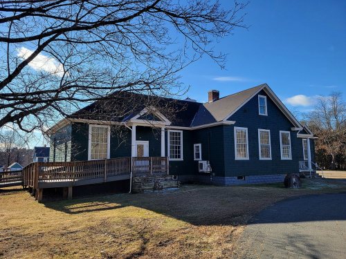



 2013
 2012
 2012
 2012
 2010