Great Barrington dates to 1726, and 36% of its homes were built before 1940
Among the most historic 1% of U.S. towns · #27 of 283 in Massachusetts. What drives it
14 places in town are on the National Register, among them the Du Bois, William E.B., Boyhood Homesite, a National Historic Landmark, and two historic districts with 179 buildings between them. Below: 11 old photos and papers, maps from 1884 on, and the census since 1790.
Founding year: Wikipedia. First post office: 1797.The full story ↓
History grade
What drives Great Barrington’s History grade
On its age, its old homes and the National Register, Great Barrington is among the most historic 1% of U.S. towns, #27 of 283 in Massachusetts. All 3 inputs put Great Barrington near the top nationally; its age ranks highest.
A+
HistoryA character grade: shown, never part of Great Barrington’s overall grade.
Massachusetts towns list more on the Register than most of the country (a typical Massachusetts town has 46.0 per 10,000 residents, the U.S. 2.4), so Great Barrington’s 274 sits above most of its state (82% of Massachusetts towns have fewer) while its 197 historic buildings outnumber those of 93% of U.S. towns.
NoteThe founding year comes from Wikipedia alone; no second source gives 1726.
How sure. Graded on any two of the three inputs instead, the letter would still be A+. The pre-1940 share is a Census survey estimate (±6.2 points).
Founding year: Wikipedia (other dates in Quick answers). Homes: Census ACS 2020–24. National Register: National Park Service, May 2026 list; each listing counted once (boundary changes and added documentation belong to their listing), and a historic district counts its contributing buildings. How TownRatings grades history →
What stands out about Great Barrington’s past
Read from the archive, the National Register and the record. The page puts what stands out first.
The country’s official list of buildings and places worth saving. One is a National Historic Landmark, the highest tier. Boundary changes and added documentation are counted with their listing.
National Park Service, National Register of Historic Places. Photos from Wikimedia Commons, credited on each place’s page.
On the map
Great Barrington on the map, 1885 to 1997
Every edition of the U.S. Geological Survey’s map of Great Barrington. Tap a year, or press play to watch the town change.
1885Sheffield sheet · 1:62,500
U.S. Geological Survey historical topographic maps (public domain), via Esri’s collection of the scans. The red ring marks the center of Great Barrington.
The Mahican Indians called the area Mahaiwe, meaning "the place downstream". It lay on the New England Path, which connected Fort Orange near Albany, New York, with Springfield and Massachusetts Bay.
The first recorded account of Europeans in the area happened in August 1676, during King Philip's War. Major John Talcott and his troops chased a group of 200 Mahican Natives west from Westfield, eventually overtaking them at the Housatonic River in what is now Great Barrington. According to reports at the time, Talcott's troops killed twenty-five Indians and imprisoned another twenty. Today, a plaque for John Talcott marks the spot where the massacre is believed to have happened.
Passages that mention Great Barrington, cut from the printed page as they were published.
History of Great Barrington, (Berkshire County,) Massachusetts1882 · page 493Read the page →
Read the text
any difficulties that may arise.* Be it enacted That the Town of Great Barrington for the present shall be the Shire Town of said County of Berkshii'e, and the Registers Office be there kept and that the Courts of General Sessions of the Peace and Inferior Court of Common Pleas appointed to be held and kept at the North Parish in Sheffield aforesaid, be held and kept in the Town of Great Barrington on the last Tuesday of April
Text read by machine from the scan; it may contain errors.
History of Great Barrington, (Berkshire County,) Massachusetts1882 · page 77Read the page →
Read the text
riod of ten years, — (from 1733 — the time of the incorporation of the town of Sheffield — to 1743 — the year in which the North Parish of Sheffield was formed — ) that part of Great Barrington lying south of the Great Bridge was included in Sheffield ; and from 1743 to 1761 — a fact not now" generally known — Sheffield, by an extension of its boundary lines, embraced the whole of the town of Great Barrington. The transactions
Text read by machine from the scan; it may contain errors.
The history of Pittsfield, (Berkshire County,) Massachusetts ... comp. and written, under the general direction of a committee1869 · page 556Read the page →
Read the text
Housatonic railroad proper, which extends from Bridgeport to the north line of Connecticut at Canaan — an extension of that road, under the name of the Berkshire, was made through ShefiSeld, Great Barrington, and the village of Van Deusenville in Stockbridge to West Stockbridge. In 1842, it received, from the Massachusetts legislature, authority to connect with the West Stockbridge road; and in 1847, to make a like connection with the Western at the state-line.
Text read by machine from the scan; it may contain errors.
Scans and text from the Internet Archive. Books published in 1930 or earlier, which are in the public domain.
Timeline
Great Barrington, 1726 to 1976
Woven from the archive, old maps, post office records, the National Register and the people born here.
Nothing in the archives for these yearsWeddings on Main Street, storms, parades, school pictures, the old store. If it’s in your family album, it belongs here.
Fire insurance maps drew every building, what it was made of and what it was used for, so insurers could price the risk of fire. Pick a year, then a sheet.
In 1726, according to Wikipedia’s history of the town. Great Barrington’s post office opened in 1797, and the first U.S. census counted 1,373 people here in 1790.
How does Great Barrington rank for history?
Great Barrington is among the most historic 1% of U.S. towns, #27 of 283 in Massachusetts. The History grade combines the town’s founding era, the share of homes built before 1940 and its National Register listings. It’s a character grade, so it isn’t part of the overall grade. How it works.
What is on the National Register in Great Barrington?
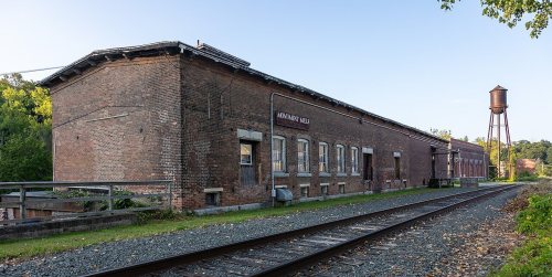
14 listings: 10 buildings, among them the Rising Paper Mill (listed 1975, the first), 2 historic districts, the Taconic and West Avenues Historic District and the Wheeler Family Farmstead, with 179 contributing buildings, and 2 sites. 197 historic buildings in all.
How old are the homes in Great Barrington?
36% of Great Barrington’s homes were built before 1940 (Census estimate, ±6.2 points), against a typical 21% for a Massachusetts town; the median home was built in 1958.
Founding dates: Wikidata, Wikipedia, the U.S. post office records of Blevins & Helbock (CC0) and the Census. Homes by year built: Census ACS 2020–24. National Register of Historic Places: National Park Service (list of May 22, 2026). Old photos, postcards and papers: Wikimedia Commons, the Library of Congress and other public archives, credited on each item’s page. Maps: U.S. Geological Survey historical topographic maps (via Esri) and Sanborn fire-insurance maps (Library of Congress). History text and census tables: Wikipedia (CC BY-SA 4.0). Places that used to be: USGS Geographic Names Information System (2021).
From Wikimedia Commons (11), Wikidata (1), the National Register of Historic Places (14), Wikipedia, Wikidata and Wikipedia for famous people, U.S. Geological Survey historical maps, U.S. Census counts (via Wikipedia), the US Post Offices dataset (Blevins & Helbock), the USGS Geographic Names Information System, Sanborn fire insurance maps (Library of Congress) and old county and town histories (Internet Archive). Archive images are copied here with their credits and licenses, shown on each photo’s page. Refreshed monthly.
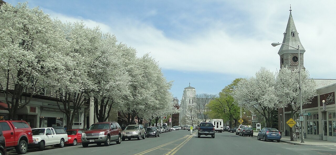


 ★ Landmark

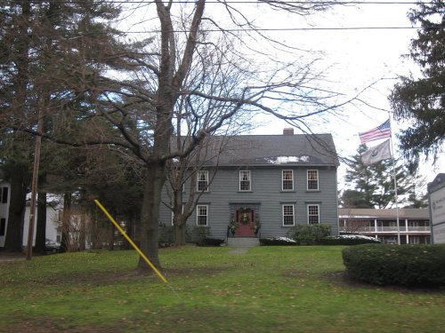



 c. 1865
 c. 1865
 c. 1865
 c. 1865
 c. 1865
 c. 1865
 1905
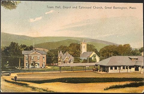 1907–1915


