Guest, Sign inJoin

Post to Alford

We’ll email a one-tap link to publish your post. No password, and nothing is public until you click it.
Already a member? Sign in
–Not graded
History · Alford

Alford dates to 1740, and 24% of its homes were built before 1940

Below: 1 old photo or paper, maps from 1885 on, and the census since 1790.

1740founded
0on the National Register
24%homes built before 1940
1old photo or paper
2famous people
Photo: ToddC4176 · CC BY-SA 3.0
Quick answers

How Alford began, and where its name came from

When was Alford founded?

1740

Alford dates its founding to 1740 (Wikidata). It appears in the first U.S. census, 1790.

First census: 577 in 17902020 census: 486286 years

How did Alford get its name?

Alford was named for Colonel John Alford of Charlestown, who was known for preaching Christianity to Native Americans and for sponsoring a theology professorship at Harvard College's Divinity School.

Founding year: Wikidata. First post office: 1829. Name: Wikipedia, licensed CC BY-SA 4.0.The full story ↓

What stands out about Alford’s past

Read from the archive, the National Register and the record. The page puts what stands out first.

★ What stands out · Help out

Start Alford’s collection

The first neighbors to add old photos shape how Alford’s history is told.

Decades since 1900 with photos
00s10s20s30s40s50s60s70s80s90s
1 of 10 decades. The empty ones are waiting for someone’s album.
On the map

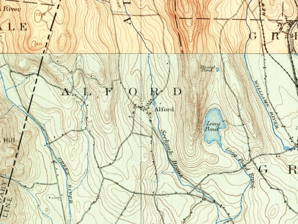
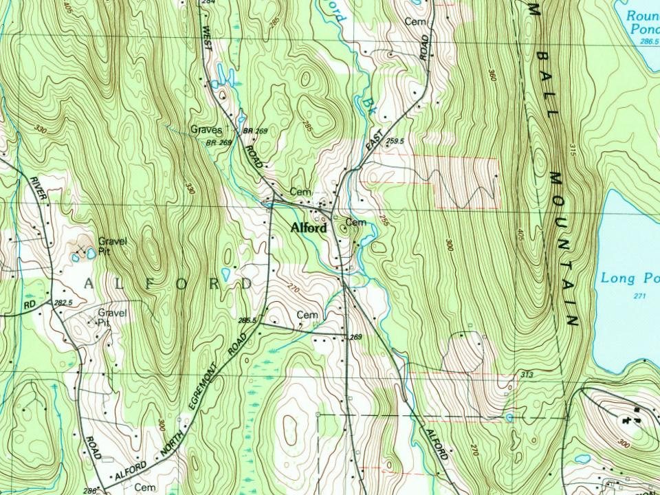
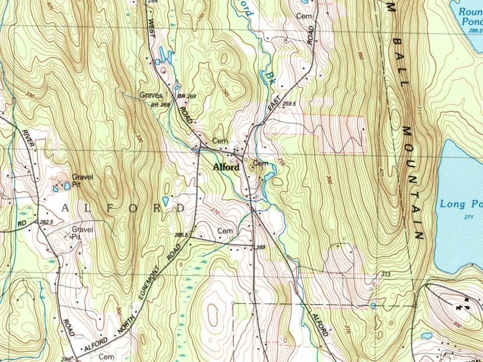
Alford on the map, 1885 to 1997

Every edition of the U.S. Geological Survey’s map of Alford. Tap a year, or press play to watch the town change.

Alford on the 1885 USGS mapAlford on the 1891 USGS mapAlford on the 1948 USGS mapAlford on the 1958 USGS mapAlford on the 1973 USGS mapAlford on the 1987 USGS mapAlford on the 1997 USGS map1885Sheffield sheet · 1:62,500

U.S. Geological Survey historical topographic maps (public domain), via Esri’s collection of the scans. The red ring marks the center of Alford.

People over time

Alford, census by census

010020030040050060018001850190019502000577 in 1790Low: 200

Lost two-thirds of its people between 1790 and 1930, then more than doubled.

19 censuses, 1790–2020.

U.S. Census Bureau decennial counts, from the census table on Alford’s Wikipedia page.

The story

How Alford came to be

From Wikipedia’s history of Alford.

Read it all →

Alford was first settled in 1756 as part of a land purchase from the Shauanum Stockbridge Mahican tribe by a group led by Timothy Woodbridge. The town, originally part of Great Barrington, separated in 1769 and was officially incorporated in 1773. It was named for Colonel John Alford of Charlestown, who was known for preaching Christianity to Native Americans and for sponsoring a theology professorship at Harvard College's Divinity School. The town has been mostly agricultural throughout its existence, however in 1799, large marble deposits were found on the western slopes of Tom Ball Mountain, and for the next 90 or so years it would be an industrious mining town. This would come to an end when the railroad was laid in a neighboring valley, rendering the last operating quarries of Alford unable to compete.

Text from Wikipedia, licensed CC BY-SA 4.0.

From the old history books

What they wrote about Alford in 1882

Passages that mention Alford, cut from the printed page as they were published.

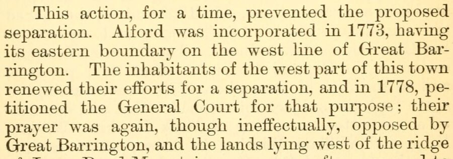
This action, for a time, prevented the proposed separation. Alford was incorporated in 1773, having its eastern boundary on the west line of Great Barrington. The inhabitants of the west part of this town renewed their efforts for a separation, and in 1778, petitioned the General Court for that pui…
History of Great Barrington, (Berkshire County,) Massachusetts1882 · page 222Read the page →
Read the text

This action, for a time, prevented the proposed separation. Alford was incorporated in 1773, having its eastern boundary on the west line of Great Barrington. The inhabitants of the west part of this town renewed their efforts for a separation, and in 1778, petitioned the General Court for that pui-pose ; their prayer was again, though ineffectually, opposed by Great Barrington, and the lands lymg west of the ridge

Text read by machine from the scan; it may contain errors.
and annexed to Alford, making with the first piece, a strip of 712 rods in length, and 296 rods in width at its southern end. In the north-eastern section, that part of the UjDper Township known as the Hoplands, was taken from this town and inchided in the town of Lee at the time of its incorporati…
History of Great Barrington, (Berkshire County,) Massachusetts1882 · page 38Read the page →
Read the text

and annexed to Alford, making with the first piece, a strip of 712 rods in length, and 296 rods in width at its southern end. In the north-eastern section, that part of the UjDper Township known as the Hoplands, was taken from this town and inchided in the town of Lee at the time of its incorporation, October 21st, 1777. By the setting oif to Alford, Great Barrington lost 1075 acres of its territory, which was still further

Text read by machine from the scan; it may contain errors.

Scans and text from the Internet Archive. Books published in 1930 or earlier, which are in the public domain.

Timeline

Alford, 1740 to 1937

Woven from the archive, old maps, post office records, the National Register and the people born here.

  1. 18th century
  2. 1740
    FoundingAlford is established
  3. 1770Born hereJohn W. Hulbert is born here
  4. 1790CensusPopulation peaks at 577
  5. 19th century
  6. 1829Post officeThe Alford post office opens
  7. 1870Born hereGeorge E. Hinman is born here
  8. 1885On the mapFirst mapped by the U.S. Geological Survey
  9. 20th century
  10. 1901Post officeThe Alford post office closes
  11. 1937In the archiveLand Utilization Town of Alford - DPLA - bdd4cb7ff2cd881a60f6a505aabd1395
By decade

Alford, decade by decade

One decade in the archive so far: the 1930s. Scroll each row; tap a photo for its story.

Then & now

Stand where they stood

No then-and-now pairs yet. Take a photo from the same spot as an old one and they appear here side by side.

Land Utilization Town of Alford - DPLA - bdd4cb7ff2cd881a60f6a505aabd1395
Retake this viewLand Utilization Town of Alford - DPLA - bdd4cb7ff2cd881a60f6a505aabd1395, 1937

Find the spot, match the angle, and add your photo. It becomes the first then-and-now pair on Alford’s page.

Retake this view · +15
Famous people

2 famous people were born in Alford

Writers, athletes, leaders and more, ranked by how widely they’re known.

See all →
Places that used to be

Lost post offices and burying grounds

Alford had its own post office from 1829 to 1901.

Alford
1829–1901
18201920today
1cemetery inside Alford
Center

US Post Offices dataset (Blevins & Helbock, CC0). Places and cemeteries from the USGS Geographic Names Information System (2021).

Stories next door

History across the town line

Each neighbor’s History grade, on the same three inputs.

Questions about Alford’s history

What year was Alford founded?

In 1740, according to Wikidata. Alford’s post office opened in 1829, and the first U.S. census counted 577 people here in 1790.

Memory lane

What the archives can’t tell you, neighbors can.

Town Square →
Start a conversation
Sources

Where this page comes from

Founding dates: Wikidata, Wikipedia, the U.S. post office records of Blevins & Helbock (CC0) and the Census. Homes by year built: Census ACS 2020–24. National Register of Historic Places: National Park Service (list of May 22, 2026). Old photos, postcards and papers: Wikimedia Commons, the Library of Congress and other public archives, credited on each item’s page. Maps: U.S. Geological Survey historical topographic maps (via Esri) and Sanborn fire-insurance maps (Library of Congress). History text and census tables: Wikipedia (CC BY-SA 4.0). Places that used to be: USGS Geographic Names Information System (2021). How TownRatings grades history →

From Wikimedia Commons (8), Wikipedia, Wikidata and Wikipedia for famous people, U.S. Geological Survey historical maps, U.S. Census counts (via Wikipedia), the US Post Offices dataset (Blevins & Helbock), the USGS Geographic Names Information System and old county and town histories (Internet Archive). Archive images are copied here with their credits and licenses, shown on each photo’s page. Refreshed monthly.