Guest, Sign inJoin

Post to Great Barrington

We’ll email a one-tap link to publish your post. No password, and nothing is public until you click it.
Already a member? Sign in
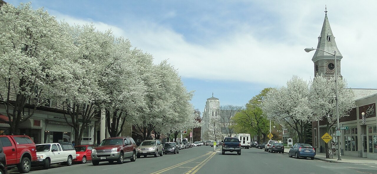
Great Barrington 2Photo: Anc516 · CC BY 3.0
A+Outdoors
Outdoors in Great Barrington

44% of Great Barrington’s land is conserved: 12,659 acres

4,725 acres are parks and preserves, 656 per 1,000 residents. 62 miles of mapped trail cross Great Barrington, 1.4 per square mile of land. The biggest trail networks: Beartown State Forest (23.4 mi), Monument Mountain Reservation (5.9 mi), Tom Ball Mountain Reserve (4.6 mi).

Ahead of 98% of U.S. towns · #92 of 283 in Massachusetts. What drives it

Conserved land
44%
12,659 acres · of 44.8 sq mi of land
Trails
62 mi
1.4 per sq mi of land
Park land
4,725 ac
656 acres per 1,000 residents
Near a park
89%
of residents within ½ mile
Bike routes
1.6 mi
0.2 mi lanes · 1.4 mi paths
Highest peak
1,837 ft
Beartown Mountain
Lakes & rivers
18
2 beaches · 2 boat launches

What kind of outdoors town is Great Barrington?

Read from the map. The page puts what stands out first.

Outdoors grade

How much outdoors does Great Barrington have?

On conserved land, trails, park land and how close residents live to a park, Great Barrington is ahead of 98% of U.S. towns, #92 of 283 in Massachusetts. All four inputs are above most U.S. towns; conserved land ranks highest, the share of residents near a park lowest.

A+
OutdoorsA character grade: shown, never part of Great Barrington’s overall grade.
All U.S. towns we grade (21,298)Ahead of 98%
LessMore
Massachusetts towns of 2,500+ (283)Ahead of 68%

Massachusetts towns conserve more land than most (a typical one, 21%; the U.S., 4%), so Great Barrington’s 44% is ahead of 95% of Massachusetts towns, while its trails per square mile lead 28% of them.

How sure. Graded on any three of the four inputs instead, the letter would still be A+. Trails and many small parks come from OpenStreetMap, mapped by volunteers, so coverage varies from town to town; the half mile is a straight line from each census block, so a river or highway in the way isn’t counted against it.

PAD-US, OpenStreetMap (© OpenStreetMap contributors), Census 2025 Gazetteer and 2020 blocks; details in Sources below. How TownRatings grades the outdoors →

The map

Conserved land, trails & bike routes

Tap a number to zoom to a park. Tap a layer to hide it.

12345678
Easements protect land from building but are usually private.© OpenStreetMap contributors · USGS PAD-US
Places to walk

Pick a walk

The longest trail network is Beartown State Forest, with 23.4 miles. Directions go to the nearest trailhead or public parking.

Beartown State Forest

Nature preserve
4,939 acres23.4 mi of trail
Beartown Mountain TrailWildcat TrailSky Peak TrailMount Wilcox Trail+1
Dog rules not recorded
Directionsto the parking lot

Monument Mountain Reservation

Managed by TTOR
475 acres5.9 mi of trail
Mohican Monument Trail (blue)Willow's Trail (orange)Hickey trail (yellow)Cross Over Trail (purple)+1
Dog rules not recorded
Directionsto the parking lot

Tom Ball Mountain Reserve

Managed by Berkshire Natural Resources Council
414 acres4.6 mi of trail
Longview Loop Trail
Dog rules not recorded
Directionsto the parking lot

East Mountain State Forest

Managed by Division of State Parks and Recreation
1,588 acres3.1 mi of trail
Appalachian Trail
Dog rules not recorded
No trailhead mapped yet

Fountain Pond State Park

Managed by Massachusetts Department of Conservation and Recreation
399 acres2.5 mi of trail
Threemile Hill Trail
Dog rules not recorded
Directionsto the parking lot

Agawam Lake Wildlife Management Area

Nature preserve
420 acres2.2 mi of trail
Unmaintained trailWillow's Trail (orange)
Dog rules not recorded
No trailhead mapped yet

Appalachian Trail Corridor

Managed by National Park Service
244 acres1.8 mi of trail
Appalachian Trail
Dogs usually limited
Directionsto the parking lot

Thomas & Palmer Brook

Managed by Berkshire Natural Resources Council (BNRC)
241 acres1.4 mi of trail
Woodland TrailMeadow LoopWhale Rock Trail
Dog rules not recorded
Directionsto the parking lot
All 33 parks & preserves
Beartown State Forest4,939 acres · 23.4 mi of trail
Directions
Monument Mountain Reservation475 acres · 5.9 mi of trail · TTOR
Directions
Tom Ball Mountain Reserve414 acres · 4.6 mi of trail · Berkshire Natural Resources Council
Directions
East Mountain State Forest1,588 acres · 3.1 mi of trail · Division of State Parks and Recreation
Fountain Pond State Park399 acres · 2.5 mi of trail · Massachusetts Department of Conservation and Recreation
Directions
Agawam Lake Wildlife Management Area420 acres · 2.2 mi of trail
Appalachian Trail Corridor244 acres · 1.8 mi of trail · National Park Service
Directions
Thomas & Palmer Brook241 acres · 1.4 mi of trail · Berkshire Natural Resources Council (BNRC)
Directions
East Mountain Forest34 acres · 1 mi of trail
East Mountain Reservoir162 acres · 0.9 mi of trail
Threemile Hill & CHP Loop121 acres · 0.9 mi of trail · Berkshire Natural Resources Council (BNRC)
Directions
Lake Mansfield Recreation Area and Conservation Forest30 acres · 0.9 mi of trail
Directions
Pfeiffer Arboretum at Long Pond40 acres · 0.8 mi of trail
Housatonic Flats27 acres · 0.8 mi of trail · Berkshire Natural Resources Council (BNRC)
Directions
Berkshire South83 acres · 0.6 mi of trail · Berkshire South Regional Community Center
Directions
McAllister Park100 acres · 0.4 mi of trail
Flag Rock Wildlife Conservation Easement45 acres · 0.4 mi of trail · Massachusetts Department of Fish & Game
Root Orchards32 acres · 0.2 mi of trail
Directions
Park Street Park5 acres · 0.1 mi of trail
Barrett Woods76 acres · Berkshire Natural Resources Council
Directions
Day Reserve, Berkshire Natural Resources Council (BNRC)63 acres · BNRC
Williams River Reserve41 acres · Berkshire Natural Resources Council (BNRC)
Housatonic River Access19 acres
Directions
John P Tracey Park9 acres
Fountain Pond Park5 acres
Memorial Field4 acres · Town of Great Barrington Parks and Recreation Department
Directions
Old Maids Park4 acres
Ball Field, Berkshire Natural Resources Council (BNRC)3 acres · BNRC
Directions
Grove Street Park2 acres
William Stanley Park1 acres
Housatonic Common1 acres
Grover's Corner1 acres · Town of Great Barrington Parks Commission
Directions
Charles Castranova Park1 acres
Who protects it

12,659 conserved acres

44% of Great Barrington’s land. Who manages Great Barrington’s conserved land, from the USGS Protected Areas Database. Approximate, because parcels can overlap.

Other state land1,954 ac
Land trusts & nonprofits1,817 ac
State natural resources405 ac
State parks244 ac
National Park Service226 ac
USDA easements (NRCS)215 ac
Town or city180 ac
State Resource Management Area · 6,944 acConservation Easement · 2,302 acAgricultural Easement · 2,286 acPrivate Other or Unknown · 1,105 acPrivate Conservation · 706 ac
Good to know

Conserved doesn’t always mean open to visitors. 2,540 acres are conservation easements, usually private land. Public access isn’t recorded for 4 of 175 parcels. The walks above are places people visit.

The biggest protected parcels
Parcel (PAD-US)Managed byAcresPublic access
Beartown State Forest
State Resource Management Area
Not recorded4,986Open
East Mountain State Forest
Local Resource Management Area
Not recorded1,850Open
Camp Institute Of Living Judaism
Private Other or Unknown
Not recorded549Unknown
Agawam Lake Wildlife Management Area
State Conservation Area
Not recorded415Open
Thomas and Palmer Brook Reserve
Private Conservation
Not recorded252Open
Fountain Pond Park
State Resource Management Area
State parks248Open
Appalachian National Scenic Trail
National Scenic or Historic Trail
National Park Service226Open
Wyantenuck Country Club
Private Other or Unknown
Not recorded187Open
Threemile Hill Conservation Area
Private Conservation
Not recorded140Open
Murdock Jeffrey H
Private Other or Unknown
Not recorded127Unknown

5 smaller protected places aren’t shown.

Things to do

42 places to go in Great Barrington

Beaches, playgrounds, peaks, falls and more. Pick a kind.

Scenic views in Great Barrington
Devil’s Pulpit overlookIn Monument Mountain Reservation
Directions
SRIT Back to Civilization?
Directions
SRIT Land Resources, Water Resources I
Directions
SRIT Land Resources, Water Resources II
Directions
SRIT Stone and Ice
Directions
SRIT The Forest for the Trees
Directions
SRIT Water in and upon the Earth
Directions
Simon's Rock
Directions
1 more scenic view
view west
Directions

Plus 11 scenic views without a name on the map.

Trails & water

25 named trails and 18 lakes & rivers

Named trails
Horses · 8.0 miUnpaved · 33.2 mi
Beartown Mountain Trail4.6 mi
Wildcat Trail4.3 mi
Appalachian Trail3.7 mi
Sky Peak Trail2.8 mi
Threemile Hill Trail2.2 mi
Mount Wilcox Trail2.1 mi
Old Taconic Skyline Trail2.1 mi
Unmaintained trail1.9 mi
Willow's Trail (orange)1.8 mi
Longview Loop Trail1.8 mi
15 more trails
Mohican Monument Trail (blue)
1.5 mi
Ski and Bridle Trail
1.1 mi
Hickey trail (yellow)
0.9 mi
Housatonic Flats Trail
0.8 mi
Simon's Rock Interpretive Trail
0.7 mi
Beebe Trail
0.7 mi
Cross Over Trail (purple)
0.7 mi
Peeskawso Peak Trail (red)
0.7 mi
Woodland Trail
0.6 mi
Main Trail
0.4 mi
Meadow Loop
0.4 mi
Lookout Trail
0.4 mi
Loop Trail
0.3 mi
Whale Rock Trail
0.3 mi
Wildcat Access Trail
0.2 mi
Lakes & rivers tap for directions
Biking & sports

1.6 miles of bike routes

Bike lanes are often missing from the map in smaller towns, so that number is likely low.

0.2 mi
painted or protected bike lanes
1.4 mi
off-road bike paths
Courts & fields
20Tennis
7Baseball
3Basketball
1Skate park
1Soccer
1Football

Includes school and college facilities, which aren’t always open to the public.

History along the way

14 places on the National Register, one a National Historic Landmark

The country’s official list of places worth saving (National Park Service). The map also marks 1 historic points from OpenStreetMap: plaques, memorials and old buildings.

History →
★
Du Bois, William E.B., Boyhood HomesiteNational Historic Landmark · Site · listed 1976
About it
Rising Paper MillBuilding · listed 1975
About it
Dwight-Henderson HouseBuilding · listed 1976
About it
Searles CastleBuilding · listed 1982
About it
Monument MillsBuilding · listed 1983
About it
US Post Office-Great Barrington MainBuilding · listed 1986
About it
Society of the Congregational Church of Great BarringtonBuilding · listed 1992
About it
Taconic and West Avenues Historic DistrictDistrict · listed 1998
About it
Housatonic Congregational ChurchBuilding · listed 2002
About it
Clinton African Methodist Episcopal Zion ChurchBuilding · listed 2008
About it
Mahaiwe BlockBuilding · listed 2008
About it
Tyringham CemeterySite · listed 2009
About it

2 more on the History page.

When to get out

The best walking months in Great Barrington: May and August

NOAA’s 1991–2020 normals for the town and the daylight at its latitude. Outlined months have long days, highs of 59 to 86 °F and little rain for the place.

JanFebMarAprMayJunJulAugSepOctNovDec
Daylight (h)9.410.511.813.314.615.215.013.912.411.09.79.1
High (°F)323644586977828072604837
Rain (in)3.22.53.43.43.84.44.44.14.64.53.43.7

February is the driest month (2.5 in) and July the warmest (highs of 82 °F). 4.6 inches fall in September, the wettest month. The climate in Great Barrington →

Next door

Great Barrington and its neighbors

Great Barrington has the most mapped trails of the 7 towns around it. Tap a town to see its outdoors.

TownConserved
of land
Trail mi
per sq mi
Park acres
per 1,000
Near a park
½ mile
Outdoors
Great Barrington44%1.465689%A+
Egremont33%0.91,91182%A+
Housatonic— not graded: under 1,000 residents or part of its town
Alford— not graded: under 1,000 residents or part of its town
Stockbridge26%0.783091%A+
West Stockbridge21%0.295085%A
Monterey47%1.02,37180%A+

The four inputs of the Outdoors grade, from the engine; shares are of land, not water.

Questions about parks and trails in Great Barrington

Where can I hike in Great Barrington?

The longest trail networks: Beartown State Forest, 23.4 miles; Monument Mountain Reservation, 5.9 miles; Tom Ball Mountain Reserve, 4.6 miles; East Mountain State Forest, 3.1 miles. Each one is on the map above, with directions to the nearest trailhead or parking.

How much of Great Barrington is conserved land?

44% of its land, against a typical 21% for a Massachusetts town and 4% nationally (PAD-US). Conserved doesn’t always mean open to visitors: easements are usually private land.

Are dogs allowed on Great Barrington’s trails?

Beartown State Forest and Monument Mountain Reservation don’t have dog rules recorded on the map; check the signs at the trailhead.

Where can I bike in Great Barrington?

1.6 miles of bike routes are on the map: 0.2 of painted or protected lanes and 1.4 of off-road paths.

Is there public land near Great Barrington?

86,019 acres of parks and open public land lie inside Great Barrington or within 10 miles of it (PAD-US), 10,171 of them inside the town line.

How much outdoors does Great Barrington have?

Ahead of 98% of U.S. towns on the Outdoors grade, #92 of 283 in Massachusetts. The grade combines the share of land that is conserved, miles of mapped trail per square mile of land, park acres per 1,000 residents and the share of residents within a half mile of a park. It’s a character grade, so it isn’t part of the overall grade. How it works.

Trail talk

Conditions, parking and favorite walks from Great Barrington neighbors.
Town Square →
Share a tip
Sources

Where this page comes from

Conserved and public land: USGS Protected Areas Database of the United States (PAD-US), service updated July 2026. Parks, trails, playgrounds, beaches and other places: OpenStreetMap (© OpenStreetMap contributors, ODbL), map data as of 2026-10-28. Land and water area: Census 2025 Gazetteer. Residents near a park: 2020 Census blocks. National Register: National Park Service. How TownRatings grades the outdoors →