Falmouth dates to 1660, and 14% of its homes were built before 1940
More historic than 90% of U.S. towns · #142 of 283 in Massachusetts. What drives it
14 places in town are on the National Register, among them four historic districts with 318 buildings between them. Below: 27 old photos and papers, maps from 1886 on, and the census since 1790.
Founding year: Wikidata; Wikipedia’s history section gives the same year. First post office: 1795.The full story ↓
History grade
What drives Falmouth’s History grade
On its age, its old homes and the National Register, Falmouth is more historic than 90% of U.S. towns, #142 of 283 in Massachusetts. All 3 inputs are above most U.S. towns; its age ranks highest and its share of homes from before 1940 lowest.
A
HistoryA character grade: shown, never part of Falmouth’s overall grade.
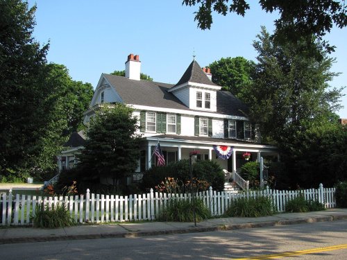
Massachusetts towns list more on the Register than most of the country (a typical Massachusetts town has 46.0 per 10,000 residents, the U.S. 2.4), so Falmouth’s 103 sits near the middle of its state (64% of Massachusetts towns have fewer) while its 341 historic buildings outnumber those of 96% of U.S. towns.
How sure. Graded on any two of the three inputs instead, the letter would range from A− to A+. The pre-1940 share (±2.0 points) is firm at this size. Two sources give 1660.
Founding year: Wikidata (other dates in Quick answers). Homes: Census ACS 2020–24. National Register: National Park Service, May 2026 list; each listing counted once (boundary changes and added documentation belong to their listing), and a historic district counts its contributing buildings. How TownRatings grades history →
What stands out about Falmouth’s past
Read from the archive, the National Register and the record. The page puts what stands out first.
Nothing in the archives for these yearsWeddings on Main Street, storms, parades, school pictures, the old store. If it’s in your family album, it belongs here.
Falmouth was first settled by English colonists in 1660 and was officially incorporated in 1686. Bartholomew Gosnold named the settlement after Falmouth, Cornwall, England, his home port. Early principal activities were farming, salt works, shipping, whaling, and sheep husbandry, which was very popular due to the introduction of Merino sheep and the beginnings of water-powered mills that could process the wool. In 1837, Falmouth averaged about 50 sheep per square mile.
Through the influence of the Rev. Joseph Metcalf, seventeen men and women were detached from the parish in Barnstable to set up a parish of their own in Falmouth, and in 1708 the First Congregational Church of Falmouth was formed. The meeting house that the people held their worship in soon became inadequate to house the steadily increasing congregation, and in 1715 the second meeting house was built. The money came from the sale
Text read by machine from the scan; it may contain errors.
tian worship in the township of Falmouth in 1930, and six denominations represented in church societies among the 5000 population; a far cry from 1708 when the first church was organized in Falmouth, with but one building, one denomination.
Text read by machine from the scan; it may contain errors.
History of Barnstable County, Massachusetts, 1620-1637-1686-18901890 · page 134Read the page →
Read the text
Falmouth early became an important town in this business, and from Woods Holl several ships were equipped and sent to the Pacific and Arctic whaling grounds. The details of their voyages more fully appear in the history of the town of Falmouth in this volume. The business from the other whaling ports of the lower Cape was still more extensive, but the details as given of the voyages from the port of Woods Holl furnish a general idea of the whalemen's experiences,
Text read by machine from the scan; it may contain errors.
Scans and text from the Internet Archive. Books published in 1930 or earlier, which are in the public domain.
Timeline
Falmouth, 1660 to 1988
Woven from the archive, old maps, post office records, the National Register and the people born here.
Every edition of the U.S. Geological Survey’s map of Falmouth. Tap a year, or press play to watch the town change.
1886Falmouth sheet · 1:62,500
U.S. Geological Survey historical topographic maps (public domain), via Esri’s collection of the scans. The red ring marks the center of Falmouth.
Every building
Falmouth, building by building, 1901–1923
Fire insurance maps drew every building, what it was made of and what it was used for, so insurers could price the risk of fire. Pick a year, then a sheet.
In 1660, according to Wikidata and Wikipedia’s history of the town. Falmouth’s post office opened in 1795, and the first U.S. census counted 1,637 people here in 1790.
How does Falmouth rank for history?
Falmouth is more historic than 90% of U.S. towns, #142 of 283 in Massachusetts. The History grade combines the town’s founding era, the share of homes built before 1940 and its National Register listings. It’s a character grade, so it isn’t part of the overall grade. How it works.
What is on the National Register in Falmouth?
14 listings: 9 buildings, among them the Crowell-Bourne Farm (listed 1980, the first), 4 historic districts with 318 contributing buildings, and 1 structure. 341 historic buildings in all.
How old are the homes in Falmouth?
14% of Falmouth’s homes were built before 1940 (Census estimate, ±2.0 points), against a typical 21% for a Massachusetts town; the median home was built in 1973.
Founding dates: Wikidata, Wikipedia, the U.S. post office records of Blevins & Helbock (CC0) and the Census. Homes by year built: Census ACS 2020–24. National Register of Historic Places: National Park Service (list of May 22, 2026). Old photos, postcards and papers: Wikimedia Commons, the Library of Congress and other public archives, credited on each item’s page. Maps: U.S. Geological Survey historical topographic maps (via Esri) and Sanborn fire-insurance maps (Library of Congress). History text and census tables: Wikipedia (CC BY-SA 4.0). Places that used to be: USGS Geographic Names Information System (2021).
From Wikimedia Commons (22), the Library of Congress (5), Wikidata (7), the National Register of Historic Places (14), Wikipedia, Wikidata and Wikipedia for famous people, U.S. Geological Survey historical maps, U.S. Census counts (via Wikipedia), the US Post Offices dataset (Blevins & Helbock), the USGS Geographic Names Information System, Sanborn fire insurance maps (Library of Congress) and old county and town histories (Internet Archive). Archive images are copied here with their credits and licenses, shown on each photo’s page. Refreshed monthly.




 1860
 c. 1863
 1886
 1901–1907
 c. 1906
 c. 1906
 1907–1915
 1907–1909
 1907–1915
 1907–1912
 1907–1915
 c. 1908
 1908
 1908
 c. 1908
 c. 1909
 c. 1909
 c. 1910
 1910
 1911
 1911
 1911
 1911
 1911
 1911
 1911
 1911


