Mashpee dates to 1660, and 2 of its places are on the National Register
More historic than 54% of U.S. towns · #277 of 283 in Massachusetts. What drives it
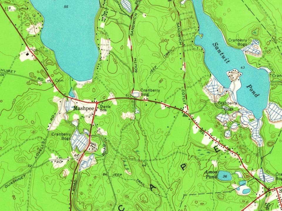
Most of Mashpee was built recently: 3% of its homes predate 1940 and the median home dates from 1988. Its Register listings are the Avant House and the Old Indian Meeting House. Below: 1 old photo or paper, maps from 1888 on, and the census since 1790.
Founding year: Wikidata; Wikipedia’s history section gives the same year. First post office: 1868.The full story ↓
History grade
What drives Mashpee’s History grade
On its age, its old homes and the National Register, Mashpee is more historic than 54% of U.S. towns, #277 of 283 in Massachusetts. Its age holds the grade up; its share of homes from before 1940 pulls it down.
B−
HistoryA character grade: shown, never part of Mashpee’s overall grade.
Massachusetts towns list more on the Register than most of the country (a typical Massachusetts town has 46.0 per 10,000 residents, the U.S. 2.4), so Mashpee’s 2.0 sits below most of its state (13% of Massachusetts towns have fewer) while its 3 historic buildings outnumber those of 65% of U.S. towns.
How sure. Graded on any two of the three inputs instead, the letter would range from C− to B+. The pre-1940 share (±0.8 points) is firm at this size. Two sources give 1660.
Founding year: Wikidata (other dates in Quick answers). Homes: Census ACS 2020–24. National Register: National Park Service, May 2026 list; each listing counted once (boundary changes and added documentation belong to their listing), and a historic district counts its contributing buildings. How TownRatings grades history →
What stands out about Mashpee’s past
Read from the archive, the National Register and the record. The page puts what stands out first.
Cape Cod was occupied for more than ten thousand years by indigenous peoples. The historic Algonquian-speaking Wampanoag were the native people encountered by the English colonists here and in the area of the Massachusetts Bay Colony in the seventeenth century. The Wampanoag also controlled considerable coastal area. These two cultures would interact, shaping each other for decades.
Passages that mention Mashpee, cut from the printed page as they were published.
History of Barnstable County, Massachusetts, 1620-1637-1686-18901890Read the page →
Read the text
organized in 1885, 1886, are in Plymouth county. The Marston's Mills and Woodland Companies, in Barnstable, were organized in 1888, 1889. Of these five companies Mr. Makepeace is treasurer and manager, and holds the same relation to the Mashpee Manufacturing Company, incorporated February 19, 1867, under the state law, and now owning the largest tract of cranberry land in Mashpee; and also to the Carver Bog Company, owning one of the most profitable bogs in the state. Since coming to the Cape Mr. Makepeace has had great confi-
Text read by machine from the scan; it may contain errors.
History of Barnstable County, Massachusetts, 1620-1637-1686-18901890Read the page →
Read the text
as the people of plantations adjoining. Papers in the hands of the state's Indian commissions in 1870 show that in 1684 Shearjashaub Bourne purchased of Quitchatassett, the principal chief and others, all the swamp land from Great pond (Mashpee pond) southward to Coleman's bridge, including the present bogs in the Mashpee river valley for one-half mile southerly from the pond. For this grant of land Mr. Bourne agreed to build a meeting house for the Mashpees.
Text read by machine from the scan; it may contain errors.
Scans and text from the Internet Archive. Books published in 1930 or earlier, which are in the public domain.
In 1660, according to Wikidata and Wikipedia’s history of the town. Mashpee’s post office opened in 1868, and the first U.S. census counted 308 people here in 1790.
How does Mashpee rank for history?
Mashpee is more historic than 54% of U.S. towns, #277 of 283 in Massachusetts. The History grade combines the town’s founding era, the share of homes built before 1940 and its National Register listings. It’s a character grade, so it isn’t part of the overall grade. How it works.
What is on the National Register in Mashpee?
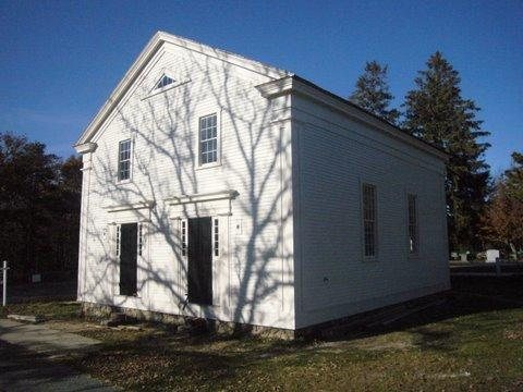
Two places: the Avant House (listed 1998) and the Old Indian Meeting House (1998).
How old are the homes in Mashpee?
3% of Mashpee’s homes were built before 1940 (Census estimate), against a typical 21% for a Massachusetts town; the median home was built in 1988.
Founding dates: Wikidata, Wikipedia, the U.S. post office records of Blevins & Helbock (CC0) and the Census. Homes by year built: Census ACS 2020–24. National Register of Historic Places: National Park Service (list of May 22, 2026). Old photos, postcards and papers: Wikimedia Commons, the Library of Congress and other public archives, credited on each item’s page. Maps: U.S. Geological Survey historical topographic maps (via Esri) and Sanborn fire-insurance maps (Library of Congress). History text and census tables: Wikipedia (CC BY-SA 4.0). Places that used to be: USGS Geographic Names Information System (2021).
From the Library of Congress (1), Wikidata (2), the National Register of Historic Places (2), Wikipedia, U.S. Geological Survey historical maps, U.S. Census counts (via Wikipedia), the US Post Offices dataset (Blevins & Helbock), the USGS Geographic Names Information System and old county and town histories (Internet Archive). Archive images are copied here with their credits and licenses, shown on each photo’s page. Refreshed monthly.



 Date?