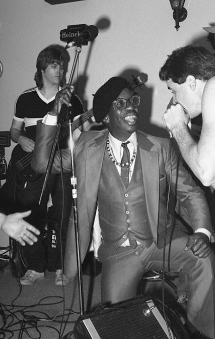
Palatine’s post office opened in 1850, and 2 of its places are on the National Register
More historic than 34% of U.S. towns · #518 of 768 in Illinois. What drives it
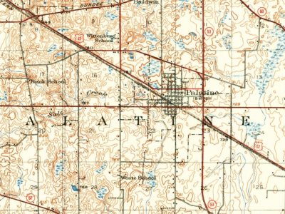
Most of Palatine was built recently: 3% of its homes predate 1940 and the median home dates from 1977. Its Register listings are the George Clayson House and the Charles H. Patten House. Its Register listings are the George Clayson House and the Charles H. Patten House. Below: 1 old photo or paper, maps from 1923 on, and the census since 1880.
Founding year: the first Palatine post office (Blevins & Helbock, CC0). Wikidata: 1866.The full story ↓
History grade
What drives Palatine’s History grade
On its age, its old homes and the National Register, Palatine is more historic than 34% of U.S. towns, #518 of 768 in Illinois. Its National Register listings hold the grade up; its share of homes from before 1940 pulls it down.
C
HistoryA character grade: shown, never part of Palatine’s overall grade.
Few Illinois towns list much on the Register (a typical Illinois town has 0.5 per 10,000 residents, the U.S. 2.4), so Palatine’s 0.3 sits near the middle of its state (58% of Illinois towns have fewer) while its 2 listings outnumber those of 60% of U.S. towns.
How sure. Graded on any two of the three inputs instead, the letter would range from C− to C+. The pre-1940 share (±0.9 points) is firm at this size. The founding year is the first post office, not a stated founding date; Wikidata’s 1866 falls in the same era, so the grade doesn’t depend on which one is used.
Founding year: the first post office (other dates in Quick answers). Homes: Census ACS 2020–24. National Register: National Park Service, May 2026 list; each listing counted once (boundary changes and added documentation belong to their listing), and a historic district counts its contributing buildings. How TownRatings grades history →
What stands out about Palatine’s past
Read from the archive, the National Register and the record. The page puts what stands out first.
The first European-American to settle in Palatine is generally thought to be George Ela, who built a log cabin in the area later called Deer Grove. Ela was one of the first of a wave of pioneers to migrate to northern Illinois following the Black Hawk War. A road that passes through the western edge of Palatine is called Ela Road in his honor. Palatine is thought to be named after a town in New York.
The Village of Palatine was founded in 1866. It was built around a station on the new Chicago and North Western Railway. Joel Wood surveyed and laid out the village, earning him the title of Palatine's founder. One of Palatine's original downtown streets is named after Wood.
Passages that mention Palatine, cut from the printed page as they were published.
History of Cook County, Illinois. From the earliest period to the present time1884 · page 839Read the page →
Read the text
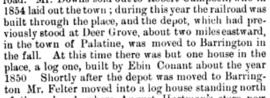
1854 laid out the town ; during this year the railroad wits built through the place, and the depot, which had previouslv stood at Deer Drove, about two mileseaslwarU, in the town of Palatine, was moved to Barriugtou in the fall. At this time there was but one house in the place, a log one, built by Ebin Oonant about the year 1850 Shortly after the dejart was moved to Barrington Mr. Felter moved into a log house standing north
Text read by machine from the scan; it may contain errors.
History of Cook County, Illinois. From the earliest period to the present time1884 · page 831Read the page →
Read the text
The town affairs were managed under this incorporation until 1869. On the 25th of March, of this vear, an act to incorporate the town of Palatine was approved by the Governor. Section 3 of this act is as follows: "That all those tracts of land embraced withiu the following boundaries to wit: Commencing at the center of Section 23, Township 42, Ranjre 10 east, thence north to the center of Section U, thence
Text read by machine from the scan; it may contain errors.
History of Cook County, Illinois1909 · page 280Read the page →
Read the text
Paul's United Evangelical church was organized in 1872 with a membership of fifteen. The first pastor was Jacob Furrer. The village of Palatine has always been prosperous, with good stores, shops and manufacturing enterprises. Riverside township, as created, comprised but four sections — 25, 26, 35 and 36 — in the southeast corner of Proviso township. This was one of the first portions of the county to become settled. As early as 1828 David and Barney Laughton built and opened a trading
Text read by machine from the scan; it may contain errors.
Scans and text from the Internet Archive. Books published in 1930 or earlier, which are in the public domain.
Timeline
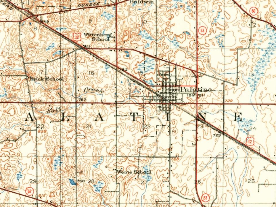
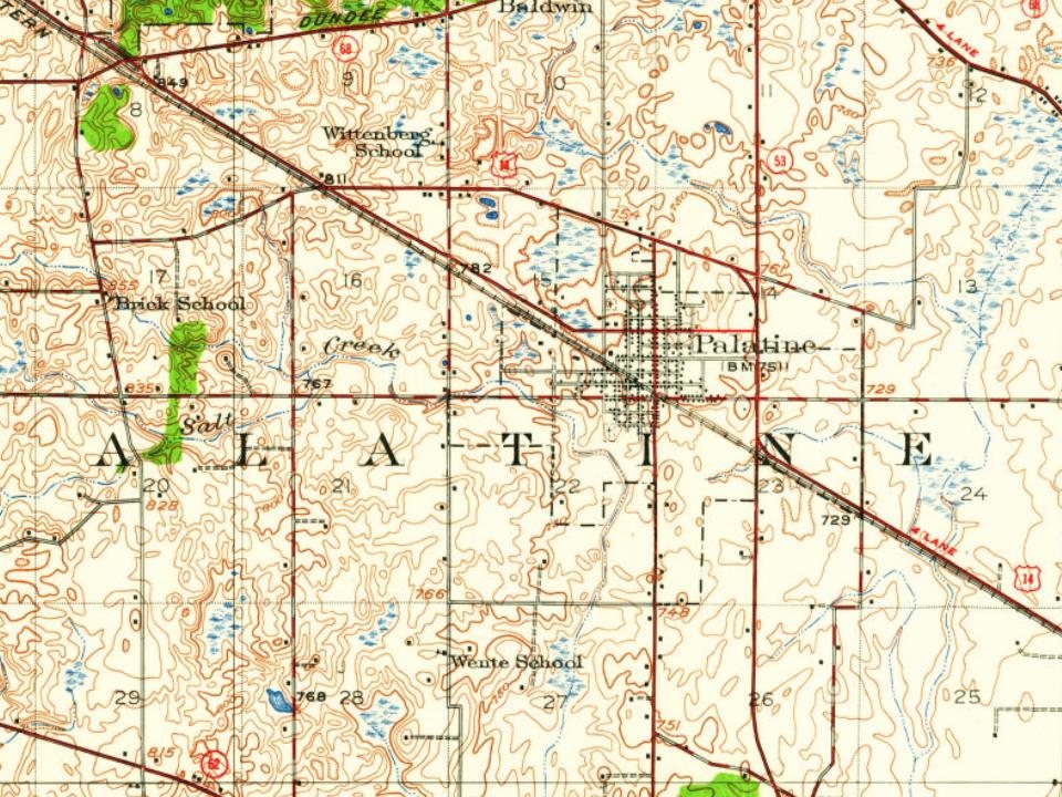
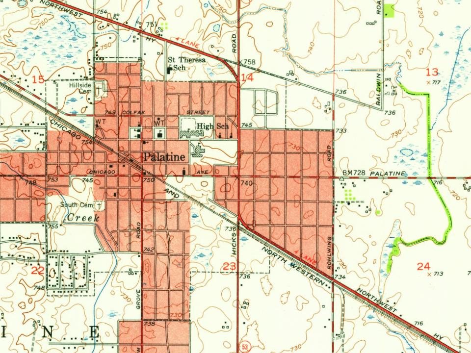
Palatine, 1850 to 1996
Woven from the archive, old maps, post office records, the National Register and the people born here.
Nothing in the archives for these yearsWeddings on Main Street, storms, parades, school pictures, the old store. If it’s in your family album, it belongs here.
The Palatine post office opened in 1850, the earliest record of the town by name (U.S. post office records). Wikidata gives 1866.
How does Palatine rank for history?
Palatine is more historic than 34% of U.S. towns, #518 of 768 in Illinois. The History grade combines the town’s founding era, the share of homes built before 1940 and its National Register listings. It’s a character grade, so it isn’t part of the overall grade. How it works.
What is on the National Register in Palatine?
Two places: the George Clayson House (listed 1979) and the Charles H. Patten House (2006).
How old are the homes in Palatine?
3% of Palatine’s homes were built before 1940 (Census estimate), against a typical 11% for an Illinois town; the median home was built in 1977.
Founding dates: Wikidata, Wikipedia, the U.S. post office records of Blevins & Helbock (CC0) and the Census. Homes by year built: Census ACS 2020–24. National Register of Historic Places: National Park Service (list of May 22, 2026). Old photos, postcards and papers: Wikimedia Commons, the Library of Congress and other public archives, credited on each item’s page. Maps: U.S. Geological Survey historical topographic maps (via Esri) and Sanborn fire-insurance maps (Library of Congress). History text and census tables: Wikipedia (CC BY-SA 4.0). Places that used to be: USGS Geographic Names Information System (2021).
From Wikimedia Commons (18), the National Register of Historic Places (2), Wikipedia, Wikidata and Wikipedia for famous people, U.S. Geological Survey historical maps, U.S. Census counts (via Wikipedia), the US Post Offices dataset (Blevins & Helbock), the USGS Geographic Names Information System and old county and town histories (Internet Archive). Archive images are copied here with their credits and licenses, shown on each photo’s page. Refreshed monthly.


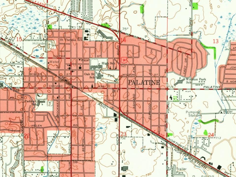
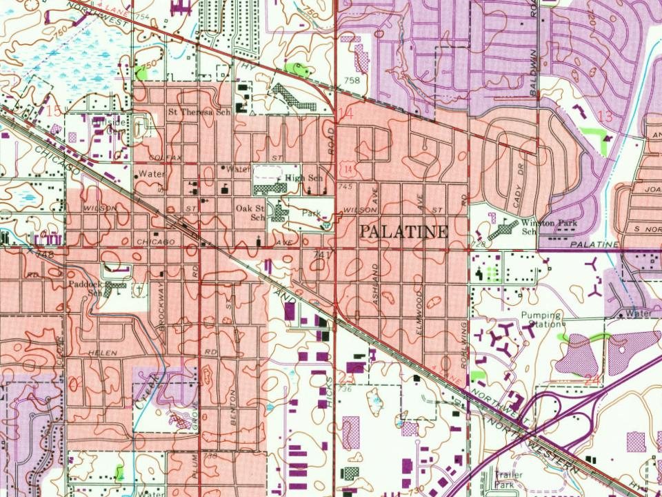
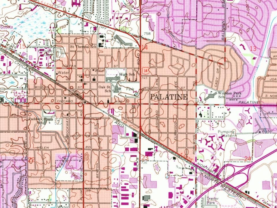
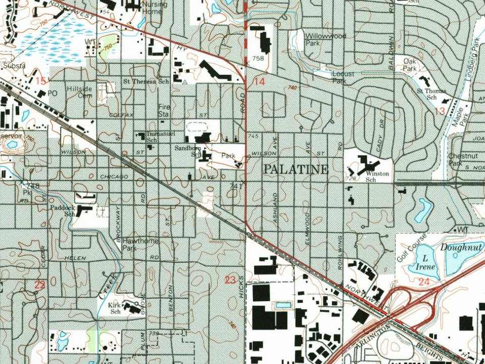




 2021
 2021
 2021
 2021
 2020
 2019
 2019
 2012
 2011
 2011
 2011
 2011
 2009
 2007
 2007
 2007
 2006