Stratford dates to 1639, and 20% of its homes were built before 1940
More historic than 91% of U.S. towns · #39 of 155 in Connecticut. What drives it
10 places in town are on the National Register, among them two historic districts with 273 buildings between them. Below: 26 old photos and papers, maps from 1891 on, and the census since 1820.
Founding year: Wikidata; Wikipedia’s history section gives the same year. First post office: 1773.The full story ↓
History grade
What drives Stratford’s History grade
On its age, its old homes and the National Register, Stratford is more historic than 91% of U.S. towns, #39 of 155 in Connecticut. All 3 inputs are above most U.S. towns; its age ranks highest and its National Register listings lowest.
A
HistoryA character grade: shown, never part of Stratford’s overall grade.
Connecticut towns list more on the Register than most of the country (a typical Connecticut town has 73.3 per 10,000 residents, the U.S. 2.4), so Stratford’s 53.6 sits near the middle of its state (41% of Connecticut towns have fewer) while its 283 historic buildings outnumber those of 95% of U.S. towns.
How sure. Graded on any two of the three inputs instead, the letter would range from A− to A. The pre-1940 share (±1.8 points) is firm at this size. Two sources give 1639.
Founding year: Wikidata (other dates in Quick answers). Homes: Census ACS 2020–24. National Register: National Park Service, May 2026 list; each listing counted once (boundary changes and added documentation belong to their listing), and a historic district counts its contributing buildings. How TownRatings grades history →
What stands out about Stratford’s past
Read from the archive, the National Register and the record. The page puts what stands out first.
Nothing in the archives for these yearsWeddings on Main Street, storms, parades, school pictures, the old store. If it’s in your family album, it belongs here.
Nothing in the archives for these yearsWeddings on Main Street, storms, parades, school pictures, the old store. If it’s in your family album, it belongs here.
Stratford was founded in 1639 by Puritan leader Reverend Adam Blakeman, William Beardsley, and either 16 families (according to legend) or approximately 35 families (suggested by later research) who had recently arrived in Connecticut Colony from England seeking religious freedom. In 1639 the General Court in Hartford made reference to the town as the "new plantation at Pequannock". In 1640 the community was known as Cupheag, a Native American Paugussett word meaning "at the enclosed place" or "place of shelter". By April 13, 1643, the growing town was known as Stratford, in honor of Stratford-upon-Avon in England.
Passages that mention Stratford, cut from the printed page as they were published.
A history of the old town of Stratford and the city of Bridgeport, Connecticut1886 · page 587Read the page →
Read the text
The committee recommended that three hundred and thirty dollars damages should be paid to Asa Benjamin bv the town of Stratford. The road was made, and liberty given to Stratford to set up a toll-gate at Lottery Bridge in Newfield, for the support of that and Benjamin's bridge, which was done in 1799. In 1797 Benjamin's bridge was voted, by the town, to be "rebuilt and made eighteen feet wide."
Text read by machine from the scan; it may contain errors.
A history of the old town of Stratford and the city of Bridgeport, Connecticut1886 · page 407Read the page →
Read the text
his proceedings to improve said grant, praying relief as per petition on file : Resolved by this Assembly, That said grant of said town of Stratford, as aforesaid, made to the petitioner be and the same is hereby ratified and confirmed ; and liberty is hereby granted to the petitioner, his heirs and assigns to erect and build a dam across said creek or river, at or near Benjamin's Bridge, in such manner as to use and employ the mill or mills
Text read by machine from the scan; it may contain errors.
Scans and text from the Internet Archive. Books published in 1930 or earlier, which are in the public domain.
On the map
Stratford on the map, 1891 to 1984
Every edition of the U.S. Geological Survey’s map of Stratford. Tap a year, or press play to watch the town change.
1891Bridgeport sheet · 1:62,500
U.S. Geological Survey historical topographic maps (public domain), via Esri’s collection of the scans. The red ring marks the center of Stratford.
Then & now
Stand where they stood
No then-and-now pairs yet. Take a photo from the same spot as an old one and they appear here side by side.
Retake this viewStratford (CT) station 1908 postcard, c. 1908
Find the spot, match the angle, and add your photo. It becomes the first then-and-now pair on Stratford’s page.
In 1639, according to Wikidata and Wikipedia’s history of the town. Stratford’s post office opened in 1773, and the census of 1820 counted 3,438 people here.
How does Stratford rank for history?
Stratford is more historic than 91% of U.S. towns, #39 of 155 in Connecticut. The History grade combines the town’s founding era, the share of homes built before 1940 and its National Register listings. It’s a character grade, so it isn’t part of the overall grade. How it works.
What is on the National Register in Stratford?
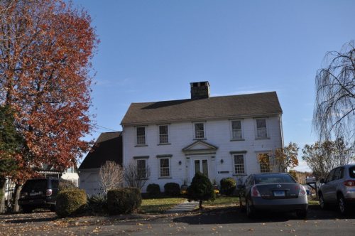
10 listings: 6 buildings, among them the Capt. David Judson House (listed 1973, the first), 2 historic districts, the Stratford Center Historic District and the Boothe Homestead, with 273 contributing buildings, and 2 structures. 283 historic buildings in all.
How old are the homes in Stratford?
20% of Stratford’s homes were built before 1940 (Census estimate, ±1.8 points), against a typical 15% for a Connecticut town; the median home was built in 1958.
Founding dates: Wikidata, Wikipedia, the U.S. post office records of Blevins & Helbock (CC0) and the Census. Homes by year built: Census ACS 2020–24. National Register of Historic Places: National Park Service (list of May 22, 2026). Old photos, postcards and papers: Wikimedia Commons, the Library of Congress and other public archives, credited on each item’s page. Maps: U.S. Geological Survey historical topographic maps (via Esri) and Sanborn fire-insurance maps (Library of Congress). History text and census tables: Wikipedia (CC BY-SA 4.0). Places that used to be: USGS Geographic Names Information System (2021).
From Wikimedia Commons (28), the Library of Congress (12), Wikidata (1), the National Register of Historic Places (10), Wikipedia, Wikidata and Wikipedia for famous people, U.S. Geological Survey historical maps, U.S. Census counts (via Wikipedia), the US Post Offices dataset (Blevins & Helbock), the USGS Geographic Names Information System and old county and town histories (Internet Archive). Archive images are copied here with their credits and licenses, shown on each photo’s page. Refreshed monthly.




 c. 1908
 1909
 c. 1930
 c. 1930
 c. 1930
 c. 1930
 c. 1930
 c. 1930
 c. 1930
 1940
 1940
 1940
 1940
 1940
 1940
 1940
 1940
 1940
 1940
 1940
 1980
 2014
 2014
 2013
 2011
 2011
 2010
 2008
 2008
 2008
 2006
 2006
 2006
 2006
 2006


