Guest, Sign inJoin

Post to Bridgeport

We’ll email a one-tap link to publish your post. No password, and nothing is public until you click it.
Already a member? Sign in
AHistory
History · Bridgeport

Bridgeport’s post office opened in 1801, and 32% of its homes were built before 1940

More historic than 93% of U.S. towns · #29 of 155 in Connecticut. What drives it

56 places in town are on the National Register, among them ten historic districts with 1,704 buildings between them. Below: 7 old photos and papers, maps from 1884 on, and the census since 1810.

1801first post office
56on the National Register
32%homes built before 1940
7old photos & papers
42famous people
From Bridgeport’s archive · credits on each photo
Quick answers

How Bridgeport began

When was Bridgeport founded?

1801

The Bridgeport post office opened in 1801, the earliest record of the town by name. Wikidata gives 1821. Another post office, Black Rock (1863), opened inside today’s city and later closed.

First census: 1,089 in 18102020 census: 148,654225 years

How historic is Bridgeport?

A

More historic than 93% of U.S. towns, on its age, its old homes and the National Register.

What drives the grade ↓
Founding year: the first Bridgeport post office (Blevins & Helbock, CC0). Wikidata: 1821.The full story ↓
History grade

What drives Bridgeport’s History grade

On its age, its old homes and the National Register, Bridgeport is more historic than 93% of U.S. towns, #29 of 155 in Connecticut. All 3 inputs are above most U.S. towns; its share of homes from before 1940 ranks highest and its age lowest.

A
HistoryA character grade: shown, never part of Bridgeport’s overall grade.
All U.S. towns we grade (21,289)Ahead of 93%
NewerOlder
Connecticut towns of 2,500+ (155)Ahead of 82%

Among the 400 U.S. cities of 100,000 or more, Bridgeport ranks #59 on History.

Connecticut towns list more on the Register than most of the country (a typical Connecticut town has 73.3 per 10,000 residents, the U.S. 2.4), so Bridgeport’s 116 sits near the middle of its state (60% of Connecticut towns have fewer) while its 1,736 historic buildings outnumber those of 99% of U.S. towns.

How sure. Graded on any two of the three inputs instead, the letter would range from A− to A. The pre-1940 share (±1.8 points) is firm at this size. The founding year is the first post office, not a stated founding date; Wikidata’s 1821 falls in the same era, so the grade doesn’t depend on which one is used.

Founding year: the first post office (other dates in Quick answers). Homes: Census ACS 2020–24. National Register: National Park Service, May 2026 list; each listing counted once (boundary changes and added documentation belong to their listing), and a historic district counts its contributing buildings. How TownRatings grades history →

What stands out about Bridgeport’s past

Read from the archive, the National Register and the record. The page puts what stands out first.

★ What stands out · On the National Register

56 listings protect 1,736 historic buildings

The country’s official list of buildings and places worth saving.

places listed
56
National Historic Landmarks
0
none yet
historic buildings protected
1,736
each building in a district counts
first listed
1972
Barnum Museum
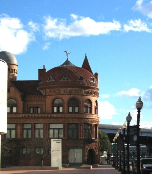
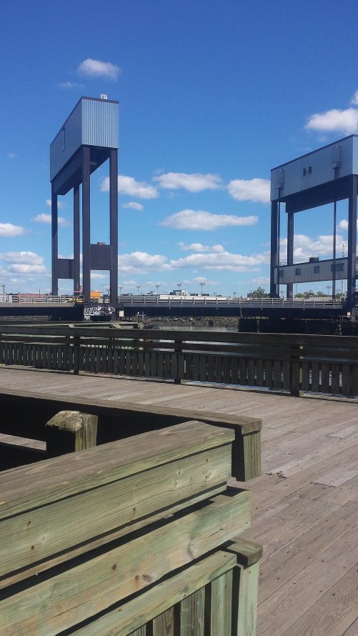
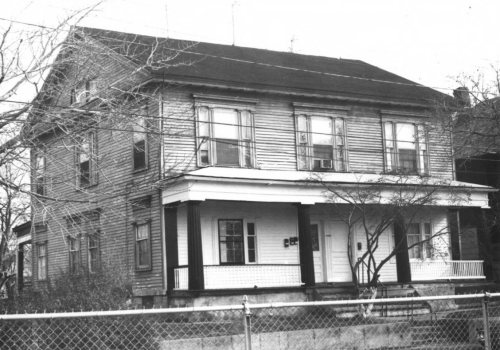
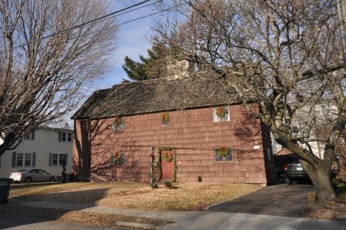
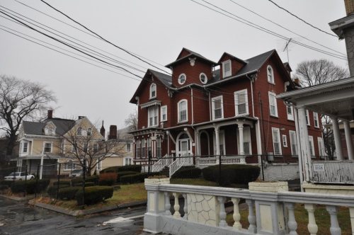
Barnum Museum, built 1893Bridgeport City HallHotel BeachSterling Block-Bishop ArcadeBerkshire No. 7, built 1935Eagle's NestBlack Rock Historic DistrictEast Bridgeport Historic DistrictStratfield Historic DistrictFairfield County CourthouseMarina Park Historic DistrictDivision Street Historic DistrictSeaside InstituteWilliam D. Bishop Cottage Development Historic DistrictSeaside ParkBarnum/Palliser Historic DistrictDavid Perry House, built 1826United Congregational ChurchSt. John's Episcopal Church, built 1875East Main Street Historic DistrictUnited Illuminating Company BuildingNathaniel Wheeler Memorial FountainFairfield County Jail, built 1870Railroad Avenue Industrial DistrictUS Post Office-Bridgeport MainPequonnock River Railroad BridgePeyton Randolph Bishop HouseBridgeport Downtown South Historic DistrictBassickville Historic DistrictBridgeport Downtown North Historic DistrictConnecticut Railway and Lighting Company Car Barn, built 1910Maplewood SchoolFirst Baptist Church, built 1893Tongue Point Lighthouse, built 1895Black Rock Gardens Historic DistrictGateway Village Historic DistrictLakeview Village Historic DistrictRemington City Historic DistrictRemington Village Historic DistrictSeaside Village Historic DistrictWilmot Apartments Historic DistrictSterling Hill Historic DistrictDeacon's Point Historic DistrictWest End Congregation-Achavath Achim Synagogue, built 1926Bikur Cholim SynagogueEin Jacob (Ayn Yacob) SynagogueMary and Eliza Freeman Houses, built 1848Beardsley Park, built 1922Cassidy HouseElmer S. DaileyPricilla DaileyPalace and Majestic TheatersGolden Hill Historic DistrictPark ApartmentsWaltersville SchoolDowntown Bridgeport Historic District
BuildingsDistrictsSitesStructuresObjects

Architectural styles listings

Colonial Revival13
Queen Anne9
Greek Revival8
Italianate8
Romanesque7
Victorian7
All 56 listings
Stratfield Historic DistrictDistrict · listed 1980Fairfield County CourthouseBuilding · listed 1982Marina Park Historic DistrictDistrict · listed 1982Division Street Historic DistrictDistrict · listed 1982Seaside InstituteBuilding · listed 1982William D. Bishop Cottage Development Historic DistrictDistrict · listed 1982Seaside ParkSite · listed 1982Barnum/Palliser Historic DistrictDistrict · listed 1982David Perry HouseBuilding · listed 1984United Congregational ChurchBuilding · listed 1984St. John's Episcopal ChurchBuilding · listed 1984East Main Street Historic DistrictDistrict · listed 1985United Illuminating Company BuildingBuilding · listed 1985Nathaniel Wheeler Memorial FountainObject · listed 1985Fairfield County JailBuilding · listed 1985Railroad Avenue Industrial DistrictDistrict · listed 1985US Post Office-Bridgeport MainBuilding · listed 1986Pequonnock River Railroad BridgeStructure · listed 1987Peyton Randolph Bishop HouseBuilding · listed 1987Bridgeport Downtown South Historic DistrictDistrict · listed 1987Bassickville Historic DistrictDistrict · listed 1987Bridgeport Downtown North Historic DistrictDistrict · listed 1987Connecticut Railway and Lighting Company Car BarnBuilding · listed 1987Maplewood SchoolBuilding · listed 1990First Baptist ChurchBuilding · listed 1990Tongue Point LighthouseStructure · listed 1990Black Rock Gardens Historic DistrictDistrict · listed 1990Gateway Village Historic DistrictDistrict · listed 1990Lakeview Village Historic DistrictDistrict · listed 1990Remington City Historic DistrictDistrict · listed 1990Remington Village Historic DistrictDistrict · listed 1990Seaside Village Historic DistrictDistrict · listed 1990Wilmot Apartments Historic DistrictDistrict · listed 1990Sterling Hill Historic DistrictDistrict · listed 1992Deacon's Point Historic DistrictDistrict · listed 1992West End Congregation-Achavath Achim SynagogueBuilding · listed 1995Bikur Cholim SynagogueBuilding · listed 1995Ein Jacob (Ayn Yacob) SynagogueBuilding · listed 1995Mary and Eliza Freeman HousesBuilding · listed 1999Beardsley ParkDistrict · listed 1999Cassidy HouseBuilding · listed 2011Elmer S. DaileyStructure · listed 1978Pricilla DaileyStructure · listed 1978Palace and Majestic TheatersBuilding · listed 1979Golden Hill Historic DistrictDistrict · listed 1987Park ApartmentsBuilding · listed 1990Waltersville SchoolBuilding · listed 2025Downtown Bridgeport Historic DistrictDistrict · listed 2025

National Park Service, National Register of Historic Places. Photos from Wikimedia Commons, credited on each place’s page.

On the map

Bridgeport on the map, 1891 to 1984

Every edition of the U.S. Geological Survey’s map of Bridgeport. Tap a year, or press play to watch the town change.

Bridgeport on the 1891 USGS mapBridgeport on the 1920 USGS mapBridgeport on the 1951 USGS mapBridgeport on the 1960 USGS mapBridgeport on the 1970 USGS mapBridgeport on the 1984 USGS map1891Bridgeport sheet · 1:62,500

U.S. Geological Survey historical topographic maps (public domain), via Esri’s collection of the scans. The red ring marks the center of Bridgeport.

The story

How Bridgeport came to be

From Wikipedia’s history of Bridgeport.

Read it all →

Bridgeport was inhabited by the Paugussett Native American tribe during the start of European colonization. The earliest European communal settlement was in the historical Stratfield district, along US Route 1, known in colonial times as the King's Highway. Close by, Mount Grove Cemetery was laid out on what was a native village that extended past the 1650s. It is also an ancient Paugussett burial ground.

Text from Wikipedia, licensed CC BY-SA 4.0.

From the old history books

What they wrote about Bridgeport, 1886–1887

Passages that mention Bridgeport, cut from the printed page as they were published.

Bridgeport, as a city, was incorporated by act of the General Assembly in May, 1836, under the name of ''T/ie Mayor, Aldermen, Collision Council, and Freemen of the Citv of Bridgeport.'' By several changes made, the incorporate title now is " The City of Bridgeport," and the title of its authoritat…
A history of the city of Bridgeport, Connecticut1887Read the page →
Read the text

Bridgeport, as a city, was incorporated by act of the General Assembly in May, 1836, under the name of ''T/ie Mayor, Aldermen, Collision Council, and Freemen of the Citv of Bridgeport.'' By several changes made, the incorporate title now is " The City of Bridgeport," and the title of its authoritative body is "The Common Council of the

Text read by machine from the scan; it may contain errors.
his new church edifice was completed, built by subscription on the site at present occupied by the same society. At first it was occupied two Sundays out of three, but after a short time every Sunday. The borough of Bridgeport was incorporated in 1800, with two hundred and fifty inhabitants, and by…
A history of the old town of Stratford and the city of Bridgeport, Connecticut1886 · page 634Read the page →
Read the text

his new church edifice was completed, built by subscription on the site at present occupied by the same society. At first it was occupied two Sundays out of three, but after a short time every Sunday. The borough of Bridgeport was incorporated in 1800, with two hundred and fifty inhabitants, and by a rapid growth it gradually absorbed the dwellers of the more ancient settlement. In 1821 the town of Bridgeport was erected and the parish of Stratfield, practically, ceased to

Text read by machine from the scan; it may contain errors.
avenue through nearlv on the line of Barnuin avenue, to Washington bridge, on the Housatonic river. This effort was bitterly and successfully opposed at every trial by tlie town of Bridgeport, the town of Stratford and the old or lower bridge company, that bridge being a toll bridge. This oppositio…
A history of the city of Bridgeport, Connecticut1887Read the page →
Read the text

avenue through nearlv on the line of Barnuin avenue, to Washington bridge, on the Housatonic river. This effort was bitterly and successfully opposed at every trial by tlie town of Bridgeport, the town of Stratford and the old or lower bridge company, that bridge being a toll bridge. This opposition isolated that district from commercial connections and no improvement was made upon it until in 1836 William P. Green, of Norwich, through the agency of his brother abolitionist, Mr.

Text read by machine from the scan; it may contain errors.
By the will of Mrs. Sterling the homestead was given to the First Congregational Society of Bridgeport for a parsonage, and after providing for friends, the residue was given to the society known as the Bridgeport Protestant Widows' Relief Society for the establishment of a Home and for general aid…
A history of the old town of Stratford and the city of Bridgeport, Connecticut1886 · page 515Read the page →
Read the text

By the will of Mrs. Sterling the homestead was given to the First Congregational Society of Bridgeport for a parsonage, and after providing for friends, the residue was given to the society known as the Bridgeport Protestant Widows' Relief Society for the establishment of a Home and for general aid, and the society has become one of the leading charities of Bridgeport.* Laura Beach married Ira Sherman, a descendant of Lieut.

Text read by machine from the scan; it may contain errors.

Scans and text from the Internet Archive. Books published in 1930 or earlier, which are in the public domain.

Timeline

Bridgeport, 1801 to 1982

Woven from the archive, old maps, post office records, the National Register and the people born here.

  1. 19th century
  2. 1801Post officeThe Bridgeport post office opens
  3. 1826BuiltDavid Perry House is built
  4. 1852In the archiveIranistan, an oriental ville (near Bridgeport, Connecticut)
  5. 1863Post officeThe Black Rock post office opens
  6. 1864In the archiveInterior view, P.T. Barnum's estate
  7. 1870In the archiveBird's-eye view of Karn railroad terminal under construction
  8. 1875BuiltSt. John's Episcopal Church is built
  9. 1891On the mapFirst mapped by the U.S. Geological Survey
  10. 1893BuiltBarnum Museum is built
  11. 1897Post officeThe Black Rock post office closes
  12. 20th century
  13. 1917Born hereRobert Mitchum is born here
  14. 1935BuiltBerkshire No. 7 is built
  15. 1938Born hereBrian Dennehy is born here
  16. 1977Born hereJohn Mayer is born here
  17. 1982Born hereAlexandra Breckenridge is born here
By decade

Bridgeport, decade by decade

3 decades in the archive, from the 1850s to the 1870s. Scroll each row; tap a photo for its story.

Every building

Bridgeport, building by building, 1884–1913

Fire insurance maps drew every building, what it was made of and what it was used for, so insurers could price the risk of fire. Pick a year, then a sheet.

Bridgeport fire insurance map, 1884, sheet 51884Sheet 5 of 20
Edition
BrickWoodStone

Sanborn Map Company, via the Library of Congress. Editions published in 1930 or earlier, which are in the public domain.

Then & now

Stand where they stood

No then-and-now pairs yet. Take a photo from the same spot as an old one and they appear here side by side.

Iranistan, an oriental ville (near Bridgeport, Connecticut)
Retake this viewIranistan, an oriental ville (near Bridgeport, Connecticut), 1852

Find the spot, match the angle, and add your photo. It becomes the first then-and-now pair on Bridgeport’s page.

Retake this view · +15
People over time

Bridgeport, census by census

020,00040,00060,00080,000100,000120,000140,000160,0001850190019502000Peak: 158,709

Between 1,089 and 158,709 people in every census since 1810.

22 censuses, 1810–2020.

U.S. Census Bureau decennial counts, from the census table on Bridgeport’s Wikipedia page.

Famous people

42 famous people were born in Bridgeport

Writers, athletes, leaders and more, ranked by how widely they’re known.

See all →
Places that used to be

Lost post offices, old corners, places now gone and burying grounds

Bridgeport’s post office has been open since 1801. Another post office, Black Rock, opened and closed inside today’s town.

Bridgeport
1801–today
Black Rock
1863–1897
18001910today
Hamlets and corners on the map
Black RockEast BridgeportGrover HillMill HillNewfieldSchoonhoven ParkToilsome Hill
Gone or out of use
Pixlee Tavernlocale
6cemeteries and burying grounds inside Bridgeport
LakeviewMountain GroveOld StratfieldParkPembrokeSaint Augustine

US Post Offices dataset (Blevins & Helbock, CC0). Places and cemeteries from the USGS Geographic Names Information System (2021).

Help out

Finish Bridgeport’s story

Most archives stop around 1920. The photos from after that are in family albums, not libraries.

Decades since 1900 with photos
00s10s20s30s40s50s60s70s80s90s
0 of 10 decades. The empty ones are waiting for someone’s album.
Stories next door

History across the town line

Each neighbor’s History grade, on the same three inputs.

Questions about Bridgeport’s history

What year was Bridgeport founded?

The Bridgeport post office opened in 1801, the earliest record of the town by name (U.S. post office records). Wikidata gives 1821.

How does Bridgeport rank for history?

Bridgeport is more historic than 93% of U.S. towns, #29 of 155 in Connecticut. The History grade combines the town’s founding era, the share of homes built before 1940 and its National Register listings. It’s a character grade, so it isn’t part of the overall grade. How it works.

What is on the National Register in Bridgeport?

56 listings: 25 buildings, among them the Barnum Museum (listed 1972, the first), 24 historic districts with 1,704 contributing buildings, 1 site, 5 structures, and 1 object. 1,736 historic buildings in all.

How old are the homes in Bridgeport?

32% of Bridgeport’s homes were built before 1940 (Census estimate, ±1.8 points), against a typical 15% for a Connecticut town; the median home was built in 1955.

Memory lane

What the archives can’t tell you, neighbors can.

Town Square →
Start a conversation
Sources

Where this page comes from

Founding dates: Wikidata, Wikipedia, the U.S. post office records of Blevins & Helbock (CC0) and the Census. Homes by year built: Census ACS 2020–24. National Register of Historic Places: National Park Service (list of May 22, 2026). Old photos, postcards and papers: Wikimedia Commons, the Library of Congress and other public archives, credited on each item’s page. Maps: U.S. Geological Survey historical topographic maps (via Esri) and Sanborn fire-insurance maps (Library of Congress). History text and census tables: Wikipedia (CC BY-SA 4.0). Places that used to be: USGS Geographic Names Information System (2021).

From the Library of Congress (7), Wikidata (4), the National Register of Historic Places (56), Wikipedia, Wikidata and Wikipedia for famous people, U.S. Geological Survey historical maps, U.S. Census counts (via Wikipedia), the US Post Offices dataset (Blevins & Helbock), the USGS Geographic Names Information System, Sanborn fire insurance maps (Library of Congress) and old county and town histories (Internet Archive). Archive images are copied here with their credits and licenses, shown on each photo’s page. Refreshed monthly.