219 years in pictures
Census counts: 2,081 in 1880, 4,780 in 2020. The archive holds 6 old photos and papers going back to 1810 and 6 maps from 1892 on.
- 1807Stafford Springs is settled
Each edition grades its towns against each other only.

Only 7 of the 156 Connecticut towns we compare have a lower middle household income than Stafford Springs. The biggest place to walk is Hyde Park, 117 acres with 1.6 miles of trail. We don’t grade Stafford Springs yet; the figures below are still real.
Where Stafford Springs beats most towns.
Where Stafford Springs’s working residents go each day. Line width shows the share.
Census LEHD 2023
Census counts: 2,081 in 1880, 4,780 in 2020. The archive holds 6 old photos and papers going back to 1810 and 6 maps from 1892 on.
Museums, parks, gardens and other places to visit around Stafford Springs. Close and well known come first.
Big draw24 mi LakeLake Chaubunagungamaug
17 mi National Historic SiteSpringfield Armory National Historic Site14K visitors a year
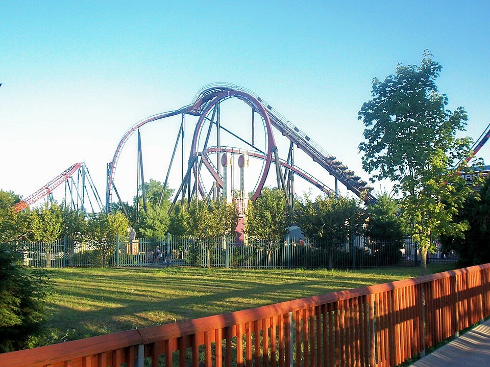
17 mi Theme parkSix Flags New England
24 mi Stadium & arenaPeoplesBank Arena
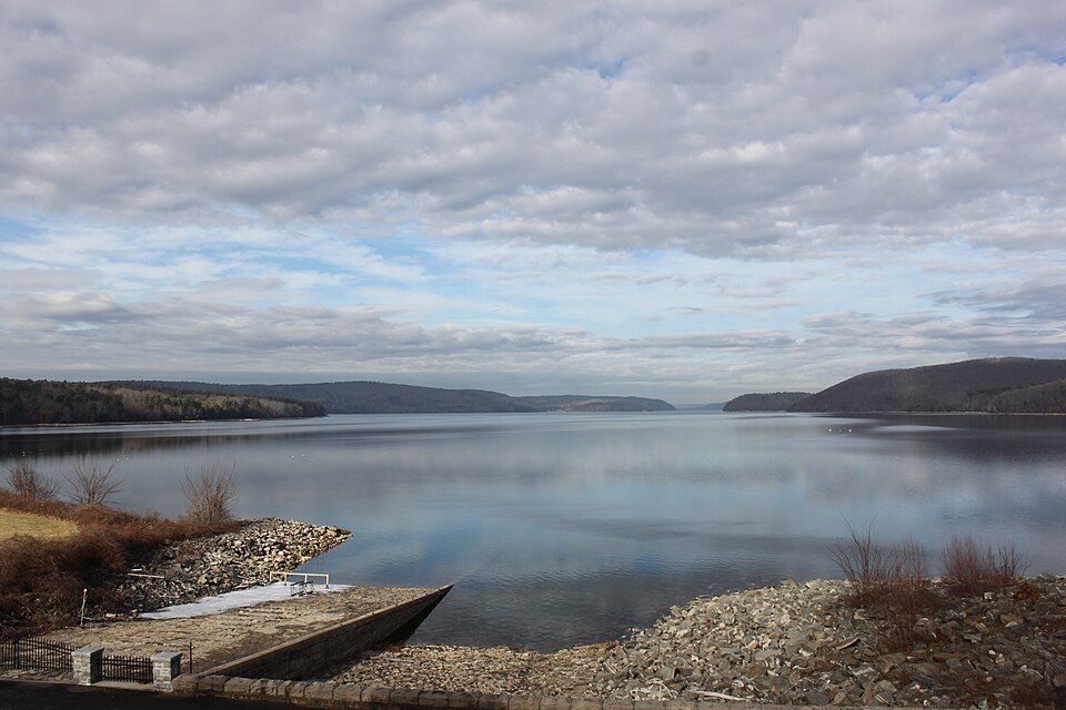
27 mi LakeQuabbin Reservoir
22 mi Stadium & arenaPratt & Whitney StadiumLake Chaubunagungamaug: Bree from Worcester, MA, USA, CC BY-SA 2.0 · Springfield Armory National Historic Site: National Park Service, Public domain · Six Flags New England: Canadaolympic989, Public domain · PeoplesBank Arena: PeoplesBank Arena, CC BY 2.5 · Quabbin Reservoir: engineerchange, CC BY 2.0 · Pratt & Whitney Stadium: Quintin Soloviev, CC BY 4.0
Stafford Springs is unincorporated, so Tolland County and regional agencies provide most services.
EPA SDWIS (Oct 9, 2026) · HIFLD + EIA-861 2025 · Census 2020 ZCTAs · NCES 2024–25 · registration: vote.gov, updated Sep 30, 2026.
Ordered by what stands out in Stafford Springs.
88% of Stafford Springs’s expected losses from natural hazards come from inland flooding. Expected storm and flood damage is higher than in four fifths of U.S. communities.
FEMA National Risk Index · OpenFEMA
Among residents in Stafford Springs, 12% live below the poverty line. Just just over a tenth of the town’s working residents have a job in town. Between 2013 and 2023, jobs here rose by 144, to 1,581. Half commute less than 16 miles.
| Stafford Springs | Connecticut towns | U.S. towns | |
|---|---|---|---|
| Below the poverty line | 12% | 5.8% | 9.6% |
| Work from home | 12% | 16% | 11% |
Census LEHD 2023 · ACS
The share of households in Stafford Springs who live in a home they own: 63%. In the year to September 2026, typical home values climbed 5.7%. For Stafford Springs, the typical rent is $1,060 a month.
| Stafford Springs | Connecticut towns | U.S. towns | |
|---|---|---|---|
| Households that own their home | 63% | 81% | 73% |
| Median rent | $1,060 a month | $1,450 a month | $1,185 a month |
Census ACS, 2020–24 · Zillow Home Value Index · Redfin Data Center
Stafford Springs’ July high is 82°F.
NOAA U.S. Climate Normals, 1991–2020
In Stafford Springs, 15% of adults say their health is fair or poor, above the Connecticut town median (14%) but below the median of U.S. towns (19%). 30% of adults have high blood pressure in the town. Only 9 of the 155 Connecticut towns we compare have a lower share of adults who had a checkup this year than Stafford Springs.
| Stafford Springs | Connecticut towns | U.S. towns | |
|---|---|---|---|
| Frequent mental distress (CDC PLACES) | 18% | 15% | 17% |
| Diabetes (CDC PLACES) | 8.7% | 9.4% | 12% |
| High blood pressure (CDC PLACES) | 30% | 33% | 35% |
| Feel lonely (CDC PLACES) | 33% | 31% | 33% |
| What stands out | Stafford Springs | CT |
|---|---|---|
| Fewer adults facing food insecurity | 11.6% | 14.9% |
| Fewer uninsured adults | 7.8% | 10% |
CDC PLACES 2025 · modeled estimates for adults · CMS · HRSA
Trails run 3.3 miles in 10 parks and preserves. Only 6 of the 156 Connecticut towns we compare have a lower share of conserved land than Stafford Springs. The concentration of trails for Stafford Springs comes to 0.5 miles per square mile.
| Stafford Springs | Connecticut towns | U.S. towns | |
|---|---|---|---|
| Conserved land | 3.2% | 14% | 4.3% |
| Miles of trail per square mile | 0.5 miles per square mile | 1.3 | 0.4 |
| Biggest places to walk | Trails | Acres |
|---|---|---|
| 1. Hyde Park | 1.6 mi | 117 |
| 2. Dennis Pond Preserve | 1 mi | 36 |
| 3. Willington Avenue Open Space | — | 9 |
Trails & parks © OpenStreetMap contributors · Conserved land: USGS PAD-US
2 within 15 miles of the center of Stafford Springs
About 3 of every 100 Stafford Springs residents are enrolled in college, against 7 across Connecticut.
Census-designated place in Connecticut, United States
Stafford Springs is a census-designated place located in Stafford, Connecticut, United States. The population was 4,780 at the 2020 Census. The village was a borough until November 1991, when it was disincorporated. Located near the source of the Willimantic River, the textile and machine-shop industries expanded rapidly due to the village's strategic water access, becoming the backbone of the local economy. The village has the Holt Memorial Fountain and the former railroad station. A portion of the village center was listed on the National Register of Historic Places in 2025. In the 18th century, the spring at Stafford Springs was famous for its reputed ability to cure "the gout, sterility…
From Wikipedia, licensed CC BY-SA 4.0 · facts via Wikidata (CC0)
4 towns share a border with Stafford Springs.
| Town | CT rank | Overall | Cost | Safety | Schools | Health |
|---|---|---|---|---|---|---|
| Stafford Springs | — | — | — | — | — | — |
| Stafford | #107 | C+ | B− | — | C+ | A− |
| Crystal Lake | — | — | — | — | — | — |
| Ellington | #59 | B+ | D | — | B+ | A |
| Willington | #112 | C+ | C | — | B− | A− |
Stafford, Ellington and Willington report no FBI crime data of their own. Stafford Springs and Crystal Lake aren’t graded (fewer than 1,000 residents, or not enough data). Compare Stafford Springs with a neighbor →
Short answers, built from the data on this page.
We don’t grade Stafford Springs yet; the figures below are still real.