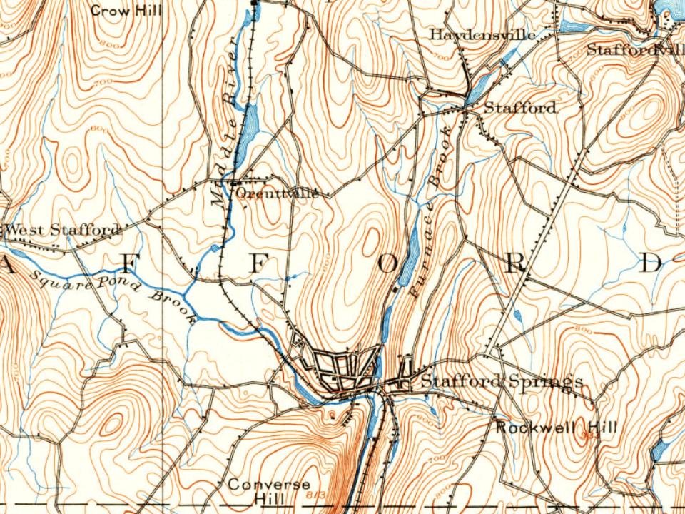
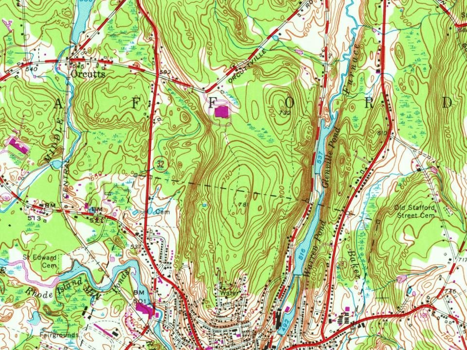
Every edition of the U.S. Geological Survey’s map of Stafford Springs. Tap a year, or press play to watch the town change.
1892Tolland sheet · 1:62,500
U.S. Geological Survey historical topographic maps (public domain), via Esri’s collection of the scans. The red ring marks the center of Stafford Springs.
Every building
Stafford Springs, building by building, 1884–1921
Fire insurance maps drew every building, what it was made of and what it was used for, so insurers could price the risk of fire. Pick a year, then a sheet.
The land that would become Stafford Springs was originally Mohegan territory. Indigenous peoples had long frequented the area's iron and sulfur mineral springs, reportedly drinking the waters for their invigorating properties. The region was acquired by Major James Fitch of Canterbury in a transaction that the Connecticut General Assembly did not fully accept; in 1718, the Assembly ordered that a town be laid out "of seven mile square ... eastward of Enfield," marking the beginning of legal settlement. Stafford was formally incorporated as a town in 1719. At the time of incorporation, the area was sparsely settled by farming families, with early industries closely tied to the agricultural economy: grist, saw, and fulling mills were built along fast-moving streams such as Furnace Brook.
Nothing in the archives for these yearsWeddings on Main Street, storms, parades, school pictures, the old store. If it’s in your family album, it belongs here.
Founding dates: Wikidata, Wikipedia, the U.S. post office records of Blevins & Helbock (CC0) and the Census. Homes by year built: Census ACS 2020–24. National Register of Historic Places: National Park Service (list of May 22, 2026). Old photos, postcards and papers: Wikimedia Commons, the Library of Congress and other public archives, credited on each item’s page. Maps: U.S. Geological Survey historical topographic maps (via Esri) and Sanborn fire-insurance maps (Library of Congress). History text and census tables: Wikipedia (CC BY-SA 4.0). Places that used to be: USGS Geographic Names Information System (2021). How TownRatings grades history →
From Wikimedia Commons (6), Wikipedia, U.S. Geological Survey historical maps, U.S. Census counts (via Wikipedia) and Sanborn fire insurance maps (Library of Congress). Archive images are copied here with their credits and licenses, shown on each photo’s page. Refreshed monthly.






 1810
 1810
 1810