Newington’s post office opened in 1828, and 8 of its places are on the National Register
More historic than 59% of U.S. towns · #139 of 155 in Connecticut. What drives it
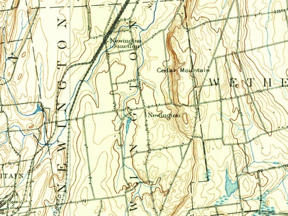
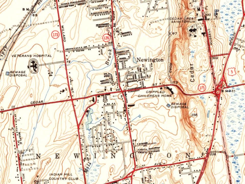
Most of Newington was built recently: 7% of its homes predate 1940 and the median home dates from 1967. 8 places in town are on the National Register, among them three historic districts with 32 buildings between them. Below: 2 old photos and papers, maps from 1893 on, and the census since 1880.
The Newington post office opened in 1828, the earliest record of the town by name. Another post office, Newington Junction (1865), opened inside today’s town and later closed.
First census: 934 in 1880198 years
How historic is Newington?
B
More historic than 59% of U.S. towns, on its age, its old homes and the National Register.
Founding year: the first Newington post office (Blevins & Helbock, CC0).The full story ↓
History grade
What drives Newington’s History grade
On its age, its old homes and the National Register, Newington is more historic than 59% of U.S. towns, #139 of 155 in Connecticut. Its age holds the grade up; its share of homes from before 1940 pulls it down.
B
HistoryA character grade: shown, never part of Newington’s overall grade.
Connecticut towns list more on the Register than most of the country (a typical Connecticut town has 73.3 per 10,000 residents, the U.S. 2.4), so Newington’s 16.2 sits below most of its state (21% of Connecticut towns have fewer) while its 50 historic buildings outnumber those of 85% of U.S. towns.
How sure. Graded on any two of the three inputs instead, the letter would range from C+ to B+. The pre-1940 share (±1.7 points) is firm at this size. The founding year is the first post office, not a stated founding date.
Founding year: the first post office (other dates in Quick answers). Homes: Census ACS 2020–24. National Register: National Park Service, May 2026 list; each listing counted once (boundary changes and added documentation belong to their listing), and a historic district counts its contributing buildings. How TownRatings grades history →
What stands out about Newington’s past
Read from the archive, the National Register and the record. The page puts what stands out first.
Newington has a history of nearly 375 years. While not established officially as a separate town until 1871, settlers from nearby Wethersfield took up residence on the western frontier of their riverside town in 1636. "West Society," as some called it, was an area rich in timber that was used for pipe staves, barrel-sized containers used for colonial trade. Grand pastures also made the land ideal for herding and grazing cattle. Its inhabitants received land grants from Wethersfield leaders. Known as "West Farms," the area west of the central portion of Wethersfield became settled by those who were almost exclusively the descendants of the earliest Wethersfield settlers. In 1721, the "western" farmers requested that the General Assembly of the Connecticut Colony give their land the name "Newington" to denote "the new town in the meadow." The Assembly granted the request, even though it t…
Passages that mention Newington, cut from the printed page as they were published.
The history of ancient Wethersfield, Connecticut1904Read the page →
Read the text
Newington in the Revnlutiunanj ir«/. — [ilr. Welles had prepared a very full and interesting chapter on this period of Xewington's history; hut it was felt necessary and more in accordance with the general plan of this Wethersfield history, that the military history of the several parishes (as Xewington then was) sluudd he emhraccd, within one chapter devoted to the subject of the American Revolution. In doing this, however, we can assure our readers that great care has been taken by the editor to incori)orate in that chapter every item of interest
Text read by machine from the scan; it may contain errors.
The history of ancient Wethersfield, Connecticut1904Read the page →
Read the text
ercising any power or authority under or by virtue of the Resolution of May 22, 1794, in that part of the old TVorthington School Society which was situated within the boundaries of the new school society of Newington. But this act did not affect the boundary lines of the Beckley and Island school districts, which still embraced territory in Newington, as already defined. These separate school districts, exercising a jurisdiction in Xewington, which was centrally located in
Text read by machine from the scan; it may contain errors.
Scans and text from the Internet Archive. Books published in 1930 or earlier, which are in the public domain.
Timeline
Newington, 1755 to 2015
Woven from the archive, old maps, post office records, the National Register and the people born here.
The Newington post office opened in 1828, the earliest record of the town by name (U.S. post office records).
How does Newington rank for history?
Newington is more historic than 59% of U.S. towns, #139 of 155 in Connecticut. The History grade combines the town’s founding era, the share of homes built before 1940 and its National Register listings. It’s a character grade, so it isn’t part of the overall grade. How it works.
What is on the National Register in Newington?
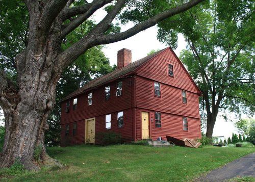
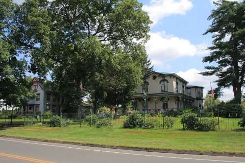
8 listings: 5 buildings, among them the Enoch Kelsey House (listed 1982, the first), and 3 historic districts, the Newington Junction North Historic District, the Newington Junction South Historic District and the Newington VA Hospital Historic District, with 32 contributing buildings. 50 historic buildings in all.
How old are the homes in Newington?
7% of Newington’s homes were built before 1940 (Census estimate, ±1.7 points), against a typical 15% for a Connecticut town; the median home was built in 1967.
Founding dates: Wikidata, Wikipedia, the U.S. post office records of Blevins & Helbock (CC0) and the Census. Homes by year built: Census ACS 2020–24. National Register of Historic Places: National Park Service (list of May 22, 2026). Old photos, postcards and papers: Wikimedia Commons, the Library of Congress and other public archives, credited on each item’s page. Maps: U.S. Geological Survey historical topographic maps (via Esri) and Sanborn fire-insurance maps (Library of Congress). History text and census tables: Wikipedia (CC BY-SA 4.0). Places that used to be: USGS Geographic Names Information System (2021).
From Wikimedia Commons (32), Wikidata (2), the National Register of Historic Places (8), Wikipedia, Wikidata and Wikipedia for famous people, U.S. Geological Survey historical maps, U.S. Census counts (via Wikipedia), the US Post Offices dataset (Blevins & Helbock), the USGS Geographic Names Information System and old county and town histories (Internet Archive). Archive images are copied here with their credits and licenses, shown on each photo’s page. Refreshed monthly.





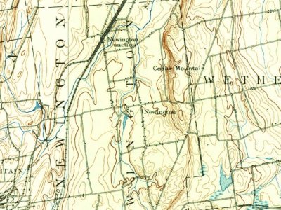

 Date?
 Date?
 2018
 2018
 2018
 2018
 2016
 2014
 2014
 2014
 2014
 2014
 2014
 2014
 2014
 2014
 2014
 2014
 2014
 2014
 2014
 2014
 2012
 2012
 2012
 2012
 2012
 2012
 2012
 2010
 2009
 2008