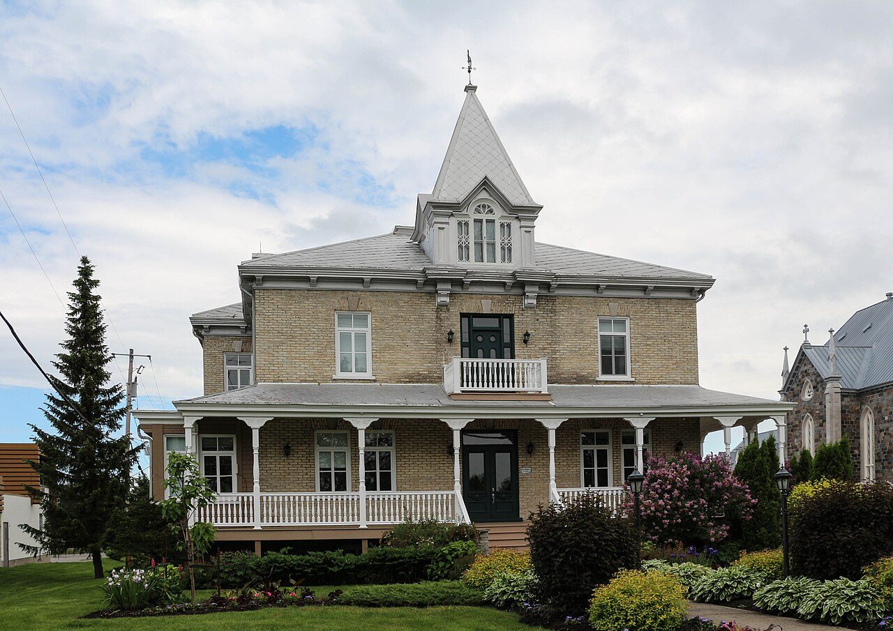
Presbytère de Saint-Henri · Photo: Bernard Gagnon · CC BY-SA 3.0
2historic places on the registers
History of Saint-Henri · Canada’s heritage registers
Saint-Henri: 2 historic places on Canada’s heritage registers
Saint-Henri’s 3.3 per 10,000 residents puts it ahead of 91% of Canadian towns. Its oldest building on the record is Presbytère de Saint-Henri, from 1906. The record has 2 municipal citations.
National Historic Sites, classified federal buildings and Québec’s classements
Provincial and local listings
2
municipal citations on Québec’s register
Oldest building
1906
the first construction date on its record
Homes built before 1961
20%
typical town: 18%
In pictures
Saint-Henri’s historic places in 2 photos
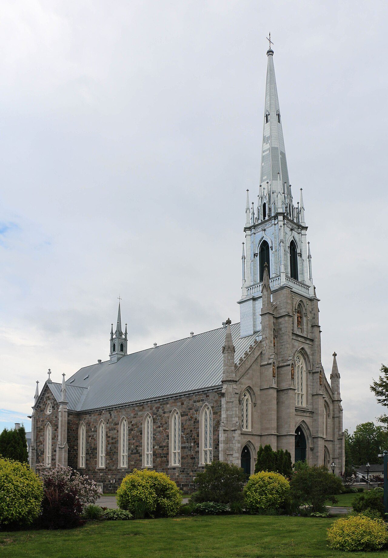
Photos show both of the places Saint-Henri’s registers name. Presbytère de Saint-Henri and Site patrimonial de l'église et du cimetière de Saint-Henri lead the set.
Photos from Wikimedia Commons, each credited to its photographer with its licence; names open the place’s page. Tap a photo to step through them full screen.
How it began
Saint-Henri’s record begins in 1976
For the municipality of Saint-Henri itself, Wikidata records October 9, 1976, a date that can be a founding as much as a merger. It succeeded Saint-Henri and Saint-Henri-de-Lauzon.
Every place on the registers inside the town, by its designation.
Provincial and local listings
Each dot is a place: point at it for the name, tap it for its page.
The 2, by tier
2 Provincial and local listings
In Québec the record is fuller than elsewhere: beside Parks Canada’s designations, the province’s register lists its classements and every municipal citation.
Points from Wikidata (Parks Canada’s files carry none) and from Québec’s register, as mapped there.
Provincial and local listings
On provincial and local lists in Saint-Henri: 2 places
The first was designated in 1990, the latest in 2013. Citations the municipality has made, registered with Québec’s ministry of culture. Presbytère de Saint-Henri and Site patrimonial de l'église et du cimetière de Saint-Henri lead the list. Each one opens its own page.
Croix de chemin, 8.6 km from Saint-Henri, is the closest
The oldest, Croix de la Montagne, dates from 1930, 8.8 km away. Count to 10 km and there are 3. Between them, 3 towns share them, mainly Saint-Charles-de-Bellechasse, Saint-Anselme and Lévis.
The 3 nearest, within 10 km
Croix de cheminMunicipal citation (Québec) · 1969 · 8.6 km away, in Saint-Charles-de-Bellechasse
Croix de la MontagneMunicipal citation (Québec) · 1930 · 8.8 km away, in Saint-Anselme
Most of Saint-Henri’s homes went up from 2001 to 2015: 34%
Like the typical town (18%), Saint-Henri has 20% of its homes from before 1961. From 2016 to 2021 Saint-Henri added 5.7% of its homes, more than the typical town’s 4.1%. Only 14% of Saint-Henri’s homes were built from 1981 to 2000, less than the typical town’s 23%.
20%
Before 1961
26%
1961–80
14%
1981–2000
34%
2001–15
5.7%
2016–21
Saint-HenriTypical town
2021 Census, private dwellings by period of construction (Statistics Canada); the typical town is the middle Canadian town of 2,500 or more.
Born here
Before 1914, Saint-Henri gave 3 lives to the record
Alfred Tremblay reached 88, the longest life here, ending in 1975. The widest known is Alfred Tremblay: 3 Wikipedia editions. At the other end is Alfred Tremblay, from 1887. Jean-Baptiste Beaudoin comes first, born in 1787.
Jean-Baptiste Beaudoin
Joseph-Théophile Larochelle
Alfred Tremblay
175017751800182518501875190019251950
Alfred Tremblay1887–1975 · Canadian explorer
JB
Jean-Baptiste Beaudoin1787–1870 · Canadian politician
JL
Joseph-Théophile Larochelle1877–1954 · Canadian politician
Everyone born in Saint-Henri → Born before 1914 (the page’s periods: Confederation to the First World War). Birthplaces from Wikidata, each checked against the person’s Wikipedia article.
Towns its size
Saint-Henri has the 2nd most of 16 towns its size
Towns of 6,000 to 6,100 residents, by places on the registers.
Of the homes standing in Saint-Henri, 20% went up before 1961, against 18% in the typical town. The lists come to 2 historic places. Just one town of its size, out of 16, has more historic places. Three lives from its past stand out: Alfred Tremblay (1887), Jean-Baptiste Beaudoin (1787) and Joseph-Théophile Larochelle (1877). Otherwise the figures are ordinary: the designations ran from 1990 to 2013.
How to read these numbers
What this data can and can’t tell you
•
People and events. The open directory puts its national historic persons nowhere, so a town shows one only on firm ground: a birth there, matched by name and life years, or a historic place there named for the person whose record says so. Events are left out.
•
Map points. Pins for federal places come from Wikidata rather than Parks Canada, which gives no points.
•
The grade. This page gives no grade; history doesn’t count toward a Canadian town’s letter.
•
Québec’s register. Québec’s Répertoire du patrimoine culturel records the province’s classements and declarations and every municipal citation, each with a description and a point.
•
The tiers. The highest designations are National Historic Sites, Classified Federal Heritage Buildings and Québec’s classements; then come the other federal designations; then provincial and local listings.
•
The federal register. Parks Canada’s Directory of Federal Heritage Designations lists every National Historic Site, federal heritage building, heritage railway station and lighthouse; the Canadian Register of Historic Places adds their statements in English and French.
•
Protection. A place classified or cited under Québec’s law is protected; National Historic Site status alone protects only what the federal government owns.
Questions about Saint-Henri’s history
How many historic places does Saint-Henri have on the registers?
2 historic places in Saint-Henri, from Canada’s heritage registers.
What is the oldest building in Saint-Henri?
Presbytère de Saint-Henri, a Municipal citation (Québec), begun in 1906.
How old are the homes in Saint-Henri?
Before 1961: 20% of its homes; the typical town has 18%.
Contains information licensed under the Open Government Licence – Canada (Parks Canada). Québec register data: Ministère de la Culture et des Communications du Québec, CC BY 4.0.
Sources: Parks Canada, Directory of Federal Heritage Designations · Canadian Register of Historic Places (federal extract) · Répertoire du patrimoine culturel du Québec (MCC, Données Québec) · Wikidata (CC0) for map points, other names and articles · Statistics Canada, 2021 Census (homes by period of construction). Under the Statistics Canada Open Licence.
 Local
 Local
