 Local
Ontario Heritage Trust easementDon Valley Brick WorksPhoto: Mathew Ingram · CC BY 2.0 · Commons file
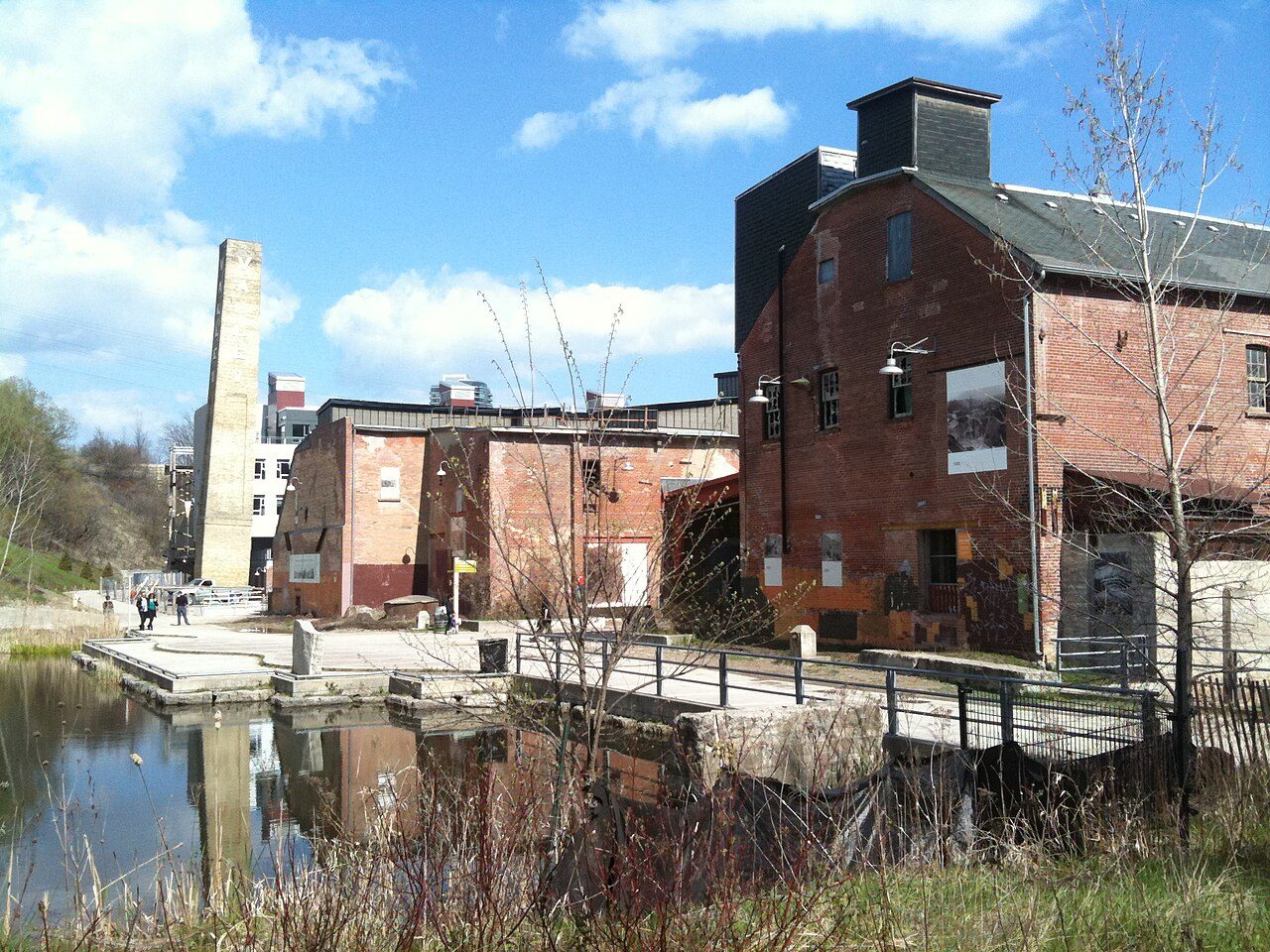 Don Valley Brick Works · Photo: Mathew Ingram · CC BY 2.0
1historic place on the registers
History of Leaside-Bennington · Canada’s heritage registers
Older housing stands out in Leaside-Bennington: 67% predates 1961
Leaside-Bennington’s share is 3.8 times the typical 18%. Inside the town the registers count 1 historic place. Relative to its size the figure is 0.6 per 10,000 residents, more than in 75% of Canadian towns.
Historic places
1
0.6 per 10,000 residents
Highest designations
0
National Historic Sites and Classified Federal Heritage Buildings
Provincial and local listings
1
provincial and municipal listings with an encyclopedia article
Homes built before 1961
67%
typical town: 18%
The map
Where Leaside-Bennington’s history is
Every place on the registers inside the town, by its designation.
Provincial and local listings
Names show on hover, and a tap takes you to the place’s page.
The 1, by tier
1 Provincial and local listings
The federal directory kept by Parks Canada supplies most of these places; provincial and municipal lists outside Québec aren’t open data, so only the ones Wikidata documents with an article appear.
Points from Wikidata (Parks Canada’s files carry none) and from Québec’s register, as mapped there.
Provincial and local listings
One more place Leaside-Bennington or its province protects
Provincial and municipal listings that Wikidata records and an encyclopedia describes. Each one opens its own page.
The age of the area
Around Leaside-Bennington, within 5 km, the dated heritage reaches back to 1837
The area, not the town: places within 5 km of Leaside-Bennington, dated by the first construction year on their records.
British North America 1760–18663
After Confederation 1867–19137
Wars and Depression 1914–19451
Since 1946 1946 on0
The bars count 11 dated places within 5 km. 3 go back before 1867. First by date comes Montgomery's Tavern in Yonge-Eglinton, from 1837.
Around the town
11 historic places within 5 km of Leaside-Bennington
By designation: 10 National Historic Sites and a provincial or municipal listing. They stand in 10 towns, Cabbagetown-South St.James Town, Mount Pleasant East and Yonge-Eglinton among them. Montgomery's Tavern, 2.7 km off, is the oldest: 1837.
The 11 nearest, within 5 km
| Mount Pleasant CemeteryNational Historic Site · 1873 · 1.9 km away, in Mount Pleasant East |
| Montgomery's TavernNational Historic Site · 1837 · 2.7 km away, in Yonge-Eglinton |
| Balmoral Fire HallNational Historic Site · 1911–1912 · 3.2 km away, in Yonge-St.Clair |
| Eglinton TheatreNational Historic Site · 1935–1937 · 3.6 km away, in Lawrence Park South |
| Studio BuildingNational Historic Site · 1913–1915 · 4 km away, in Rosedale-Moore Park |
| Chapel of St. James-the-LessNational Historic Site · 1857–1862 · 4.1 km away, in Cabbagetown-South St.James Town |
| Heliconian HallNational Historic Site · 1876–1877 · 4.4 km away, in Annex |
| Winchester HotelDesignated heritage property (part IV) · 1880 · 4.5 km away, in Cabbagetown-South St.James Town |
| SpadinaNational Historic Site · 1866–1914 · 4.6 km away, in Casa Loma |
| Annesley HallNational Historic Site · 1902–1904 · 4.8 km away, in Bay-Cloverhill |
| Royal Conservatory of MusicNational Historic Site · 1880–1882 · 4.9 km away, in University |
Homes by age
Leaside-Bennington added few homes from 2016 to 2021: 3%, where most towns have 4.1%
Homes built from 1961 to 1980 make up just 9% of Leaside-Bennington’s, against 27% in the typical town. Only 8.7% of Leaside-Bennington’s homes were built from 1981 to 2000, less than the typical town’s 23%. Leaside-Bennington built little from 2001 to 2015: 9% of its homes, where most towns have 15%.
67%
Before 1961
9%
1961–80
8.7%
1981–2000
9%
2001–15
3%
2016–21
Leaside-BenningtonTypical town
2021 Census, private dwellings by period of construction (Statistics Canada); the typical town is the middle Canadian town of 2,500 or more.
Towns its size
Leaside-Bennington has the 2nd most of 16 towns its size
Towns of 16,500 to 16,900 residents, by places on the registers.
Leaside-Bennington1
Ahead of it: Saint-Édouard. Their median is 0. 11 of them have nothing on the registers.
Neighbours
Leaside-Bennington and its neighbours
| Town | People | Places | Highest | Oldest |
|---|---|---|---|---|
| Leaside-Bennington | 16,710 | 1 | 0 | — |
| Mount Pleasant East | 16,373 | 1 | 1 | 1873 |
| Thorncliffe Park | 20,637 | 0 | 0 | — |
| Broadview North | 11,080 | 0 | 0 | — |
| South Eglinton-Davisville | 23,380 | 0 | 0 | — |
| North Toronto | 16,007 | 0 | 0 | — |
| Bridle Path-Sunnybrook-York Mills | 9,909 | 0 | 0 | — |
In brief
Leaside-Bennington in brief
Older stock first: 67% of homes in Leaside-Bennington were standing by 1961, against 18% in the typical town. The count is 1 historic place. Just one town of its size, out of 16, has more historic places.
How to read these numbers
What this data can and can’t tell you
- People and events. Persons of national historic significance come with no location; a town gets one only by birthplace (name and both life years agreeing) or by one of its own places that bears the name and whose record tells the story. Events, which can’t be tied, are left out.
- The grade. There is no history grade: the page sets out the record and compares it with other towns.
- Provincial and municipal lists. The local and provincial lists outside Québec aren’t published openly, so this page counts what Wikidata records and pages only the places an encyclopedia describes.
- Protection. National historic designation honours a place but binds only federal owners; a private building’s protection depends on its province or municipality.
- The tiers. Tiers follow the designation: national recognition and classement first, other federal designations next, provincial and local listings last.
- The federal register. Federal places come from Parks Canada’s directory, which counts National Historic Sites, federal heritage buildings, stations and lighthouses; their statements are the register’s own.
- Map points. Where a federal place sits on the map is Wikidata’s placing; the directory itself has no coordinates.
Questions about Leaside-Bennington’s history
How old are the homes in Leaside-Bennington?
67% of its homes were built before 1961, against 18% in the typical Canadian town.
How many historic places does Leaside-Bennington have on the registers?
Inside Leaside-Bennington: 1 historic place.
Contains information licensed under the Open Government Licence – Canada (Parks Canada).
Sources: Parks Canada, Directory of Federal Heritage Designations · Canadian Register of Historic Places (federal extract) · Wikidata (CC0) for map points, other names and articles · Statistics Canada, 2021 Census (homes by period of construction). Under the Statistics Canada Open Licence.
Adapted from Statistics Canada (Census of Population 2021, population estimates 2025, 2021 census boundaries) under the Statistics Canada Open Licence; this does not constitute an endorsement by Statistics Canada. Neighbourhood names in some cities © OpenStreetMap contributors (ODbL).