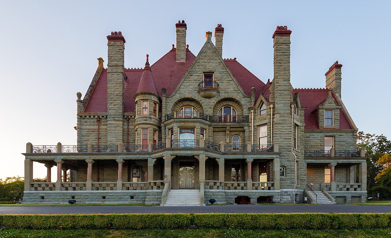
Craigdarroch
In French: Château Craigdarroch
Also known as Dunsmuir Castle , Craigdarroch Castle
1050 Joan Crescent, Victoria
About Craigdarroch
In Victoria, Craigdarroch is one of 23 National Historic Sites. Construction of Craigdarroch is recorded as 1887–1891. The register names Warren H. Williams, Arthur L. Smith and Thomas Moffat as its architects.
Situated on the summit of the highest hill adjacent to downtown Victoria, British Columbia, Craigdarroch National Historic Site of Canada is a well-known and prominent landmark. Its Scottish Baronial design combines an eclectic fusion of elements borrowed from various architectural styles to evoke the romantic image of a hilltop castle. Built between 1887 and 1890, the castle is distinguished by its distinctive combination of materials, asymmetrical massing with a strong vertical emphasis, steeply-pitched picturesque roofline, and rich contrast of materials, colours and details. The building occupies a remnant of the original 11-hectare (28 acres) Dunsmuir estate and dominates the surrounding Rockland residential area of Victoria. The designation refers to the house on its legal lot as of 1992.
From the Canadian Register of Historic Places, Craigdarroch National Historic Site of Canada · Open Government Licence – Canada · the register’s own words, unchanged
The Historic Sites and Monuments Board recommends National Historic Sites; the designation marks national significance, not ownership.
Finding Craigdarroch
Victoria


It is a stop on its own: the next historic place is a longer trip.
Questions about Craigdarroch
What is Craigdarroch?
Craigdarroch became a National Historic Site in 1992.
Can you visit Craigdarroch?
From outside, yes; going in depends on who owns or runs it.
Is Craigdarroch protected?
The designation recognizes its national significance; it doesn’t by itself protect a building the federal government doesn’t own. Provincial or municipal designation may.
When was Craigdarroch built?
Craigdarroch went up in 1887–1891, by its record.
Contains information licensed under the Open Government Licence – Canada (Parks Canada).
Sources: Parks Canada, Directory of Federal Heritage Designations · Canadian Register of Historic Places (federal extract) · Photos: Wikimedia Commons, each credited with its licence and copied to our own server · Wikidata (CC0) for map points, other names and articles.
Adapted from Statistics Canada (Census of Population 2021, population estimates 2025, 2021 census boundaries) under the Statistics Canada Open Licence; this does not constitute an endorsement by Statistics Canada. Neighbourhood names in some cities © OpenStreetMap contributors (ODbL).