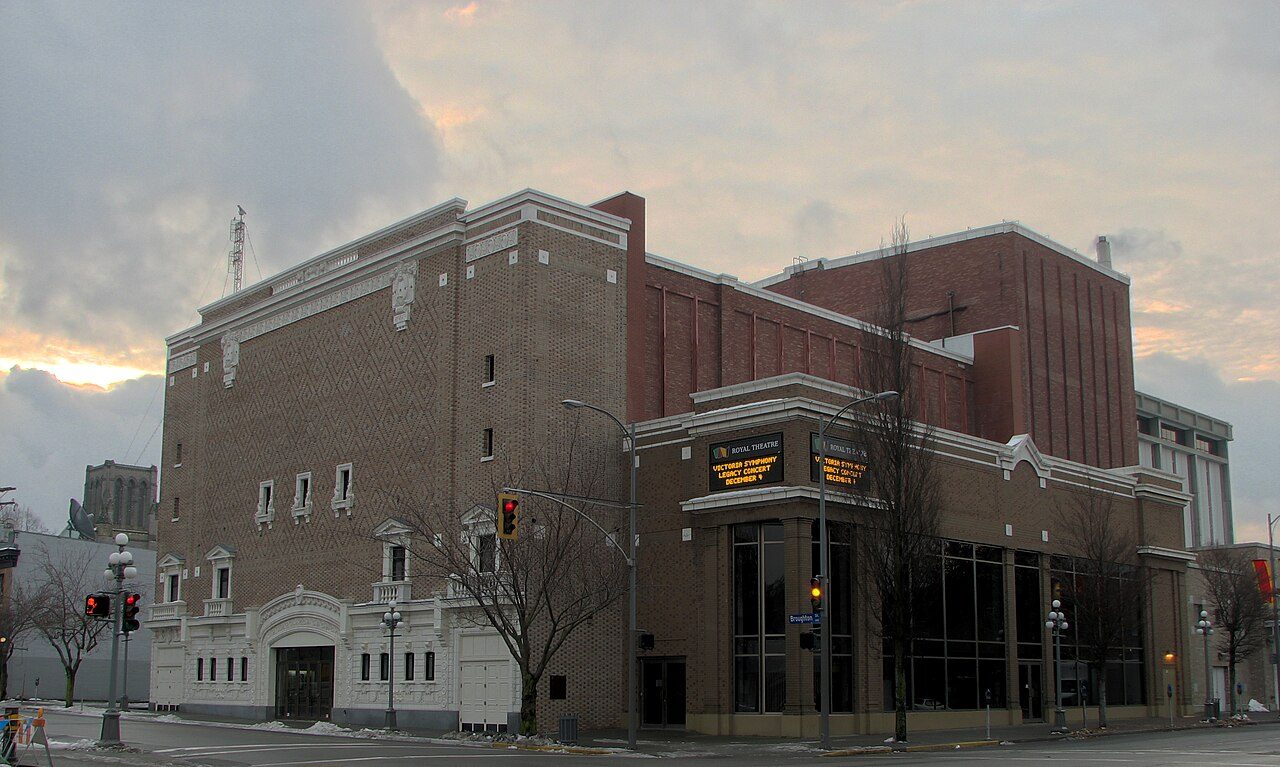
Royal Theatre
In French: The Royal
805 Broughton Street, Victoria
About Royal Theatre
Canada counts Royal Theatre among Victoria’s 23 National Historic Sites. By its record, Royal Theatre was built in 1912–1914. Its design is credited to Rochfort and Sankey. Within 400 m there are 9 more historic places.
The Royal Theatre is a large, brick-faced theatre building occupying most of its urban lot in downtown Victoria.
From the Canadian Register of Historic Places, Royal Theatre National Historic Site of Canada · Open Government Licence – Canada · quoted as the register has it
National Historic Sites are places the Minister of Environment designates, on the advice of the Historic Sites and Monuments Board, for their national significance.
Make it a walk: 5 historic places in about 10 minutes
Victoria · about 500 m on foot, as the crow flies


- 1Royal TheatreStart here
- 2Alexandra Ladies' ClubListed in a community heritage register · 200 m on
- 3St. Andrew's Presbyterian ChurchHeritage designation · 100 m on
- 4Rogers BuildingNational Historic Site · 100 m on
- 5Belmont BuildingHeritage designation · 100 m on
7 within 300 m
Every place on the record within this distance; each opens its own page.
Questions about Royal Theatre
Can you visit Royal Theatre?
Its exterior is visible from public ground; access inside is up to the owner.
When was Royal Theatre built?
Its register puts the building of Royal Theatre at 1912–1914.
Is Royal Theatre protected?
The designation recognizes its national significance; it doesn’t by itself protect a building the federal government doesn’t own. Provincial or municipal designation may.
What is Royal Theatre?
Royal Theatre became a National Historic Site in 1987.
Contains information licensed under the Open Government Licence – Canada (Parks Canada).
Sources: Parks Canada, Directory of Federal Heritage Designations · Canadian Register of Historic Places (federal extract) · Photos: Wikimedia Commons, each credited with its licence and copied to our own server · Wikidata (CC0) for map points, other names and articles.
Adapted from Statistics Canada (Census of Population 2021, population estimates 2025, 2021 census boundaries) under the Statistics Canada Open Licence; this does not constitute an endorsement by Statistics Canada. Neighbourhood names in some cities © OpenStreetMap contributors (ODbL).