First pick
Memorial Park
Park or garden
1.1 ha
0.9 km north-eastfrom the centre
Directionsto a point inside
Each edition grades its towns against each other only.
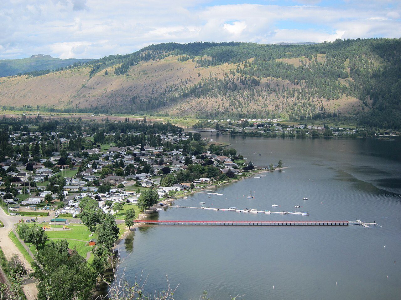 Photo: The Interior · CC BY-SA 3.0
Of the country within 10 km, 7% lies in protected areas; the median Canadian town has 2.3%. No national park lies within 100 km. Count 7 protected areas within 10 km of town.
Each figure against the 2,611 Canadian towns and neighbourhoods of 2,500+ (not city hubs or reserves), with the town marked and the typical one’s line. Outdoors isn’t one of Canada’s graded subjects, so there’s no letter here: each figure is set against other Canadian towns instead.
CPCAD 2.9.0 (ECCC, 2026), OpenStreetMap (November 2026). Distances from the town’s outline.
The 40 Canadian towns nearest in population (2,543 to 2,646 residents), by the share of the land within 10 km that is protected. Hover for each one’s figures; click for its page.
Among its peers, Chase’s strong point is protected land nearby, where 8 of 39 top it.
| Town | Protected within 10 km | In town | Areas | Routes | Beaches | |
|---|---|---|---|---|---|---|
| 1 | Tsawwassen BC | 31% | 0% | 24 | 0 | 8 |
| 2 | Division No. 7, Subdivision E NL | 30% | 28% | 4 | 1 | 0 |
| 3 | Gracefield QC | 19% | 19% | 34 | 0 | 6 |
| 4 | East Preston NS | 16% | 6.3% | 20 | 1 | 5 |
| 5 | Bonfield ON | 15% | 23% | 4 | 0 | 2 |
| 6 | Outlook SK | 11% | 0.1% | 8 | 0 | 1 |
| 7 | Sainte-Croix QC | 9.6% | 0.3% | 32 | 0 | 3 |
| 8 | Castlemore Estates ON | 7.8% | 6.5% | 26 | 0 | 1 |
| 9 | Chase BC | 7% | 0% | 7 | 0 | 0 |
| 10 | Sainte-Victoire-de-Sorel QC | 6.9% | 0% | 41 | 0 | 1 |
| 11 | Saint-Polycarpe QC | 4.2% | 0% | 11 | 0 | 2 |
| 12 | Macassa ON | 4.1% | 0% | 18 | 1 | 0 |
| 13 | Saint-Damien QC | 4% | 3.2% | 22 | 1 | 9 |
| 14 | Boothill SK | 3.9% | 76% | 4 | 2 | 1 |
| 15 | Unity SK | 3.4% | 0% | 3 | 0 | 0 |
| 16 | Sherwood ON | 3.4% | 0% | 19 | 2 | 0 |
| 17 | Kinburn ON | 3.1% | 0% | 31 | 0 | 6 |
| 18 | Saint-Mathieu QC | 2.4% | 0% | 12 | 0 | 0 |
| 19 | City Commercial Core ON | 1.8% | 0% | 20 | 0 | 0 |
| 20 | Lambeth ON | 1.8% | 0% | 14 | 0 | 0 |
| 21 | High Prairie AB | 1.7% | 0% | 1 | 0 | 0 |
| 22 | Hébertville QC | 1.6% | 0.1% | 12 | 0 | 4 |
| 23 | Electoral Area G, Cowichan Valley BC | 1.6% | 0.7% | 46 | 1 | 14 |
| 24 | Westmeria ON | 1.6% | 0% | 18 | 2 | 5 |
| 25 | Brockville MB | 1.5% | 0% | 24 | 0 | 1 |
| 26 | South River Heights MB | 1.5% | 0% | 24 | 0 | 1 |
| 27 | Caswell Hill SK | 1.4% | 0% | 16 | 0 | 3 |
| 28 | Logy Bay-Middle Cove-Outer Cove NL | 1.1% | 0% | 3 | 1 | 20 |
| 29 | Waterville QC | 0.7% | 0% | 6 | 0 | 1 |
| 30 | Berwick NS | 0.6% | 0% | 6 | 0 | 0 |
| 31 | Saint-Chrysostome QC | 0.4% | 0.3% | 5 | 0 | 2 |
| 32 | Brooke-Alvinston ON | 0.3% | 0.2% | 6 | 0 | 0 |
| 33 | Minchau AB | 0.3% | 0% | 2 | 0 | 3 |
| 34 | Sweet Grass AB | 0.3% | 0% | 2 | 0 | 0 |
| 35 | Salisbury NB | 0.1% | 2.1% | 4 | 0 | 0 |
| 36 | Dufferin MB | 0.1% | 0% | 1 | 0 | 0 |
| 37 | Saint-Éphrem-de-Beauce QC | 0% | 0% | 1 | 0 | 1 |
| 38 | Rosetown SK | 0% | 0% | 0 | 0 | 0 |
| 39 | Magrath AB | 0% | 0% | 0 | 0 | 0 |
| 40 | Sexsmith AB | 0% | 0% | 0 | 0 | 0 |
The town’s parks, woods, protected land and paths, with its named places numbered.
The biggest is Memorial Park, 1.1 ha. Biggest first, numbered as on the map.
Source: OpenStreetMap parks, gardens, commons and woods with a name, in the town or within 400 m, © OpenStreetMap contributors, ODbL. Sizes are the mapped outline’s.
Residents of each 2021 dissemination area, at a point inside it, within 400 m (about a 5-minute walk) of a park or playing field mapped on OpenStreetMap.
That beats the typical Canadian town, where it is 83%.
Every protected and conserved area in CPCAD within 10 km of the town’s edge: parks, reserves, wildlife areas and conservation land.
5 of the 7 belong to a government or an Indigenous nation. Tsútswecw Park covers 1,073 ha, the most of any named area. 2 areas belong to private owners or land trusts and aren’t named here.
1 area recorded only by its type (a provincial layer such as wildlife habitat areas) is counted, not listed.
Source: Canadian Protected and Conserved Areas Database (CPCAD) 2.9.0, Environment and Climate Change Canada. Contains information licensed under the Open Government Licence – Canada.
National parks (Parks Canada) and provincial or territorial parks by direction and distance from the town’s edge: every one within 10 km, and the nearest of each within 100 km.
There is no national park within 100 km; for big parks, Chase has its province’s. There are 4 provincial parks within 10 km.
Source: CPCAD 2.9.0 (ECCC): areas and outlines, distances outline to outline; directions from the town’s centre point.
OpenStreetMap footpaths, paths, bridleways and steps, and tracks open on foot, in the town and 1 km around it; woods as mapped (landuse=forest, natural=wood).
For woods, it beats 78% of Canadian towns. It has fewer paths per km² than 78% of Canadian towns.
Source: OpenStreetMap, © OpenStreetMap contributors, ODbL. Mapping varies by place: a dense figure can mean keen local mappers as much as many paths.
Named walking and hiking routes on OpenStreetMap with at least 300 m within 2 km of the town, longest first; national routes lead.
OpenStreetMap lists no walking route near the town, though paths on the ground may well exist.
Source: OpenStreetMap (route relations hiking, foot and walking), © OpenStreetMap contributors, ODbL. Trans Canada Trail sections as OSM maps them.
Daylight at the town’s latitude and ECCC’s 1991–2020 normals (Salmon Arm, 35 km away). Good months: long days, highs of 15–30 °C, light rain.
| Jan | Feb | Mar | Apr | May | Jun | Jul | Aug | Sep | Oct | Nov | Dec | |
|---|---|---|---|---|---|---|---|---|---|---|---|---|
| Daylight (h) | 8.4 | 9.9 | 11.7 | 13.7 | 15.5 | 16.5 | 16.1 | 14.5 | 12.5 | 10.6 | 8.8 | 8.0 |
| High (°C) | 1 | 3 | 9 | 16 | 21 | 24 | 28 | 28 | 21 | 13 | 6 | 1 |
| Rain & snow (mm) | 78 | 37 | 39 | 41 | 53 | 64 | 43 | 35 | 41 | 61 | 83 | 78 |
In July the typical high is 28 °C; in January, 1 °C. Expect 83 mm in November, the wettest month, and 35 mm in August. A typical year sees 203 cm of snow. The climate in Chase →
Viewpoints, peaks, waterfalls, picnic sites, nature reserves, playgrounds, dog parks, campsites and boat launches mapped within 2 km of the town.
Count 5 viewpoints, the biggest group.
Plus 3 viewpoints without a name on the map.
Plus 1 picnic site without a name on the map.
Plus 3 playgrounds without a name on the map.
Source: OpenStreetMap (tourism, natural, waterway and leisure tags), © OpenStreetMap contributors, ODbL.
The nearest places, coloured by the share of the land within 10 km that is protected; tap one for its outdoors page. Chase has few close neighbours with figures, so the list reaches 16–29 km out.
| Town | Protected within 10 km | Areas | Routes | Beaches |
|---|---|---|---|---|
| Chase | 7% | 7 | 0 | 0 |
| Sun Peaks Mountain 16 km | 9.8% | 2 | 0 | 0 |
| Blind Bay 23 km | 1.6% | 15 | 0 | 8 |
| Electoral Area L (Grasslands), Thompson-Nicola 25 km | 3.8% | 25 | 0 | 0 |
| Electoral Area P (Rivers and the Peaks), Thompson-Nicola 27 km | 11% | 21 | 0 | 0 |
| Electoral Area F, Columbia-Shuswap 29 km | 6.2% | 18 | 0 | 5 |
Its neighbours have no more than twice Chase’s protected share.
Protected areas cover 7% of the land within 10 km.
No national park lies within 100 km of Chase.
On the normals, April to September: that is when days are long, highs reach 15 °C and rain is light.
Tsútswecw Park: 1,073 ha, a provincial park.
Tsútswecw Park, 1.8 km from the edge of town.
Protected areas: Canadian Protected and Conserved Areas Database (CPCAD) 2.9.0, Environment and Climate Change Canada, 2026: every area within 10 km and the nearest national and provincial parks, measured outline to outline.
Walking routes and beaches: OpenStreetMap, November 2026: named hiking, foot and walking route relations within 2 km and beaches within 5 km.
Towns: Statistics Canada 2021 Census boundaries and populations; the comparison is the Canadian towns and neighbourhoods of 2,500+, not city hubs or reserves.
When to go: Environment and Climate Change Canada, Canadian Climate Normals 1991–2020, from the nearest station that publishes them.
Green space, paths, woods, things to do: OpenStreetMap (Geofabrik’s Canada extract), November 2026: parks, gardens, playing fields, woods, footpaths, the coastline and things to do in and around each town.
Residents: Statistics Canada 2021 Census dissemination areas (population, boundaries), each at a point inside it.
Walking routes and beaches © OpenStreetMap contributors, available under the Open Database Licence (ODbL).
Not on this page: trailheads and trail grades, and beach water quality. No open Canadian dataset gives these for every town yet.
Adapted from Statistics Canada (Census of Population 2021, population estimates 2025, 2021 census boundaries) under the Statistics Canada Open Licence; this does not constitute an endorsement by Statistics Canada. Neighbourhood names in some cities © OpenStreetMap contributors (ODbL).