Santa Cruz dates to 1791, and 19% of its homes were built before 1940
More historic than 92% of U.S. towns · #4 of 847 in California. What drives it
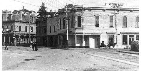
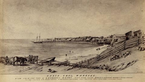
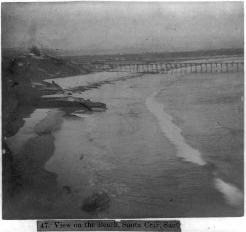
20 places in town are on the National Register, among them 2 National Historic Landmarks and three historic districts with 220 buildings between them. Below: 11 old photos and papers, maps from 1886 on, and the census since 1860.
Founding year: Wikidata; Wikipedia’s history section gives the same year. First post office: 1850.The full story ↓
History grade
What drives Santa Cruz’s History grade
On its age, its old homes and the National Register, Santa Cruz is more historic than 92% of U.S. towns, #4 of 847 in California. All 3 inputs are above most U.S. towns; its National Register listings ranks highest and its share of homes from before 1940 lowest.
A
HistoryA character grade: shown, never part of Santa Cruz’s overall grade.
Few California towns list much on the Register (a typical California town has 0.0 per 10,000 residents, the U.S. 2.4), so Santa Cruz’s 40.1 sits above most of its state (96% of California towns have fewer) while its 247 historic buildings outnumber those of 94% of U.S. towns.
How sure. Graded on any two of the three inputs instead, the letter would range from A− to A. The pre-1940 share (±2.2 points) is firm at this size. Two sources give 1791.
Founding year: Wikidata (other dates in Quick answers). Homes: Census ACS 2020–24. National Register: National Park Service, May 2026 list; each listing counted once (boundary changes and added documentation belong to their listing), and a historic district counts its contributing buildings. How TownRatings grades history →
What stands out about Santa Cruz’s past
Read from the archive, the National Register and the record. The page puts what stands out first.
Indigenous people have been living in the Santa Cruz region for at least 12,000 years. Prior to the arrival of Spanish soldiers, missionaries and colonists in the late 18th century, the area was home to the Awaswas nation of Ohlone people, who lived in a territory stretching slightly north of Davenport to Rio Del Mar. The Awaswas tribe was made up of no more than 1,000 people and their language is now extinct. The only remnants of their spoken language are three local place names: Aptos, Soquel and Zayante; and the name of a native shellfish – abalone. At the time of colonization, the Indigenous people belonged to the Uypi tribe of the Awaswas-speaking dialectical group. They called the area Aulinta.
Passages that mention Santa Cruz, cut from the printed page as they were published.
History of monterey and santa cruz counties, california1925 · page 226Read the page →
Read the text
gold, and he also engaged in teaming to the mines, hauling supplies from Sacramento, California, to Salt Lake City, Utah. In 1878 he moved to Watsonville and before the advent of the railroad in this section of the country did a good business in teaming through the Santa Cruz mountains. He transported lumber to the town of Santa Cruz for shipment by water and subsequently turned his attention to the cultivation of the soil. When he arrived in Alameda county, Oakland was a small town and he lived to witness remarkable changes as the work of development and civilization was carried forward, passing away in 1909. Three sons and one daughter were born
Text read by machine from the scan; it may contain errors.
History of monterey and santa cruz counties, california1925 · page 182Read the page →
Read the text
On April 1, 1886, Mr. Strazicich arrived in the city of Santa Cruz, California, with but a few dollars in his pocket, joining his brother and sister, who had preceded him to this country. He obtained a job as a ditch digger for the Santa Cruz Gas Company, afterward working in a lime kiln and later as cook for the crew of seventy-five men employed in the Santa Cruz Tannery. In November, 1886, he came to Watsonville and for six months worked in a restaurant. On the expiration of that period he started in business for himself. Securing a location on Main street, he opened the second restaurant in the town. As soon as he was established in business
Text read by machine from the scan; it may contain errors.
Scans and text from the Internet Archive. Books published in 1930 or earlier, which are in the public domain.
Timeline
Santa Cruz, 1791 to 1987
Woven from the archive, old maps, post office records, the National Register and the people born here.
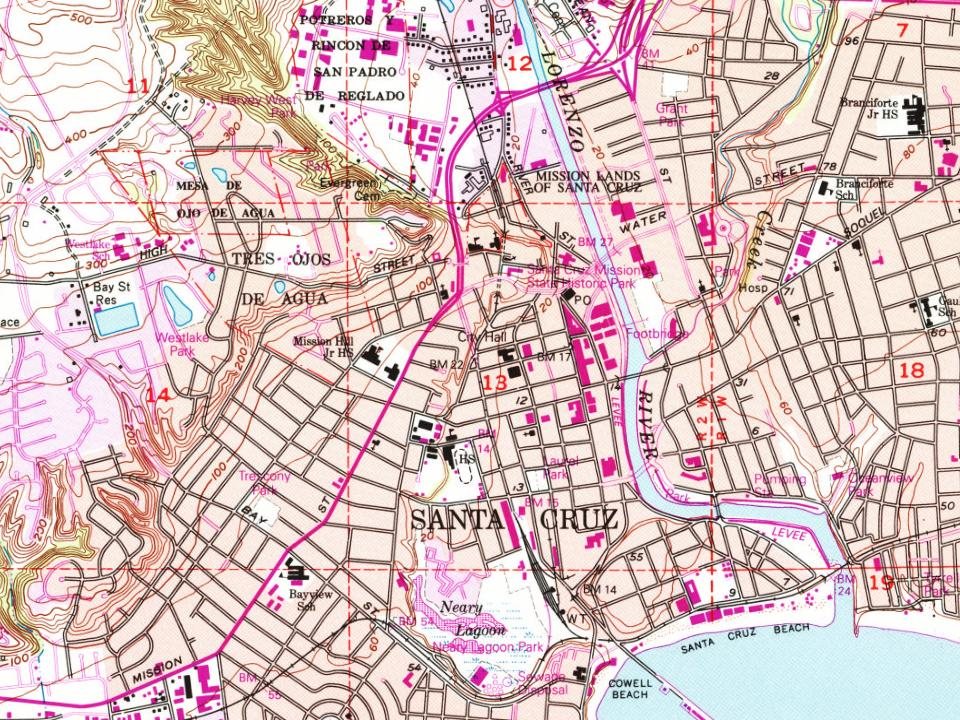
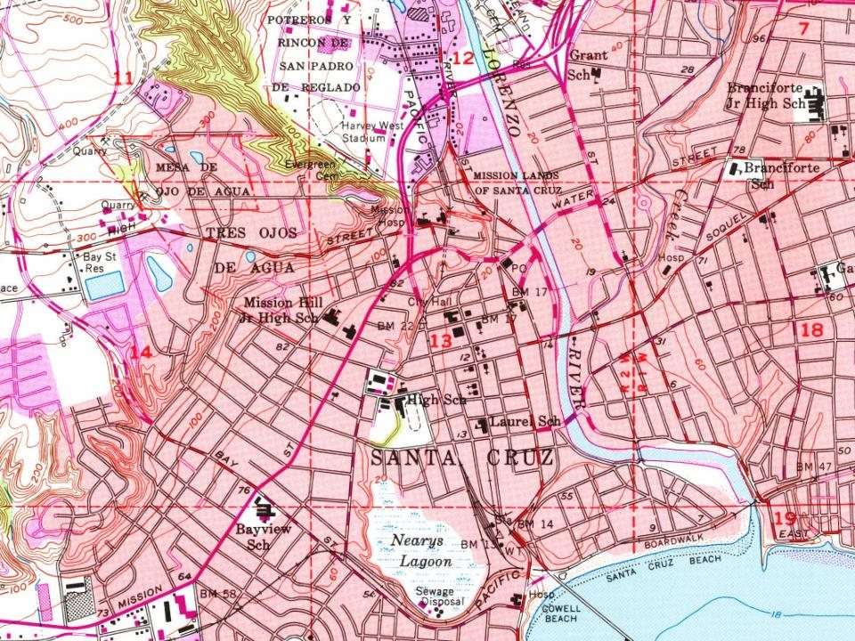
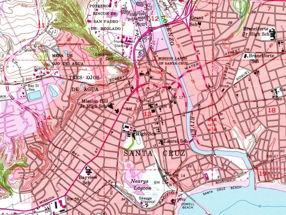
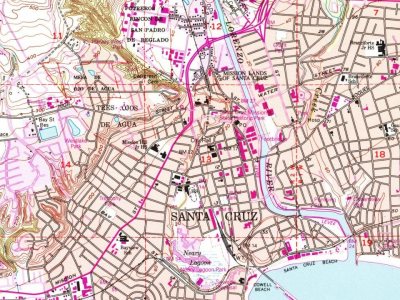
Every edition of the U.S. Geological Survey’s map of Santa Cruz. Tap a year, or press play to watch the town change.
1954Santa Cruz sheet · 1:24,000
U.S. Geological Survey historical topographic maps (public domain), via Esri’s collection of the scans. The red ring marks the center of Santa Cruz.
Every building
Santa Cruz, building by building, 1886–1905
Fire insurance maps drew every building, what it was made of and what it was used for, so insurers could price the risk of fire. Pick a year, then a sheet.
In 1791, according to Wikidata and Wikipedia’s history of the town. Santa Cruz’s post office opened in 1850, and the census of 1860 counted 950 people here.
How does Santa Cruz rank for history?
Santa Cruz is more historic than 92% of U.S. towns, #4 of 847 in California. The History grade combines the town’s founding era, the share of homes built before 1940 and its National Register listings. It’s a character grade, so it isn’t part of the overall grade. How it works.
What is on the National Register in Santa Cruz?
20 listings, 2 of them National Historic Landmarks: 14 buildings, among them the Octagon Building (listed 1971, the first), 3 historic districts, the Mission Hill Area Historic District, the Cowell Lime Works Historic District and the Santa Cruz Downtown Historic District, with 220 contributing buildings, and 3 structures. 247 historic buildings in all.
How old are the homes in Santa Cruz?
19% of Santa Cruz’s homes were built before 1940 (Census estimate, ±2.2 points), against a typical 3.4% for a California town; the median home was built in 1970.
Founding dates: Wikidata, Wikipedia, the U.S. post office records of Blevins & Helbock (CC0) and the Census. Homes by year built: Census ACS 2020–24. National Register of Historic Places: National Park Service (list of May 22, 2026). Old photos, postcards and papers: Wikimedia Commons, the Library of Congress and other public archives, credited on each item’s page. Maps: U.S. Geological Survey historical topographic maps (via Esri) and Sanborn fire-insurance maps (Library of Congress). History text and census tables: Wikipedia (CC BY-SA 4.0). Places that used to be: USGS Geographic Names Information System (2021).
From Wikimedia Commons (10), the Library of Congress (1), the National Register of Historic Places (20), Wikipedia, Wikidata and Wikipedia for famous people, U.S. Geological Survey historical maps, U.S. Census counts (via Wikipedia), the US Post Offices dataset (Blevins & Helbock), the USGS Geographic Names Information System, Sanborn fire insurance maps (Library of Congress) and old county and town histories (Internet Archive). Archive images are copied here with their credits and licenses, shown on each photo’s page. Refreshed monthly.
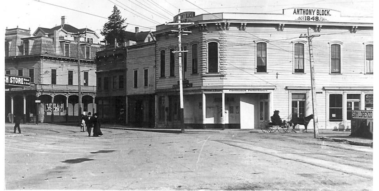

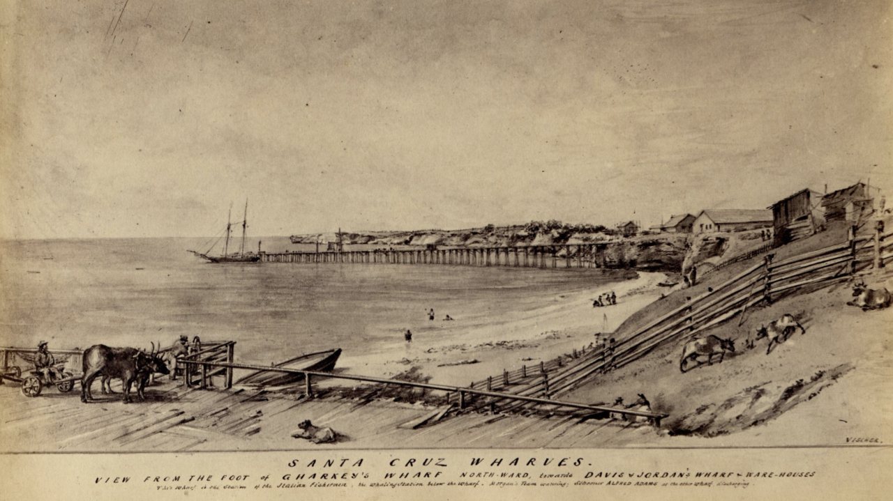


 ★ Landmark
 ★ Landmark
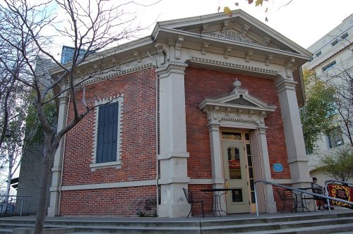


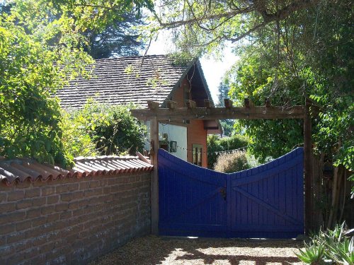

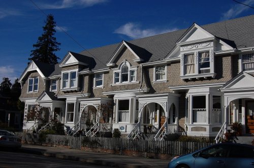






 1863
 1866
 1866
 1866
 1866
 1866
 1866
 1866
 1866