San Rafael dates to 1817, and 8 of its places are on the National Register
More historic than 79% of U.S. towns · #31 of 847 in California. What drives it
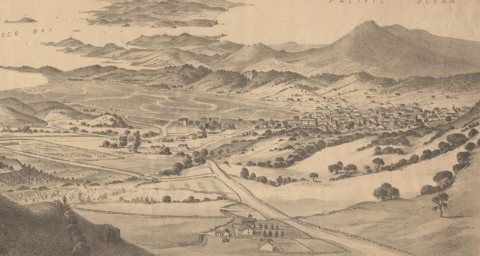
Most of San Rafael was built recently: 10% of its homes predate 1940 and the median home dates from 1968. 8 places in town are on the National Register, among them the Marin County Civic Center, a National Historic Landmark, and a historic district with 9 buildings. Below: 7 old photos and papers, maps from 1887 on, and the census since 1870.
Founding year: Wikipedia. First post office: 1851.The full story ↓
History grade
What drives San Rafael’s History grade
On its age, its old homes and the National Register, San Rafael is more historic than 79% of U.S. towns, #31 of 847 in California. Its National Register listings hold the grade up; its share of homes from before 1940 pulls it down.
A−
HistoryA character grade: shown, never part of San Rafael’s overall grade.
Few California towns list much on the Register (a typical California town has 0.0 per 10,000 residents, the U.S. 2.4), so San Rafael’s 2.8 sits above most of its state (83% of California towns have fewer) while its 17 historic buildings outnumber those of 79% of U.S. towns.
NoteThe founding year comes from Wikipedia alone; no second source gives 1817.
How sure. Graded on any two of the three inputs instead, the letter would range from B to A−. The pre-1940 share (±1.6 points) is firm at this size.
Founding year: Wikipedia (other dates in Quick answers). Homes: Census ACS 2020–24. National Register: National Park Service, May 2026 list; each listing counted once (boundary changes and added documentation belong to their listing), and a historic district counts its contributing buildings. How TownRatings grades history →
What stands out about San Rafael’s past
Read from the archive, the National Register and the record. The page puts what stands out first.
Freitas RanchlocaleLas Gallinas Golf ClublocaleNanaguanuilocaleNike Site SF-93CmilitaryNike Site SF-93LmilitarySan Francisco Bay AirportairportTrinity Lutheran Churchchurch
2cemeteries and burying grounds inside San Rafael
Mount OlivetMount Tamalpais
US Post Offices dataset (Blevins & Helbock, CC0). Places and cemeteries from the USGS Geographic Names Information System (2021).
On the map
San Rafael on the map, 1897 to 1993
Every edition of the U.S. Geological Survey’s map of San Rafael. Tap a year, or press play to watch the town change.
1897Tamalpais sheet · 1:62,500
U.S. Geological Survey historical topographic maps (public domain), via Esri’s collection of the scans. The red ring marks the center of San Rafael.
San Rafael was once the site of several Coast Miwok villages: Awani-wi, near downtown San Rafael; Ewu, near Terra Linda; and Shotomko-cha, in Marinwood.
Mission San Rafael Arcángel was founded as the 20th Spanish mission in the colonial province of Alta California by three priests—Father Narciso Durán from Mission San José, Father Abella from Mission San Francisco de Asís, Father Luis Gíl y Taboada from La Iglesia de Nuestra Señora Reina de los Angeles—on December 14, 1817, four years before Mexico gained independence from Spain. The mission from which the downtown grew and the city being named after the Archangel Raphael, the Angel of Healing.
Passages that mention San Rafael, cut from the printed page as they were published.
History of Marin County, California ... also an historical sketch of the state of California1880Read the page →
Read the text
and the following proceedings were had : " The county officers of Marin county, having become informed of the death of Bradley Hall, Esq., one of their number, an impromptu meeting of the officers of said county, and of the citizens of San Rafael, immediately assembled at the court-room, in the town of San Rafael, at two o'clock p.m. of this day (January 8, 1870), for the purpose of expressing their sorrow for so unlooked-for an event. The meeting was called to order by E. B. Mahon, who briefly stated its object.
Text read by machine from the scan; it may contain errors.
History of Marin County, California ... also an historical sketch of the state of California1880 · page 328Read the page →
Read the text
In April, 1802, tlie mail route between San Francisco and San Rafael was stricken from the list. Heretofore letters had been carried by the Petaluma steamer and landed at Point San Quentin, being conveyed thence by stage to the post office at San Rafael under the promise that proper communication would be made, but as this was never carried out both the steamer and stage company gave notice that mail matter would not be conveyed by them; thus was the little town left without a post-office, the nearest in the county to it being at Tomales, a distance of nearly forty miles. On June
Text read by machine from the scan; it may contain errors.
Scans and text from the Internet Archive. Books published in 1930 or earlier, which are in the public domain.
Timeline
San Rafael, 1817 to 1991
Woven from the archive, old maps, post office records, the National Register and the people born here.
Nothing in the archives for these yearsWeddings on Main Street, storms, parades, school pictures, the old store. If it’s in your family album, it belongs here.
Fire insurance maps drew every building, what it was made of and what it was used for, so insurers could price the risk of fire. Pick a year, then a sheet.
In 1817, according to Wikipedia’s history of the town. San Rafael’s post office opened in 1851, and the census of 1870 counted 841 people here.
How does San Rafael rank for history?
San Rafael is more historic than 79% of U.S. towns, #31 of 847 in California. The History grade combines the town’s founding era, the share of homes built before 1940 and its National Register listings. It’s a character grade, so it isn’t part of the overall grade. How it works.
What is on the National Register in San Rafael?
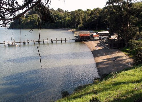
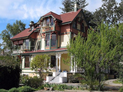
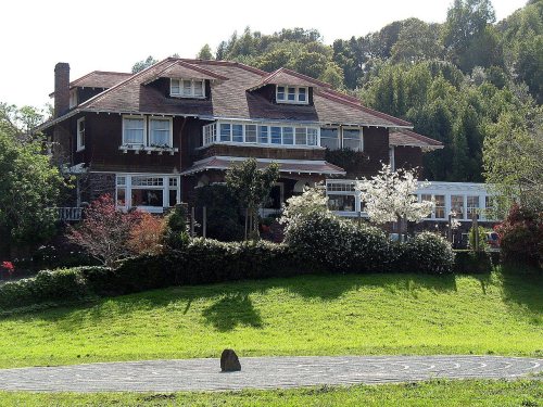
8 listings: 7 buildings, among them the Marin County Civic Center (a National Historic Landmark since 1991) and the Robert Dollar Estate (listed 1972, the first), and 1 historic district, the China Camp, with 9 contributing buildings. 17 historic buildings in all.
How old are the homes in San Rafael?
10% of San Rafael’s homes were built before 1940 (Census estimate, ±1.6 points), against a typical 3.4% for a California town; the median home was built in 1968.
Founding dates: Wikidata, Wikipedia, the U.S. post office records of Blevins & Helbock (CC0) and the Census. Homes by year built: Census ACS 2020–24. National Register of Historic Places: National Park Service (list of May 22, 2026). Old photos, postcards and papers: Wikimedia Commons, the Library of Congress and other public archives, credited on each item’s page. Maps: U.S. Geological Survey historical topographic maps (via Esri) and Sanborn fire-insurance maps (Library of Congress). History text and census tables: Wikipedia (CC BY-SA 4.0). Places that used to be: USGS Geographic Names Information System (2021).
From Wikimedia Commons (3), the Library of Congress (6), Wikidata (6), the National Register of Historic Places (8), Wikipedia, Wikidata and Wikipedia for famous people, U.S. Geological Survey historical maps, U.S. Census counts (via Wikipedia), the US Post Offices dataset (Blevins & Helbock), the USGS Geographic Names Information System, Sanborn fire insurance maps (Library of Congress) and old county and town histories (Internet Archive). Archive images are copied here with their credits and licenses, shown on each photo’s page. Refreshed monthly.
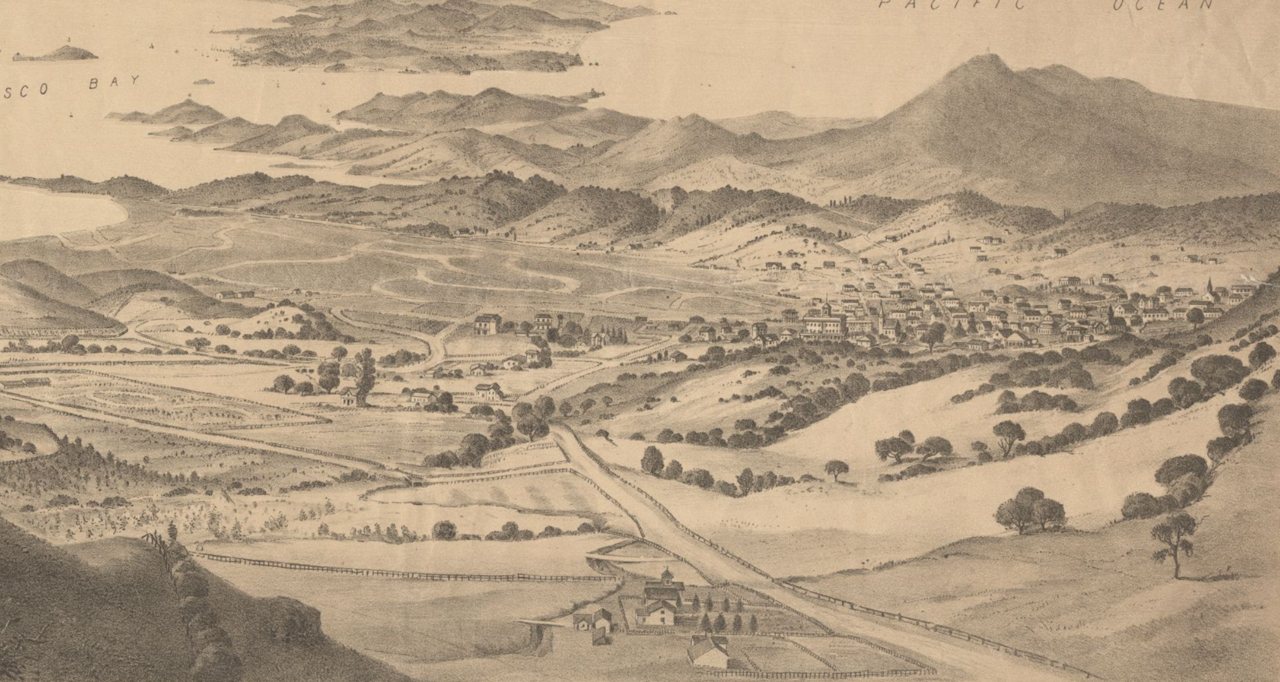


 ★ Landmark







 Date?
 Date?
 Date?
 Date?
 Date?
 2023
 2016

