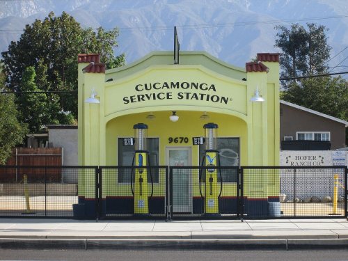
Rancho Cucamonga was first counted by the census in 1980, and 4 of its places are on the National Register
More historic than 20% of U.S. towns · #483 of 847 in California. What drives it
Most of Rancho Cucamonga was built recently: 1% of its homes predate 1940 and the median home dates from 1988. Below: 8 old photos and papers, maps from 1897 on, and the census since 1980.
From Rancho Cucamonga’s archive · credits on each photo
Quick answers
How Rancho Cucamonga began
When was Rancho Cucamonga founded?
1980
Rancho Cucamonga first appears in the census in 1980. Four smaller post offices, North Cucamonga (1888), Grapelande (1889) and Rochester (1890), opened inside today’s city and later closed.
First census: 55,250 in 19802020 census: 174,45346 years
How historic is Rancho Cucamonga?
C−
More historic than 20% of U.S. towns, on its age, its old homes and the National Register.
On its age, its old homes and the National Register, Rancho Cucamonga is more historic than 20% of U.S. towns, #483 of 847 in California. Its National Register listings hold the grade up; its age pulls it down.
C−
HistoryA character grade: shown, never part of Rancho Cucamonga’s overall grade.
Among the 400 U.S. cities of 100,000 or more, Rancho Cucamonga ranks #346 on History.
Few California towns list much on the Register (a typical California town has 0.0 per 10,000 residents, the U.S. 2.4), so Rancho Cucamonga’s 0.3 sits above most of its state (68% of California towns have fewer) while its 6 historic buildings outnumber those of 72% of U.S. towns.
Newer cities are common at Rancho Cucamonga’s size: in the typical U.S. city of 100,000 or more, 5% of homes predate 1940.
How sure. Graded on any two of the three inputs instead, the letter would range from D− to C+. The pre-1940 share (±0.3 points) is firm at this size.
Founding year: the first census (other dates in Quick answers). Homes: Census ACS 2020–24. National Register: National Park Service, May 2026 list; each listing counted once (boundary changes and added documentation belong to their listing), and a historic district counts its contributing buildings. How TownRatings grades history →
What stands out about Rancho Cucamonga’s past
Read from the archive, the National Register and the record. The page puts what stands out first.
Lost post offices, old corners and places now gone
Four other post offices opened and closed inside today’s town.
Cucamonga
1864–today
Etiwanda
1883–today
North Cucamonga
1888–1923
Grapelande
1889–1905
Rochester
1890–1911
Ioamosa
1895–1913
Alta Loma
1913–today
18601940today
Hamlets and corners on the map
Alta LomaEtiwandaGrapelandLas UvasNorth CucamongaRochester
Gone or out of use
Alta Loma SchoolschoolCucamonga Guard StationlocaleInland Quarrymine
US Post Offices dataset (Blevins & Helbock, CC0). Places and cemeteries from the USGS Geographic Names Information System (2021).
On the map
Rancho Cucamonga on the map, 1897 to 1981
Every edition of the U.S. Geological Survey’s map of Rancho Cucamonga. Tap a year, or press play to watch the town change.
1897Cucamonga sheet · 1:62,500
U.S. Geological Survey historical topographic maps (public domain), via Esri’s collection of the scans. The red ring marks the center of Rancho Cucamonga.
Help out
Start Rancho Cucamonga’s collection
The first neighbors to add old photos shape how Rancho Cucamonga’s history is told.
Decades since 1900 with photos
00s10s20s30s40s50s60s70s80s90s
0 of 10 decades. The empty ones are waiting for someone’s album.
By 1200 AD, Kukamongan Native Americans had established a village settlement in the area around present-day Red Hill, near the city's western border, where Red Hill Country Club stands today. Kukamonga derives its name from a Tongva word meaning "sandy place." Anthropologists have determined that this cluster of settlers likely belonged to the Tongva people or Kich people, at one time one of the largest concentrations of Native American peoples on the North American continent. In the 18th century, following an expedition led by Gaspar de Portola, the land was incorporated into the Mission System established by Father Junipero Serra and his group of soldiers and Franciscan friars.
The Rancho Cucamonga post office opened in 1980, the earliest record of the town by name (U.S. post office records).
How does Rancho Cucamonga rank for history?
Rancho Cucamonga is more historic than 20% of U.S. towns, #483 of 847 in California. The History grade combines the town’s founding era, the share of homes built before 1940 and its National Register listings. It’s a character grade, so it isn’t part of the overall grade. How it works.
What is on the National Register in Rancho Cucamonga?
4 listings: 4 buildings, among them the John Rains House (listed 1973, the first). 6 historic buildings in all.
How old are the homes in Rancho Cucamonga?
1% of Rancho Cucamonga’s homes were built before 1940 (Census estimate), against a typical 3.4% for a California town; the median home was built in 1988.
Founding dates: Wikidata, Wikipedia, the U.S. post office records of Blevins & Helbock (CC0) and the Census. Homes by year built: Census ACS 2020–24. National Register of Historic Places: National Park Service (list of May 22, 2026). Old photos, postcards and papers: Wikimedia Commons, the Library of Congress and other public archives, credited on each item’s page. Maps: U.S. Geological Survey historical topographic maps (via Esri) and Sanborn fire-insurance maps (Library of Congress). History text and census tables: Wikipedia (CC BY-SA 4.0). Places that used to be: USGS Geographic Names Information System (2021).
From Wikimedia Commons (1), the Library of Congress (9), Wikidata (4), the National Register of Historic Places (4), Wikipedia, Wikidata and Wikipedia for famous people, U.S. Geological Survey historical maps, U.S. Census counts (via Wikipedia), the US Post Offices dataset (Blevins & Helbock) and the USGS Geographic Names Information System. Archive images are copied here with their credits and licenses, shown on each photo’s page. Refreshed monthly.


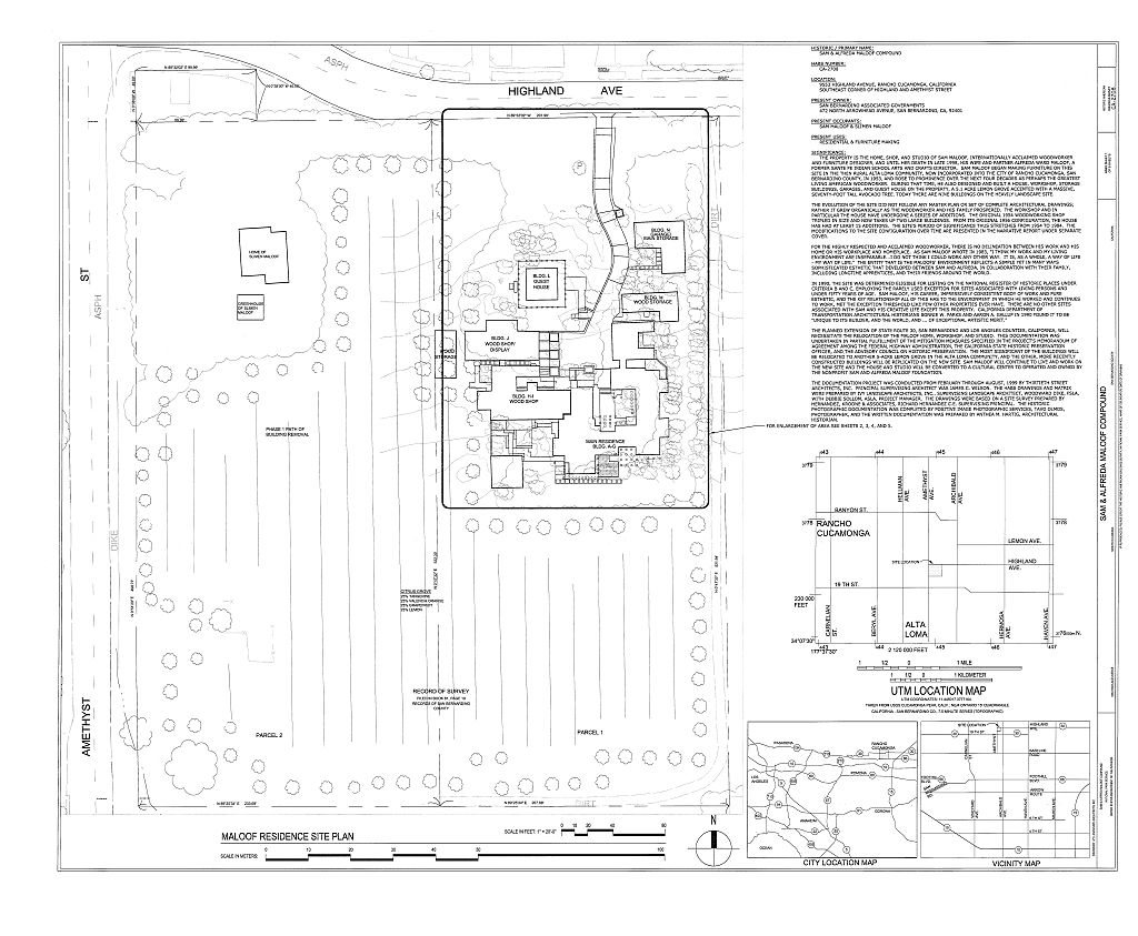


 Date?
 Date?
 Date?
 Date?
 Date?
 Date?
 Date?
 Date?
 2015
 2005