Pajaro DunesCA
143 people call this town in California home.
Is Pajaro Dunes a good place to live?
67% of adults 25 and older hold a bachelor’s degree or more in Pajaro Dunes, above both the California town median (29%) and the median of U.S. towns (29%). Of the 848 California towns we compare, none has a higher share of households owning their home than Pajaro Dunes. Pajaro Dunes’ trail density is 1.6 miles per square mile, against 1.0 in California’s towns and 0.4 across U.S. towns. The biggest park or preserve is Sunset State Beach, at 160 acres. Pajaro Dunes has fewer than 1,000 residents, too few for fair grades; the figures below are still real.
143 people, and everyone knows the way
In a town this size, neighbors are the best guide. Ask them anything.
Levi's Stadium and 60 more within 40 miles
Museums, parks, gardens and other places to visit around Pajaro Dunes. Close and well known come first.
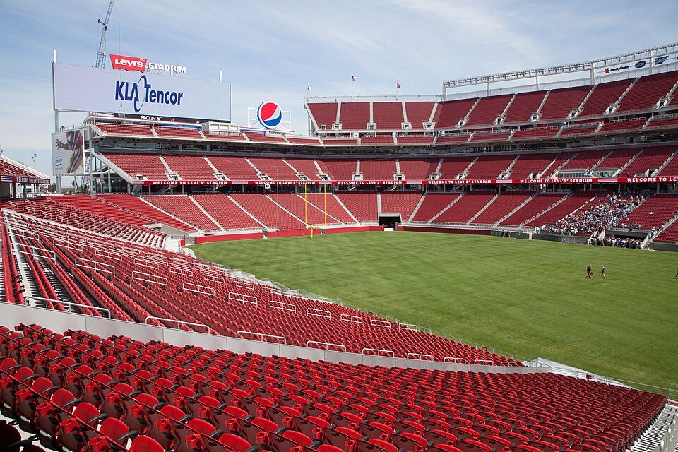 Big draw38 mi Stadium & arenaLevi's Stadium
 Big draw38 mi Theme parkCalifornia's Great America
 18 mi Zoo & aquariumMonterey Bay Aquarium
 19 mi MuseumMonterey Museum of Art
 33 mi Stadium & arenaSAP Center6 mi Canyon & gorgeMonterey Canyon
Photo credits
Levi's Stadium: Matthew Roth, CC BY-SA 2.0 · California's Great America: Oleg Alexandrov, CC BY-SA 4.0 · Monterey Bay Aquarium: Meij.kobayashi, Public domain · Monterey Museum of Art: Sgerbic, CC BY-SA 4.0 · SAP Center: Dicklyon, CC BY-SA 4.0


Moving to Pajaro Dunes: who provides what
Pajaro Dunes is unincorporated, so Santa Cruz County and regional agencies provide most services.
EPA SDWIS (Oct 9, 2026) · HIFLD + EIA-861 2025 · Census 2020 ZCTAs · NCES 2024–25 · registration: vote.gov, updated Nov 18, 2024.
The data
Ordered by what stands out in Pajaro Dunes.
Pajaro Dunes has a very high natural-hazard risk, chiefly from drought
FEMA puts nearly two fifths of Pajaro Dunes’s expected hazard losses down to drought, and 31% to earthquakes. Expected storm and flood damage is higher than in 90% of U.S. communities.
FEMA National Risk Index · OpenFEMA
Pajaro Dunes has mild winters and pleasant summers
For Pajaro Dunes, the peak summer temperature is 68°F.
Typical low → high °F
NOAA U.S. Climate Normals, 1991–2020
How healthy Pajaro Dunes is
On the CDC’s 32 measures, Pajaro Dunes is ahead of California on 8 and behind on 2. The share of adults in Pajaro Dunes who have obesity: 24%.
| Pajaro Dunes | California towns | U.S. towns | |
|---|---|---|---|
| Sleep under 7 hours (CDC PLACES) | 28% | 35% | 36% |
| Obesity (CDC PLACES) | 24% | 29% | 35% |
| Smoke cigarettes (CDC PLACES) | 9% | 11% | 14% |
| Yearly checkup (CDC PLACES) | 73% | 72% | 79% |
| What stands out | Pajaro Dunes | CA |
|---|---|---|
| Fewer older adults who have lost all their teeth | 6.9% | 10.6% |
| Fewer adults facing housing insecurity | 11.3% | 14.9% |
| More adults who have had cancer | 10.4% | 6.4% |
CDC PLACES 2025 · modeled estimates for adults · CMS · HRSA
6.2% of the land in Pajaro Dunes is protected from building
Count the trails in 4 parks and preserves and they come to 4.1 miles. Parks and preserves in Pajaro Dunes: 4, covering 220 acres.
| Biggest places to walk | Trails | Acres |
|---|---|---|
| 1. Sunset State Beach | 0.6 mi | 160 |
| 2. Sunset Wetland Natural Preserve | — | 42 |
| 3. Zmudowski State Beach | — | 9 |
Trails & parks © OpenStreetMap contributors · Conserved land: USGS PAD-US
Zillow Home Value Index · Redfin Data Center
Everything we know about Pajaro Dunes
Colleges nearby
4 within 15 miles of the center of Pajaro Dunes
About 0 of every 100 Pajaro Dunes residents are enrolled in college, against 8 across California.
About Pajaro Dunes
Census-designated place in California, United States
Pajaro Dunes is a census-designated place (CDP) in Santa Cruz County, California, United States. Pajaro Dunes is situated at an elevation of 13 feet (4.0 m) above sea level. The 2020 United States census reported Pajaro Dunes' population was 122.
From Wikipedia, licensed CC BY-SA 4.0 · facts via Wikidata (CC0)
- Area
- 2.6 sq mi
- Elevation
- 13 ft
Questions about Pajaro Dunes
Short answers, built from the data on this page.
Is Pajaro Dunes, CA a good place to live?
Pajaro Dunes has fewer than 1,000 residents, too few for fair grades; the figures below are still real.