173 years in pictures
Census counts: 398 in 1860, 52,590 in 2020. The archive holds 12 old photos and papers going back to 1871 and 6 maps from 1912 on.
8 places on the National Register of Historic Places.
- 1853Watsonville is settled
Each edition grades its towns against each other only.

Watsonville grades D− overall, ranked 720th of 841 in California. In its favor, it is more walkable than 86% of U.S. towns. Watsonville’s July high is 73°F, below both California’s towns (89°F) and U.S. towns (85°F). FEMA rates its natural-hazard risk higher than 97% of U.S. communities, with earthquakes at the top. Watsonville has 8 places on the National Register of Historic Places, among them Judge Lee House and Godfrey M. Bockius House.
Where Watsonville beats most towns, and one thing worth knowing.
Census counts: 398 in 1860, 52,590 in 2020. The archive holds 12 old photos and papers going back to 1871 and 6 maps from 1912 on.
8 places on the National Register of Historic Places.
Each subject compared with towns across the country (schools within California), ordered by how far Watsonville is from typical.
Its grades run from A for walkability (better than 86% of comparable towns) to D− for hazard risk (better than 2%), so the D− overall blends very different results.
How TownRatings grades towns →
Museums, parks, gardens and other places to visit around Watsonville. Close and well known come first.
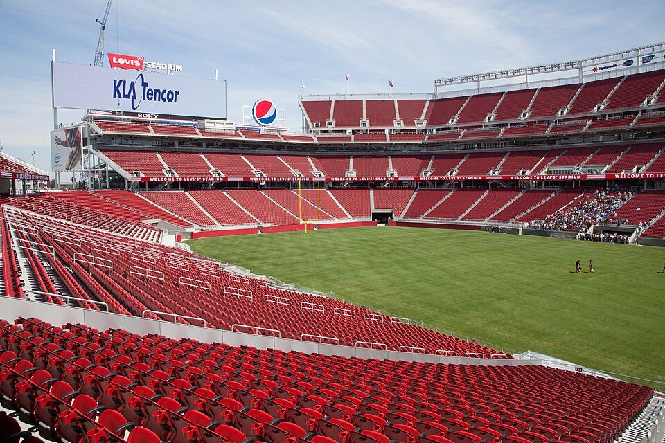
Big draw35 mi Stadium & arenaLevi's Stadium
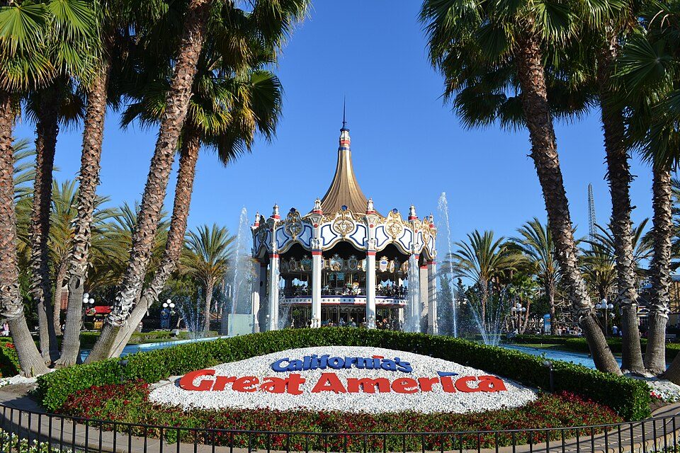
Big draw34 mi Theme parkCalifornia's Great America
22 mi Zoo & aquariumMonterey Bay Aquarium
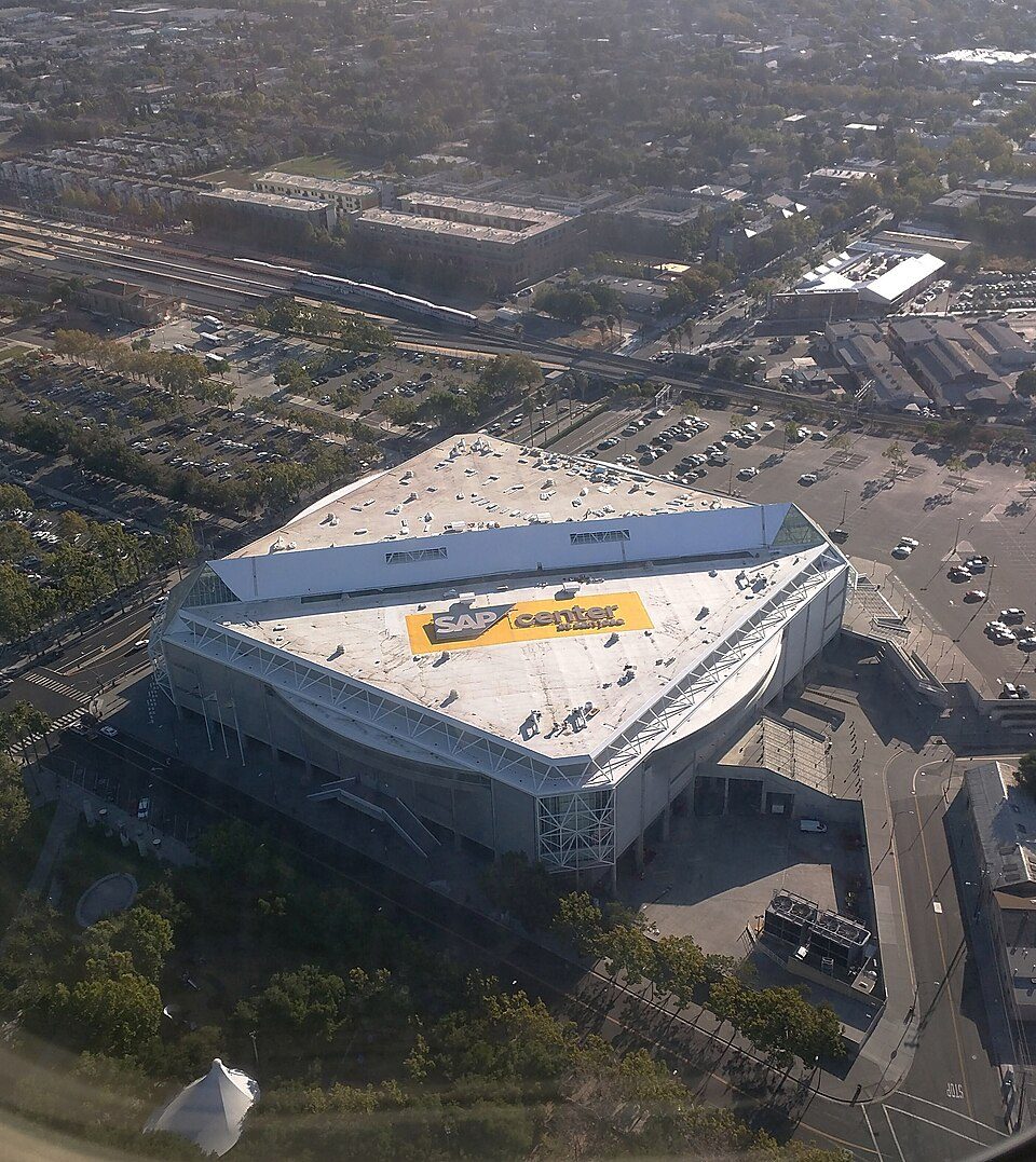
29 mi Stadium & arenaSAP Center
24 mi MuseumMonterey Museum of Art
14 mi Theme parkSanta Cruz Beach BoardwalkLevi's Stadium: Matthew Roth, CC BY-SA 2.0 · California's Great America: Oleg Alexandrov, CC BY-SA 4.0 · Monterey Bay Aquarium: Meij.kobayashi, Public domain · SAP Center: Dicklyon, CC BY-SA 4.0 · Monterey Museum of Art: Sgerbic, CC BY-SA 4.0 · Santa Cruz Beach Boardwalk: Josta Photo, CC BY 2.0
Who provides power, water and the rest in Watsonville, and how to reach them.
EPA SDWIS (Oct 9, 2026) · HIFLD + EIA-861 2025 · Census 2020 ZCTAs · NCES 2024–25 · registration: vote.gov, updated Nov 18, 2024.
Ordered by what stands out in Watsonville.
Watsonville has a longer frost-free season than nearly all U.S. towns, trades workers with Santa Cruz and other neighbors and has seen reported crime fall by a third or more.
Since 1980, 112 flood insurance claims have been paid out in Watsonville.
FEMA flood insurance claims · FEMA National Risk Index · OpenFEMA
Its public schools are run by the Pajaro Valley Unified school district. Three of its 22 schools are below, each with why it’s listed.
| School | Level | Students | Letter |
|---|---|---|---|
| Rolling Hills MiddleLargest public middle schoolGrades 6–8 | Grades 6–8 | 588 | – |
| Watsonville HighLargest public high schoolGrades 9–12 | Grades 9–12 | 2,215 | – |
| Diamond Technology InstituteTop results in townGrades 9–12 | Grades 9–12 | 87 | A |
NCES · EDFacts · graded within CA on state tests and graduation
Watsonville beats the California average on 1 of 32 CDC measures and trails it on 17. 67% of Watsonville adults had a checkup this year.
| Watsonville | California towns | U.S. towns | |
|---|---|---|---|
| Fair or poor health (CDC PLACES) | 32% | 22% | 19% |
| Food insecurity (CDC PLACES) | 32% | 16% | 14% |
| Yearly checkup (CDC PLACES) | 67% | 72% | 79% |
| No health insurance, 18–64 (CDC PLACES) | 23% | 9% | 8.1% |
| What stands out | Watsonville | CA |
|---|---|---|
| Fewer adults who have had cancer | 4.9% | 6.4% |
| More uninsured adults | 22.7% | 10.6% |
CDC PLACES 2025 · modeled estimates for adults · CMS · HRSA
Reported crimes fell from 1,033 to 714 over the last three FBI years, a drop beyond ordinary year-to-year swings.
Watsonville’s violent crime rate is 4.2 per 1,000 residents. Within California, it does better than 48% of towns.
| Watsonville | California towns | U.S. towns | |
|---|---|---|---|
| Violent crimes per 1,000 (2025) | 4.2 per 1,000 residents | 2.9 | 1.6 |
| Property crimes per 1,000 (2025) | 9.8 per 1,000 residents | 13.4 | 9.9 |
FBI crime data, 2025 · crimes reported to police
The Watsonville Wtr Wks weather station records that the frost-free season runs about 324 days, longer than in 96% of U.S. towns. July afternoons average 73.3°, cooler than in 99% of U.S. towns; January nights average 40.6°.
Watsonville has warm winters and cool summers, with very little rain. The January low in Watsonville is 41°F. Snow is almost unheard of.
NOAA U.S. Climate Normals, 1991–2020
Watsonville has about as many jobs (17,123) as working residents, but only 4,359 people both live and work here.
About one in 5 of Watsonville’s working residents works in town. 15% of residents live below the poverty line in Watsonville. The top destinations are Santa Cruz (8%), San Jose (7%) and Live Oak (4%).
| Watsonville | California towns | U.S. towns | |
|---|---|---|---|
| Working residents who work in town | 22% | 6.6% | 8% |
| Work from home | 6.4% | 14% | 11% |
| Below the poverty line | 15% | 10% | 9.6% |
| Median household income | $78,000 | $95,000 | $80,000 |
Census LEHD 2023 · ACS
3.2 miles of trail in 23 parks and preserves. The biggest park or preserve is Struve Slough, at 99 acres.
| Biggest places to walk | Trails | Acres |
|---|---|---|
| 1. Ramsay Park | 0.5 mi | 29 |
| 2. Franich Park | 0.5 mi | 13 |
| 3. Struve Slough | — | 99 |
Trails & parks © OpenStreetMap contributors · Conserved land: USGS PAD-US
The typical Watsonville home is worth about $813,000, up 1.5% in a year, 7% above the California typical home.
| Watsonville | California towns | U.S. towns | |
|---|---|---|---|
| Households that own their home | 45% | 64% | 73% |
| Median rent | $1,889 a month | $1,898 a month | $1,185 a month |
| Renters paying 30%+ of income on rent | 55% | 55% | 48% |
Zillow Home Value Index · Redfin Data Center
3 within 15 miles of the center of Watsonville
About 7 of every 100 Watsonville residents are enrolled in college, about the same as California.
8 places in Watsonville on the National Register of Historic Places.
27 notable people were born in Watsonville.
City in California, United States
Watsonville is a city in Santa Cruz County, California, United States, in the Monterey Bay Area of the Central Coast of California. The population was 52,590 at the 2020 census. Predominantly Latino and Democratic, Watsonville is a self-designated sanctuary city.
From Wikipedia, licensed CC BY-SA 4.0 · facts via Wikidata (CC0)
6 towns share a border with Watsonville.
| Town | CA rank | Overall | Cost | Safety | Schools | Health |
|---|---|---|---|---|---|---|
| Watsonville | #720 | D− | D | C | C | C |
| Freedom | #347 | C | C− | — | C | B |
| Amesti | #654 | D | D | — | C | C+ |
| Interlaken | #625 | D | D | — | C | B− |
| Corralitos | — | — | D− | — | C | A− |
| Pajaro | #820 | D− | D | — | C | D |
| Day Valley | #340 | C | C− | — | C | A |
Corralitos has fewer than 2,500 residents, so it gets subject grades but no overall grade. Freedom, Amesti, Interlaken, Corralitos, Pajaro and Day Valley report no FBI crime data of their own. Compare Watsonville with a neighbor →
Short answers, built from the data on this page.
Watsonville grades D− overall, better than 4% of U.S. towns and #720 of 841 in California. It grades C for health, C for safety and C for schools. Hazard risk is its weak spot, with a D−.
Within California, it does better than 48% of towns.
Yes. That is 7.3 years of the area's median household income ($111,093 across the Santa Cruz-Watsonville, CA metro area). Cost of living, which also weighs rents, property taxes and how many households pay 30% or more of their income for housing, grades D.
27 notable people were born here, including Tony Carey and Bob Scott.