
Tonto National Monument
Tonto National Monument is a National Monument in the Superstition Mountains, in Gila County of central Arizona. It lies 1 mi southeast of Roosevelt. Its operator is the National Park Service. Some 26K visitors came through in 2025.

A national monument, 1 mi southeast of Roosevelt
Summers are hot
June, July and August highs run 99–101°, and about 150 days a year reach 90°. When to go ↓
Plan where you’ll sleep
The nearest town with many places to stay is Tonto Basin, 18 miles northwest. Where to stay ↓
Visits fell 15% in 2025
The National Park Service counted 26,160 visitors in 2025, down from 30,840 the year before. Visitors ↓
Roosevelt is inside the park
Roosevelt sits inside the park’s boundary. Where to stay ↓
Best month: Oct
October is mild and quieter than average, with a high of 84°. When to go ↓
Written from National Park Service visitor counts, NOAA 1991–2020 normals, Overture places to stay, Census town figures, Wikidata and Wikipedia. Updated when the Park Service posts a new month.
When it’s busy, and the weather
Each month at Tonto has its visitors and its weather below.
Tonto National Monument
Tonto National Monument is a National Monument in the Superstition Mountains, in Gila County of central Arizona. The area lies on the northeastern edge of the Sonoran Desert ecoregion, an arid habitat with annual rainfall of about 16 inches (400 mm). The Salt River runs through this area, providing a rare, year-round source of water.
- Type
- National Monument
- Established
- 1905
- Run by
- National Park Service
- Listed
- International Dark Sky Park (2019)
- Wikipedia readers
- 4K a year
- Official site
- nps.gov/tont
Opening times and entry
- Per Person$10
- Education/Academic GroupsFree
Overnight near Tonto National Monument
The closest lodging is in Tonto Basin (11) and Apache Junction (33).
Tonto Basin
1,750 people · 30% vacation homes
18 mi northwest of the visitor center · 17 mi to the park
Compare 8 towns
| Town | From the visitor center | Drive | Places to stay | People | Typical home | Safety |
|---|---|---|---|---|---|---|
| Roosevelt 100% vacation homes | inside the park | — | 2 1 campground · 1 RV park | — | — | — |
| Tonto Basin 30% vacation homes | 18 mi northwest | 25 min | 11 1 inn or B&B · 1 lodge or cabins · 9 RV parks | 1,750 | $269K | — |
| Roosevelt Estates | 7 mi east | 10 min | 2 1 campground · 1 RV park | 593 | $190K | — |
| Apache Junction | 31 mi southwest | 45 min | 33 8 hotels · 1 motel · 1 lodge or cabins · 2 campgrounds · 21 RV parks | 45,672 | $212K | C |
| Globe | 28 mi southeast | 40 min | 19 9 hotels · 5 motels · 3 inns & B&Bs · 2 lodges & cabins | 7,191 | $207K | D− |
| Superior | 26 mi south | 40 min | 7 3 hotels · 1 motel · 3 campgrounds | 2,611 | $140K | C− |
| Gold Canyon | 26 mi southwest | 40 min | 3 1 hotel · 2 RV parks | 13,107 | $508K | — |
| Miami | 22 mi southeast | 35 min | 1 1 inn or B&B | 1,514 | $78K | — |
Day trip from
Straight-line miles.
Getting there
Nearest airports with airline service, from the visitor center
More to see nearby
Pair a visit with these, within 68 miles.
 Big draw68 mi Stadium & arenaState Farm Stadium
 58 mi Stadium & arenaMortgage Matchup Center
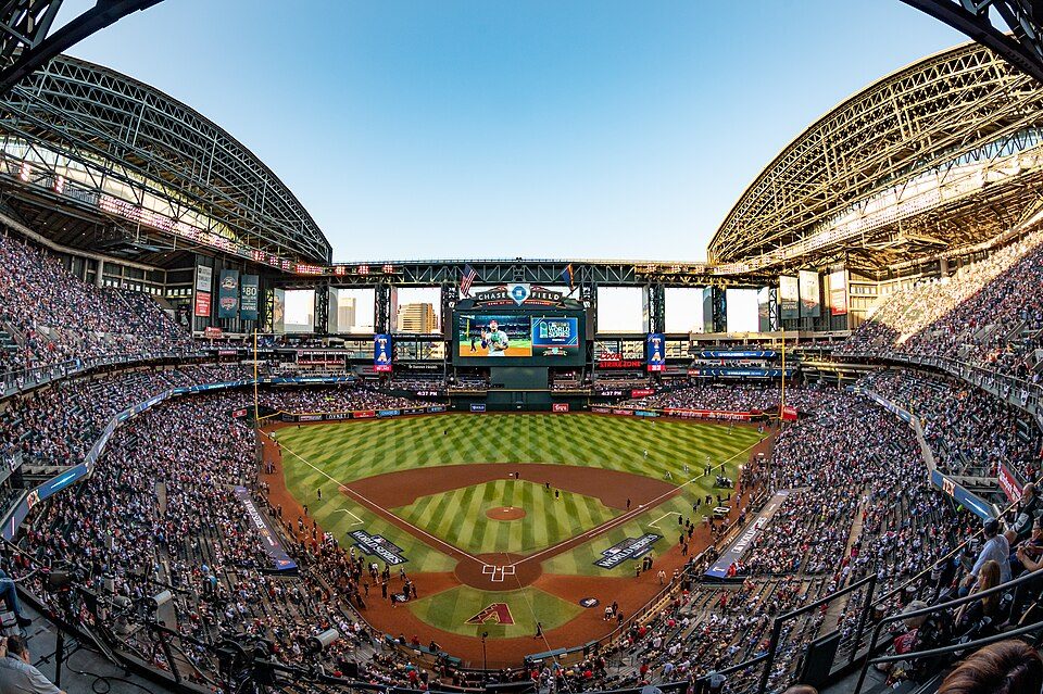 58 mi Stadium & arenaChase Field
 51 mi Stadium & arenaMountain America Stadium
 68 mi Stadium & arenaDesert Diamond Arena
 117 mi National forestTonto National Forest
 51 mi Stadium & arenaMullett Arena
 51 mi MountainCamelback Mountain
Photo credits
State Farm Stadium: Taken by en:Flickr user MCSixth, CC BY-SA 2.0 · Mortgage Matchup Center: Troutfarm27, CC BY-SA 4.0 · Chase Field: U.S. Air Force photo by Staff Sgt. Tyler J. Bolken, Public domain · Mountain America Stadium: Clintus McGintus, CC BY-SA 2.0 · Desert Diamond Arena: Unknown, CC BY 2.0 · Tonto National Forest: Bernard Gagnon, CC BY-SA 3.0 · Mullett Arena: Kyvuh, CC0 · Camelback Mountain: Dru Bloomfield from Scottsdale, Arizona, USA, CC BY 2.0


In 2025, 26,160 visitors
The record starts in 2016 and runs to 2025.
Tonto: what to know
What town is Tonto National Monument near?
Roosevelt, AZ, about 1 miles northwest.
When is the best time to visit Tonto National Monument?
October, with a high of 84°. March is the busiest month (about 5,861 visitors).
How many people visit Tonto National Monument each year?
26,160 in 2025, according to the National Park Service. The record is 40,898, set in 2017.
How far is Tonto National Monument from Mesa and Phoenix?
About 39 miles southwest of Mesa and about 56 miles west of Phoenix, as the crow flies.
What is the closest airport to Tonto National Monument?
Mesa Gateway (AZA), about 39 miles away. The nearest big hub is Phoenix Sky Harbor (PHX), about 53 miles.
Where should I stay near Tonto National Monument?
Tonto Basin (18 mi, 11 places to stay), Apache Junction (31 mi, 33 places to stay) and Globe (28 mi, 19 places to stay).
Local tips in Roosevelt
Questions and tips go in Roosevelt’s Town Square.
Sources: National Park Service · ski areas © OpenSkiMap / OpenStreetMap contributors · Wikidata · Wikipedia readership · National Park Service visitor use statistics · NOAA climate normals · U.S. Census.