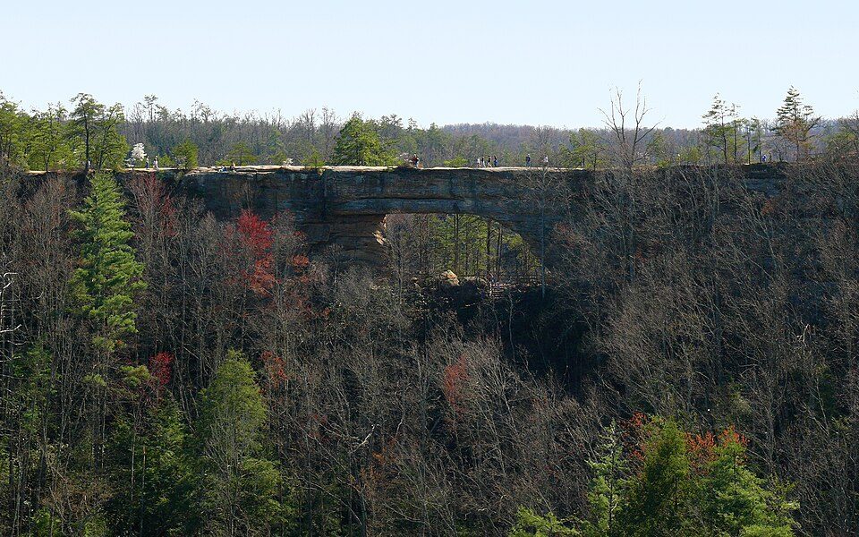
Natural Bridge State Resort Park
Natural Bridge State Resort Park is a public recreation area located along the Middle Fork of the Red River, two miles south of the unincorporated community of Slade, in Powell and Wolfe counties, Kentucky, United States. It lies 9 mi west of Campton. Its story as a place to visit starts in 1926.

A state park, 9 mi west of Campton
Campton is the nearest base
Campton is 9 miles east, with 7 places to stay. Where to stay ↓
Best months: Apr, May, Jun, Sep and Oct
April, May, June, September and October are the mild months, with highs of 69–83°. When to go ↓
Established in 1926
Natural Bridge State Resort Park dates from 1926. About ↓
Written from NOAA 1991–2020 normals, Overture places to stay, Census town figures, Wikidata and Wikipedia.
The year’s weather
Below are typical highs and lows near Natural Bridge State Resort Park.
Natural Bridge State Resort Park
Natural Bridge State Resort Park is a public recreation area located along the Middle Fork of the Red River, two miles south of the unincorporated community of Slade, in Powell and Wolfe counties, Kentucky, United States. The state park lies adjacent to the Red River Gorge geologic area and is surrounded by the Daniel Boone National Forest. Its namesake natural bridge is the centerpiece of the park. The natural sandstone arch spans 78 feet (24 m) and is 65 feet (20 m) high. The natural process of weathering formed the arch over millions of years. Some of the most famous sites in the park are the arch itself, "Lover's Leap", and "Fat Man's Squeeze".
- Type
- State park
- Established
- 1926
- Area
- 2,250 acres
- Wikipedia readers
- 6.6K a year
Overnight near Natural Bridge State Resort Park
For a bed close by, look to Campton (7) and Stanton (4).
Campton
The closest town with somewhere to stay.
300 people
9 mi east of Natural Bridge State Resort Park
Compare 8 towns
| Town | From Natural Bridge State Resort Park | Drive | Places to stay | People | Typical home | Safety |
|---|---|---|---|---|---|---|
| Campton | 9 mi east | 15 min | 7 3 hotels · 1 inn or B&B · 3 lodges & cabins | 300 | — | — |
| Stanton | 10 mi northwest | 15 min | 4 1 hotel · 1 motel · 1 lodge or cabins · 1 campground | 3,153 | $123K | B+ |
| Beattyville | 13 mi south | 20 min | 3 1 motel · 1 inn or B&B · 1 RV park | 2,114 | $114K | A+ |
| Farmers | 26 mi north | 40 min | 9 1 hotel · 1 motel · 3 lodges & cabins · 3 campgrounds · 1 RV park | 206 | $201K | — |
| Irvine | 16 mi west | 25 min | 2 1 hotel · 1 inn or B&B | 2,273 | $139K | A− |
| Mount Sterling | 24 mi northwest | 35 min | 5 5 hotels | 7,586 | $188K | B− |
| West Liberty | 25 mi northeast | 40 min | 5 4 hotels · 1 lodge or cabins | 3,339 | $206K | A− |
| Clay City | 14 mi northwest | 20 min | 1 1 motel | 1,174 | $64K | A |
Getting there
Nearest airports with airline service
More to see nearby
Every place here is under 58 miles away.
 16 mi Canyon & gorgeRed River Gorge
 47 mi Stadium & arenaKroger Field
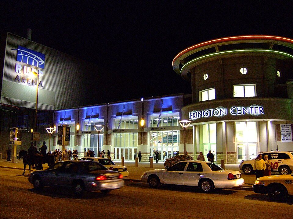 48 mi Stadium & arenaRupp Arena
 35 mi National forestDaniel Boone National Forest2.5M visitors a year
 49 mi GardenLexington Cemetery
 32 mi State parkFort Boonesborough State Park
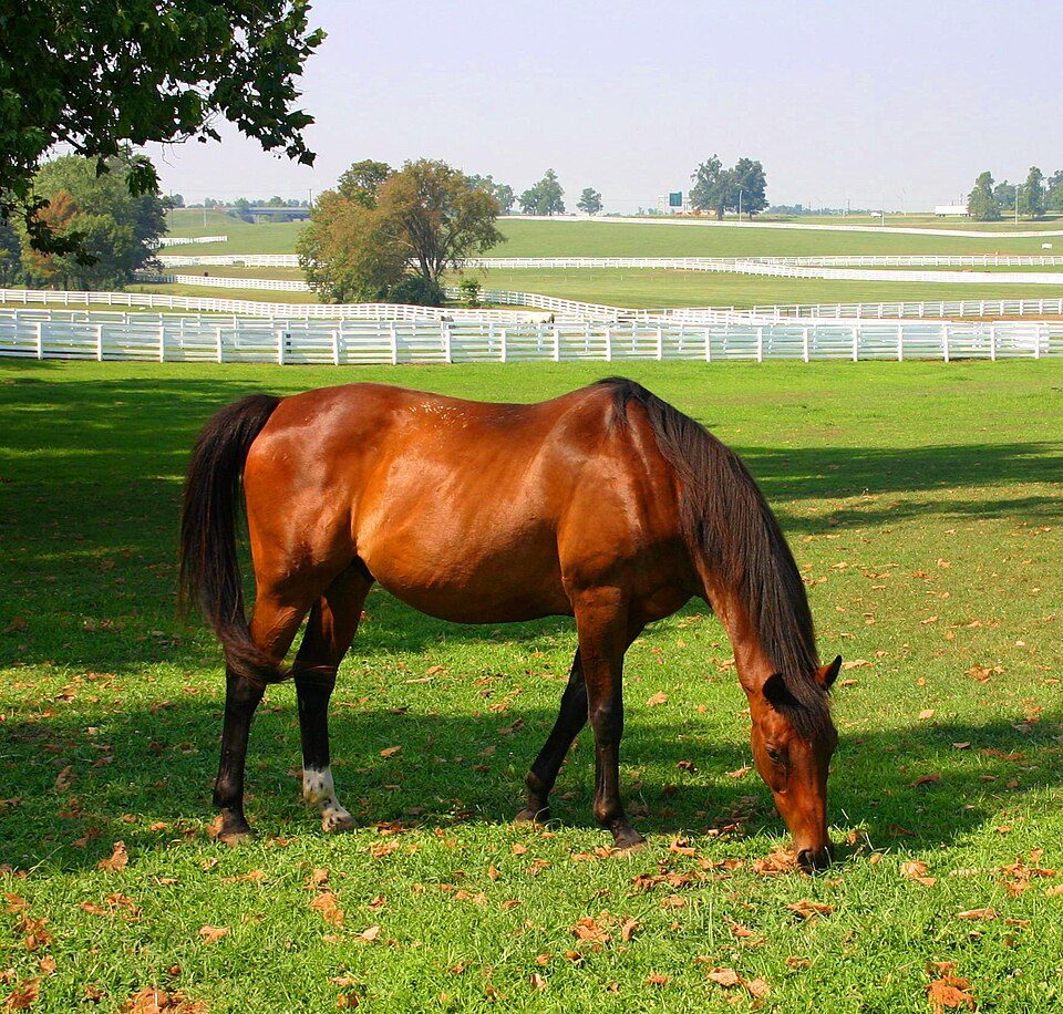 52 mi Park & preserveKentucky Horse Park
 57 mi Ancient sitePleasant Hill
Photo credits
Red River Gorge: Robert G. Davis, NWSRS, Public domain · Kroger Field: Navin75, CC BY-SA 2.0 · Rupp Arena: The original uploader was Analogue Kid at English Wikipedia., CC BY 2.5 · Daniel Boone National Forest: Schwaltz, CC BY-SA 3.0 · Lexington Cemetery: Analogue Kid at en.wikipedia, CC BY 2.5 · Fort Boonesborough State Park: Bubba73, CC BY-SA 3.0 · Kentucky Horse Park: Wes Blevins, CC BY-SA 2.5 · Pleasant Hill: Unknown, CC BY-SA 2.0


Before visiting Natural Bridge State Resort Park
What town is Natural Bridge State Resort Park near?
Campton, KY, about 9 miles east.
When is the best time to visit Natural Bridge State Resort Park?
April, May, June, September and October, with highs of 69–83°.
How far is Natural Bridge State Resort Park from Lexington?
About 45 miles northwest of Lexington, as the crow flies.
What is the closest airport to Natural Bridge State Resort Park?
Blue Grass (LEX), about 53 miles away. The nearest big hub is Cincinnati Northern Kentucky (CVG), about 102 miles.
Where should I stay near Natural Bridge State Resort Park?
Campton (9 mi, 7 places to stay), Stanton (10 mi, 4 places to stay) and Beattyville (13 mi, 3 places to stay).
Inside knowledge from Campton
Be the first to share a tip in Campton’s Town Square.
Sources: National Park Service · ski areas © OpenSkiMap / OpenStreetMap contributors · Wikidata · Wikipedia readership · NOAA climate normals · U.S. Census.