
Muir Woods National Monument
Muir Woods National Monument ( MURE) is a United States national monument managed by the National Park Service and named after naturalist John Muir. You will find it 2 mi southwest of Mill Valley. The site is in the hands of the National Park Service. It welcomed 757K visitors in 2025.

A national monument, 2 mi southwest of Mill Valley
July is the busiest month
July averages about 108,190 visitors, 2.7 times February. When to go ↓
One of the most looked-up attractions in the U.S.
About 72K people a year read its Wikipedia article, more than for 95% of the 7,770 attractions we track.
Mill Valley is the nearest base
Mill Valley is 2 miles northeast, with 8 places to stay. Where to stay ↓
Best month: Oct
October is mild and quieter than average, with a high of 70°. When to go ↓
A day trip from San Jose
San Jose is about 58 miles southeast (straight-line). Where to stay ↓
Written from National Park Service visitor counts, NOAA 1991–2020 normals, Overture places to stay, Census town figures, Wikidata and Wikipedia. Updated when the Park Service posts a new month.
The year in visitors and weather
Crowds at Muir Woods rise and fall through the year, as below.
Muir Woods National Monument
Muir Woods National Monument ( MURE) is a United States national monument managed by the National Park Service and named after naturalist John Muir. It is located on Mount Tamalpais near the Pacific coast in southwestern Marin County, California. The Monument is part of the Golden Gate National Recreation Area, and is 12 miles (19 km) north of San Francisco. It protects 554 acres (224 ha), of which 240 acres (97 ha) are old-growth coast redwood (Sequoia sempervirens) forests, one of the few such stands remaining in the San Francisco Bay Area.
- Type
- National Monument
- Established
- 1908
- Area
- 554 acres
- Elevation
- 545 ft
- Run by
- National Park Service
- Wikipedia readers
- 72K a year
- Official site
- nps.gov/muwo
Getting in
- Per Person$15
A base for Muir Woods National Monument
Close by, places to stay are in San Francisco (528) and San Rafael (18).
- 1Alcatraz Federal Penitentiary
- 2Chase Center
- 3Presidio of San Francisco
- 4Lombard Street
- 5Oracle Park
- 6USS Hornet
- 7Mount Tamalpais
San Francisco
The closest town with somewhere to stay.
826,079 people
12 mi southeast of Muir Woods Visitor Center · 11 mi to the park
Compare 8 towns
| Town | From the visitor center | Drive | Places to stay | People | Typical home | Safety |
|---|---|---|---|---|---|---|
| San Francisco | 12 mi southeast | 15 min | 528 426 hotels · 24 motels · 37 inns & B&Bs · 5 lodges & cabins · 27 hostels · 6 campgrounds · 3 RV parks | 826,079 | $1,395K | D |
| San Rafael | 7 mi northeast | 10 min | 18 15 hotels · 1 motel · 2 inns & B&Bs | 59,410 | $1,356K | D |
| Oakland | 21 mi southeast | 30 min | 89 56 hotels · 22 motels · 7 inns & B&Bs · 1 lodge or cabins · 1 hostel · 2 campgrounds | 440,838 | $930K | D− |
| Sausalito | 5 mi southeast | 10 min | 10 5 hotels · 1 inn or B&B · 1 lodge or cabins · 1 hostel · 2 campgrounds | 7,019 | $1,895K | B− |
| Mill Valley | 2 mi northeast | 5 min | 8 4 hotels · 1 inn or B&B · 3 campgrounds | 13,799 | $2,000K | B+ |
| Berkeley | 15 mi east | 25 min | 30 24 hotels · 4 inns & B&Bs · 1 lodge or cabins · 1 hostel | 121,911 | $1,414K | D− |
| Richmond | 12 mi east | 20 min | 14 9 hotels · 3 motels · 2 lodges & cabins | 114,861 | $668K | D |
| South San Francisco | 20 mi southeast | 30 min | 36 32 hotels · 2 motels · 1 lodge or cabins · 1 RV park | 64,941 | $1,189K | C |
Day trip from
Straight-line miles.
Getting there
Nearest airports with airline service, from the visitor center
While you are near Muir Woods
These well-known sights sit within 48 miles.
 Big draw19 mi MuseumAlcatraz Federal Penitentiary
 Big draw213 mi Stadium & arenaChase Center
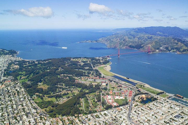 Big draw39 mi GardenPresidio of San Francisco
 Big draw410 mi LandmarkLombard Street
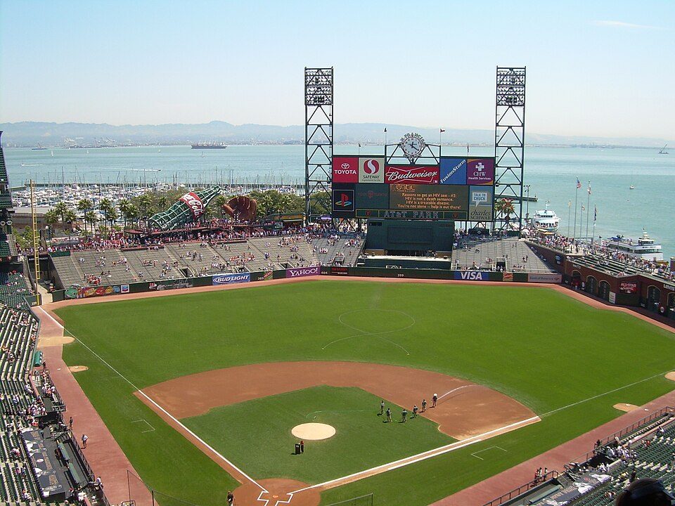 Big draw513 mi Stadium & arenaOracle Park
 Big draw617 mi MuseumUSS Hornet
 73 mi MountainMount Tamalpais
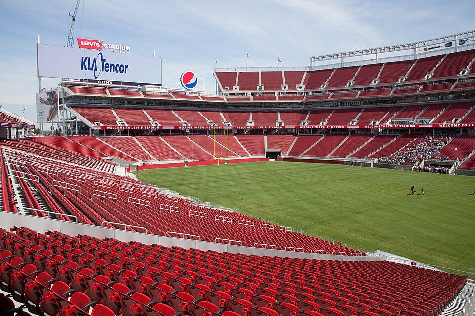 Big draw47 mi Stadium & arenaLevi's Stadium
Photo credits
Alcatraz Federal Penitentiary: druchoy, CC BY-SA 2.0 · Chase Center: Gregory Varnum, CC BY-SA 4.0 · Presidio of San Francisco: Robert Campbell, CC BY-SA 3.0 · Lombard Street: The original uploader was Y6y6y6 at English Wikipedia., Public domain · Oracle Park: User Coasttocoast on en.wikipedia, CC BY-SA 3.0 · USS Hornet: kitmasterbloke, CC BY 2.0 · Mount Tamalpais: Originally uploaded by Nelso (Transferred by DimiTalen), CC BY-SA 3.0 · Levi's Stadium: Matthew Roth, CC BY-SA 2.0


Visits reached 756,573 in 2025
Each bar is one year, from 2016 to 2025.
Muir Woods, answered
What town is Muir Woods National Monument near?
Mill Valley, CA, about 2 miles northeast.
When is the best time to visit Muir Woods National Monument?
October, with a high of 70°. July is the busiest month (about 108,190 visitors).
How many people visit Muir Woods National Monument each year?
756,573 in 2025, according to the National Park Service. The record is 1,123,121, set in 2016.
How far is Muir Woods National Monument from San Jose and Stockton?
About 58 miles southeast of San Jose and about 69 miles east of Stockton, as the crow flies.
What is the closest airport to Muir Woods National Monument?
San Francisco (SFO), about 22 miles away.
Where should I stay near Muir Woods National Monument?
San Francisco (12 mi, 528 places to stay), San Rafael (7 mi, 18 places to stay) and Oakland (21 mi, 89 places to stay).
Locals’ advice in Mill Valley
People in Mill Valley have not posted tips yet; their Town Square is open.
Sources: National Park Service · ski areas © OpenSkiMap / OpenStreetMap contributors · Wikidata · Wikipedia readership · National Park Service visitor use statistics · NOAA climate normals · U.S. Census.