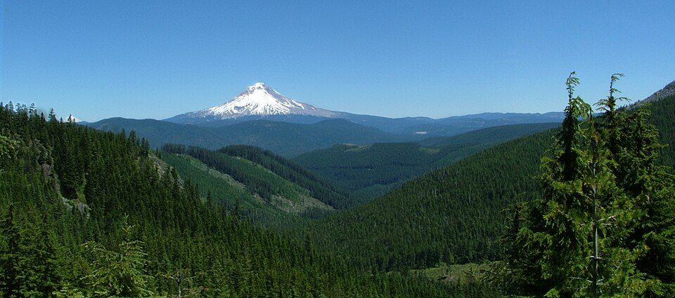
Mount Hood National Forest
The Mount Hood National Forest is a U.S. National Forest in the U.S. state of Oregon, located 62 miles (100 km) east of the city of Portland and the northern Willamette River valley. It lies 5 mi northeast of Government Camp. Its origins go back to 1924.

A national forest, 5 mi northeast of Government Camp
Government Camp is the nearest base
Government Camp is 5 miles southwest, with 31 places to stay. Where to stay ↓
A day trip from Portland
Portland is about 47 miles west (straight-line). Where to stay ↓
Best months: Jul, Aug and Sep
July, August and September are the mild months, with highs of 64–71°. When to go ↓
Established in 1924
Mount Hood National Forest dates from 1924. About ↓
Written from NOAA 1991–2020 normals, Overture places to stay, Census town figures, Wikidata and Wikipedia.
A month-by-month look
Each month’s highs and lows around Mount Hood National Forest are below.
Mount Hood National Forest
The Mount Hood National Forest is a U.S. National Forest in the U.S. state of Oregon, located 62 miles (100 km) east of the city of Portland and the northern Willamette River valley. The Forest extends south from the Columbia River Gorge across more than 60 miles (97 km) of forested mountains, lakes and streams to the Olallie Scenic Area, a high lake basin under the slopes of Mount Jefferson. The Forest includes and is named after Mount Hood, a stratovolcano and the highest mountain in the state.
The Forest encompasses some 1,067,043 acres (4,318.17 km2). Forest headquarters are located in Sandy, Oregon. A 1993 Forest Service study estimated that the extent of old growth in the Forest was 345,300 acres (139,700 ha). The Forest is divided into four separate districts – Barlow (with offices in Dufur), Clackamas River (Sandy), Hood River (Mount Hood-Parkdale), and Zigzag (Zigzag).
- Type
- National forest
- Established
- 1924
- Area
- 1,674 square miles
- Wikipedia readers
- 8.4K a year
A base for Mount Hood National Forest
Places to stay start in Government Camp (31) and Mount Hood Villages (20).
Government Camp
The closest town with somewhere to stay.
147 people · 81% vacation homes
5 mi southwest of Mount Hood National Forest
Mount Hood Villages
4,703 people · 27% vacation homes
14 mi west of Mount Hood National Forest
Compare 8 towns
| Town | From Mount Hood National Forest | Drive | Places to stay | People | Typical home | Safety |
|---|---|---|---|---|---|---|
| Government Camp 81% vacation homes | 5 mi southwest | 10 min | 31 11 hotels · 16 lodges & cabins · 4 campgrounds | 147 | — | — |
| Mount Hood Villages 27% vacation homes | 14 mi west | 20 min | 20 7 hotels · 2 inns & B&Bs · 7 lodges & cabins · 3 campgrounds · 1 RV park | 4,703 | $456K | — |
| Rhododendron 80% vacation homes | 8 mi southwest | 10 min | 7 1 motel · 4 lodges & cabins · 2 campgrounds | 214 | $415K | — |
| Hood River | 25 mi north | 40 min | 28 15 hotels · 2 motels · 7 inns & B&Bs · 3 lodges & cabins · 1 hostel | 8,315 | $684K | C |
| Parkdale | 11 mi northeast | 15 min | 2 2 inns & B&Bs | 319 | $376K | — |
| Stevenson | 24 mi northwest | 35 min | 8 5 hotels · 3 lodges & cabins | 1,596 | $497K | — |
| Carson | 26 mi north | 40 min | 8 2 hotels · 3 lodges & cabins · 3 campgrounds | 2,318 | $490K | — |
| Cascade Locks | 23 mi north | 35 min | 5 1 hotel · 2 motels · 2 campgrounds | 1,367 | $385K | — |
Getting there
Nearest airports with airline service
Make a day of it near Mount Hood National Forest
More places people know lie within 62 miles.
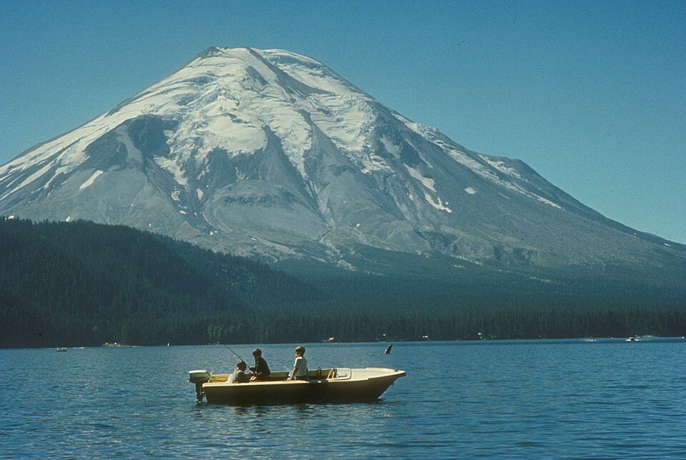 Big draw62 mi MountainMount St. Helens
 224 mi WaterfallMultnomah Falls
 323 mi Canyon & gorgeColumbia River Gorge
 48 mi Stadium & arenaModa Center
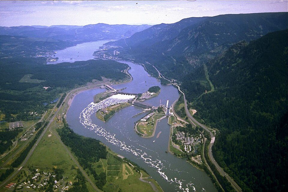 422 mi DamBonneville Dam
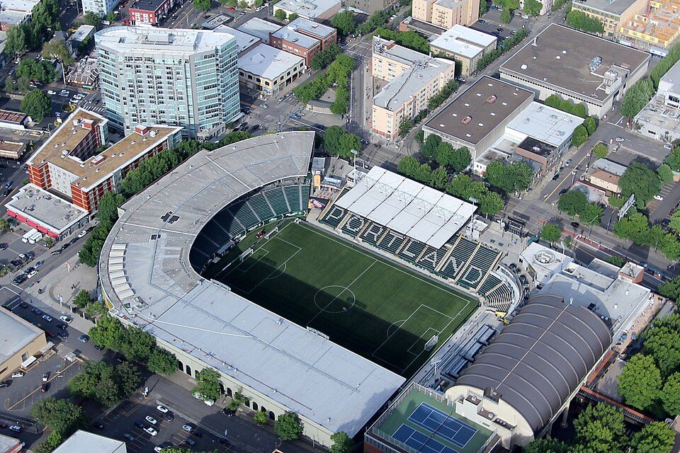 49 mi Stadium & arenaProvidence Park
 58 mi MountainMount Adams
Photo credits
Mount St. Helens: U.S. Forest Service- Pacific Northwest Region, Public domain · Multnomah Falls: John Fowler from Placitas, NM, USA, CC BY 2.0 · Columbia River Gorge: Hux, Public domain · Moda Center: Lugnuts, CC BY-SA 3.0 · Bonneville Dam: U.S. Army Corps of Engineers, Public domain · Providence Park: Pdx.rollingthunder, CC BY-SA 4.0 · Mount Adams: USGS Photo by R. Iverson, USGS/CVO, Public domain


Questions before you go
What town is Mount Hood National Forest near?
Government Camp, OR, about 5 miles southwest.
When is the best time to visit Mount Hood National Forest?
July, August and September, with highs of 64–71°.
How far is Mount Hood National Forest from Portland?
About 47 miles west of Portland, as the crow flies.
What is the closest airport to Mount Hood National Forest?
Portland (PDX), about 46 miles away.
Where should I stay near Mount Hood National Forest?
Government Camp (5 mi, 31 places to stay), Mount Hood Villages (14 mi, 20 places to stay) and Rhododendron (8 mi, 7 places to stay).
From people who live in Government Camp
Nobody has posted a tip yet; ask or answer in Government Camp’s Town Square.
Sources: National Park Service · ski areas © OpenSkiMap / OpenStreetMap contributors · Wikidata · Wikipedia readership · NOAA climate normals · U.S. Census.