
Mount Rogers
Mount Rogers is the highest natural point in Virginia, United States, with a summit elevation of 5,729 ft (1,746 m) above mean sea level.

A mountain, 6 mi southwest of Troutdale
Marion is the nearest base
Marion is 12 miles north, with 10 places to stay. Where to stay ↓
Best months: May, Jun, Jul, Aug, Sep and Oct
May, June, July, August, September and October are the mild months, with highs of 62–78°. When to go ↓
Written from NOAA 1991–2020 normals, Overture places to stay, Census town figures, Wikidata and Wikipedia.
Weather, month by month
Typical highs and lows in Troutdale. Green months are the mild ones.
Mount Rogers
Mount Rogers is the highest natural point in Virginia, United States, with a summit elevation of 5,729 ft (1,746 m) above mean sea level. The summit straddles the border of Grayson and Smyth Counties, Virginia, about 6.45 mi (10.38 km) WSW of Troutdale, Virginia. Most of the mountain is contained within the Lewis Fork Wilderness, while the entire area is part of the Mount Rogers National Recreation Area, which itself is a part of the Jefferson National Forest.
The mountain is named for William Barton Rogers, a Virginian educated at the College of William & Mary, who taught at William & Mary and the University of Virginia, became Virginia's first State Geologist, and went on to found the Massachusetts Institute of Technology.
- Type
- Mountain
- Elevation
- 5,988 ft
- Wikipedia readers
- 26K a year
Where to stay near Mount Rogers
The closest towns with hotels, motels or campgrounds are Damascus (21) and Marion (10).
Compare 8 towns
| Town | From Mount Rogers | Drive | Places to stay | People | Typical home | Safety |
|---|---|---|---|---|---|---|
| Damascus | 14 mi west | 20 min | 21 2 hotels · 7 inns & B&Bs · 6 lodges & cabins · 4 hostels · 2 RV parks | 780 | $174K | — |
| Marion | 12 mi north | 20 min | 10 4 hotels · 3 motels · 2 inns & B&Bs · 1 hostel | 5,555 | $173K | C− |
| Abingdon | 24 mi west | 35 min | 26 13 hotels · 2 motels · 7 inns & B&Bs · 2 lodges & cabins · 1 hostel · 1 campground | 8,284 | $228K | C+ |
| Troutdale 27% vacation homes | 6 mi northeast | 10 min | 2 1 inn or B&B · 1 lodge or cabins | 138 | $109K | — |
| Glade Spring | 16 mi northwest | 25 min | 5 3 hotels · 1 motel · 1 inn or B&B | 1,366 | $174K | C+ |
| Mountain City | 20 mi southwest | 30 min | 8 2 hotels · 1 motel · 1 inn or B&B · 3 campgrounds · 1 RV park | 2,490 | $216K | B− |
| West Jefferson 21% vacation homes | 20 mi south | 30 min | 8 4 hotels · 1 inn or B&B · 2 lodges & cabins · 1 campground | 1,348 | $232K | D |
| Chilhowie | 12 mi northwest | 20 min | 3 2 hotels · 1 motel | 1,599 | $154K | C |
Getting there
Nearest airports with airline service
Also near Mount Rogers
Other well-known places within 64 miles. Numbered ones are on the map above.
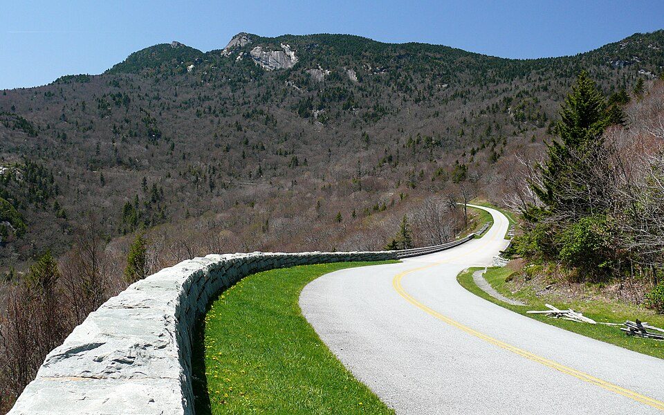 30 mi ParkwayBlue Ridge Parkway16.5M visitors a year
 13 mi State parkGrayson Highlands State Park
 41 mi MountainGrandfather Mountain34 mi Theme parkTweetsie Railroad
 63 mi MountainPilot Mountain
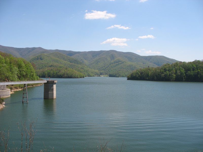 32 mi National forestCherokee National Forest38 mi Theme parkLand of Oz
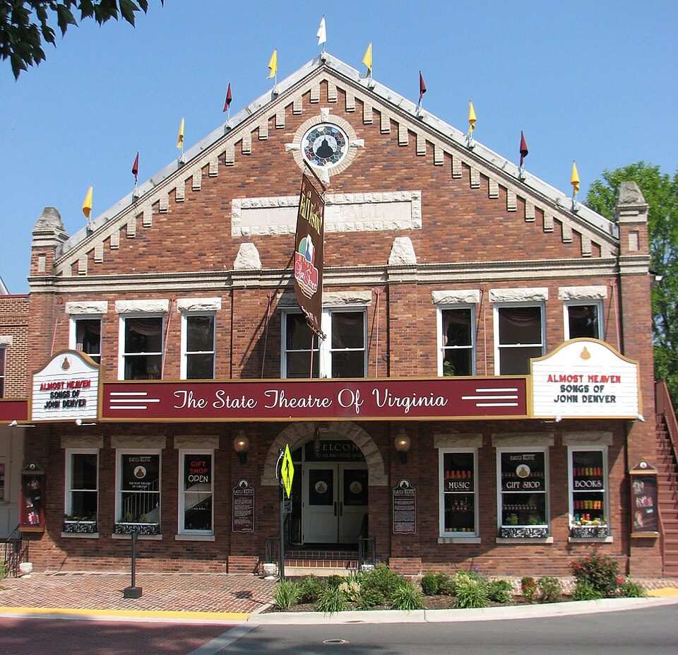 224 mi TheatreBarter Theatre
Photo credits
Blue Ridge Parkway: Ken Thomas, Public domain · Grayson Highlands State Park: Ken Thomas, Public domain · Grandfather Mountain: Original uploader was KyleAndMelissa22 at en.wikipedia, Public domain · Pilot Mountain: Berean Hunter, CC BY-SA 2.5 · Cherokee National Forest: Ryan Rice at en.wikipedia, CC BY-SA 3.0 · Barter Theatre: RebelAt (talk) (Uploads), Public domain


Visiting Mount Rogers
What town is Mount Rogers near?
Troutdale, VA, about 6 miles northeast.
When is the best time to visit Mount Rogers?
May, June, July, August, September and October, with highs of 62–78°.
What is the closest airport to Mount Rogers?
Tri-Cities Regional TN/VA (TRI), about 50 miles away. The nearest big hub is Piedmont Triad (GSO), about 97 miles.
Where should I stay near Mount Rogers?
Damascus (14 mi, 21 places to stay), Marion (12 mi, 10 places to stay) and Abingdon (24 mi, 26 places to stay).
Tips from people in Troutdale
No tips yet. Ask, or answer, in Troutdale’s Town Square.
Sources: National Park Service · ski areas © OpenSkiMap / OpenStreetMap contributors · Wikidata · Wikipedia readership · NOAA climate normals · U.S. Census.