154 years in pictures
The archive holds 3 old photos and papers going back to 2005.
2 places on the National Register of Historic Places.
- 1872Cedarville is settled
Each edition grades its towns against each other only.

A town of 1,458, settled in 1872.
The best of Cedarville’s subject grades is an A− for cost of living; the weakest is a D− for health. Of the 124 Arkansas towns we compare, none has a higher share of households owning their home than Cedarville. Most errands need a car: it is less walkable than 81% of U.S. towns. No town among the 109 in Arkansas we compare has a lower violent crime rate than Cedarville. Cedarville has 2 places on the National Register of Historic Places, among them Cedarville School Building and Wing School. Cedarville has fewer than 2,500 residents, so it gets subject grades but no overall grade.
Where Cedarville beats most towns, and one thing worth knowing.
| School | Grades | Students |
|---|---|---|
| Cedarville Elementary School | K–4 | 274 |
| Cedarville Middle School | 5–8 | 207 |
| Cedarville High School | 9–12 | 250 |
In a town this size, neighbors are the best guide. Ask them anything.
Each subject compared with towns across the country (schools within Arkansas), ordered by how far Cedarville is from typical.
How TownRatings grades towns →
The archive holds 3 old photos and papers going back to 2005.
2 places on the National Register of Historic Places.
Who provides power, water and the rest in Cedarville, and how to reach them.
EPA SDWIS (Oct 9, 2026) · HIFLD + EIA-861 2025 · Census 2020 ZCTAs · NCES 2024–25 · registration: vote.gov, updated Nov 18, 2024.
Ordered by what stands out in Cedarville.
Cedarville beats the Arkansas average on 0 of 32 CDC measures and trails it on 11. 19% of Cedarville adults report frequent physical distress, where Arkansas’ towns sit at 16% and U.S. towns at 14%. 21% of Cedarville adults smoke cigarettes.
| Cedarville | Arkansas towns | U.S. towns | |
|---|---|---|---|
| Frequent physical distress (CDC PLACES) | 19% | 16% | 14% |
| Smoke cigarettes (CDC PLACES) | 21% | 17% | 14% |
| Fair or poor health (CDC PLACES) | 30% | 25% | 19% |
| Frequent mental distress (CDC PLACES) | 21% | 20% | 17% |
| What stands out | Cedarville | AR |
|---|---|---|
| More adults with COPD | 11.9% | 8.6% |
| More smokers | 21.3% | 15.8% |
| More adults in frequent physical distress | 19.3% | 15.6% |
CDC PLACES 2025 · modeled estimates for adults · CMS · HRSA
Its public schools are run by the Cedarville School District. Two of its 3 schools are below, each with why it’s listed.
| School | Level | Students | Letter |
|---|---|---|---|
| Cedarville Elementary SchoolLargest public elementary schoolGrades K–4 | Grades K–4 | 274 | C |
| Cedarville High SchoolLargest public high schoolGrades 9–12 | Grades 9–12 | 250 | C |
NCES · EDFacts · graded within AR on state tests and graduation
Most working residents leave Cedarville for work: only 4% work in town. Since 2013, Cedarville has added 177 jobs, to 210 in 2023. 9.5% of Cedarville residents live below the poverty line, against 18% in Arkansas’ towns and 9.6% across U.S. towns.
| Cedarville | Arkansas towns | U.S. towns | |
|---|---|---|---|
| Working residents who work in town | 4.2% | 22% | 8% |
| Below the poverty line | 9.5% | 18% | 9.6% |
| Average trip to work | 26 minutes | 21 minutes | 25 minutes |
| Median household income | $60,000 | $55,000 | $80,000 |
Census LEHD 2023 · ACS
Cedarville has mild winters and warm summers, with plenty of rain. Cedarville’s July high is 91°F.
NOAA U.S. Climate Normals, 1991–2020
Adults 35 to 64 are 44% of residents (37% statewide); adults 18 to 34 are 16% of residents (22% statewide). The median age in Cedarville is 43.5 years. Cedarville has grown 3.3% since 2020, to 1,458 residents in the Census Bureau’s 2025 estimate.
| Cedarville | Arkansas towns | U.S. towns | |
|---|---|---|---|
| Median age | 43.5 years | 36.6 years | 40.5 years |
| Bachelor’s degree or more, 25+ | 16% | 20% | 29% |
| Under 18 | 23% | 25% | 22% |
57% women, 43% men
That’s an even split within the survey’s margin of ±7.3 points. Across Arkansas, 50.6% of residents are women.
| Cedarville | AR | U.S. | |
|---|---|---|---|
| Under 10 | 8% | 12.3% | 11.6% |
| 10 to 17 | 15.2% | 10.8% | 10.3% |
| 18 to 24 | 8.8% | 9.4% | 9.1% |
| 25 to 34 | 7.1% | 13% | 13.7% |
| 35 to 44 | 14.2% | 12.7% | 13.2% |
| 45 to 54 | 14.4% | 11.8% | 12.2% |
| 55 to 64 | 15% | 12.5% | 12.7% |
| 65 to 74 | 12.4% | 10.3% | 10.2% |
| 75 and older | 4.9% | 7.2% | 7% |
| No diploma | 11% | 11.3% | 10.4% |
| High school | 46.4% | 34.1% | 26% |
| Some college | 21.5% | 20.7% | 19.1% |
| Associate’s | 4.8% | 8.2% | 8.8% |
| Bachelor’s | 10.4% | 16.3% | 21.6% |
| Graduate | 5.8% | 9.5% | 14.1% |
Census population estimates, 2025 · U.S. Census Bureau · ACS 2020-2024 5-year estimates · in a town of 1,500, single groups can be off by several points
Expected storm and flood damage is higher than in 62% of U.S. communities.
FEMA National Risk Index · OpenFEMA
Cedarville's reported crime rate is well below Arkansas's. Most reported incidents are property crimes, mainly thefts. Violent crime is rare: 1 reported in 2025.
FBI crime data, 2025 · crimes reported to police
The typical Cedarville home is worth about $251,000, up 7.7% in a year, 12% above the Arkansas typical home.
Zillow Home Value Index · Redfin Data Center
0.7 miles of trail in 2 parks and preserves.
| Cedarville | Arkansas towns | U.S. towns | |
|---|---|---|---|
| Miles of trail per square mile | 0.1 miles per square mile | 0.3 | 0.4 |
| Conserved land | 0.1% | 0.8% | 4.3% |
| Biggest places to walk | Trails | Acres |
|---|---|---|
| 1. Ozark-Saint Francis National Forest | — | 7 |
| 2. Cedarville City Park | 0.2 mi | 2 |
Trails & parks © OpenStreetMap contributors · Conserved land: USGS PAD-US
Museums, parks, gardens and other places to visit around Cedarville. Close and well known come first.
22 mi Ancient siteSpiro Mounds
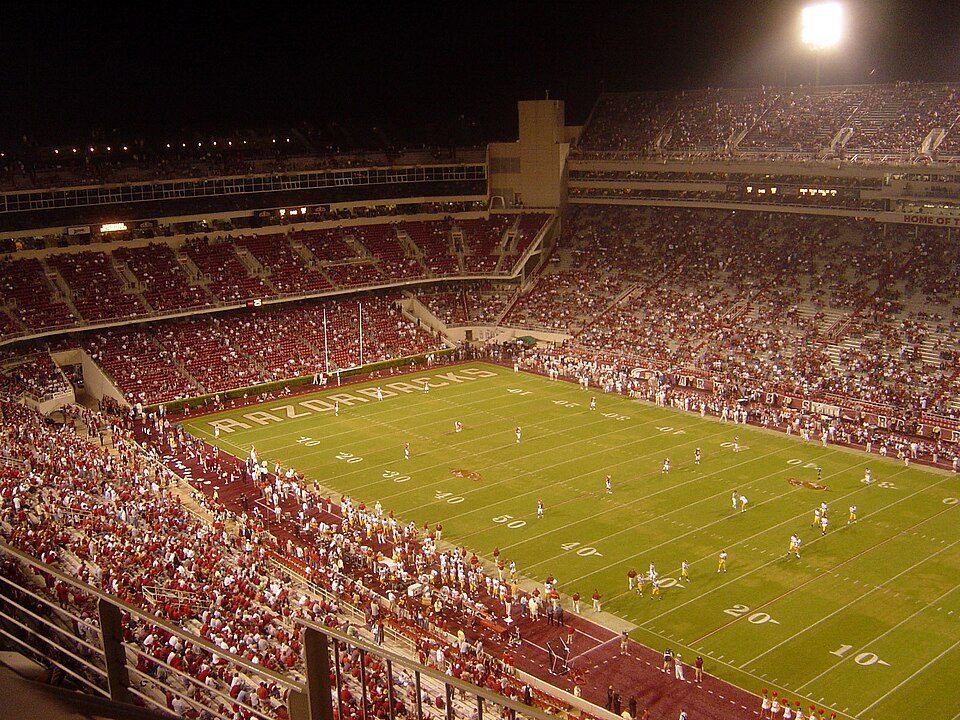
35 mi Stadium & arenaDonald W. Reynolds Razorback Stadium
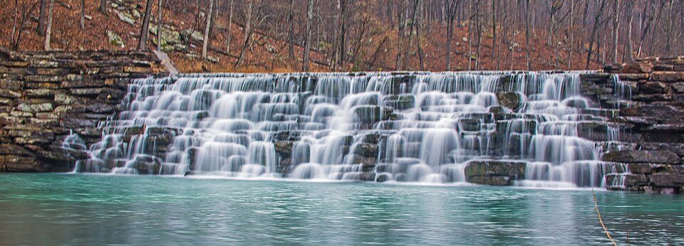
15 mi State parkDevil's Den State Park
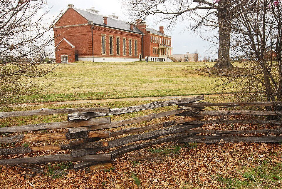
14 mi National Historic SiteFort Smith National Historic Site107K visitors a year
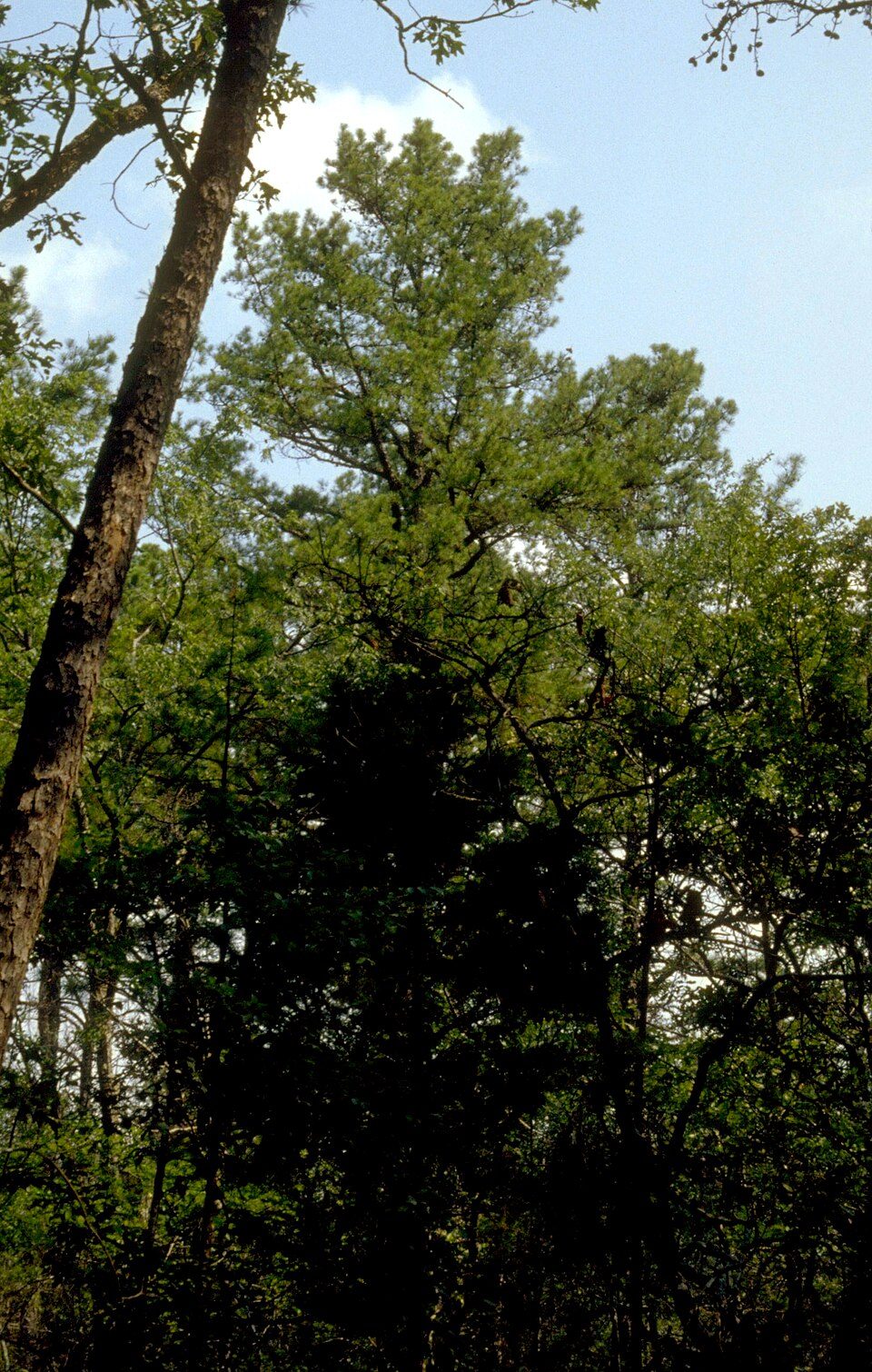
22 mi National forestOzark–St. Francis National Forest
35 mi Stadium & arenaBud Walton ArenaSpiro Mounds: Herb Roe Original uploader was Heironymous Rowe at en.wikipedia, CC BY-SA 3.0 · Donald W. Reynolds Razorback Stadium: Bobak at en.wikipedia, CC BY-SA 2.5 · Devil's Den State Park: jaystout, CC BY 2.0 · Fort Smith National Historic Site: Photolitherland (talk) Chris Litherland, CC BY-SA 3.0 · Ozark–St. Francis National Forest: Paul A. Mistretta, USDA Forest Service, CC BY 3.0 us · Bud Walton Arena: ~ (The Rebel At) ~, CC BY-SA 3.0
1 within 15 miles of the center of Cedarville
About 3 of every 100 Cedarville residents are enrolled in college, against 5 across Arkansas.
Where Cedarville’s working residents go each day. Line width shows the share.
Census LEHD 2023
2 places in Cedarville on the National Register of Historic Places.
City in Arkansas, United States
Cedarville is a city in Crawford County, Arkansas, United States. It is part of the Fort Smith, Arkansas-Oklahoma Metropolitan Statistical Area. The population was 1,410 at the 2020 census.
From Wikipedia, licensed CC BY-SA 4.0 · facts via Wikidata (CC0)
Short answers, built from the data on this page.
Not for the area. Cost of living, which also weighs rents, property taxes and how many households pay 30% or more of their income for housing, grades A−.