Waukesha dates to 1839, and 12% of its homes were built before 1940
More historic than 86% of U.S. towns · #62 of 362 in Wisconsin. What drives it
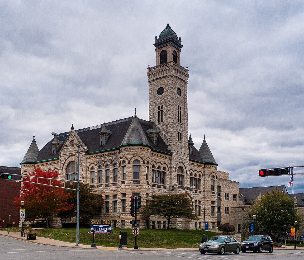
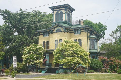
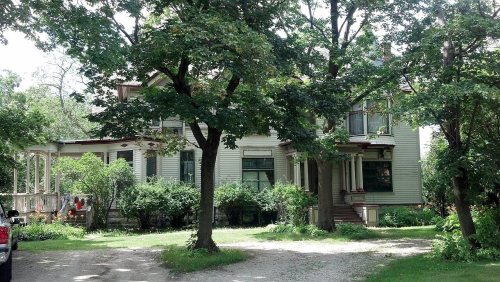
66 places in town are on the National Register, among them ten historic districts with 342 buildings between them. Below: 1 old photo or paper, maps from 1884 on, and the census since 1860.
Founding year: Wikidata. First post office: 1842.The full story ↓
History grade
What drives Waukesha’s History grade
On its age, its old homes and the National Register, Waukesha is more historic than 86% of U.S. towns, #62 of 362 in Wisconsin. All 3 inputs are above most U.S. towns; its National Register listings ranks highest and its share of homes from before 1940 lowest.
A
HistoryA character grade: shown, never part of Waukesha’s overall grade.
Wisconsin towns list more on the Register than most of the country (a typical Wisconsin town has 3.0 per 10,000 residents, the U.S. 2.4), so Waukesha’s 56.9 sits above most of its state (89% of Wisconsin towns have fewer) while its 405 historic buildings outnumber those of 96% of U.S. towns.
How sure. Graded on any two of the three inputs instead, the letter would range from B+ to A. The pre-1940 share (±1.4 points) is firm at this size. Two sources give 1839.
Founding year: Wikidata (other dates in Quick answers). Homes: Census ACS 2020–24. National Register: National Park Service, May 2026 list; each listing counted once (boundary changes and added documentation belong to their listing), and a historic district counts its contributing buildings. How TownRatings grades history →
What stands out about Waukesha’s past
Read from the archive, the National Register and the record. The page puts what stands out first.
The Waukesha area was first settled by European-Americans in 1834, with Morris D. Cutler as its first settler. The founders of Waukesha were settlers from New England, part of a wave of New England farmers who headed west into what was then the wilds of the Northwest Territory during the early 1800s. Most arrived as a result of the completion of the Erie Canal as well as the end of the Black Hawk War. When the first settlers arrived, there was nothing but dense virgin forest and wild prairie. The settlers laid out farms, constructed roads, erected government buildings and established post routes. They brought many of their Yankee values, such as a passion for education, establishing many schools as well as staunch support for abolitionism. They were mostly members of the Congregationalist Church though some were Episcopalian. Due to the second Great Awakening some had converted to Metho…
Passages that mention Waukesha, cut from the printed page as they were published.
The History of Waukesha County, Wisconsin. Containing an account of its settlement, growth, development and resources1880 · page 676Read the page →
Read the text
Town Cemetery. — This beautiful home of the dead is as much for the village of Waukesha and surrounding towns as for the town of Waukesha, although owned and controlled exclusively by the latter. As is the case with every newly settled place, Waukesha was for many years without any common burial-place. David Jackson was buried in an Indian mound in the east part of the village of Waukesha, in December, 1841 ; a few were buried on the knoll where the Park Hotel now stands, opposite the Silurian Spring, which was the seat of an Indian cemetery; and some, a few years later, were buried where the present cemetery was afterward located.
Text read by machine from the scan; it may contain errors.
Portrait and biographical record of Waukesha County, Wisconsin, containing biographical sketches of old settlers1894 · page 894Read the page →
Read the text
Prior to his coming to Waukesha, .Mr. Sawyer was engaged in the lumber business in \'ermont, where he accumulated considerable property. For a time after locating in Waukesha he did not engage in active business, but subseciuently became interested in merchandising in North Prairie, Waukesha County, though always making his home in the village of Waukesha, lie also became inter-
Text read by machine from the scan; it may contain errors.
The History of Waukesha County, Wisconsin. Containing an account of its settlement, growth, development and resources1880 · page 677Read the page →
Read the text
Waukesha Observatory. — This structure, about the first feature noticed by the visitor to the vicinity of the village of Waukesha, is an octagon tower ninety-five feet in height, built by Thomas Spence, in 1873, for the accommodation of those who desire a complete bird's-eye view of the surrounding scenery. It looks down from the highest hill in the vicinity of Waukesha.
Text read by machine from the scan; it may contain errors.
Portrait and biographical record of Waukesha County, Wisconsin, containing biographical sketches of old settlers1894 · page 889Read the page →
Read the text
Foster is largely interested in real estate in the village of Waukesha, and in the town of Waukesha, lie and his wife are members of the Methodist Episcopal Church of Waukesha and of their means contribute to its sup|)ort. They occupy an envialile position in the social circle of their village, and are classed among her representative citizens.
Text read by machine from the scan; it may contain errors.
Scans and text from the Internet Archive. Books published in 1930 or earlier, which are in the public domain.
Timeline
Waukesha, 1839 to 1986
Woven from the archive, old maps, post office records, the National Register and the people born here.
Every edition of the U.S. Geological Survey’s map of Waukesha. Tap a year, or press play to watch the town change.
1892Waukesha sheet · 1:62,500
U.S. Geological Survey historical topographic maps (public domain), via Esri’s collection of the scans. The red ring marks the center of Waukesha.
Every building
Waukesha, building by building, 1884–1922
Fire insurance maps drew every building, what it was made of and what it was used for, so insurers could price the risk of fire. Pick a year, then a sheet.
Lost post offices, places now gone and burying grounds
Waukesha’s post office has been open since 1847. Another post office, Prairieville, opened and closed inside today’s town.
Prairieville
1842–1847
Waukesha
1847–today
18401930today
Gone or out of use
Fire Station Number 2buildingNike Site M-74CmilitaryNike Site M-74LmilitarySalem Evangelical United Brethren ChurchchurchSunnyslope SchoolschoolTorhorst SchoolschoolUnion Public Schoolschool
1cemetery inside Waukesha
Prairie Home
US Post Offices dataset (Blevins & Helbock, CC0). Places and cemeteries from the USGS Geographic Names Information System (2021).
Stories next door
History across the town line
Each neighbor’s History grade, on the same three inputs.
In 1839, according to Wikidata. Waukesha’s post office opened in 1842, and the census of 1860 counted 1,456 people here.
How does Waukesha rank for history?
Waukesha is more historic than 86% of U.S. towns, #62 of 362 in Wisconsin. The History grade combines the town’s founding era, the share of homes built before 1940 and its National Register listings. It’s a character grade, so it isn’t part of the overall grade. How it works.
What is on the National Register in Waukesha?
66 listings: 56 buildings, among them the Lain-Estburg House (listed 1974, the first), and 10 historic districts with 342 contributing buildings. 405 historic buildings in all.
How old are the homes in Waukesha?
12% of Waukesha’s homes were built before 1940 (Census estimate, ±1.4 points), against a typical 12% for a Wisconsin town; the median home was built in 1979.
Founding dates: Wikidata, Wikipedia, the U.S. post office records of Blevins & Helbock (CC0) and the Census. Homes by year built: Census ACS 2020–24. National Register of Historic Places: National Park Service (list of May 22, 2026). Old photos, postcards and papers: Wikimedia Commons, the Library of Congress and other public archives, credited on each item’s page. Maps: U.S. Geological Survey historical topographic maps (via Esri) and Sanborn fire-insurance maps (Library of Congress). History text and census tables: Wikipedia (CC BY-SA 4.0). Places that used to be: USGS Geographic Names Information System (2021).
From the Library of Congress (1), Wikidata (5), the National Register of Historic Places (66), Wikipedia, Wikidata and Wikipedia for famous people, U.S. Geological Survey historical maps, U.S. Census counts (via Wikipedia), the US Post Offices dataset (Blevins & Helbock), the USGS Geographic Names Information System, Sanborn fire insurance maps (Library of Congress) and old county and town histories (Internet Archive). Archive images are copied here with their credits and licenses, shown on each photo’s page. Refreshed monthly.