Delafield dates to 1837, and 11% of its homes were built before 1940
1 place in town is on the National Register, among them a historic district with 8 buildings. Below: 5 old photos and papers, maps from 1892 on, and the census since 1880.
Delafield was established in 1837, named after Dr. Charles Delafield of Milwaukee. It was the hometown of the Cushing brothers, who served the Union cause during the American Civil War—Alonzo (killed during Pickett's Charge at Gettysburg), William (led the raid on CSS Albemarle), and Howard (an Indian fighter killed fighting the Apache in Arizona after the war). Cushing Memorial Park is named after them and is home to a war memorial in their honor, and Cushing Elementary is specifically named after Alonzo Cushing. Since 1927, a culinary event known as the "Coon Feed" has taken place in Delafield.
Passages that mention Delafield, cut from the printed page as they were published.
The History of Waukesha County, Wisconsin. Containing an account of its settlement, growth, development and resources1880 · page 987Read the page →
Read the text
HOIV. ALBERT ALDEN, Sec. 17 ; P. 0. Delafield ; was born in Portland, Me., Maich 5, 1811, where he received a liberal education, and afterward engaged in the mercantile business; in 1836, he went to New Orleans and clerked in a mercantile house until 1842, in which year he came to Wisconsin and engaged in keeping a general store in the village of Delafield, this county, which business he continued in until 1840; this was the first store established in the town of Delafield; he was also the first Postmaster in the town; in 1846, he was elected Sherifi', a position he filled two years, being the first Sheriff elected in Waukesha County ; he was again elected to the same position in 1864, and again served the people well for two years ; he was a member of the first regular Wisconsin Assembly in 1849,
Text read by machine from the scan; it may contain errors.
The History of Waukesha County, Wisconsin. Containing an account of its settlement, growth, development and resources1880 · page 731Read the page →
Read the text
Originally the present town of Delafield, Township 7, of Range 18 east, formed a part of the town of Warren, now Merton; by act of the Legislature, approved February 17, 1842, it was included as part of Warren, the election to be held at the schoolhouse in District No. 1 ; by an act approved March 21, 1843, the boundaries were established as they now are, and the town named Nehmabin, the first election to be held at the house of N. P. Hawks; and by an act of the Legislature, passed January 26, 1844, the name was changed from Nehmabin to Delafield.
Text read by machine from the scan; it may contain errors.
Scans and text from the Internet Archive. Books published in 1930 or earlier, which are in the public domain.
By decade
Delafield, decade by decade
One decade in the archive so far: the 1930s. Scroll each row; tap a photo for its story.
Nothing in the archives for these yearsWeddings on Main Street, storms, parades, school pictures, the old store. If it’s in your family album, it belongs here.
Founding dates: Wikidata, Wikipedia, the U.S. post office records of Blevins & Helbock (CC0) and the Census. Homes by year built: Census ACS 2020–24. National Register of Historic Places: National Park Service (list of May 22, 2026). Old photos, postcards and papers: Wikimedia Commons, the Library of Congress and other public archives, credited on each item’s page. Maps: U.S. Geological Survey historical topographic maps (via Esri) and Sanborn fire-insurance maps (Library of Congress). History text and census tables: Wikipedia (CC BY-SA 4.0). Places that used to be: USGS Geographic Names Information System (2021). How TownRatings grades history →
From Wikimedia Commons (21), Wikidata (3), the National Register of Historic Places (1), Wikipedia, Wikidata and Wikipedia for famous people, U.S. Geological Survey historical maps, U.S. Census counts (via Wikipedia), the USGS Geographic Names Information System, Sanborn fire insurance maps (Library of Congress) and old county and town histories (Internet Archive). Archive images are copied here with their credits and licenses, shown on each photo’s page. Refreshed monthly.


 1933
 1933
 1933
 1933
 2013
 2012
 2012
 2009
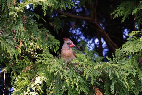 2009
 2009
 2009
 2009
 2009
 2009
 2009
 2009
 2009
 2009
 2009
 2009
