Founding year: the first Cross Plains post office (Blevins & Helbock, CC0). Wikidata: 1920.The full story ↓
History grade
What drives Cross Plains’ History grade
On its age, its old homes and the National Register, Cross Plains is more historic than 55% of U.S. towns, #185 of 362 in Wisconsin. Its age holds the grade up; its National Register listings pull it down.
B−
HistoryA character grade: shown, never part of Cross Plains’ overall grade.
Wisconsin towns list more on the Register than most of the country (a typical Wisconsin town has 3.0 per 10,000 residents, the U.S. 2.4), so Cross Plains’ 0.0 sits below most of its state (28% of Wisconsin towns have fewer) while its 0 listings outnumber those of 23% of U.S. towns.
How sure. Graded on any two of the three inputs instead, the letter would range from C+ to B+. The pre-1940 share is a Census survey estimate (±6.5 points). The founding year is the first post office, not a stated founding date; Wikidata gives 1920.
Founding year: the first post office (other dates in Quick answers). Homes: Census ACS 2020–24. National Register: National Park Service, May 2026 list; each listing counted once (boundary changes and added documentation belong to their listing), and a historic district counts its contributing buildings. How TownRatings grades history →
What stands out about Cross Plains’ past
Read from the archive, the National Register and the record. The page puts what stands out first.
Passages that mention Cross Plains, cut from the printed page as they were published.
Madison, Dane County and surrounding towns1877 · page 445Read the page →
Read the text
In approaching the town of Cross Plains from the east, on the Madison and Mineral Point road, we oome to the dividing ridge or ancient beach, so well defined and preserved as to be observed by every stu* dent of geology. This beach, or ancient sea shore on this road, comes within ten rods of the east line of the town of Cross Plains. On its summit there is yet to be seen an old log, behitid which Ebenezer Brig-
Text read by machine from the scan; it may contain errors.
Madison, Dane County and surrounding towns1877 · page 266Read the page →
Read the text
The town of Berry is situated in the western part of Dane county, and lies south o! the town of Roxbury, west of the town of Springfield, north of the town of Cross Plains, and east of the town of Black Eartli. The general character of the to^n ifi hilly, althongh there are several rich valleys, the largest being Halfway Prairie, which is eometimes called the English settlement, and that portion of Black Earth
Text read by machine from the scan; it may contain errors.
History of Dane County, Wisconsin ... preceded by a history of Wisconsin, statistics of the state, and an abstract of its laws and constitution and of the Constitution of the United States1880 · page 855Read the page →
Read the text
Pebliminaet View— Town of Christiana— Town of Cottage Grove— Town of Oregon- Village OF Oregon— Town of Montrose— Town of riTCHBURO — Town of Springfield- Town or Verona— Town of Clarkjson (extinct)— Town of Windsor- Town of Cross Plains. PRELIMINARY VIEW. Within a year after the formation of the towns of Rutland, Rome, Albion, Dunkirk, Sun Prairie and Madison — " the original towns" — the Territorial Legislature set off the north half of Albion into a new town. This was on the 23d of January, 1847. The same Legislature, on the 11th day of the next month, passed an act, as previously explained, greatly reducing the
Text read by machine from the scan; it may contain errors.
History of Dane County, Wisconsin ... preceded by a history of Wisconsin, statistics of the state, and an abstract of its laws and constitution and of the Constitution of the United States1880 · page 874Read the page →
Read the text
The territory now constituting the town of Cross Plains — Township 7 north, of Range 7 east — when first brought under a town goverament, on the 2d day of February, 1846, was a part of the town of Madison. It so continued until 1847, when, on the 11th day of February
Text read by machine from the scan; it may contain errors.
Scans and text from the Internet Archive. Books published in 1930 or earlier, which are in the public domain.
The Cross Plains post office opened in 1838, the earliest record of the town by name (U.S. post office records). Wikidata gives 1920.
How does Cross Plains rank for history?
Cross Plains is more historic than 55% of U.S. towns, #185 of 362 in Wisconsin. The History grade combines the town’s founding era, the share of homes built before 1940 and its National Register listings. It’s a character grade, so it isn’t part of the overall grade. How it works.
How old are the homes in Cross Plains?
14% of Cross Plains’ homes were built before 1940 (Census estimate, ±6.5 points), against a typical 12% for a Wisconsin town; the median home was built in 1986.
Founding dates: Wikidata, Wikipedia, the U.S. post office records of Blevins & Helbock (CC0) and the Census. Homes by year built: Census ACS 2020–24. National Register of Historic Places: National Park Service (list of May 22, 2026). Old photos, postcards and papers: Wikimedia Commons, the Library of Congress and other public archives, credited on each item’s page. Maps: U.S. Geological Survey historical topographic maps (via Esri) and Sanborn fire-insurance maps (Library of Congress). History text and census tables: Wikipedia (CC BY-SA 4.0). Places that used to be: USGS Geographic Names Information System (2021).
From Wikimedia Commons (18), Wikipedia, Wikidata and Wikipedia for famous people, U.S. Geological Survey historical maps, U.S. Census counts (via Wikipedia), the US Post Offices dataset (Blevins & Helbock), the USGS Geographic Names Information System and old county and town histories (Internet Archive). Archive images are copied here with their credits and licenses, shown on each photo’s page. Refreshed monthly.


 2012
 2012
 2012
 2012
 2012
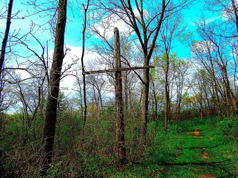 2012
 2012
 2011
 2011
 2011
 2011
 2011
 2011
 2011
 2010
 2010
 2009
 2009