3 places in town are on the National Register, among them a historic district with 24 buildings. Below: 1 old photo or paper, maps from 1885 on, and the census since 1850.
Founding year: Wikidata; Wikipedia’s history section gives the same year.The full story ↓
History grade
What drives Baraboo’s History grade
On its age, its old homes and the National Register, Baraboo is more historic than 89% of U.S. towns. All 3 inputs are above most U.S. towns; its National Register listings ranks highest and its share of homes from before 1940 lowest.
A
HistoryA character grade: shown, never part of Baraboo’s overall grade.
Wisconsin towns list more on the Register than most of the country (a typical Wisconsin town has 3.0 per 10,000 residents, the U.S. 2.4), so Baraboo’s 162 sits above most of its state (97% of Wisconsin towns have fewer) while its 26 historic buildings outnumber those of 81% of U.S. towns.
How sure. Graded on any two of the three inputs instead, the letter would range from A− to A. The pre-1940 share is a Census survey estimate (±5.5 points). Two sources give 1838.
Founding year: Wikidata (other dates in Quick answers). Homes: Census ACS 2020–24. National Register: National Park Service, May 2026 list; each listing counted once (boundary changes and added documentation belong to their listing), and a historic district counts its contributing buildings. How TownRatings grades history →
What stands out about Baraboo’s past
Read from the archive, the National Register and the record. The page puts what stands out first.
Every edition of the U.S. Geological Survey’s map of Baraboo. Tap a year, or press play to watch the town change.
1901Denzer sheet · 1:62,500
U.S. Geological Survey historical topographic maps (public domain), via Esri’s collection of the scans. The red ring marks the center of Baraboo.
Every building
Baraboo, building by building, 1885–1913
Fire insurance maps drew every building, what it was made of and what it was used for, so insurers could price the risk of fire. Pick a year, then a sheet.
The area around Baraboo was the site of a Kickapoo village as early as 1665. The current community was established by Abe Wood in 1838, and was originally known as the village of Adams. In 1839 several settlers arrived and started building cabins, and a saw mill. In 1846 it became the county seat of Sauk County after a fierce fight with the nearby village of Reedsburg. In 1852, the village was renamed "Baraboo", after the nearby river. It was incorporated as a village in 1866 and as a city in 1882.
Passages that mention Baraboo, cut from the printed page as they were published.
The history of Sauk County, Wisconsin, containing an account of settlement, growth, development and resources ... biographical sketches ... the whole preceded by a history of Wisconsin1880 · page 611Read the page →
Read the text
The territory noAv embraced in the town of Lavalle Avas originally in the town of Baraboo, and subsequently in the town of Marston. It became the town of Lavalle in 1861. The first town meeting Avas held in the village of Lavalle April 1, 1862. J. G. Blakeslee was elected Chairman: E. B. Hageman and J. H. Douglass, Supervisors; C. F. Christnot, Clerk; II. G.
Text read by machine from the scan; it may contain errors.
A standard history of Sauk County, Wisconsin1918 · page 324Read the page →
Read the text
At the annual meeting of the Town of Baraboo on April 7, 1903, William Toole introduced a resolution providing that the town road leading into Baraboo receiving the largest donations be paved, providing arrangements could be made with the City of Baraboo to connect the paved portion of the city streets with the town road. The road leading toward Reedsburg through Lyons received the most subscriptions and was paved with crush rock from a quarry west of the city and near the highway. The resolution introduced by Mr. Toole presupposed the
Text read by machine from the scan; it may contain errors.
The history of Sauk County, Wisconsin, containing an account of settlement, growth, development and resources ... biographical sketches ... the whole preceded by a history of Wisconsin1880 · page 513Read the page →
Read the text
The original town of Baraboo did not include the present village of Baraboo, but comprised the territory now embraced in the towns of Lavalle, Winfield and Dellona, and the north half of the towns of Ironton, Reedsburg and Excelsior. The first election in the town thus bounded and described, occurred April 3, 1849, at the house of D. C. Reed, situated in what is now the village of Reedsburg. The town was subsequently divided, from time to time, until the name Baraboo was dropped entirely, so far as it related to the territory mentioned.
Text read by machine from the scan; it may contain errors.
A standard history of Sauk County, Wisconsin1918 · page 278Read the page →
Read the text
"In 1850 I located in Baraboo. At that time the village was called Baraboo and the township was called Brooklyn and the postoffice was named Adams. The name of the postoffice was afterwards changed to Baraboo, as they thought this name unique and also there was another postoffice in the state named Adams. The census of the township was taken in 1850, which was then larger than now and included the then unincorporated village of Baraboo and altogether the census was only about 800. C. H. McLaughlin took the census at that time, and estab-
Text read by machine from the scan; it may contain errors.
Scans and text from the Internet Archive. Books published in 1930 or earlier, which are in the public domain.
Timeline
Baraboo, 1838 to 1972
Woven from the archive, old maps, post office records, the National Register and the people born here.
Nothing in the archives for these yearsWeddings on Main Street, storms, parades, school pictures, the old store. If it’s in your family album, it belongs here.
In 1838, according to Wikidata and Wikipedia’s history of the town. the census of 1850 counted 255 people here.
How does Baraboo rank for history?
Baraboo is more historic than 89% of U.S. towns. The History grade combines the town’s founding era, the share of homes built before 1940 and its National Register listings. It’s a character grade, so it isn’t part of the overall grade. How it works.
What is on the National Register in Baraboo?
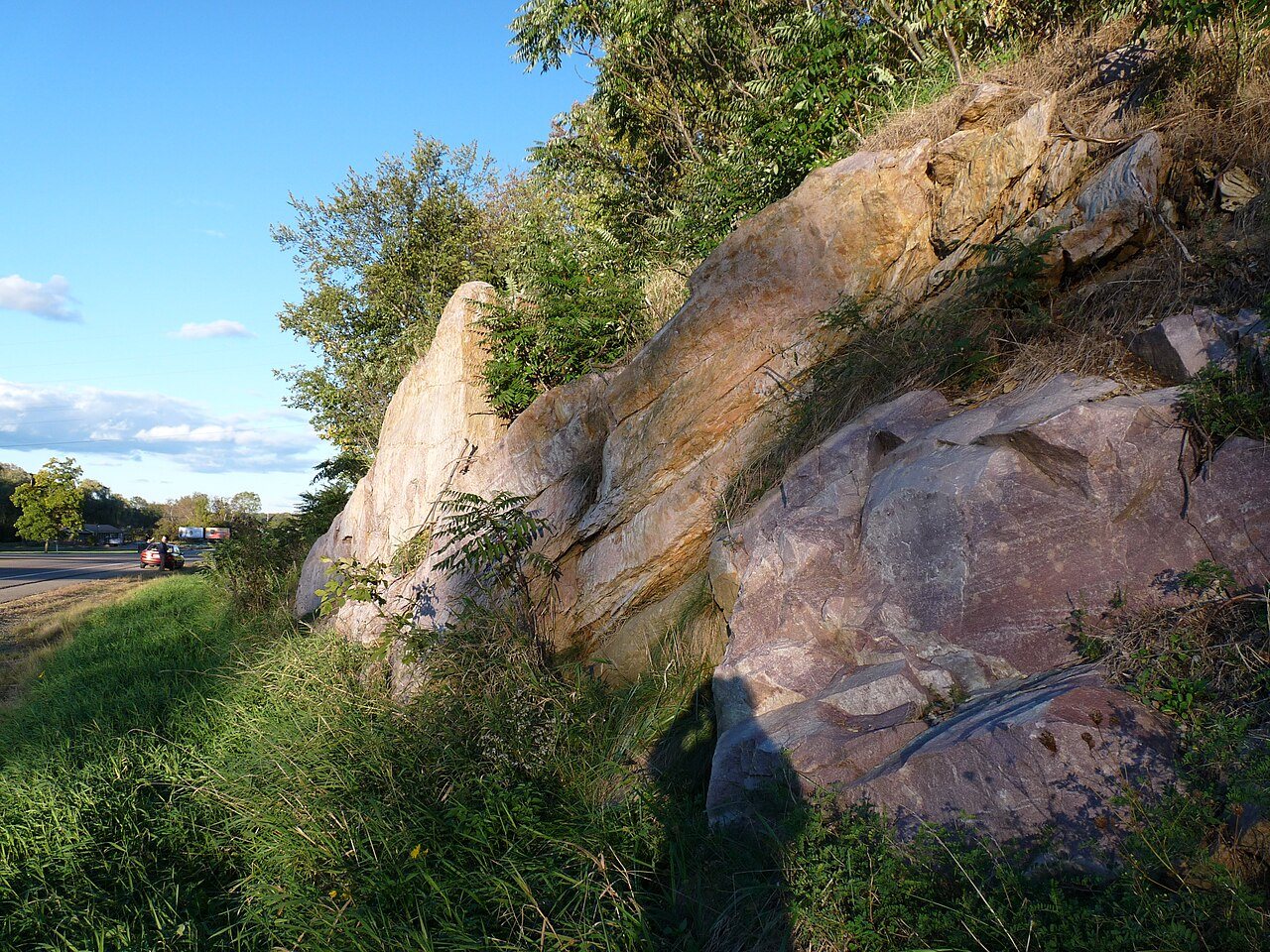
Three places: the A.G. Tuttle Estate (listed 1980), the Point of Rocks (2010) and the Devil's Lake State Park (2015).
How old are the homes in Baraboo?
18% of Baraboo’s homes were built before 1940 (Census estimate, ±5.5 points), against a typical 12% for a Wisconsin town; the median home was built in 1978.
Founding dates: Wikidata, Wikipedia, the U.S. post office records of Blevins & Helbock (CC0) and the Census. Homes by year built: Census ACS 2020–24. National Register of Historic Places: National Park Service (list of May 22, 2026). Old photos, postcards and papers: Wikimedia Commons, the Library of Congress and other public archives, credited on each item’s page. Maps: U.S. Geological Survey historical topographic maps (via Esri) and Sanborn fire-insurance maps (Library of Congress). History text and census tables: Wikipedia (CC BY-SA 4.0). Places that used to be: USGS Geographic Names Information System (2021).
From Wikimedia Commons (1), Wikidata (8), the National Register of Historic Places (3), Wikipedia, Wikidata and Wikipedia for famous people, U.S. Geological Survey historical maps, U.S. Census counts (via Wikipedia), the USGS Geographic Names Information System, Sanborn fire insurance maps (Library of Congress) and old county and town histories (Internet Archive). Archive images are copied here with their credits and licenses, shown on each photo’s page. Refreshed monthly.