188 years in pictures
Census counts: 255 in 1850, 12,556 in 2020. The archive holds 9 old photos and papers going back to 1860 and 3 maps from 1901 on.
3 places on the National Register of Historic Places.
- 1838Baraboo is settled
Each edition grades its towns against each other only.

Home to 3 places on the National Register of Historic Places.
Baraboo’s best subject grades are an A for history and an A− for the outdoors; its weakest is a C for schools. Baraboo’s average trip to work is 18 minutes, against 22 minutes in Wisconsin’s towns and 25 minutes across U.S. towns. Only 6 of the 363 Wisconsin towns we compare have a lower share of working residents who work in town than Baraboo. 20% of the land in Baraboo is conserved, against 3.8% in Wisconsin’s towns and 4.3% across U.S. towns. The biggest place to walk is Devil's Lake State Park, 2,223 acres with 3.9 miles of trail. On history, just 69 of Wisconsin’s 879 towns do better. Baraboo has fewer than 2,500 residents, so it gets subject grades but no overall grade.
Where Baraboo beats most towns.
Where Baraboo’s working residents go each day. Line width shows the share.
Census LEHD 2023
Each subject compared with towns across the country (schools within Wisconsin), ordered by how far Baraboo is from typical.
How TownRatings grades towns →
Census counts: 255 in 1850, 12,556 in 2020. The archive holds 9 old photos and papers going back to 1860 and 3 maps from 1901 on.
3 places on the National Register of Historic Places.
Who provides power, water and the rest in Baraboo, and how to reach them.
EPA SDWIS (Oct 9, 2026) · HIFLD + EIA-861 2025 · Census 2020 ZCTAs · NCES 2024–25 · registration: vote.gov, updated Nov 18, 2024.
Ordered by what stands out in Baraboo.
Expected storm and flood damage is lower than in 79% of U.S. communities.
FEMA National Risk Index · OpenFEMA
Most working residents leave Baraboo for work: only 1% work in town. Jobs based in Baraboo fell to 279 in 2023, 143 fewer than in 2013. Baraboo’s median household income is $101,000.
| Baraboo | Wisconsin towns | U.S. towns | |
|---|---|---|---|
| Median household income | $101,000 | $87,000 | $80,000 |
| Work from home | 9.6% | 12% | 11% |
| Below the poverty line | 6.1% | 6.4% | 9.6% |
Census LEHD 2023 · ACS
Adults 18 to 34 are 9% of residents (22% statewide); adults 35 to 64 are 48% of residents (38% statewide). 34% of adults 25 and older have a bachelor’s degree or more, vs 33% across Wisconsin.
| Baraboo | Wisconsin towns | U.S. towns | |
|---|---|---|---|
| Median age | 47.9 years | 42.1 years | 40.5 years |
| Bachelor’s degree or more, 25+ | 34% | 32% | 29% |
| Under 18 | 23% | 21% | 22% |
48% women, 52% men
That’s an even split within the survey’s margin of ±6.1 points. Across Wisconsin, 49.9% of residents are women.
| Baraboo | WI | U.S. | |
|---|---|---|---|
| Under 10 | 8.5% | 11.2% | 11.6% |
| 10 to 17 | 14.3% | 10.2% | 10.3% |
| 18 to 24 | 3.4% | 9.3% | 9.1% |
| 25 to 34 | 5.7% | 12.6% | 13.7% |
| 35 to 44 | 15.8% | 12.7% | 13.2% |
| 45 to 54 | 11.1% | 11.8% | 12.2% |
| 55 to 64 | 21.5% | 13.8% | 12.7% |
| 65 to 74 | 12.8% | 11.2% | 10.2% |
| 75 and older | 7% | 7.3% | 7% |
| No diploma | 6.3% | 6.4% | 10.4% |
| High school | 26.5% | 29.4% | 26% |
| Some college | 23.7% | 19.5% | 19.1% |
| Associate’s | 9.1% | 11.3% | 8.8% |
| Bachelor’s | 20.2% | 22% | 21.6% |
| Graduate | 14.2% | 11.4% | 14.1% |
U.S. Census Bureau · ACS 2020-2024 5-year estimates · in a town of 1,800, single groups can be off by several points
| Biggest places to walk | Trails | Acres |
|---|---|---|
| 1. Devil's Lake State Park | 3.9 mi | 2,223 |
| 2. East Bluff State Natural Area | 1.3 mi | 131 |
| 3. Baxter's Hollow State Natural Area | 0.3 mi | 1,393 |
Trails & parks © OpenStreetMap contributors · Conserved land: USGS PAD-US
Baraboo has cold, snowy winters and pleasant summers. July afternoons reach 82°, January nights drop to 10° and about 43 inches of snow falls in a winter.
NOAA U.S. Climate Normals, 1991–2020
Baraboo tracks Wisconsin closely on all 32 CDC measures. 40% of adults have obesity in Baraboo.
| Baraboo | Wisconsin towns | U.S. towns | |
|---|---|---|---|
| Obesity (CDC PLACES) | 40% | 38% | 35% |
| Get no exercise (CDC PLACES) | 29% | 26% | 25% |
| Feel lonely (CDC PLACES) | 31% | 30% | 33% |
| Depression (CDC PLACES) | 25% | 24% | 23% |
CDC PLACES 2025 · modeled estimates for adults · CMS · HRSA
Museums, parks, gardens and other places to visit around Baraboo. Close and well known come first.
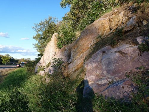
in town Park & preserveIce Age Trail
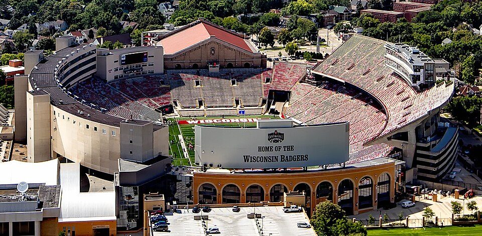
32 mi Stadium & arenaCamp Randall Stadium
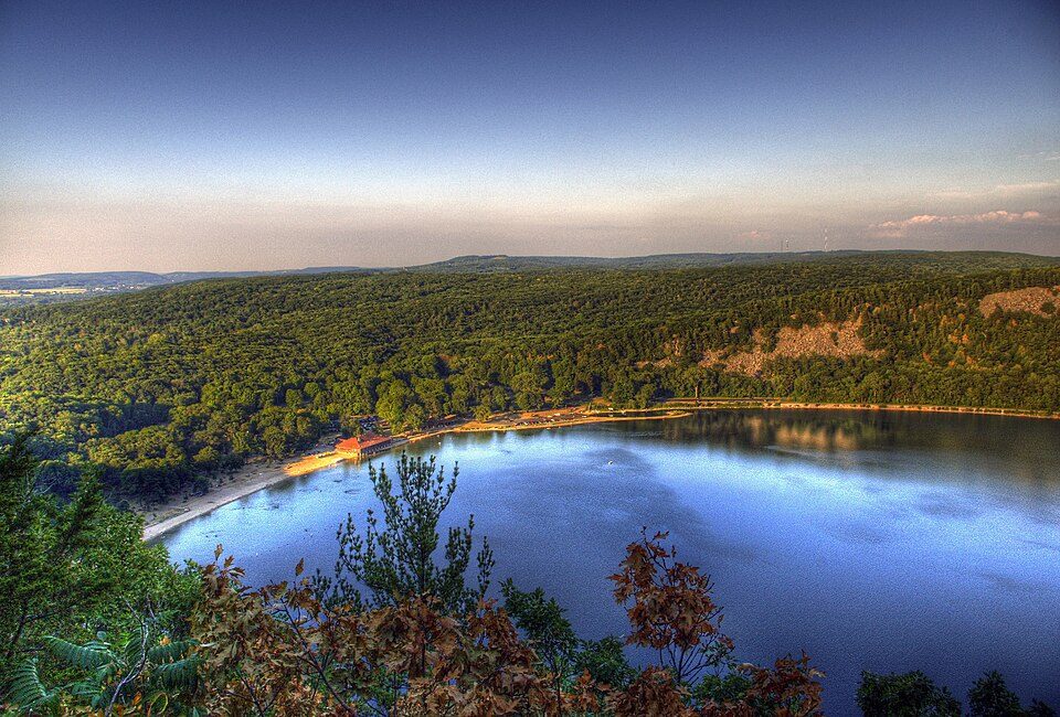
4 mi State parkDevil's Lake State Park
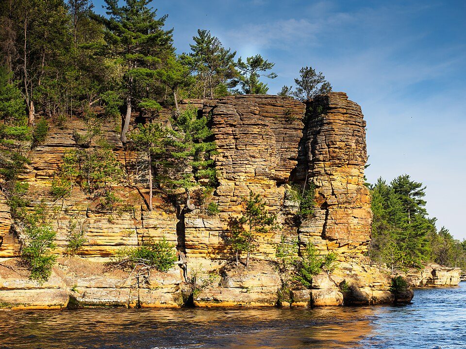
13 mi Canyon & gorgeDells of the Wisconsin River11 mi Theme parkNoah's Ark Water Park
3 mi MuseumCircus World MuseumIce Age Trail: MDuchek, CC BY-SA 3.0 · Camp Randall Stadium: Carol M. Highsmith, Public domain · Devil's Lake State Park: CrispAir at en.wikipedia, CC BY 3.0 · Dells of the Wisconsin River: atramos, CC BY 2.0 · Circus World Museum: Jonathunder, GFDL 1.2
None within 15 miles of Baraboo; the nearest are
About 3 of every 100 Baraboo residents are enrolled in college, against 6 across Wisconsin.
3 places in Baraboo on the National Register of Historic Places.
22 notable people were born in Baraboo.


City in Wisconsin, United States
Baraboo ( BAIR-ə-boo) is the county seat of Sauk County, Wisconsin, United States, located along the Baraboo River. The population was 12,556 at the 2020 census. The most populous city in the county, Baraboo is the principal city of the Baraboo micropolitan statistical area, which comprises a portion of the Madison combined statistical area. Baraboo is home to the Circus World Museum and the former headquarters and winter home of the Ringling Brothers Circus. The Al. Ringling Theatre is an active landmark in the city. Baraboo is near Devil's Lake State Park and Aldo Leopold Shack and Farm. The Ho-Chunk Nation of Wisconsin has an active cultural and community presence in the Baraboo area.
From Wikipedia, licensed CC BY-SA 4.0 · facts via Wikidata (CC0)
9 towns share a border with Baraboo.
| Town | WI rank | Overall | Cost | Safety | Schools | Health |
|---|---|---|---|---|---|---|
| Baraboo | — | — | C+ | — | C | B− |
| Baraboo | #269 | B− | B− | — | C | B− |
| West Baraboo | — | — | C+ | — | C | B− |
| Sumpter | — | — | B+ | — | B− | B− |
| Delton | — | — | A− | — | C+ | C+ |
| Freedom | — | — | — | — | — | — |
| Excelsior | — | — | C+ | — | C+ | C+ |
| Fairfield | — | — | C | — | C | B− |
Baraboo, West Baraboo, Sumpter, Delton, Excelsior and Fairfield have fewer than 2,500 residents, so they get subject grades but no overall grade. Baraboo, Baraboo, West Baraboo, Sumpter, Delton, Excelsior and Fairfield report no FBI crime data of their own. Freedom isn’t graded (fewer than 1,000 residents, or not enough data). Compare Baraboo with a neighbor →
Short answers, built from the data on this page.
Home to 3 places on the National Register of Historic Places.
Cost of living, which also weighs rents, property taxes and how many households pay 30% or more of their income for housing, grades C+.
22 notable people were born here, including Daryl Morey and May Wood Simons.