
St. Joseph's Mission, Ahtanum Valley
Tampico’s story
142 years in pictures
The archive holds 1 old photo or paper and 4 maps from 1899 on.
- 1884Tampico is settled
Each edition grades its towns against each other only.
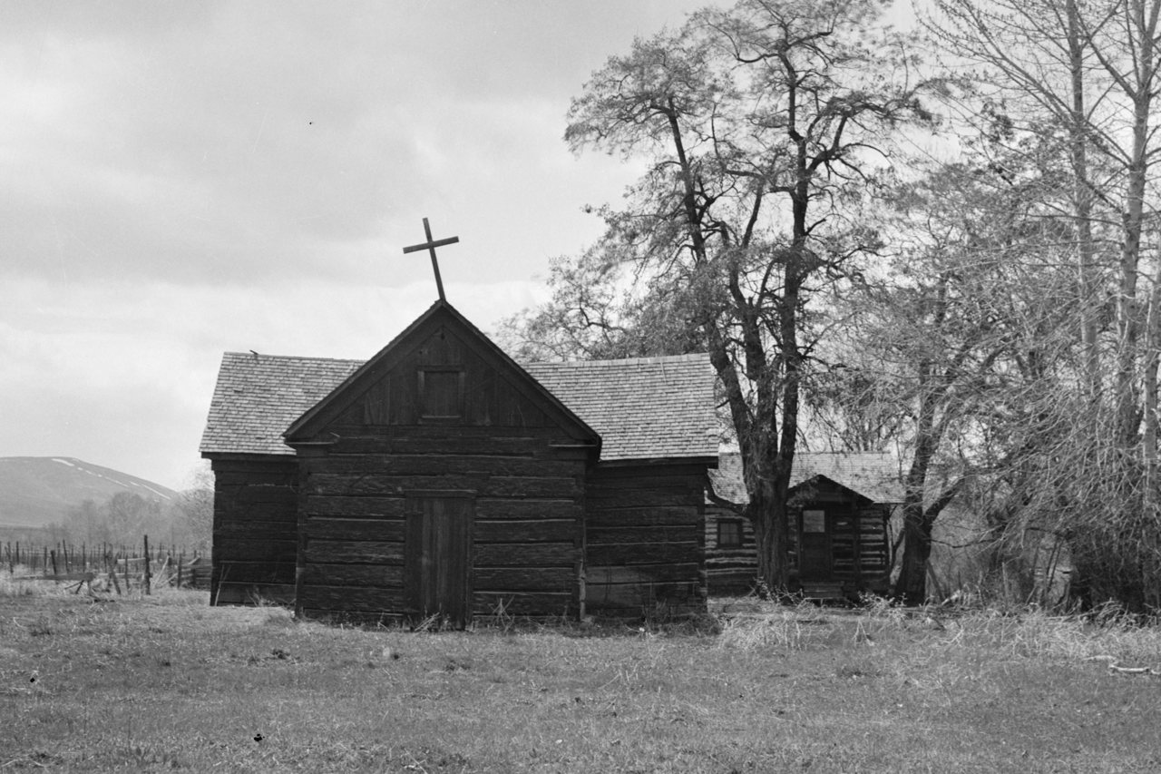
Today 604 people live in this town, first settled in 1884.
Tampico’s mean commuting time is 37 minutes, above both Washington’s towns (27 minutes) and U.S. towns (25 minutes). Among 286 Washington towns, just 10 have a lower share of adults with a bachelor’s degree than Tampico. Tampico has fewer than 1,000 residents, too few for fair grades; the figures below are still real.
In a town this size, neighbors are the best guide. Ask them anything.
The archive holds 1 old photo or paper and 4 maps from 1899 on.
Tampico is unincorporated, so Yakima County and regional agencies provide most services.
EPA SDWIS (Oct 9, 2026) · HIFLD + EIA-861 2025 · Census 2020 ZCTAs · NCES 2024–25 · registration: vote.gov, updated Sep 30, 2026.
Ordered by what stands out in Tampico.
FEMA puts 43% of Tampico’s expected hazard losses down to wildfires, and 31% to avalanches. Expected storm and flood damage is higher than in 100% of U.S. communities.
FEMA National Risk Index · OpenFEMA
The top destinations are Yakima (32%), Union Gap (5%) and Ahtanum (4%). Only 1% of working residents stay in Tampico for work; the rest commute out. Its typical household income stands at $110,000. Employers in Tampico added 77 jobs between 2013 and 2023, to 84.
| Tampico | Washington towns | U.S. towns | |
|---|---|---|---|
| Median household income | $110,000 | $98,000 | $80,000 |
| Working residents who work in town | 1.2% | 4.9% | 8% |
| Below the poverty line | 10% | 7.9% | 9.6% |
Census LEHD 2023 · ACS
The town’s typical July afternoon high is 85°F.
NOAA U.S. Climate Normals, 1991–2020
The share of adults in Tampico who get no exercise outside work: 22%. CDC measures, 31 in all: Tampico beats Washington on 1 and trails on 17. Two figures for adults here: 73% had a checkup this year, 37% have high blood pressure.
| Tampico | Washington towns | U.S. towns | |
|---|---|---|---|
| Sleep under 7 hours (CDC PLACES) | 29% | 33% | 36% |
| Yearly checkup (CDC PLACES) | 73% | 71% | 79% |
| High blood pressure (CDC PLACES) | 37% | 31% | 35% |
| Diabetes (CDC PLACES) | 13% | 9.8% | 12% |
| What stands out | Tampico | WA |
|---|---|---|
| More adults treating high blood pressure | 76.1% | 70.7% |
| More older adults who have lost all their teeth | 14.7% | 9% |
CDC PLACES 2025 · modeled estimates for adults · CMS · HRSA
2.4 miles of trail. The trail density for Tampico comes to 0.6 miles per square mile.
Trails & parks © OpenStreetMap contributors · Conserved land: USGS PAD-US
Museums, parks, gardens and other places to visit around Tampico. Close and well known come first.
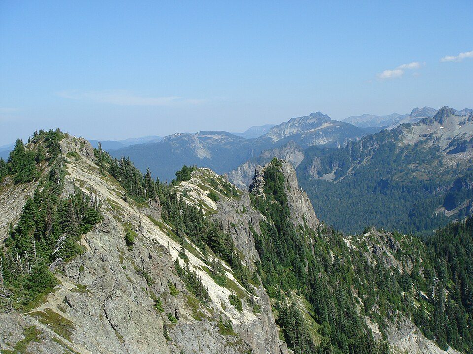 32 mi National ParkMount Rainier National Park1.6M visitors a year
 37 mi MountainMount Adams
 18 mi MuseumYakima Electric Railway Museum26 mi Ski areaWhite Pass Ski Area55 runs · 2,035 ft vertical
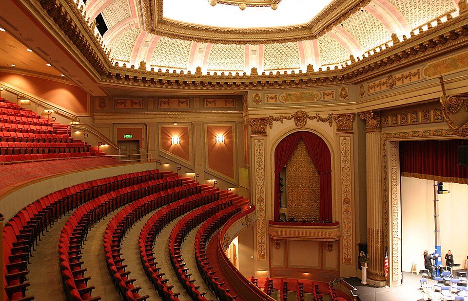 18 mi TheatreCapitol Theatre
 20 mi GardenYakima Area Arboretum
Mount Rainier National Park: Ricardo Martins from Gent, Belgium, CC BY 2.0 · Mount Adams: USGS Photo by R. Iverson, USGS/CVO, Public domain · Yakima Electric Railway Museum: Steve Morgan, CC BY-SA 3.0 · Capitol Theatre: User:Cacophony, CC BY 2.5 · Yakima Area Arboretum: Bobjgalindo, CC BY-SA 3.0
None within 15 miles of Tampico; the nearest are
About 0 of every 100 Tampico residents are enrolled in college, against 6 across Washington.
Where Tampico’s working residents go each day. Line width shows the share.
Census LEHD 2023
Unincorporated community in Washington, United States
Tampico is a census-designated place and unincorporated community in Yakima County, Washington, United States, located approximately eighteen miles west of Yakima on Ahtanum Creek. As of the 2020 census, Tampico had a population of 467.
From Wikipedia, licensed CC BY-SA 4.0 · facts via Wikidata (CC0)
Short answers, built from the data on this page.
Tampico has fewer than 1,000 residents, too few for fair grades; the figures below are still real.


