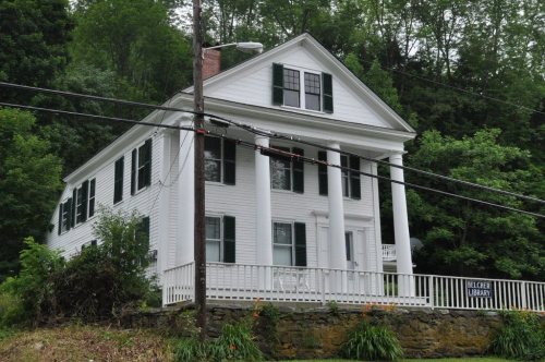
Stockbridge’s post office opened in 1811, and 22% of its homes were built before 1940
4 places in town are on the National Register, among them a historic district with 6 buildings. Below: 2 old photos and papers, maps from 1915 on, and the census since 1790.
US Post Offices dataset (Blevins & Helbock, CC0). Places and cemeteries from the USGS Geographic Names Information System (2021).
The story so far
Stockbridge, in brief
Wikipedia doesn’t have a history of Stockbridge yet. The photos, dates and memories neighbors add here are how it gets written.
Stockbridge is a town in Windsor County, Vermont, United States, which contains the village of Gaysville. The population was 718 at the 2020 census. Stockbridge was one of thirteen Vermont towns isolated by flooding caused by Hurricane Irene in 2011.
Its first post office opened in 1811. Between the 2010 and 2020 censuses its population fell from 736 to 718 (-2%).
Intro from Wikipedia. Population: U.S. Census Bureau.
From the old history books
What they wrote about Stockbridge in 1891
Passages that mention Stockbridge, cut from the printed page as they were published.
History of Windsor county, Vermont1891 · page 588Read the page →
Read the text
Stockbridge is drained by several streams, the largest of which are the White River, Tweed River and Stony Brook. The White River has its headwaters in the Green Mountains, and thence flowing south and east enters Stockbridge near its northeast corner, thence it courses southeasterly to the center part of the town, and then bends almost abruptly northward and eastward, and leaves the town at its northeast corner.
Text read by machine from the scan; it may contain errors.
History of Windsor County, Vermont, with illustrations and biographical sketches of some of its prominent men and pioneers1891 · page 588Read the page →
Read the text
Stockbridge is drained by several streams, tlie largest of which are the White River, Tweed River and Stonj' Brook. The White River has its hcadw, iters in the Green Mountains, ami thence flowing south and east enters Stockbridge near its northeast corner, thence it courses southeasterly to the center part of the town, and then bends almost abruptly northward and eastward, and leaves the town at its northeast corner.
Text read by machine from the scan; it may contain errors.
every available stream in the town had along its banks one or more of this class of industries. In i860 the principal manufacturers of Stockbridge town were, at Gaysville, M. Gay & Son and Thomas Greenbank, woolen goods; at Stockbridge village, Partridge & Hayden, tanners and manufacturers of leatlier At that time, also, the merchants were Carroll & Brown at Stockbridge, and R. L. Fay and A. A. Brooks at Gaysville. In 1870 the merchants of the town were H. D. Morgan, Asgood & Culver, Kimball & Montgomery, L. P. Dean ; and the manu-
Text read by machine from the scan; it may contain errors.
History of Windsor County, Vermont, with illustrations and biographical sketches of some of its prominent men and pioneers1891 · page 587Read the page →
Read the text
AT the time of takiiiLj the first census of Vermont, in 1791, the town of Stockbridge was found to have a less number of inhabitants than any other of the county towns ; but at the last census tiiere were no less than eight towns that showed a less number than this. This tends to prove and establish the fact that Stockbridge possessed resources which, when fully developed, gave the town an advantage over many others, and that a residence once efifected generally became permanent, and there was a less desire on the part of its people to emigrate to other States.
Text read by machine from the scan; it may contain errors.
Scans and text from the Internet Archive. Books published in 1930 or earlier, which are in the public domain.
Timeline
Stockbridge, 1803 to 1974
Woven from the archive, old maps, post office records, the National Register and the people born here.
Nothing in the archives for these yearsWeddings on Main Street, storms, parades, school pictures, the old store. If it’s in your family album, it belongs here.
The Stockbridge post office opened in 1811, the earliest record of the town by name (U.S. post office records).
What is on the National Register in Stockbridge?
4 listings: 2 buildings, among them the Daniel Gay House (listed 1978, the first), 1 historic district, the Stockbridge Common Historic District, with 6 contributing buildings, and 1 structure. 15 historic buildings in all.
Founding dates: Wikidata, Wikipedia, the U.S. post office records of Blevins & Helbock (CC0) and the Census. Homes by year built: Census ACS 2020–24. National Register of Historic Places: National Park Service (list of May 22, 2026). Old photos, postcards and papers: Wikimedia Commons, the Library of Congress and other public archives, credited on each item’s page. Maps: U.S. Geological Survey historical topographic maps (via Esri) and Sanborn fire-insurance maps (Library of Congress). History text and census tables: Wikipedia (CC BY-SA 4.0). Places that used to be: USGS Geographic Names Information System (2021). How TownRatings grades history →
From Wikimedia Commons (18), the National Register of Historic Places (4), Wikidata and Wikipedia for famous people, U.S. Geological Survey historical maps, U.S. Census counts (via Wikipedia), the US Post Offices dataset (Blevins & Helbock), the USGS Geographic Names Information System and old county and town histories (Internet Archive). Archive images are copied here with their credits and licenses, shown on each photo’s page. Refreshed monthly.


 1974
 2015
 2011
 2009
 2009
 2009
 2009
 2009
 2009
 2009
 2009
 2009
 2009
 2009
 2009
 2009
 2004