1 place in town is on the National Register, among them a historic district with 5 buildings. Below: 1 old photo or paper, maps from 1919 on, and the census since 1800.
Founding year: Wikidata. First post office: 1805.The full story ↓
History grade
What drives Brownington’s History grade
On its age, its old homes and the National Register, Brownington is more historic than 77% of U.S. towns. All 3 inputs are above most U.S. towns; its age ranks highest and its National Register listings lowest.
A−
HistoryA character grade: shown, never part of Brownington’s overall grade.
Vermont towns list more on the Register than most of the country (a typical Vermont town has 147 per 10,000 residents, the U.S. 2.4), so Brownington’s 43.7 sits near the middle of its state (46% of Vermont towns have fewer) while its 5 historic buildings outnumber those of 70% of U.S. towns.
How sure. Graded on any two of the three inputs instead, the letter would range from B+ to A−. The pre-1940 share is a Census survey estimate (±6.1 points). Two sources give 1790.
Founding year: Wikidata (other dates in Quick answers). Homes: Census ACS 2020–24. National Register: National Park Service, May 2026 list; each listing counted once (boundary changes and added documentation belong to their listing), and a historic district counts its contributing buildings. How TownRatings grades history →
What stands out about Brownington’s past
Read from the archive, the National Register and the record. The page puts what stands out first.
The town was named after the family Brown. Two chief grantees of Brownington were Daniel and Timothy Brown. There were six other male Browns and one woman, Sarah.
Until 1816, court convened here, alternating with Craftsbury, both shire towns of the county. After that year, the legislature changed the county seat to Irasburg.
Alexander Twilight built Athenian Hall, now called the Old Stone House as a dormitory for a boarding academy in 1836. It is a museum today.
Part of the museum complex is the Samuel Read Hall House, located on the Hinman Settler Road. This Federal-style building was completed in 1831. For about twenty years it was the home of Hall, a pioneer in the field of American education.
Passages that mention Brownington, cut from the printed page as they were published.
The history of Orleans county, Vermont. Civil, ecclesiastical, biographical and military1882 · page 367Read the page →
Read the text
said mill to Charleston line ; and the farms made narrow on said County road, and settled each way from said road. They had another hill road to Brownington, and the settlement of East Brownington was made so as to help Westmore settlement by the influence of Judge Strong of Brownington and old Col. Eaton, one of the first settlers of Westmore, a leading man
Text read by machine from the scan; it may contain errors.
The history of Orleans county, Vermont. Civil, ecclesiastical, biographical and military1882 · page 376Read the page →
Read the text
Brownington Gore was granted to the same proprietors as the township of Brownington ; 40 acres to each right — and this Gore was said to be the best land in the County. The settlement was caused by Judge Strong. The settlers, by paying an annual interest, had as many j^ears as they wished in wliich to make their payments — but in the paying of their interest had as many
Text read by machine from the scan; it may contain errors.
Scans and text from the Internet Archive. Books published in 1930 or earlier, which are in the public domain.
Timeline
Brownington, 1790 to 1934
Woven from the archive, old maps, post office records, the National Register and the people born here.
In 1790, according to Wikidata. Brownington’s post office opened in 1805, and the census of 1800 counted 65 people here.
How does Brownington rank for history?
Brownington is more historic than 77% of U.S. towns. The History grade combines the town’s founding era, the share of homes built before 1940 and its National Register listings. It’s a character grade, so it isn’t part of the overall grade. How it works.
What is on the National Register in Brownington?
One place: the Brownington Village Historic District (listed 1973).
How old are the homes in Brownington?
17% of Brownington’s homes were built before 1940 (Census estimate, ±6.1 points), against a typical 22% for a Vermont town; the median home was built in 1985.
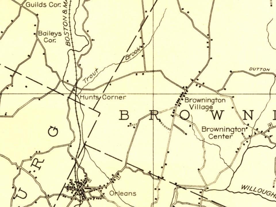
Founding dates: Wikidata, Wikipedia, the U.S. post office records of Blevins & Helbock (CC0) and the Census. Homes by year built: Census ACS 2020–24. National Register of Historic Places: National Park Service (list of May 22, 2026). Old photos, postcards and papers: Wikimedia Commons, the Library of Congress and other public archives, credited on each item’s page. Maps: U.S. Geological Survey historical topographic maps (via Esri) and Sanborn fire-insurance maps (Library of Congress). History text and census tables: Wikipedia (CC BY-SA 4.0). Places that used to be: USGS Geographic Names Information System (2021).
From Wikimedia Commons (4), the Library of Congress (1), Wikidata (1), the National Register of Historic Places (1), Wikipedia, Wikidata and Wikipedia for famous people, U.S. Geological Survey historical maps, U.S. Census counts (via Wikipedia), the US Post Offices dataset (Blevins & Helbock), the USGS Geographic Names Information System and old county and town histories (Internet Archive). Archive images are copied here with their credits and licenses, shown on each photo’s page. Refreshed monthly.



 Date?
 2025
 2025
 2016
 2004
