Norfolk dates to 1682, and 15% of its homes were built before 1940
More historic than 94% of U.S. towns · #10 of 253 in Virginia. What drives it
66 places in town are on the National Register, among them ten historic districts with 5,695 buildings between them. Below: 14 old photos and papers, maps from 1887 on, and the census since 1790.
Founding year: Wikidata. First post office: 1775.The full story ↓
History grade
What drives Norfolk’s History grade
On its age, its old homes and the National Register, Norfolk is more historic than 94% of U.S. towns, #10 of 253 in Virginia. All 3 inputs are above most U.S. towns; its age ranks highest and its share of homes from before 1940 lowest.
A
HistoryA character grade: shown, never part of Norfolk’s overall grade.
Among the 400 U.S. cities of 100,000 or more, Norfolk ranks #50 on History.
Virginia towns list more on the Register than most of the country (a typical Virginia town has 3.6 per 10,000 residents, the U.S. 2.4), so Norfolk’s 246 sits above most of its state (81% of Virginia towns have fewer) while its 5,738 historic buildings outnumber those of 100% of U.S. towns.
How sure. Graded on any two of the three inputs instead, the letter would range from A to A+. The pre-1940 share (±0.9 points) is firm at this size. Two sources give 1682.
Founding year: Wikidata (other dates in Quick answers). Homes: Census ACS 2020–24. National Register: National Park Service, May 2026 list; each listing counted once (boundary changes and added documentation belong to their listing), and a historic district counts its contributing buildings. How TownRatings grades history →
What stands out about Norfolk’s past
Read from the archive, the National Register and the record. The page puts what stands out first.
When the South Hampton Roads portion of the shire was separated, Thoroughgood suggested the name of his birthplace for the newly formed New Norfolk County. One year later, it was divided into two counties, Upper Norfolk and Lower Norfolk (the latter now incorporated into the City of Norfolk), chiefly on Thoroughgood's recommendation. This area of Virginia became known as the place of entrepreneurs, including men of the Virginia Company of London.
Norfolk developed in the late-seventeenth century as a "Half Moone" fort was constructed and 50 acres (200,000 m2) were acquired from local natives of the Powhatan Confederacy in exchange for 10,000 pounds of tobacco. The House of Burgesses established the "Towne of Lower Norfolk County" in 1680.
Passages that mention Norfolk, cut from the printed page as they were published.
The history of Norfolk, Virginia1877 · page 166Read the page →
Read the text
March 29th, the City Council of Norfolk held a meeting to protest against the appointment of a Receiver of the Atlantic, Mississippi and Ohio Railroad (from Norfolk to Bristol, Tennessee,), but adopted resolutions to this effect, viz : " That if the honorable Court determines that a Receiver shall be appointed, the City of Norfolk respectfully asks,throughits Attorney and associate counsel, the appointment of General William Mahone as Receiver of said road." [This resolution was adopted with only one dissenting
Text read by machine from the scan; it may contain errors.
The history of Norfolk, Virginia1877 · page 14Read the page →
Read the text
connections with the South and West. And yet there were blockheads in our midst, who opposed the great scheme — who could see no good to come from it, and even noiv in 1877, are foolish enough to say that " the Atlantic, Mississippi and Ohio Railroad does Norfolk no good," and that she would " be better off without it." But we congratulate the city upon the fact that the counsels of such stupid asses did not prevail, and Norfolk's great railroad scheme was successfully carried out, and she has reaped the benefits of it. The greatest aim of her peo-
Text read by machine from the scan; it may contain errors.
Scans and text from the Internet Archive. Books published in 1930 or earlier, which are in the public domain.
Timeline
Norfolk, 1682 to 1921
Woven from the archive, old maps, post office records, the National Register and the people born here.
Every edition of the U.S. Geological Survey’s map of Norfolk. Tap a year, or press play to watch the town change.
1921Newport News sheet · 1:62,500
U.S. Geological Survey historical topographic maps (public domain), via Esri’s collection of the scans. The red ring marks the center of Norfolk.
Every building
Norfolk, building by building, 1887–1921
Fire insurance maps drew every building, what it was made of and what it was used for, so insurers could price the risk of fire. Pick a year, then a sheet.
In 1682, according to Wikidata. Norfolk’s post office opened in 1775, and the first U.S. census counted 2,959 people here in 1790.
How does Norfolk rank for history?
Norfolk is more historic than 94% of U.S. towns, #10 of 253 in Virginia. The History grade combines the town’s founding era, the share of homes built before 1940 and its National Register listings. It’s a character grade, so it isn’t part of the overall grade. How it works.
What is on the National Register in Norfolk?
66 listings: 38 buildings, among them the Norfolk Academy (listed 1969, the first), 26 historic districts with 5,695 contributing buildings, 1 site, and 1 structure. 5,738 historic buildings in all.
How old are the homes in Norfolk?
15% of Norfolk’s homes were built before 1940 (Census estimate), against a typical 1.9% for a Virginia town; the median home was built in 1964.
Founding dates: Wikidata, Wikipedia, the U.S. post office records of Blevins & Helbock (CC0) and the Census. Homes by year built: Census ACS 2020–24. National Register of Historic Places: National Park Service (list of May 22, 2026). Old photos, postcards and papers: Wikimedia Commons, the Library of Congress and other public archives, credited on each item’s page. Maps: U.S. Geological Survey historical topographic maps (via Esri) and Sanborn fire-insurance maps (Library of Congress). History text and census tables: Wikipedia (CC BY-SA 4.0). Places that used to be: USGS Geographic Names Information System (2021).
From Wikimedia Commons (14), Wikidata (3), the National Register of Historic Places (66), Wikipedia, Wikidata and Wikipedia for famous people, U.S. Geological Survey historical maps, U.S. Census counts (via Wikipedia), the US Post Offices dataset (Blevins & Helbock), the USGS Geographic Names Information System, Sanborn fire insurance maps (Library of Congress) and old county and town histories (Internet Archive). Archive images are copied here with their credits and licenses, shown on each photo’s page. Refreshed monthly.


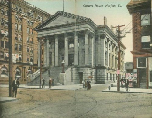


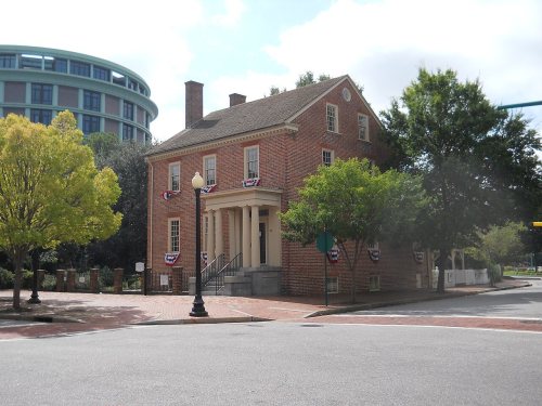


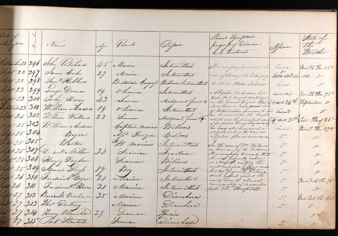

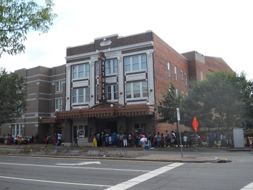

 1775
 1785
 1822
 1830
 1832
 1832
 1845
 1845


